
“Wherever we go in the mountains, or indeed in any of God’s wild fields, we find more than we seek”
-John Muir, My First Summer in the Sierra (1911)
John Muir, the prominent author/naturalist/preservationist of the late 19th and early 20th centuries, is arguably the most influential character in American natural history since Lewis and Clark. The time he spent wandering among the high peaks and lush valleys of the Sierra-Nevada mountain range, captured in his journals and correspondence with friends and family, has made a lasting impact on America’s moral compass. While the inspiration for his wilderness excursions could be linked to the concept of “manifest destiny”, which was so prevalent in the US around the time of his birth, his perception of what the west had to offer and his insatiable desire to preserve and protect those sacred lands could not have been more revolutionary- especially when considering the common American’s feelings about nature at the time. When the nation took Horace Greeley’s advice to “Go West, young man!”, they didn’t hesitate to capitalize on the abundant wealth of natural resources strewn about those humongous, untamed, and relatively new US territories, often no matter what the cost; forests were leveled for use as timber, the hearts of the most marvelous mountains were torn out by massive mining operations, and the crystal clear waters that flowed from snow-melt off the highest peaks were quickly being contaminated by the residual pollutants of the industrial and civilized world. John Muir had the foresight to understand, even after his first short outing into the wilderness, that if his children’s children were ever to see such glorious and pristine natural scenes, someone would have to stand up, in the name of conservation, to the protect the unique birds, trees, rivers, and rocks that distinguished our country from the over-crowded and deeply exploited lands of Europe. It took generations (and chiefly the political leverage of Theodore Roosevelt) for Muir’s dreams to become reality, but today 1 in 20 acres of US land is part of a designated wilderness area. As it pertains to my adventure, a vast majority of the miles on the Pacific Crest Trail pass through these lands that Muir worked so feverishly to defend. In fact, roughly 210 miles of the PCT coincide with the John Muir Trail through the “finest mountain scenery in the United States”, as the PCTA states on their website. As I reflect on my time spent walking through these breathtaking Western landscapes, on the trail named after one of my personal heroes, I realize now more than ever how important it is to respect and take care of the vast and diverse American ecosystem that belongs, in part, to all of us. But enough of the philosophical mumbo-jumbo. Let’s talk trail!
*NOTE- CLICK ON THE PICTURE TO SEE IT IN FULLSCREEN. THE PICTURES ARE BLURRY WITHIN THIS POST, BUT IN HIGH DEFINITION WHILE IN FULLSCREEN
The Mojave
After leaving Agua Dulce, where I published my last blog post, I spent a few days crossing the far western edge of the Mojave Desert. Thankfully, a cold front blew in around the same time and I was able to walk under the shade of thick, billowy clouds.
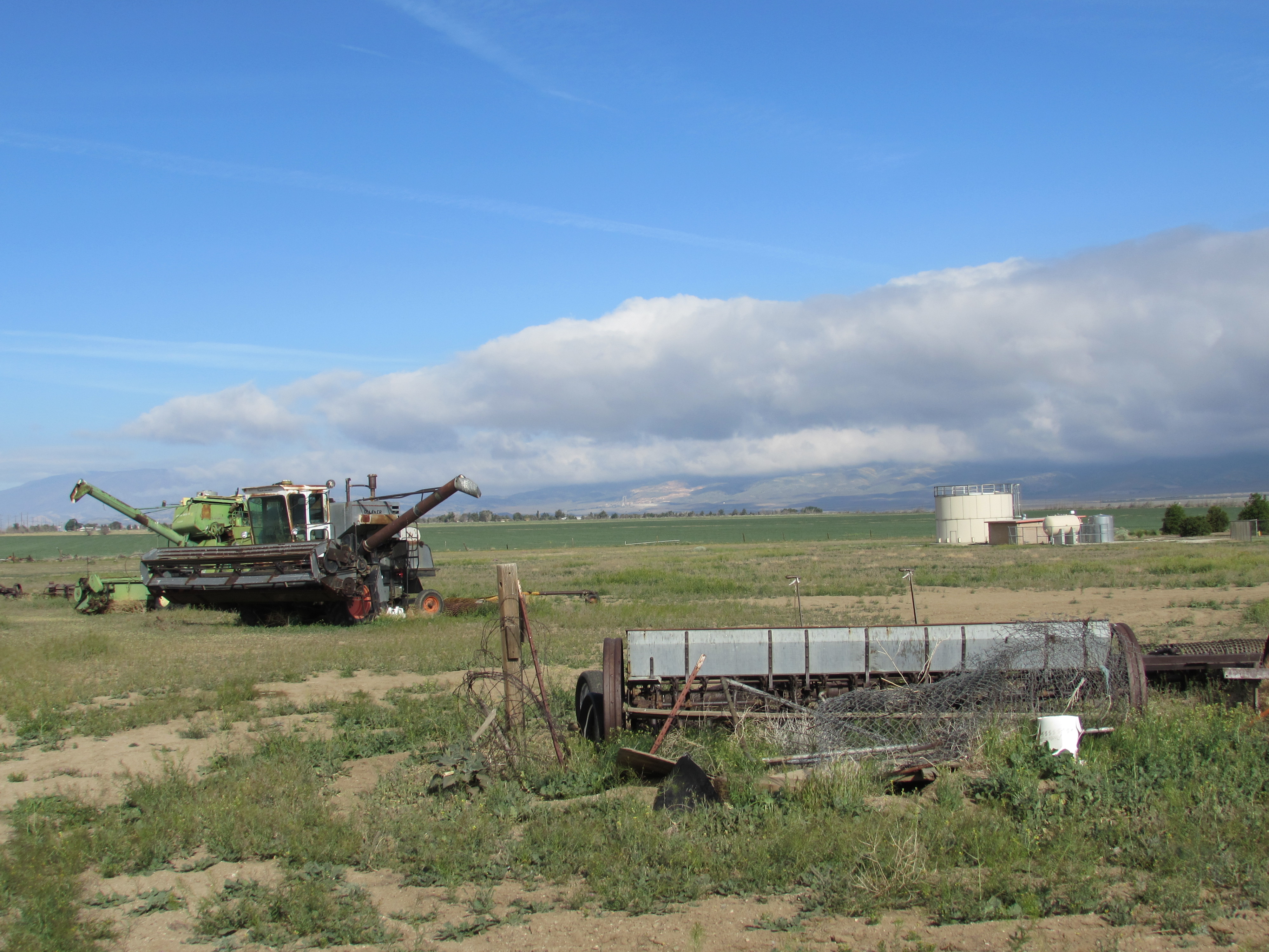
Farm Equipment in the Mojave Desert
If it weren’t for my fortunate timing, there would have no place to gain respite from the torturous rays of the sun, and I would been fried like a thin slice of bacon on a red-hot frying pan. Due to wildfires in recent years, quite a few sections of the trail in Southern California are closed this year, and I was so sick of walking through burn areas that I hitched a ride for around 10-12 miles to avoid a boring road-walk.
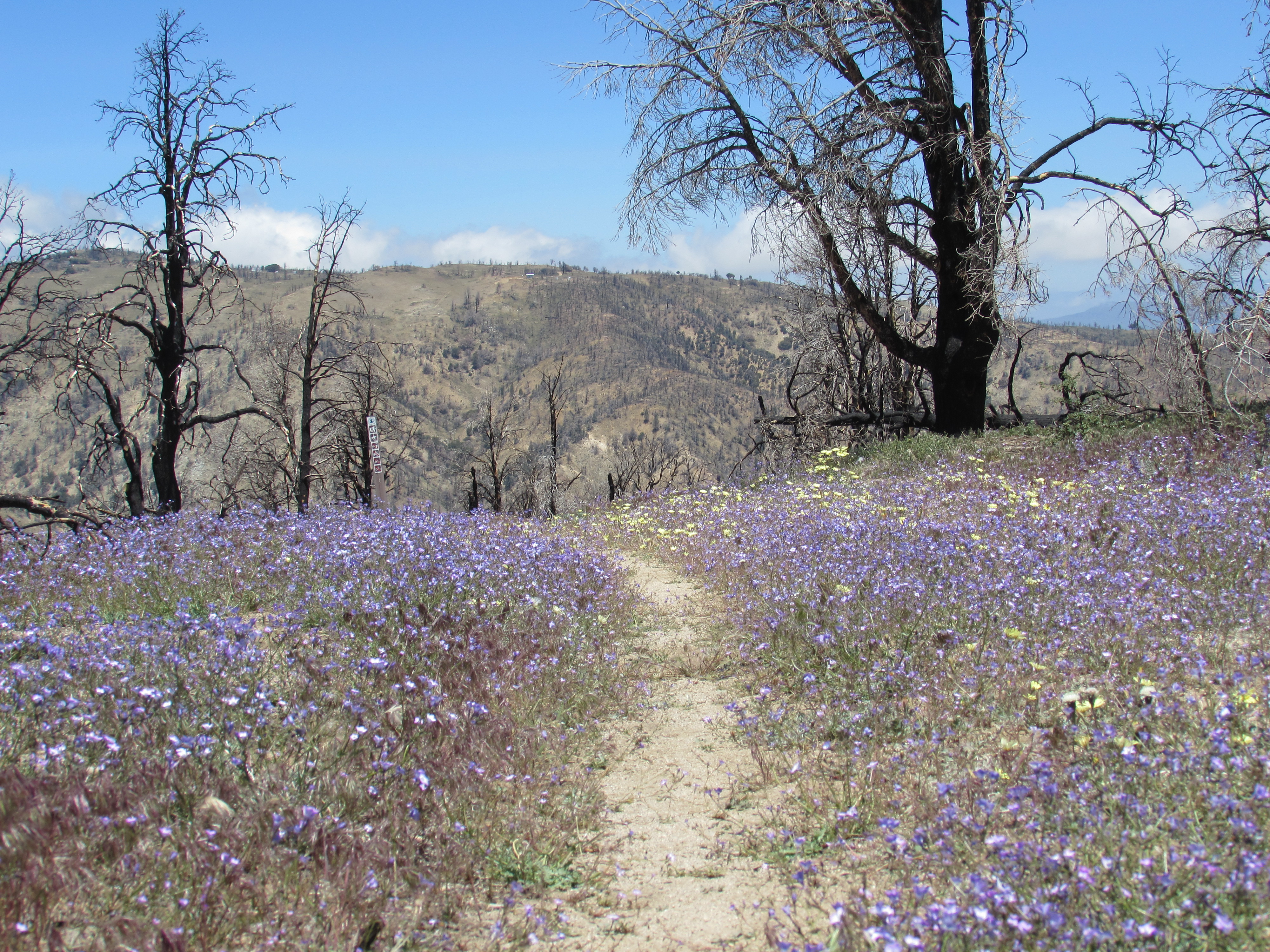
Flowers Bloom After Recent Wildfire in the Mojave Desert
Once I left “Hikertown”, an oasis for PCT hikers run by trail angels Richard and Roberta Skaggs, I spent a few days walking under gigantic wind turbines within a wind farm that must supply power to hundreds of thousands, if not millions of people.
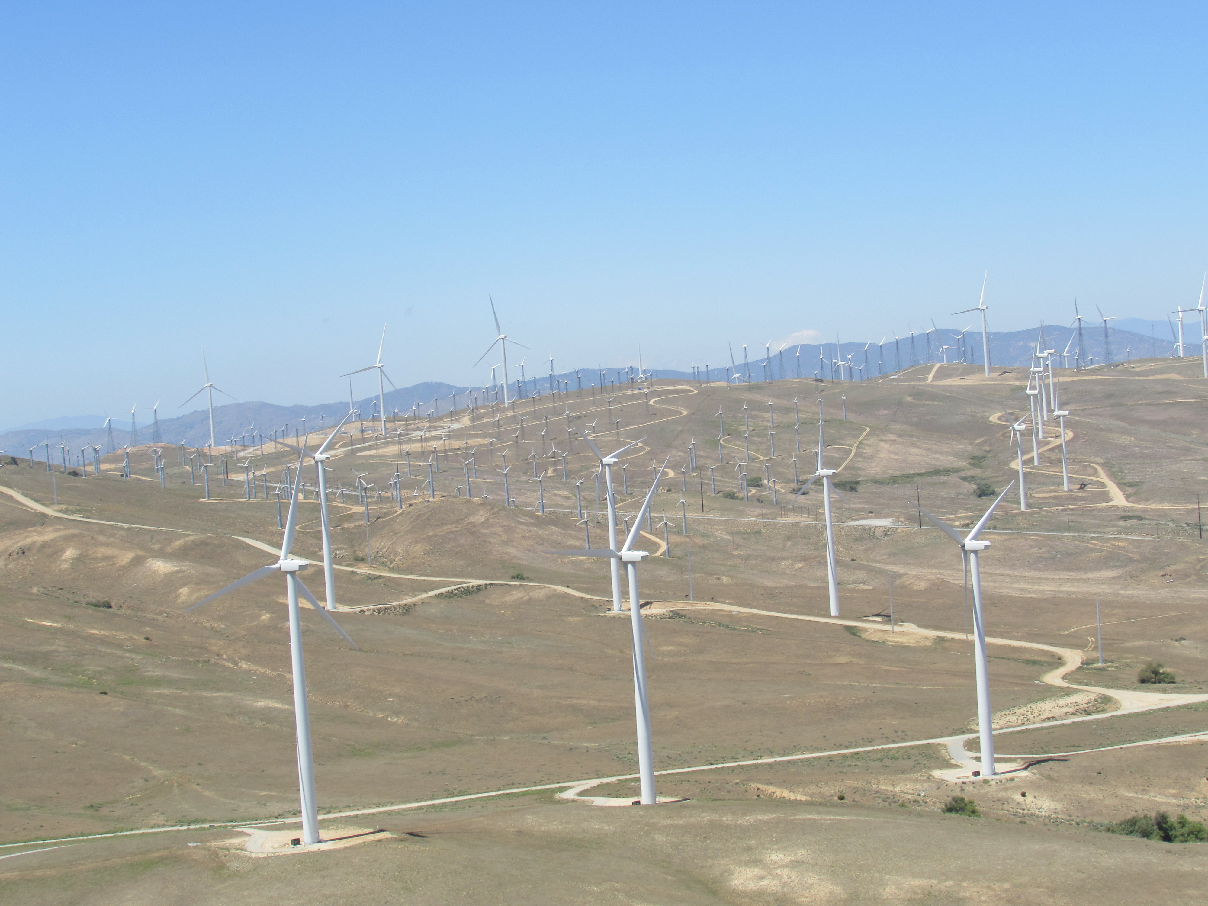
Wind Farm in Tehachapi
I soon learned why they had chosen that area to build so many turbines- there were three days of relentless and powerful winds, the second day the worst of them all. After a few hours of 30-50 mph gusts that would nearly knock me completely off the mountain, the hardest part came when I tried to cross an unpaved forest service road that sat on top of a ridge above a canyon. The wind was so intense and powerful that I had to sit down because it was impossible to stand without being lifted off the ground. I literally crawled the 40 feet across the ridge, and spent the night huddled behind a short rock-wall built by hikers that had passed through the area before me. By the time I was able to hitch into Tehachapi two days later, I craved the indoors even more than I craved greasy food, which is quite rare for me.
The Sierras
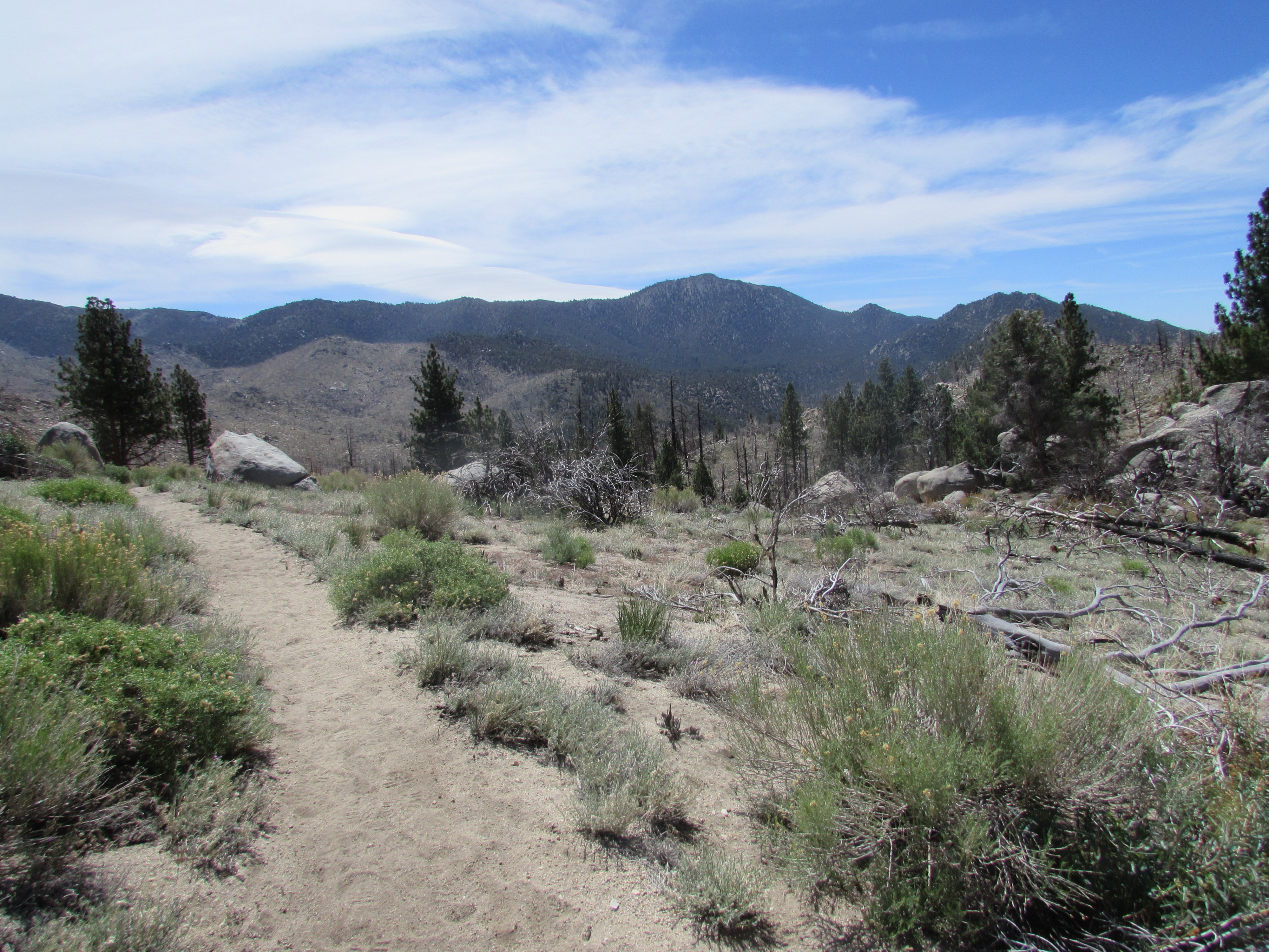
Just after Tehachapi, there was a pretty steep climb that lead into the southern-most section of the Sierra-Nevada mountain range over Walker Pass. There were finally trees again, and I was surrounded by fascinating wildlife at every turn.
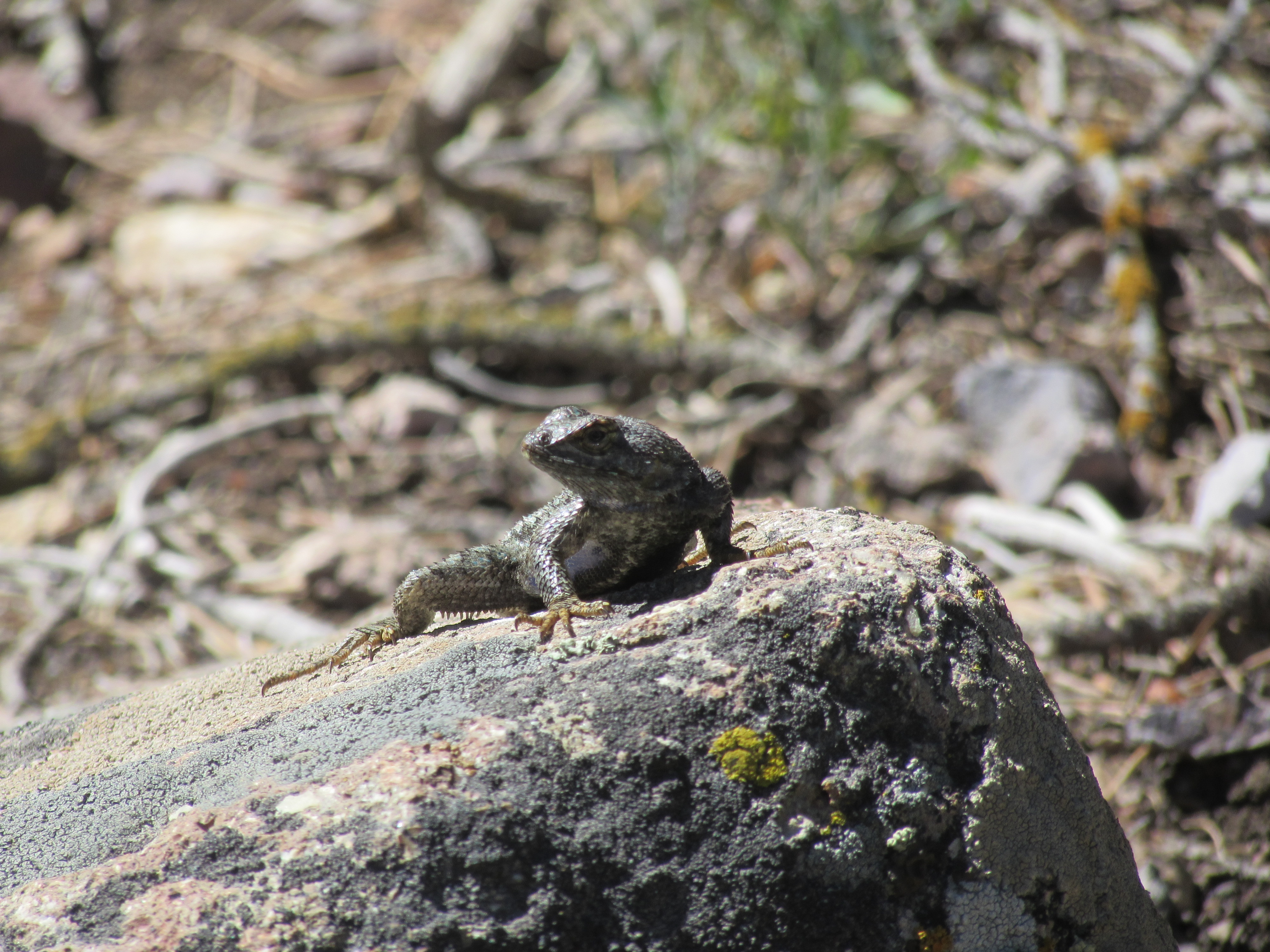
Lizard in the Southern Sierra Nevada
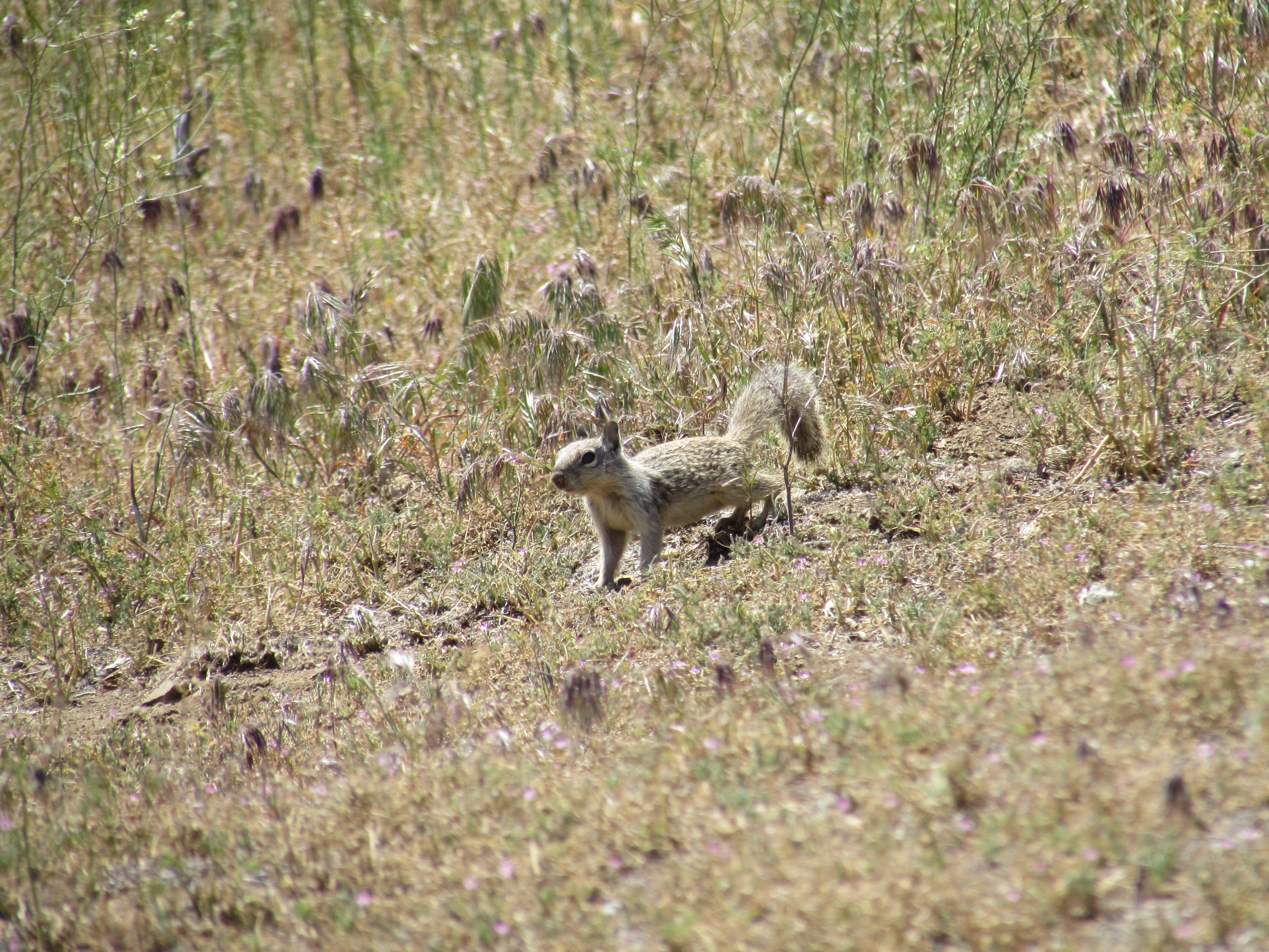
Ground Squirrel in the Southern Sierra Nevada
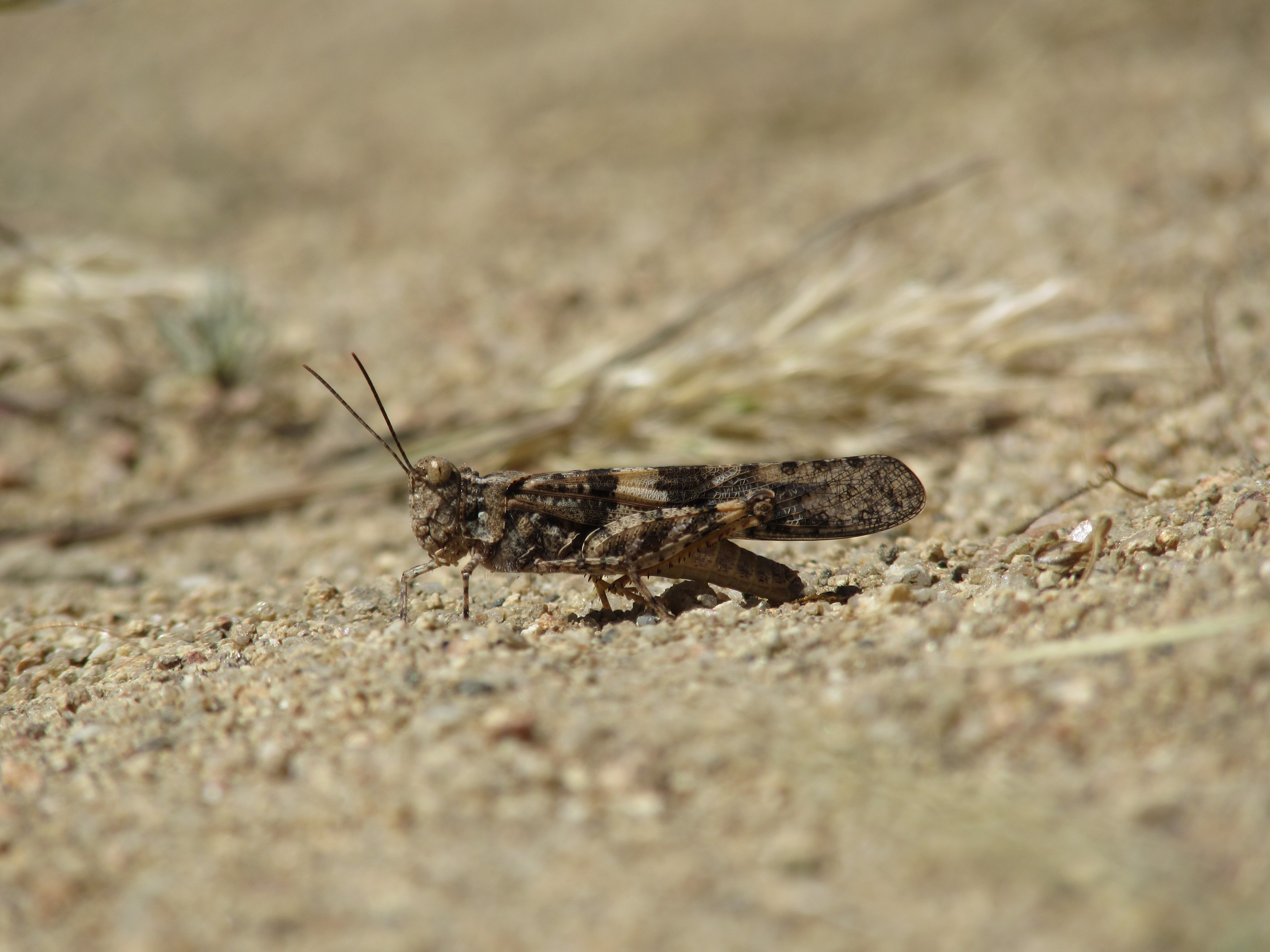
Grasshopper in the Southern Sierra Nevada
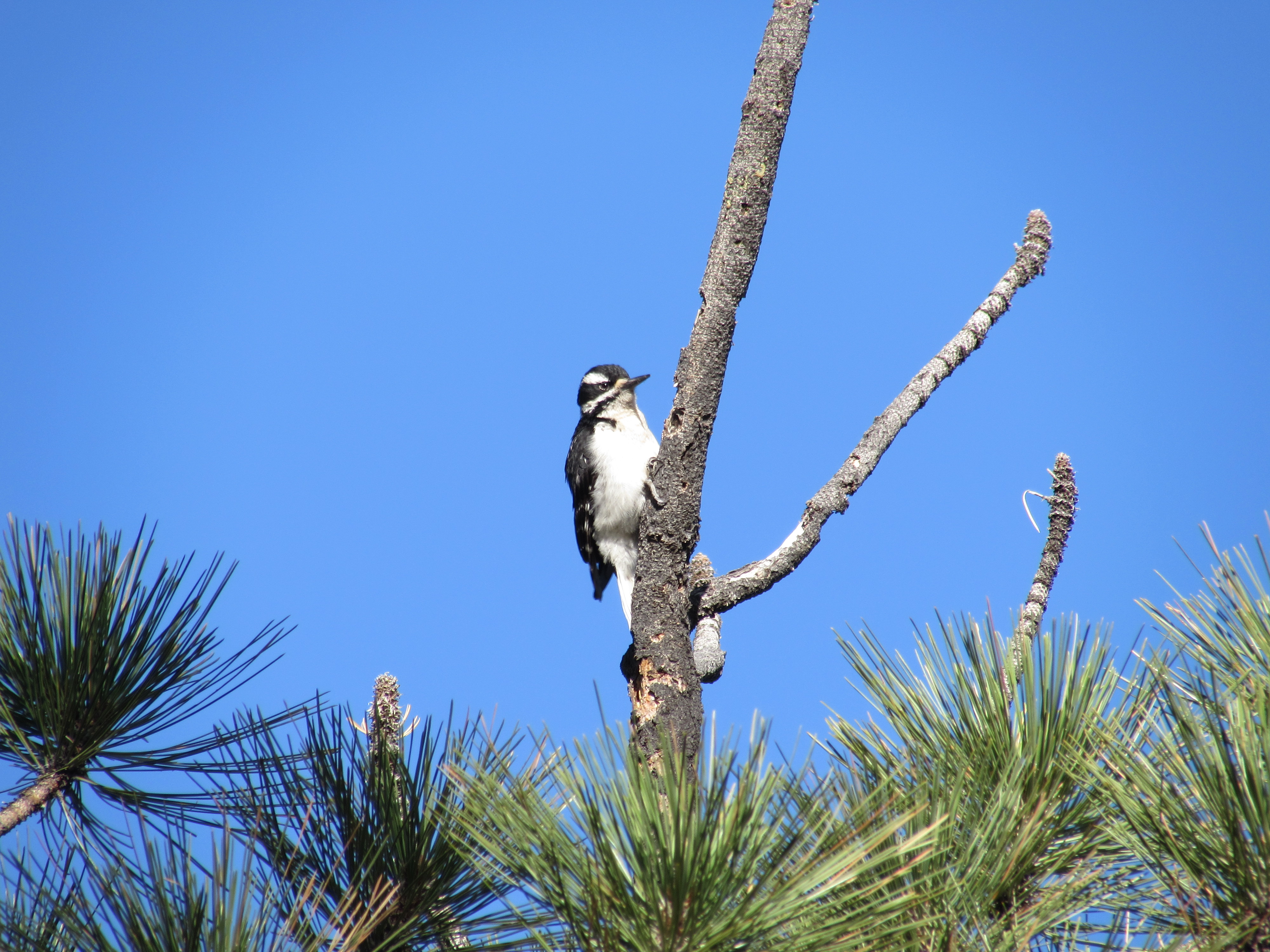
Woodpecker in the Southern Sierra Nevada
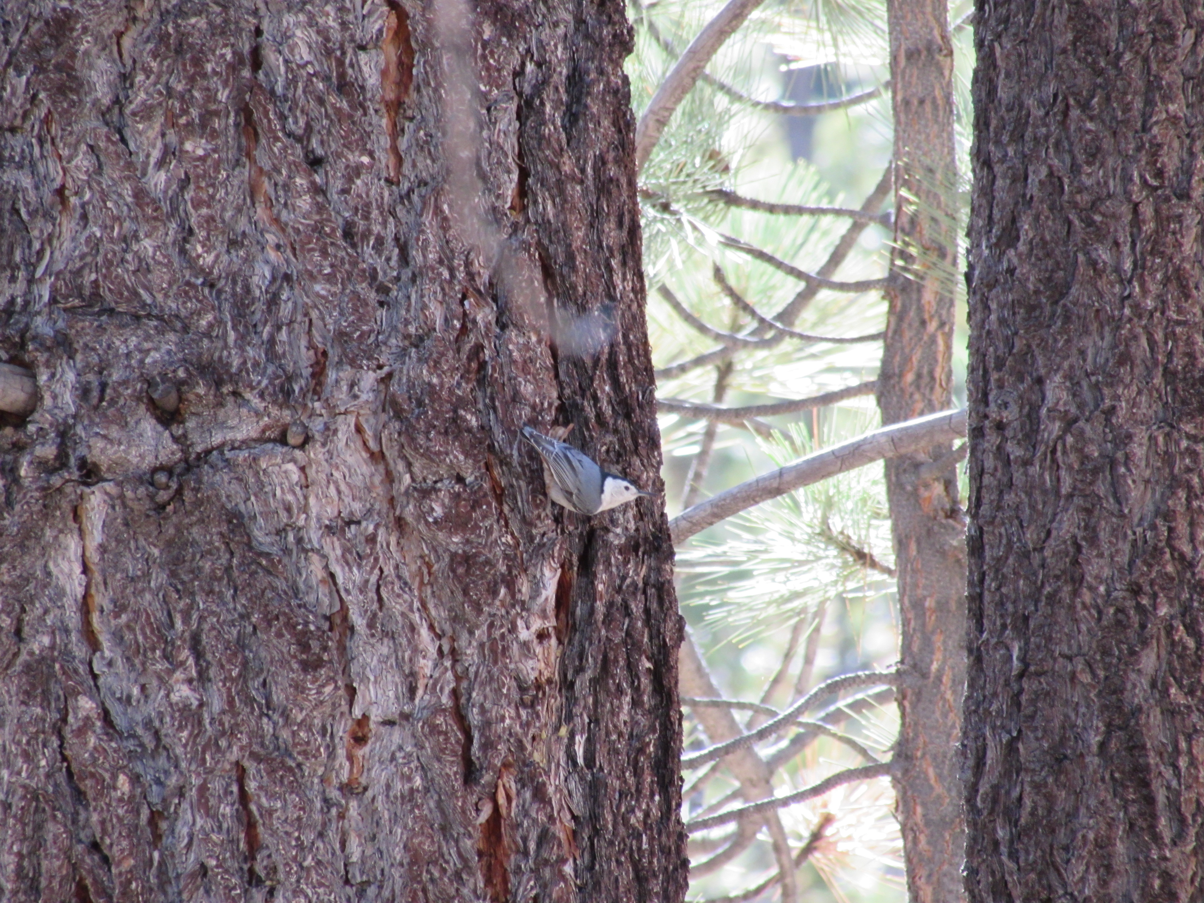
Pygmy Nuthatch in the Southern Sierra Nevada
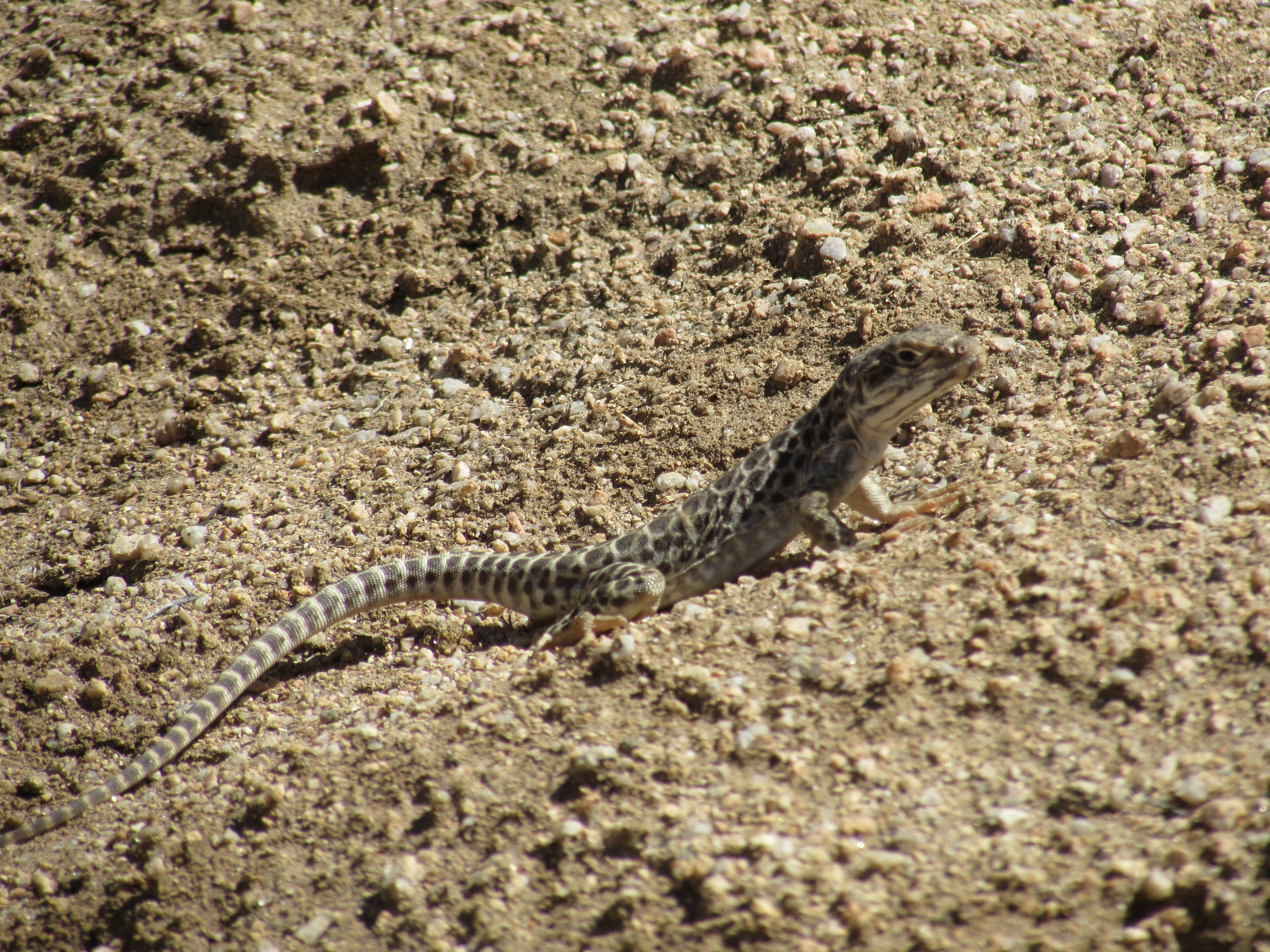
Long-Nosed Leopard Lizard in the Mojave Desert
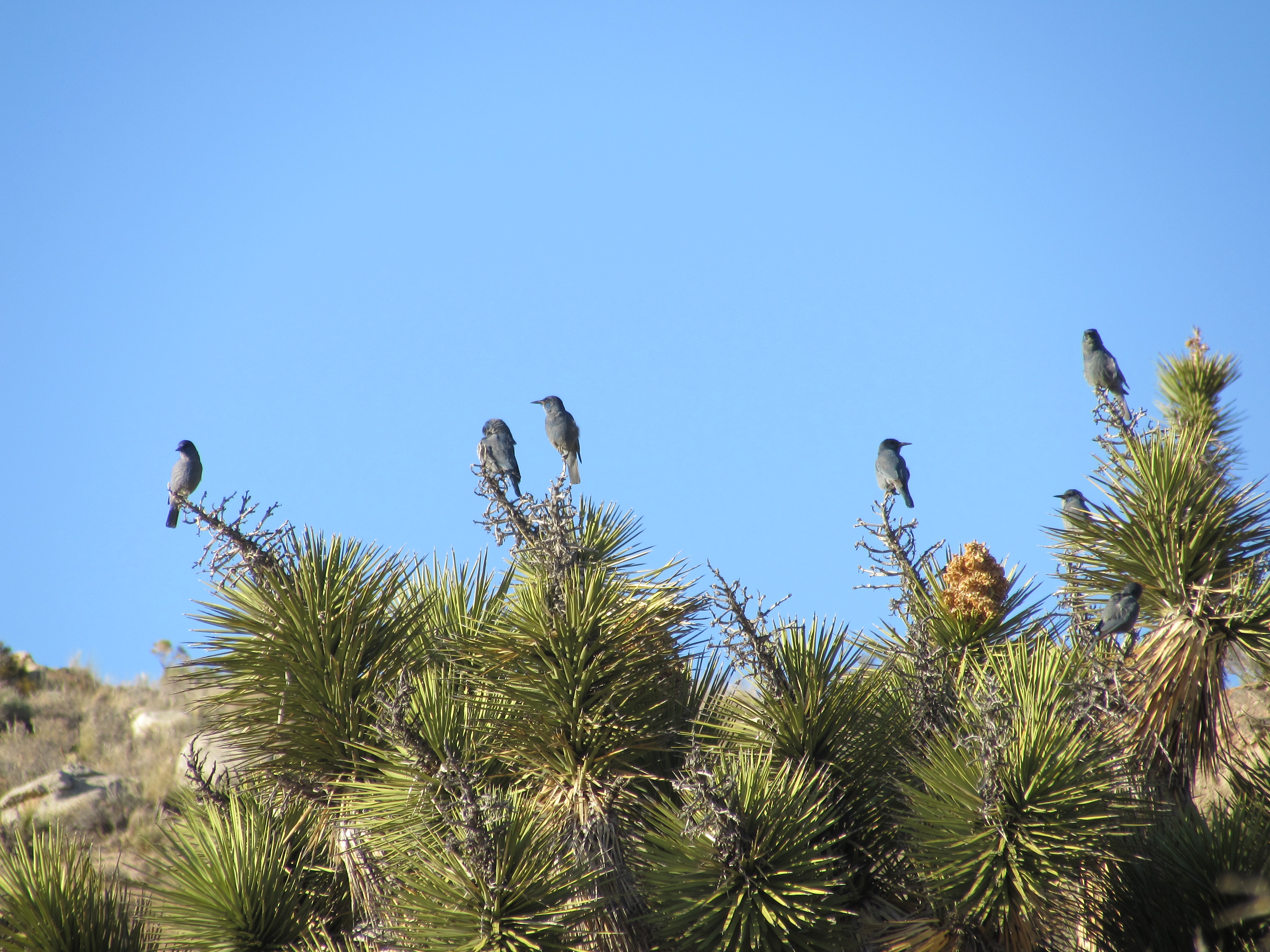
Scrub Jays Sit on a Cactus in the Mojave Desert

Hawk Sits on a Cactus in the Mojave Desert
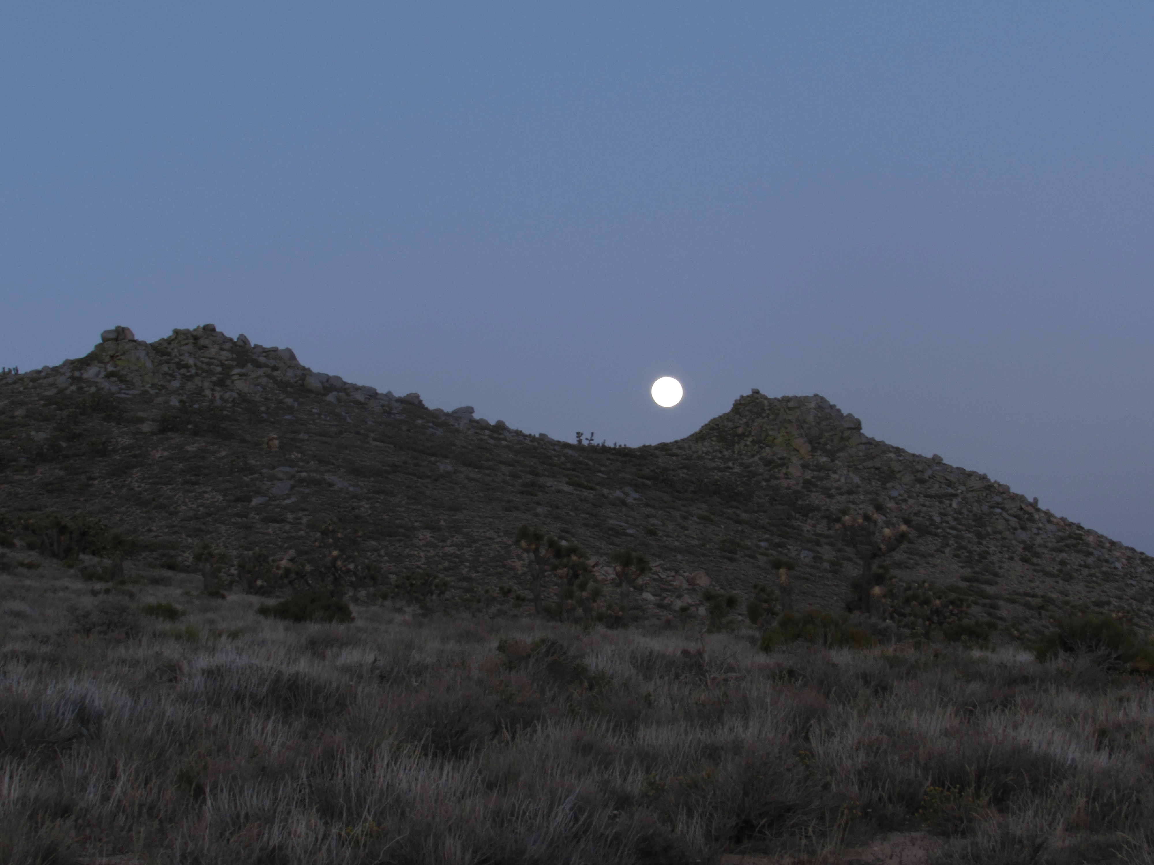
The full moon over the desert was bright enough to cast a shadow of my body into the light of my headlamp and I walked past midnight for 3 or 4 consecutive nights.

Moonrise Over the Mojave Desert
Moonrise Over the Hills of the Mojave Desert

Red Moon Over the Mojave Desert
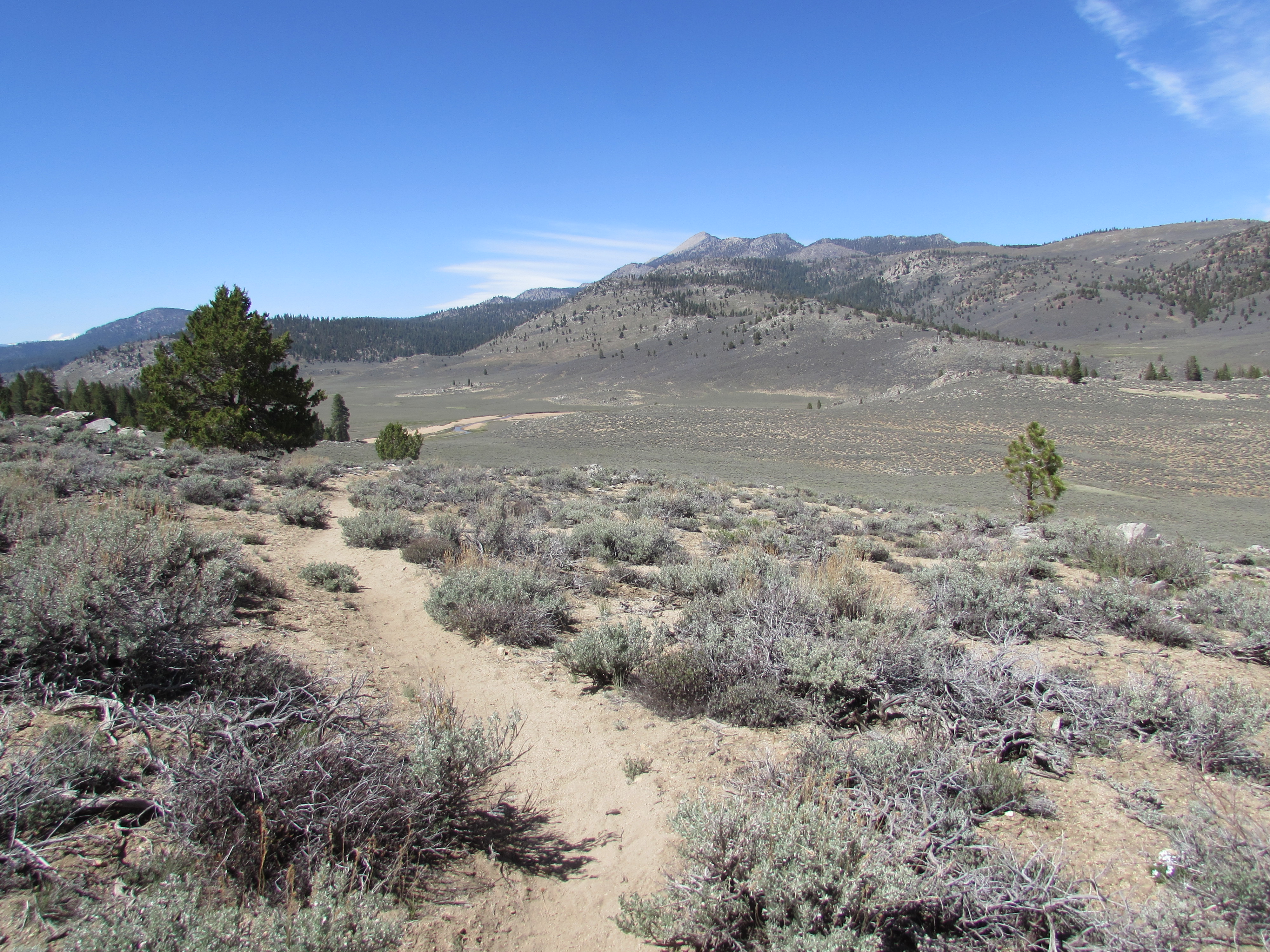
Just before arriving to Kennedy Meadows, the unofficial start of the High Sierras on the PCT, I ran out of food and had to hitch-hike another 15-20 miles to get into town. During my first thru-hike, I know I would have gone back to make up those miles, but I have learned not to fret over a few lost miles, especially if they consist of a steep climb through a burn area, like these did. There’s no glory in forcing myself to walk a section I know I wouldn’t enjoy- this hike is about having fun anyway, and as long as I don’t make a habit out of it, then it makes no difference to me- not to mention that I was already tantalizingly close to the high country, so I decided to just push on. That first day in the South Sierra Wilderness was a day that I will never forget.
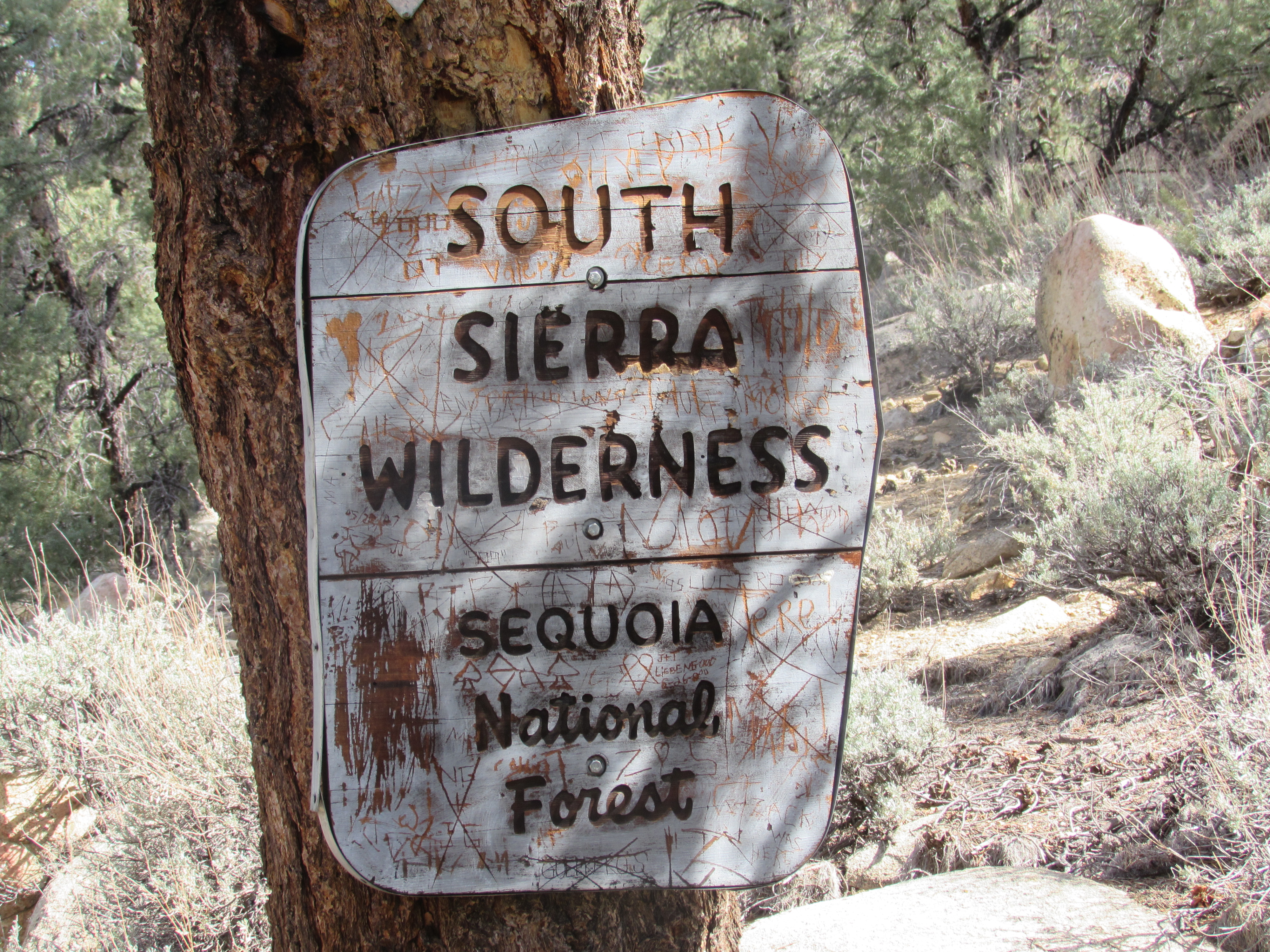
Sign for the South Sierra Wilderness in Sequoia National Forest
Trail in the South Sierra Wilderness
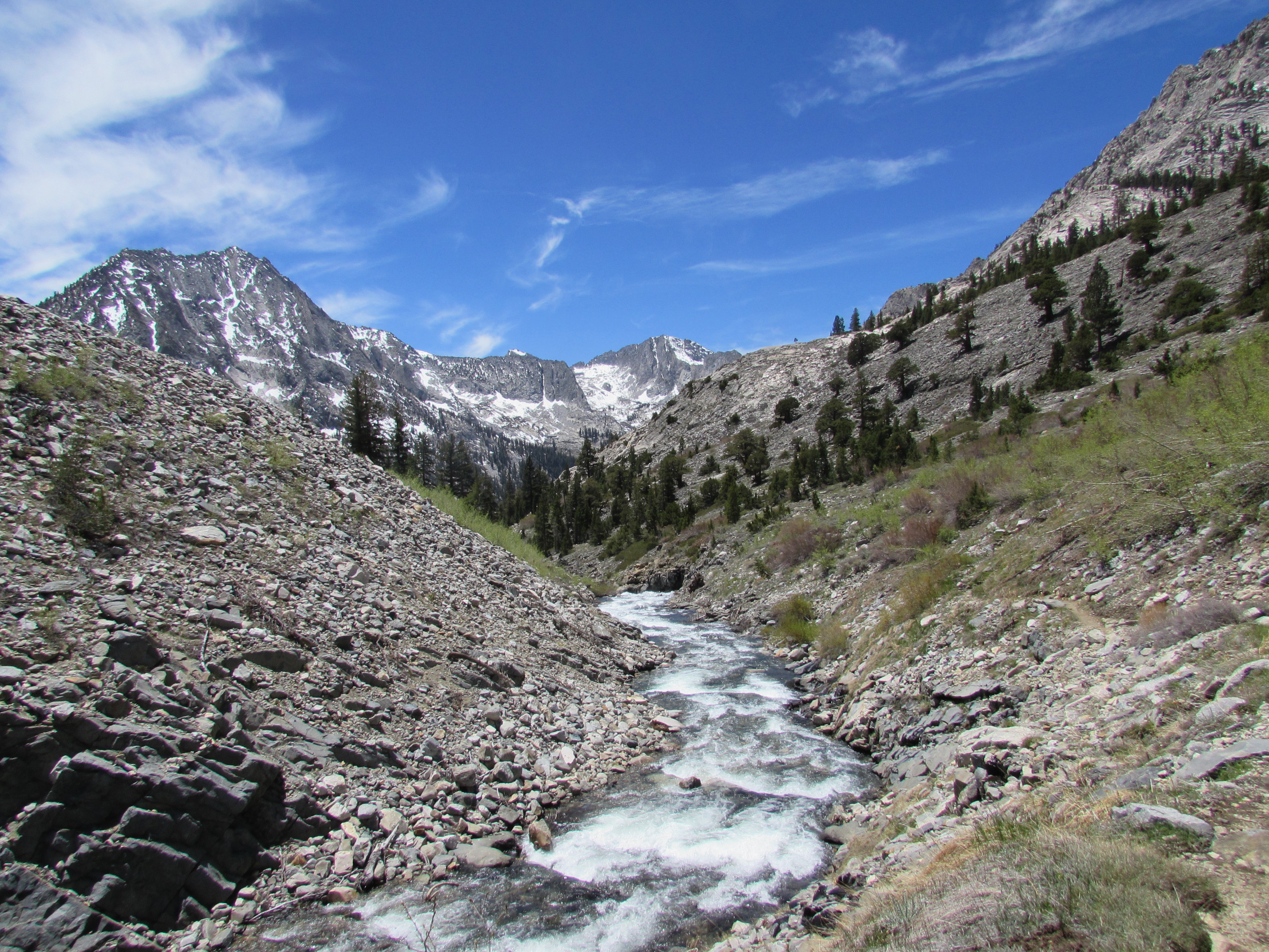
Death Canyon in the South Sierra Wilderness

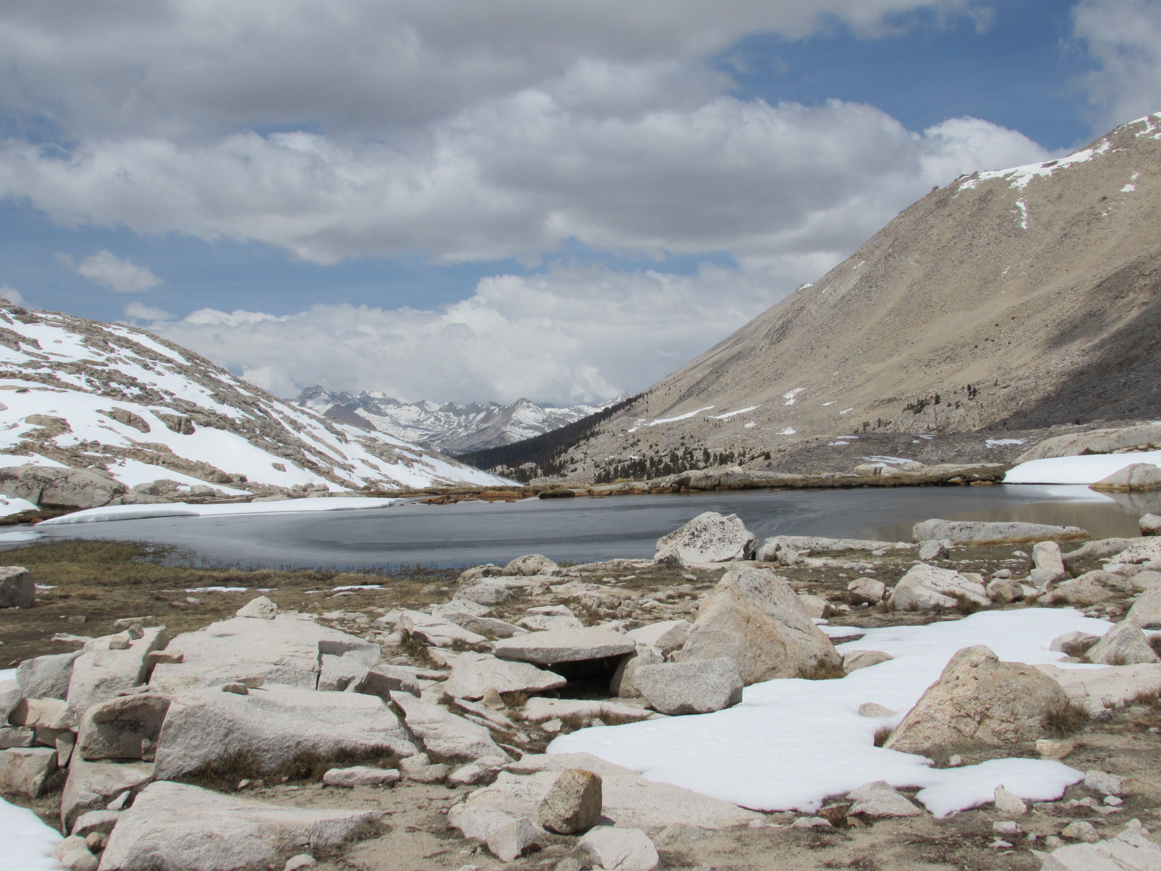
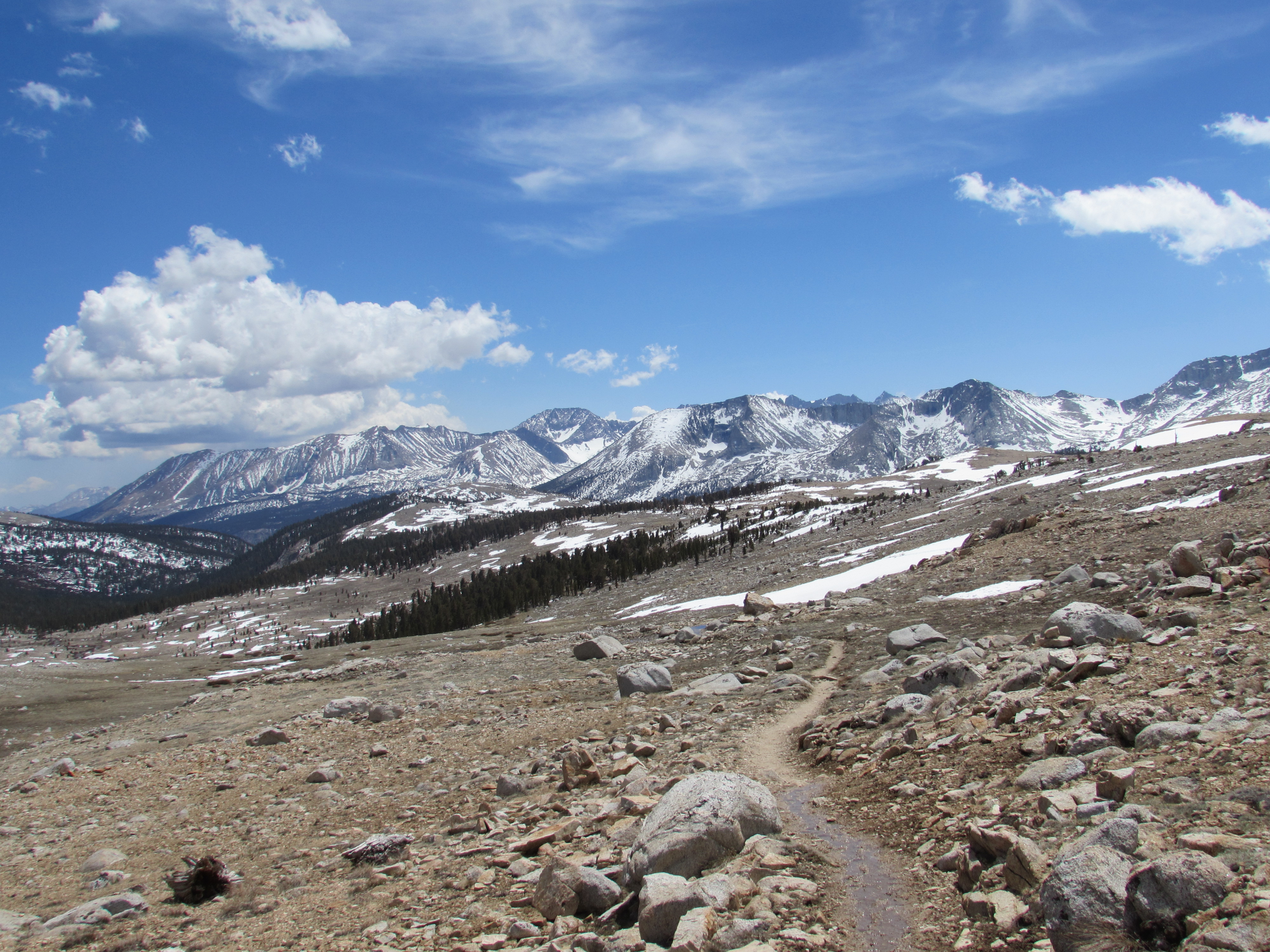
South Sierra Wilderness
I could feel my muscles craving more oxygen on slopes that normally would have been pretty easy, and as I gazed over the snow-capped mountains in the distance, I became both excited and anxious to no end. Their beauty is only matched by the difficulty of the trails that undulate around them; the climbs were no steeper than those I’d already conquered, but they seemed to drag on forever, up and up and up these huge mountains. When I thought I’d nearly reached the peak after hours of climbing, I would creep up and over the last switchback, only to realize that I had really been ascending to the base of an even greater mountain the entire time and still had a very long way to go to get to the top.
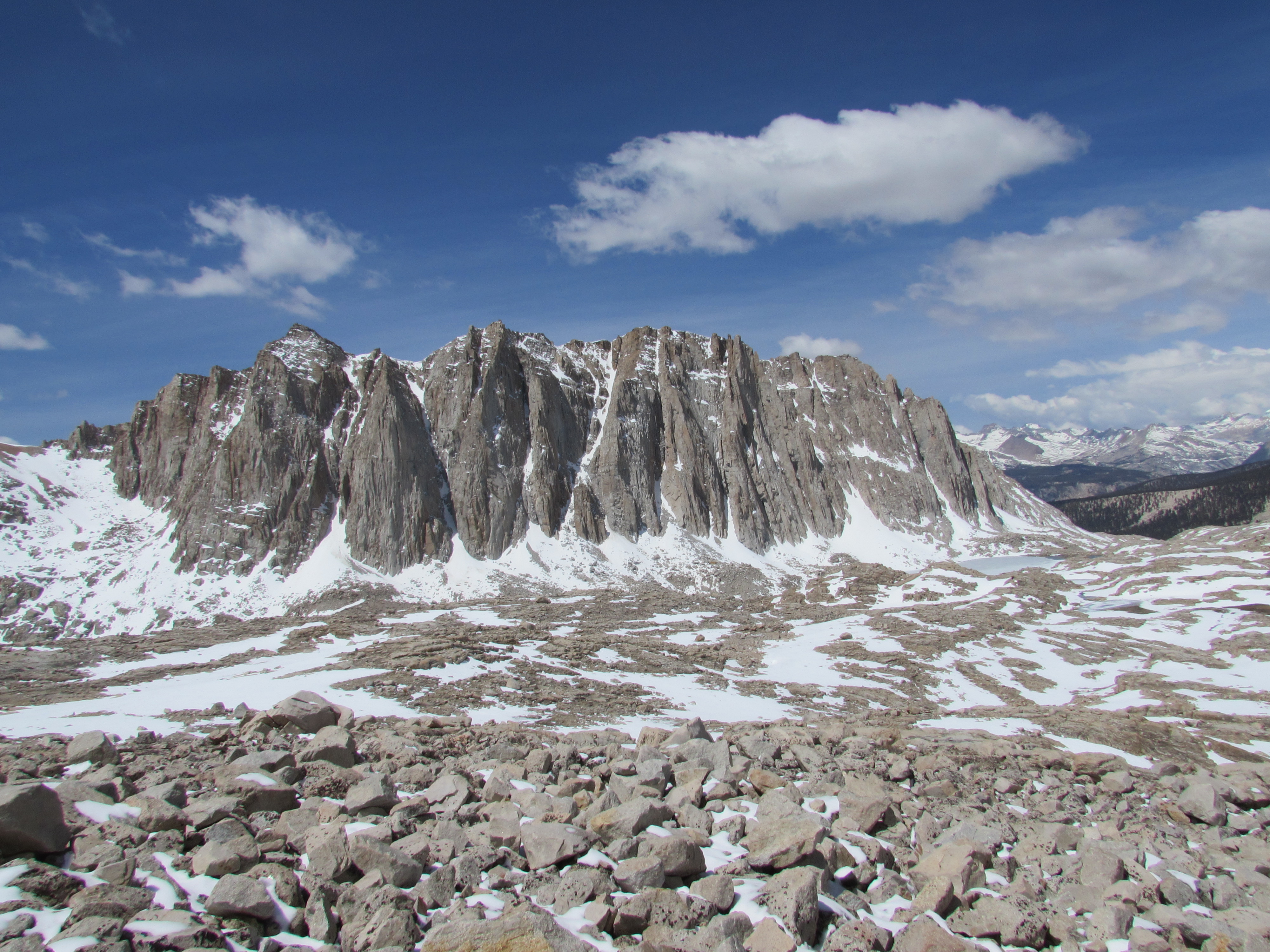
Owens Peak Wilderness in the Sequoia National Forest
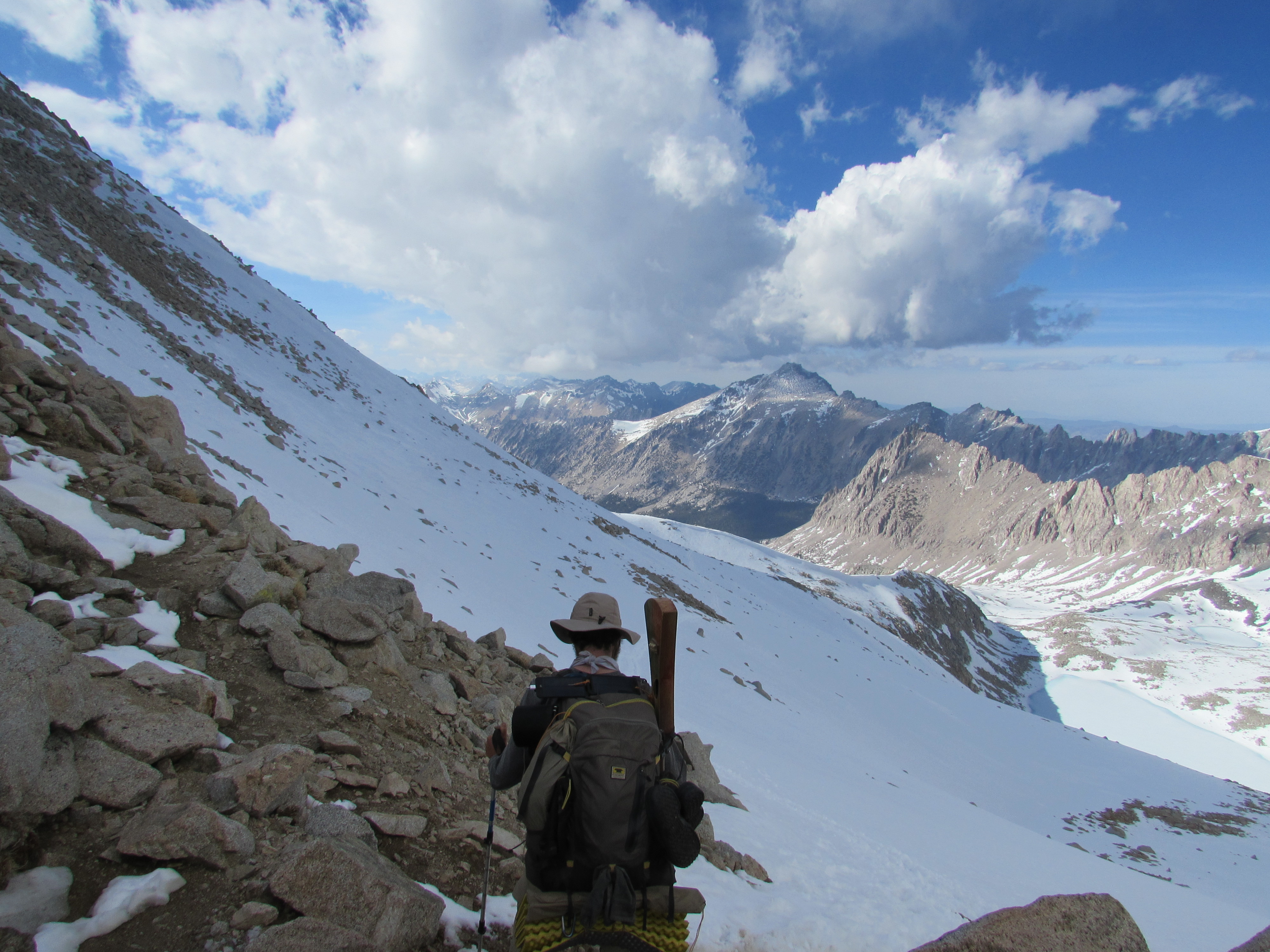
My daily mileage was nearly cut in half by the increasing altitude, but the extra time I needed to rest allowed me to take many pictures and occasionally go for a swim in the frigid waters of the high altitude lakes, filled with the clearest and cleanest water imaginable. I couldn’t wait to tackle Mount Whitney, which at 14,505 feet makes it the highest peak in the contiguous United States. Just as I approached its base, however, a snowstorm blew in that lasted 3 days, and I crammed into a station wagon with 7 other hikers while hitching into Lone Pine to wait it out. 5 of us ended up squeezing into a 2-bed room at the hotel (it was cheaper per person than staying at the hostel), and we had a blast playing cards and staying up late, swapping stories from the trail. Under the wave of anticipation and excitement that abounded in all of us, there was an evident but helpless worry for a few other hikers that hadn’t come into town and were undoubtedly stuck in the storm. We could watch the snow dumping on top of the mountain from our window, and concluded that no one should try to summit Whitney alone, but that none of us were discouraged from trying it as soon as the snow had ceased.
Mount Whitney
The day came and we all got rides back up to 10,500 feet where the PCT lead to the Whitney Spur Trail. It was warm out, and the trail was covered in slushy snow and mud for the first few miles.
Cottonwood Pass in the Inyo National Forest
I stuck with the 4 other hikers that had split the hotel room with me, and we napped in a gorgeous meadow in the afternoon so that we would be well rested when we hiked up at night and saw the sun rise the following morning. We left around 9:30pm at the start of the 8.5 mile Whitney Spur Trail.At first, we joked about how it was so warm out, and we made a great pace for the first couple miles.
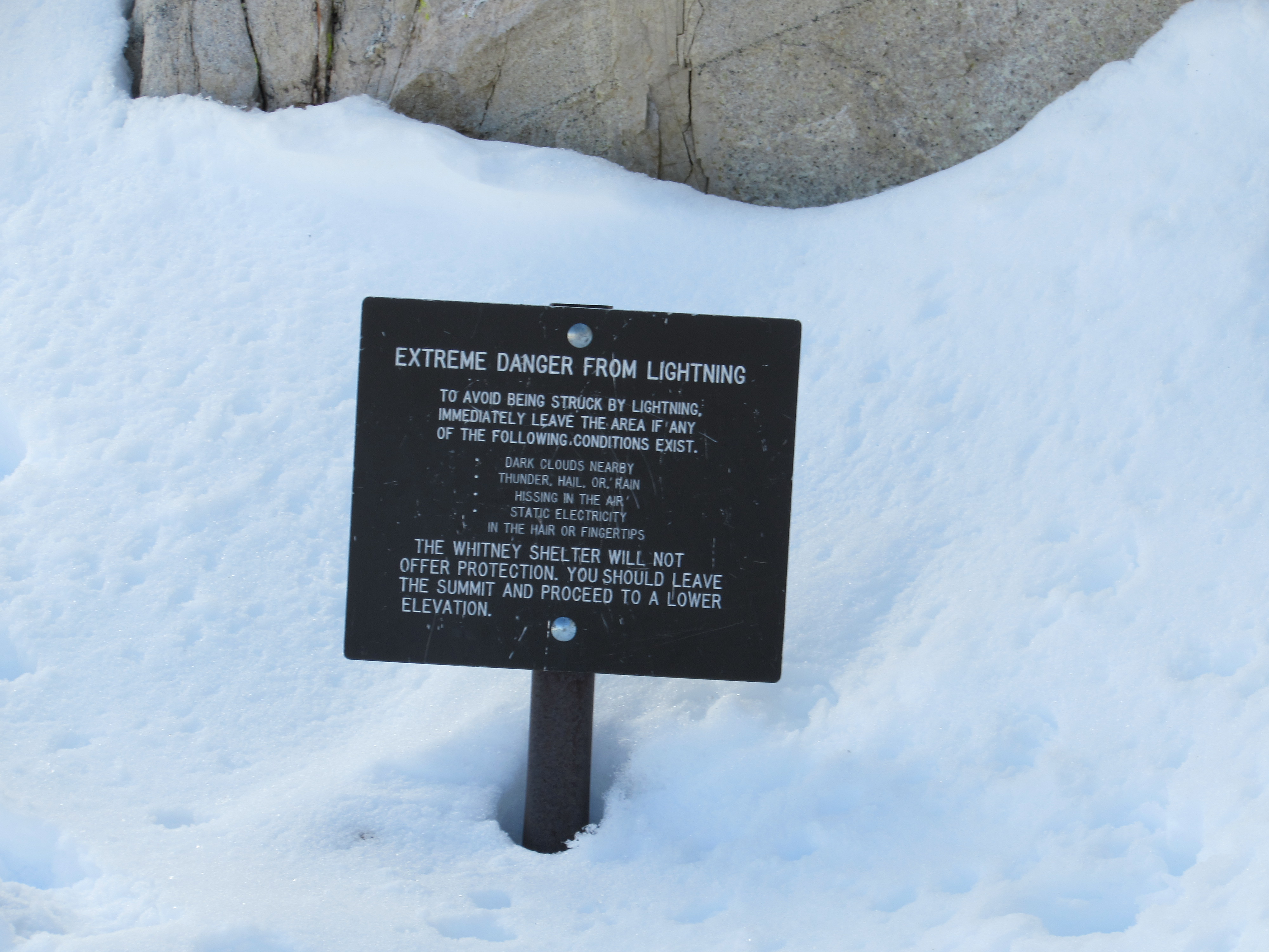
Lightning Danger Sign Near the Summit of Mount Whitney
Once we hit snow, however, the ascent became difficult and we all strapped the spikes onto our shoes. I was the only person in our group with full crampons rather than microspikes, and I was also feeling very anxious to get to the top, so mid-way up the mountain, I decided to lead the way. I stopped at a small patch of exposed rocks to allow the group to reassemble and we all put a few more layers on. It was starting to get cold, and we agreed to continue moving to stay warm. Soon, we were crossing steep ice faces, and it was clear that we were the first ones to walk in the fresh snow, because there were no footprints on this side of the mountain, so I lead the way again and made tracks with my crampons for the rest to follow. We gradually slowed down as the terrain became more treacherous and our bodies more worn from the deepening snow. The trail crest, where the trails on both sides of the mountain meet and lead to the summit as one, was 1.9 miles from the top. Walking those last 1.9 miles, between maybe 1:30-3:30AM was unquestionably the most physically demanding experience of my entire life. With nearly every step, I would sink up to my knees in half-frozen snow, and there were many times where a fall would have easily lead to serious injury or death. One person in our group did fall while crossing a steep slope of ice, but he managed to self-arrest with his ice-axe and continued walking, a little shaken but still strong. We were all being pushed to the absolute limits of our capability, and around half a mile from the summit, it became so cold and windy, and taking a single step was so exhausting, that I wasn’t sure if reaching the shelter on the summit was just a challenge anymore- this seemed closer to a matter of survival. Very near the top, with maybe a quarter mile left to climb, the trail seemed to just end, and it was too dark even with my headlamp, to see the shelter. I made a bold but important choice and began scrambling straight up the mountain in near desperation. I was able to take one step about every 3 seconds and each breath felt like I had just come up from holding my breath under water. Halfway through one of my steps, I sank down to my waist in snow and my foot dangled in a crevasse between two giant boulders. I was fortunate not to have broken my ankle, for a rescue up here especially at this hour, would be impossible, assuming we were able to contact them
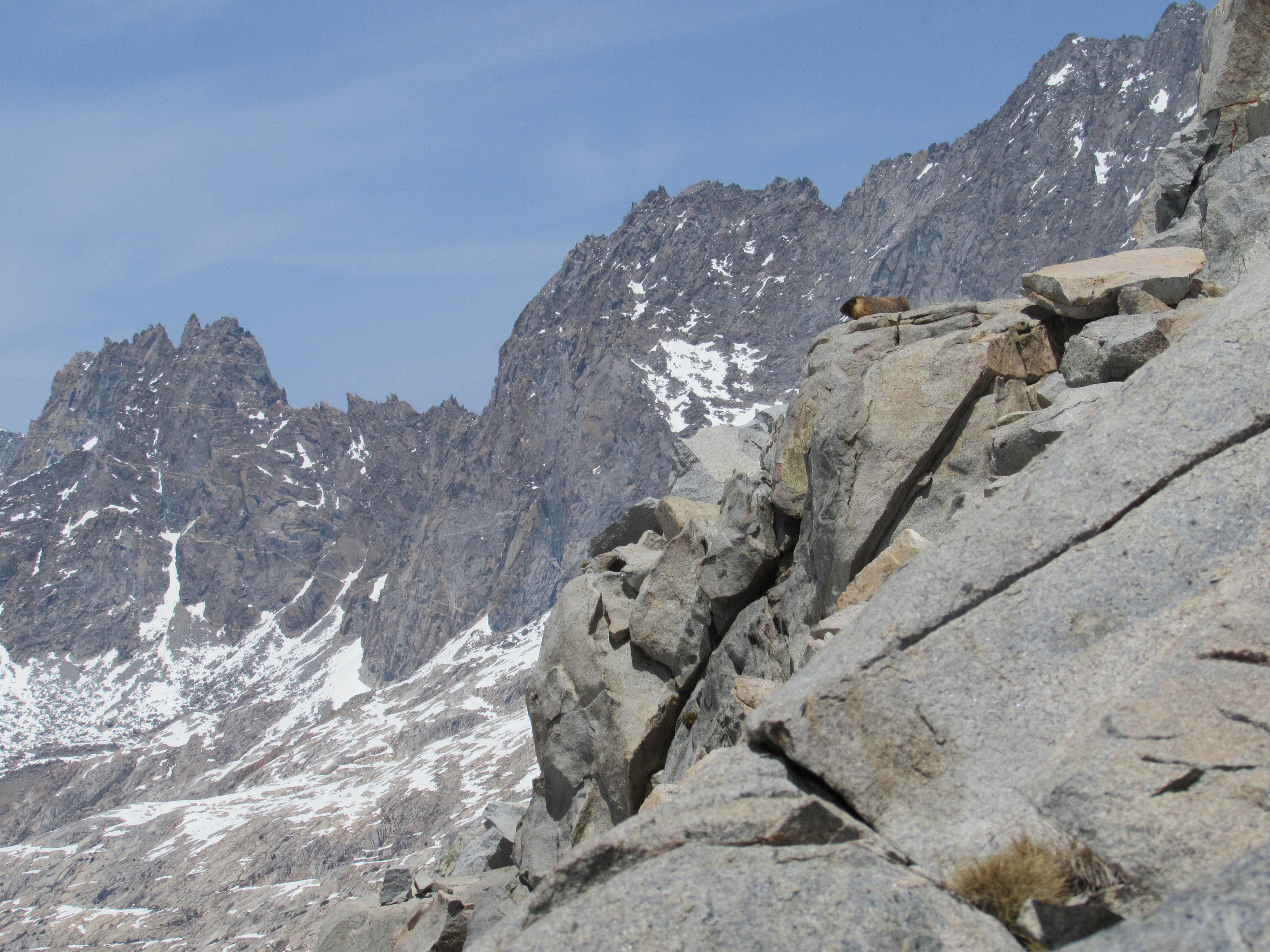
in the first place. Even when I finally was able to see the shelter, it felt like hours passed by before I actually reached it, and when I opened the door, I was surprised to see someone else already in their sleeping bag in the small square room. He had come up from the other side of the mountain during the day, and had been here since the time we left the meadow hours earlier. The snow must have blown over his tracks over night. I must’ve seemed like a madman, panting and delirious from being so exhausted. I moved as quickly as I could, taking off my heavy wet boots and crawling into my sleeping bag, very glad to have made it and to be talking with someone who was much more level-headed than I was. He asked about who was behind me, and I felt a pang of worry rush through me. What if my friends weren’t able to follow my tracks straight up the mountain? What if they were lost out there somewhere? How long should I wait before going out to look for them? Part of me knew that I was disoriented and couldn’t think clearly, but part of me began to realize the seriousness of the danger we had put ourselves into. Just then I saw a faint light around the edges of the doorway, and the hiker that had been there said “that must be them,” apparently not as worried and probably a little more rational than I was. The 4 of them came in, looking as breathless as I had been moments before. It wasn’t easy by any means, but we had all done it. We were on the highest mountain in the lower 48 states! With a sigh of relief, I fell asleep immediately. When I woke up, there were at least 10 other people in this tiny room and shoulder-to-shoulder was not efficient enough to fit us all. I had missed the sunrise during my slumber, but also managed to remain unconscious while more and more hikers packed into the shelter with us. “Well, hello everybody!” I said to the group, rubbing my eyes and smelling the scent of coffee that someone had just brewed and passed to me. As the sun came out, it warmed up to maybe 30 degrees- we guessed that it was around 20 at the coldest that night- and one by one, we all made our way down the mountain after taking the obligatory picture or two and signing the register at the top. Although I was the first to have made it up during the night, I was one of the last to leave that morning. It took me a long time to crawl out of my sleeping bag and I took my time staring out over the most stunning vista I’d ever witnessed. As grueling as it was to climb up the mountain, hiking down that morning was the most pleasant walk of my entire young life. I could finally see all the frozen lakes and the rushing streams that flowed from them, the truly epic mountaintops capped by lenticular clouds, and the resilient little marmots that lived at this elevation without issue: all of which I couldn’t see the night before.
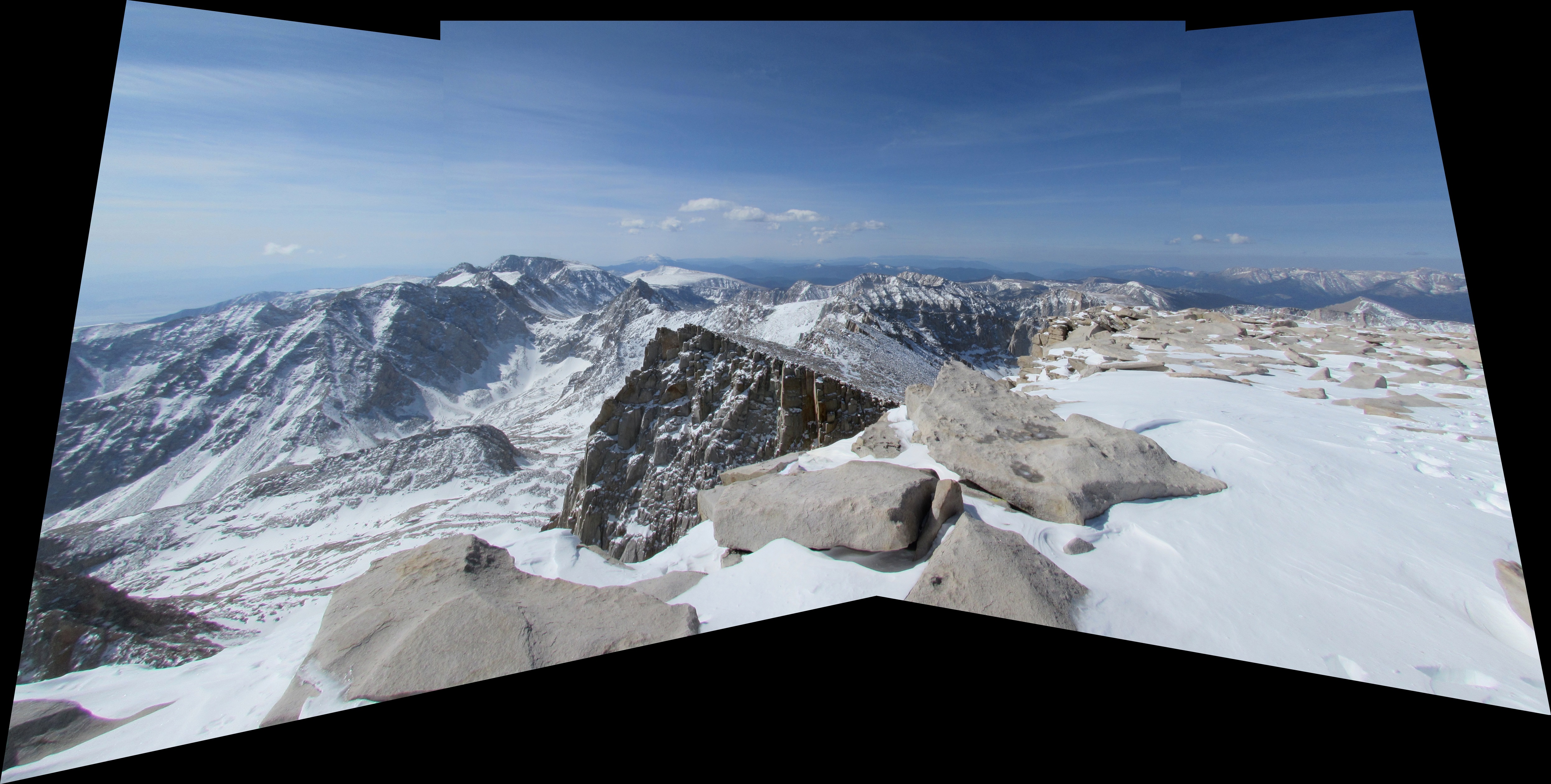
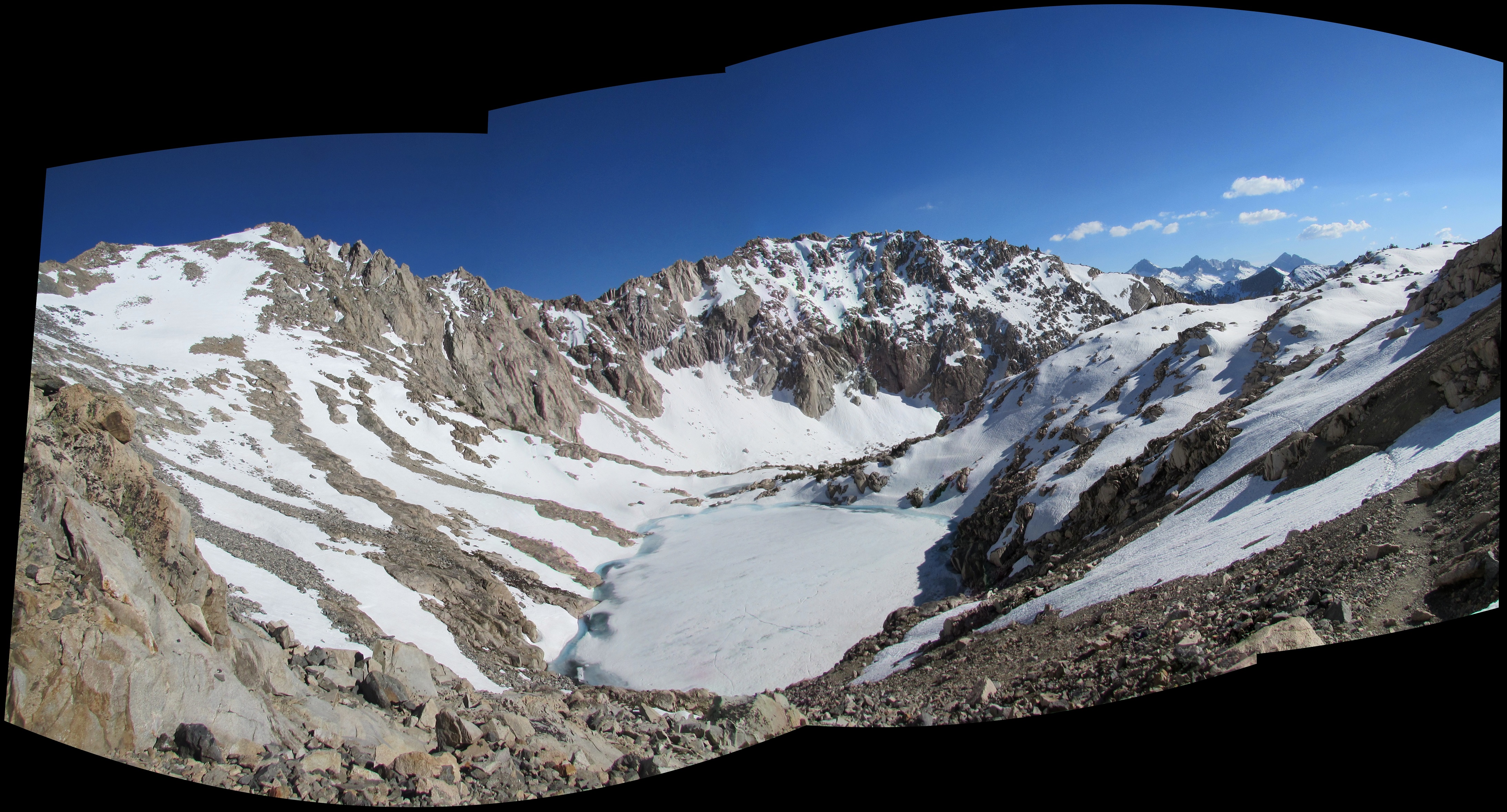
Mount Whitney in the Inyo National Forest Panorama
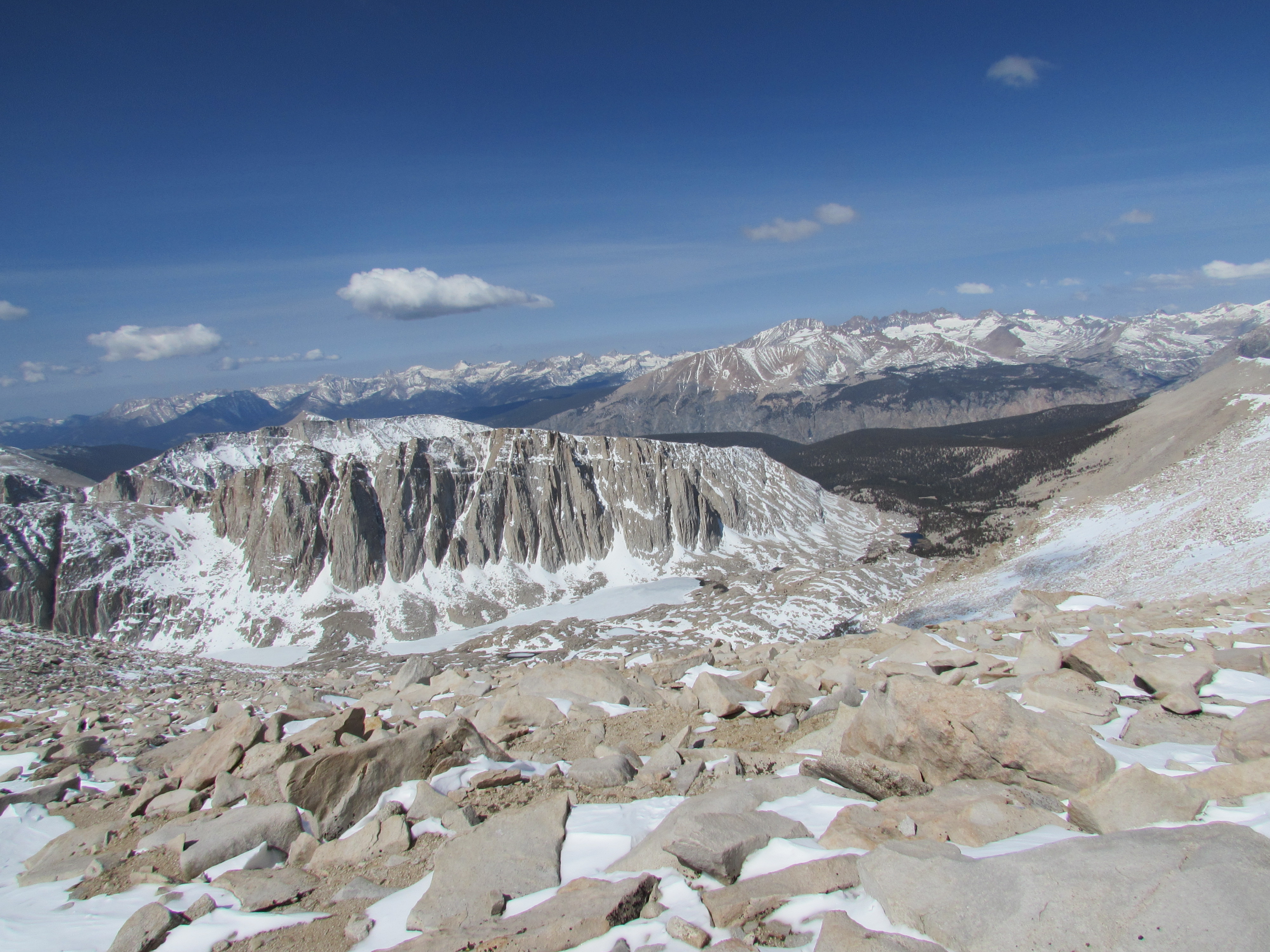
View from the Summit of Mount Whitney at 14,505 feet
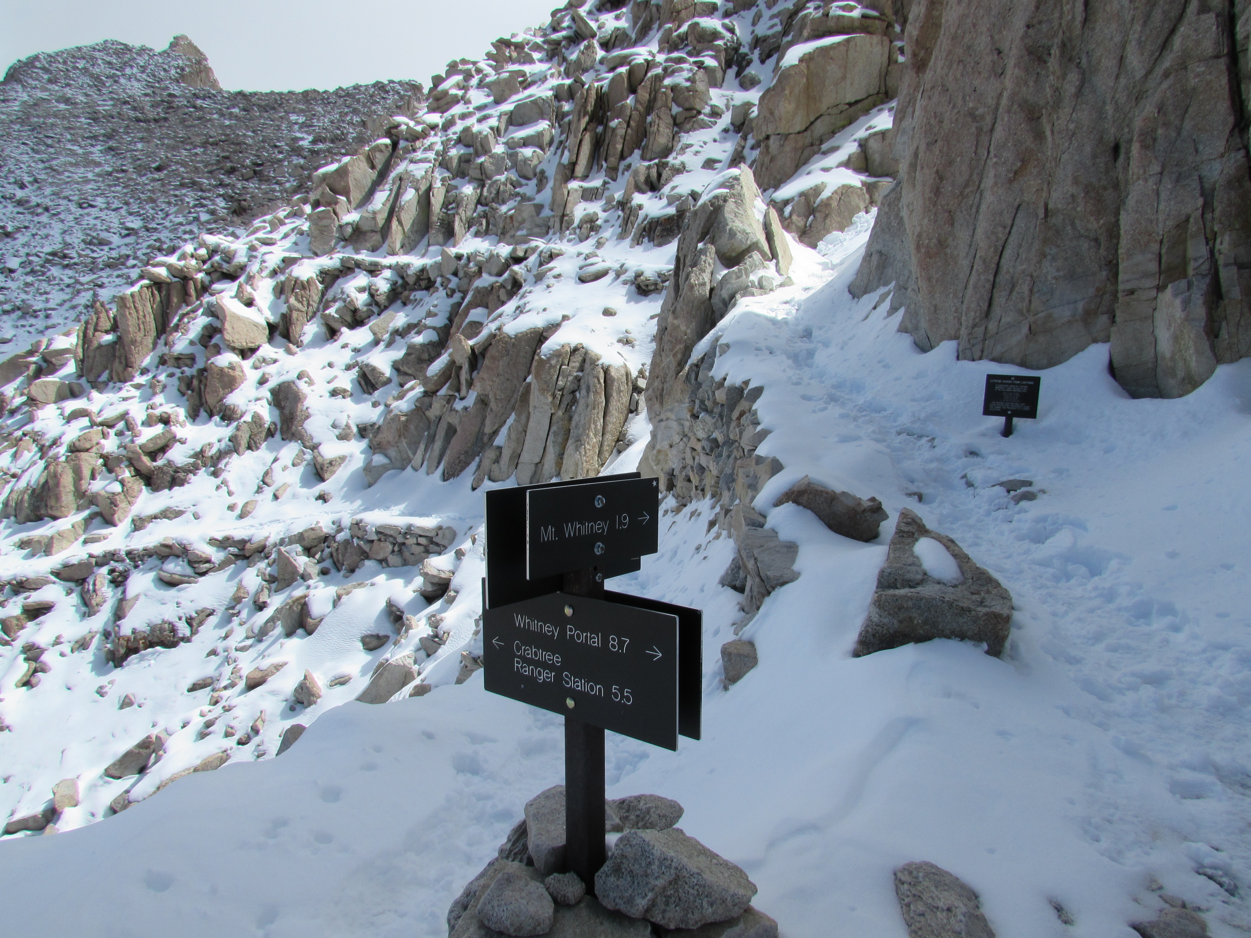
Trail Junction on Mount Whitney
Mount Hale on the Way up to Mount Whitney

Mount Hale on the Way up to Mount Whitney
Guitar Lake on the Way up to Mount Whitney
I walked slowly and let it all sink in. Just below the snow line, I saw a bald eagle swoop down in slow motion and snatch a fish right out of Timberline lake from about 50 yards away. Could life get any blissful than this? Is there any place in the world more serene? Our group had split up as we meandered down the mountain and I ended up back in the beautiful meadow that afternoon. I had only eaten a few Clif bars and a couple handfuls of granola in the past 24 hours, but for some reason I still had no appetite. I forced down food because I knew I was calorie deficient, and watched the marmots and deer roam around for an hour or two before I fell asleep again, this time without a worry in the world.
Acclimatizing
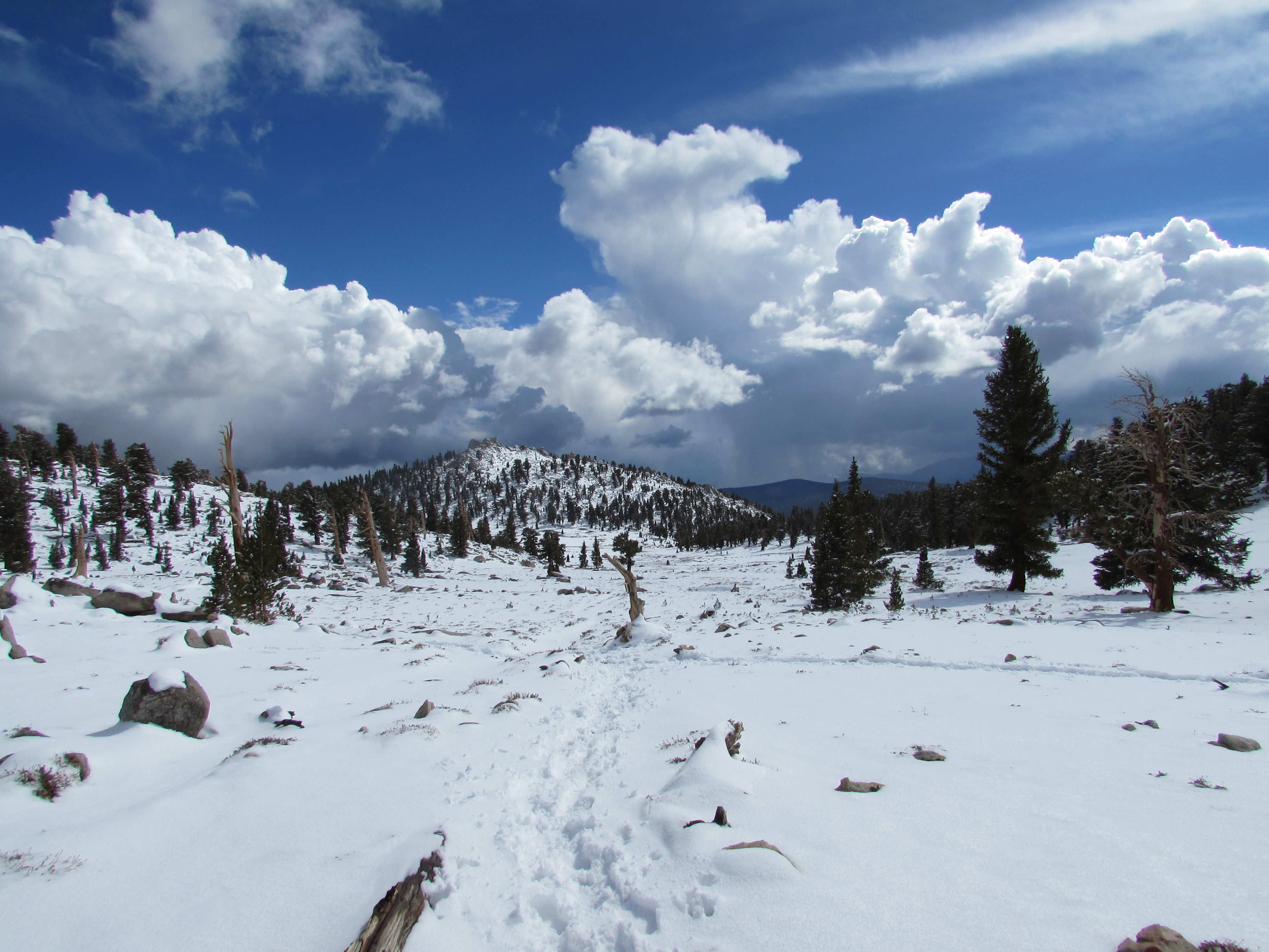
Mentally, I felt unstoppable, but climbing up to Forester Pass the next day reminded me that I had only just begun my time in the High Sierras. It was much, much easier to take rest breaks in the daylight, and following others’ tracks made it especially easy in comparison to Whitney, but I walked about 15 miles that day and was totally beat afterwards. That’s half the distance I was walking some days in the desert! So much for finishing in late July, I guess. As a morale booster, one of the hikers ahead of me decided to hike up the entire pass, totally in the nude. It was really unexpected and gave me a good laugh when I realized what he was doing. It was even better when 2 other hikers decided to join him! There was a bit of sketchy rock scrambling involved with reaching the top, and a few really steep snow banks that kept my eyes straight ahead in fear that looking down would give me vertigo and make me fall.
Bighorn Plateau in Sequoia National Park
First Person Perspective of Walking Down from Forester Pass
Hikers Coming Down from Forester Pass
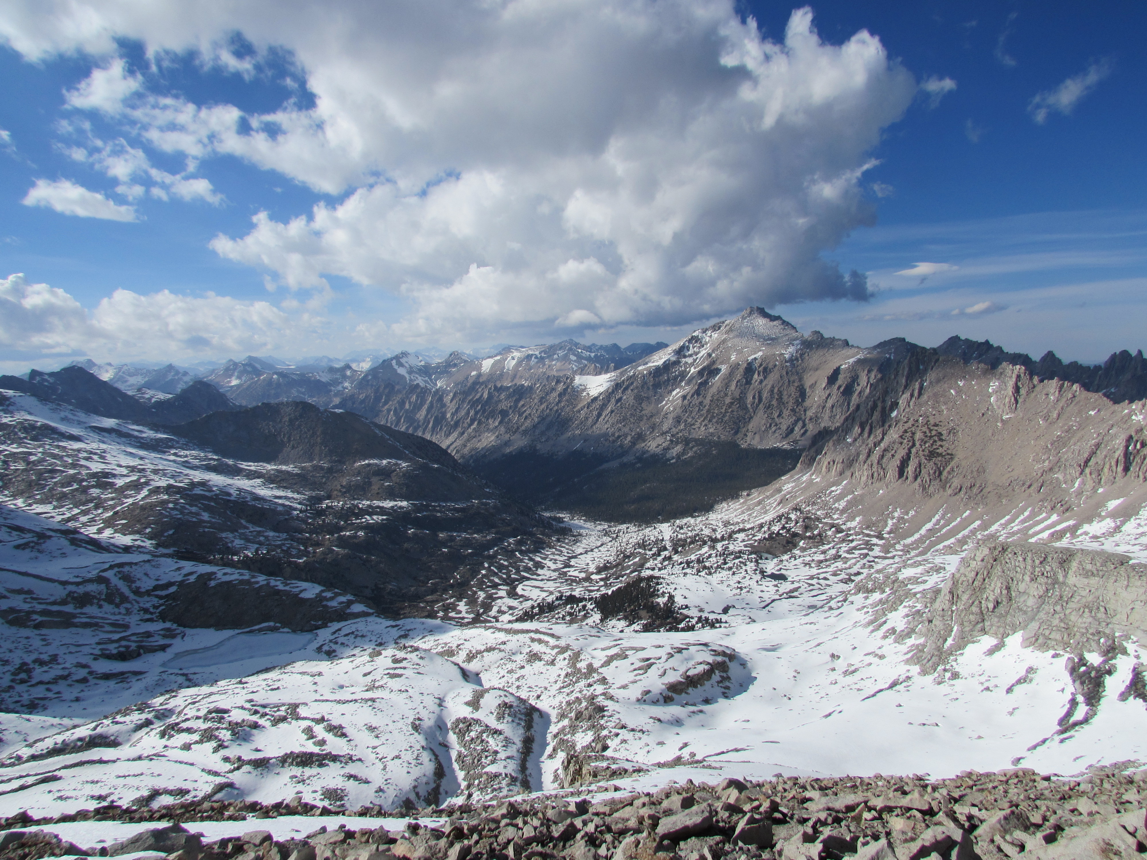
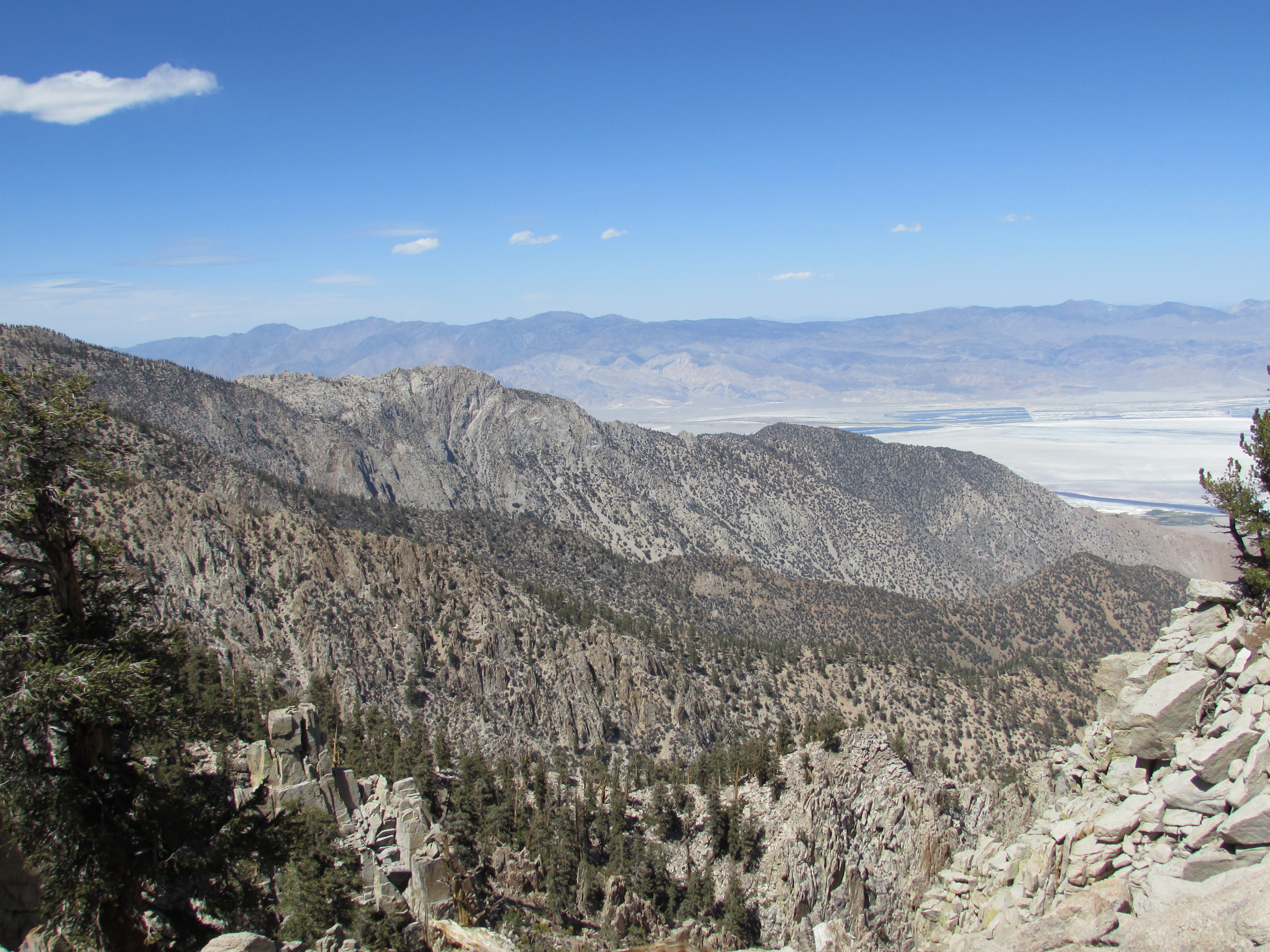
View of Kings Canyon National Park from Forester Pass
View of Kings Canyon National Park from Forester Pass
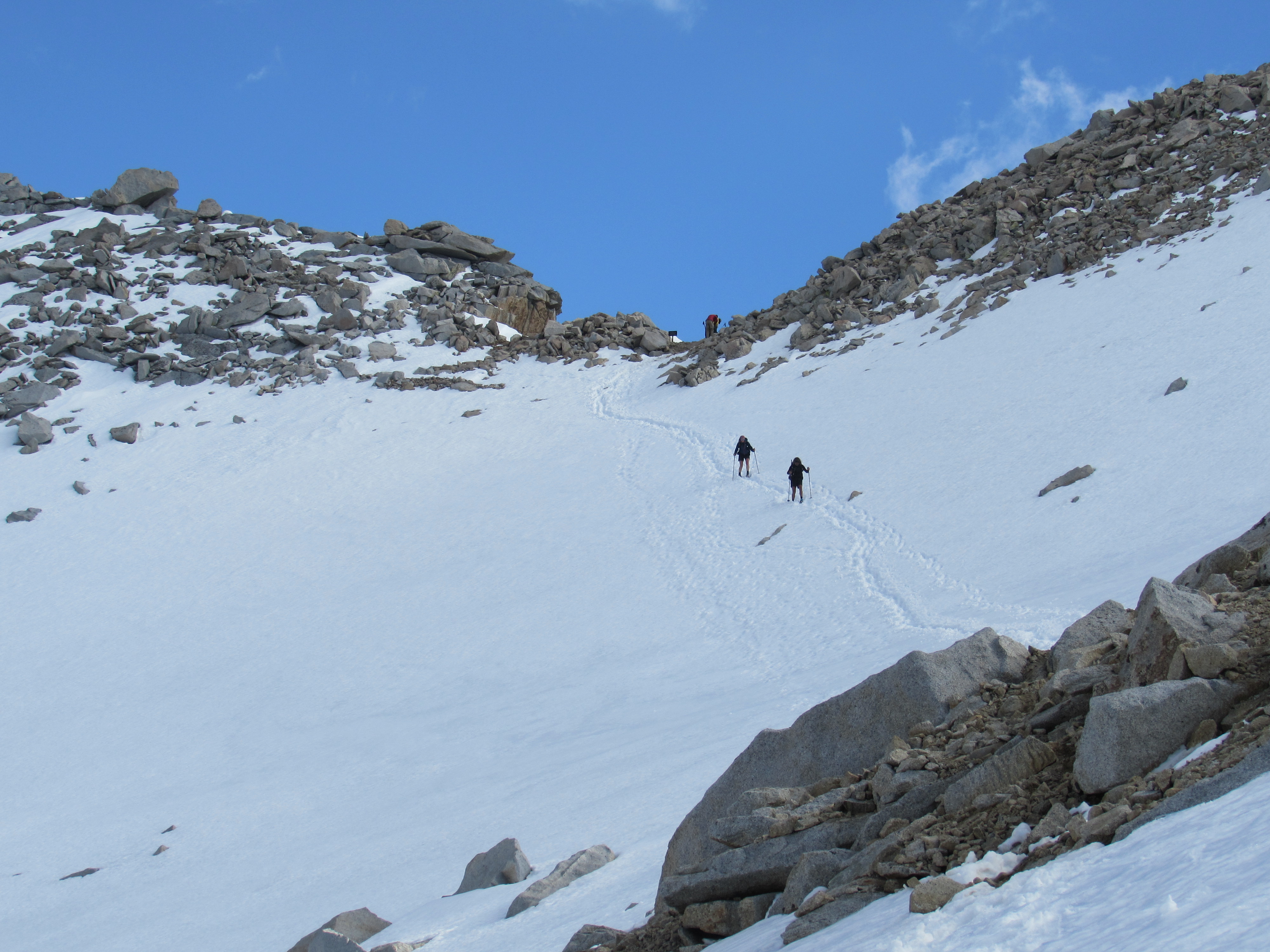
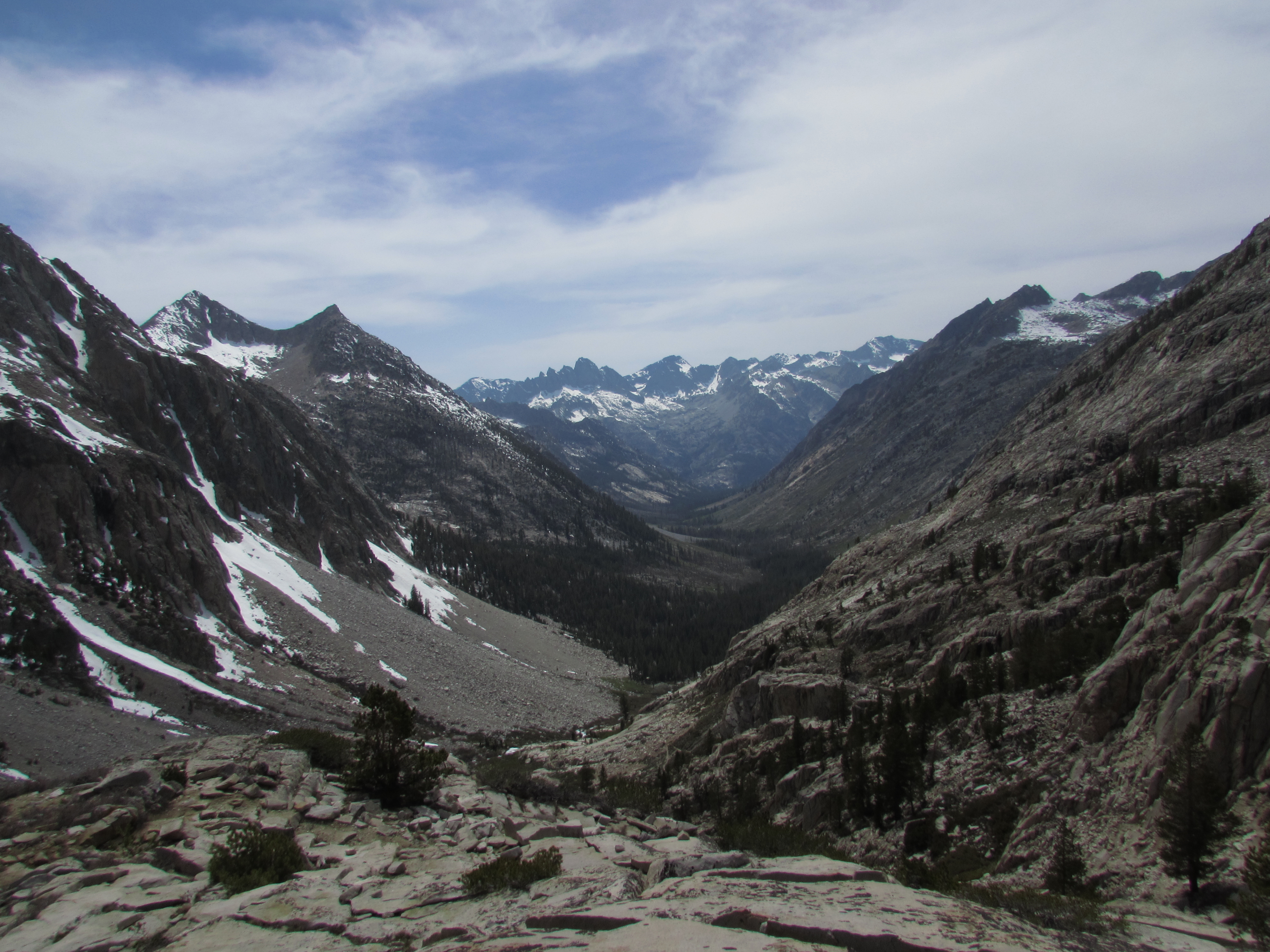
The next few days were pretty similar to this- supremely beautiful walking in the day while under 10,000 feet, then pushing hard to get up and over the pass where there are only rocks and snow to scramble on instead of clearly defined switchbacks, maybe a couple deep post-holes here and there, then reveling in the grandeur of the view at the top. To come down, you either have to slide on your butt, using your feet as breaks, or basically run, taking 8 foot strides straight down the mountain in soft, perpetually melting snow. I learned very quickly, though, that following footsteps isn’t always such a good idea. I would climb up and over a new pass each day, and was often led to very precarious boulder fields or steep ice faces when trusting that the person ahead of me knew how to navigate very well despite the snow.

Matt Fro Climbing on the Rocks on Kearsarge Pass in Kings Canyon National Park
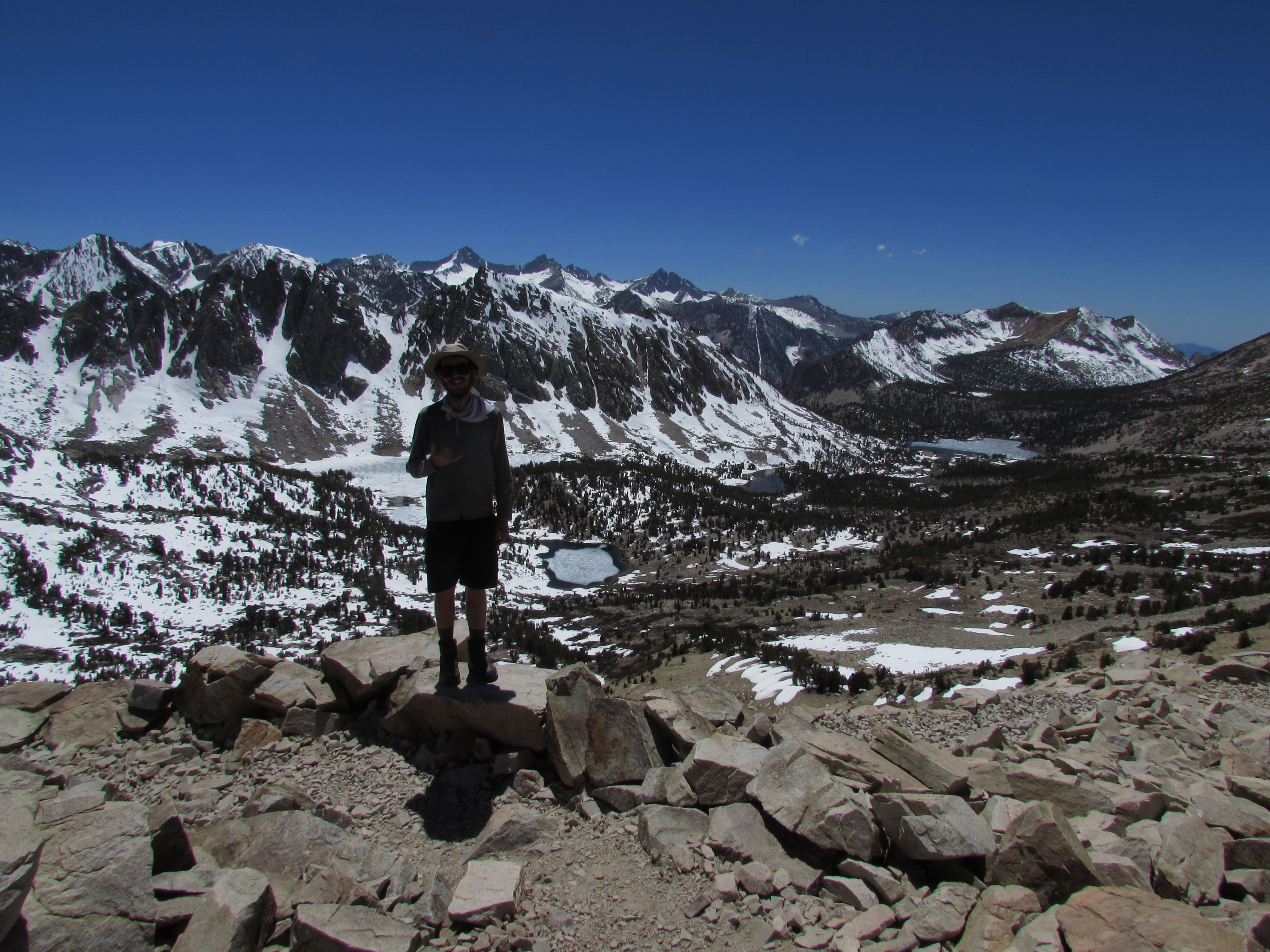
Standing on Top of Kearsarge Pass in Kings Canyon National Park
Woods Creek in Kings Canyon National Park
Marmot on Mather Pass in Sequoia National Park
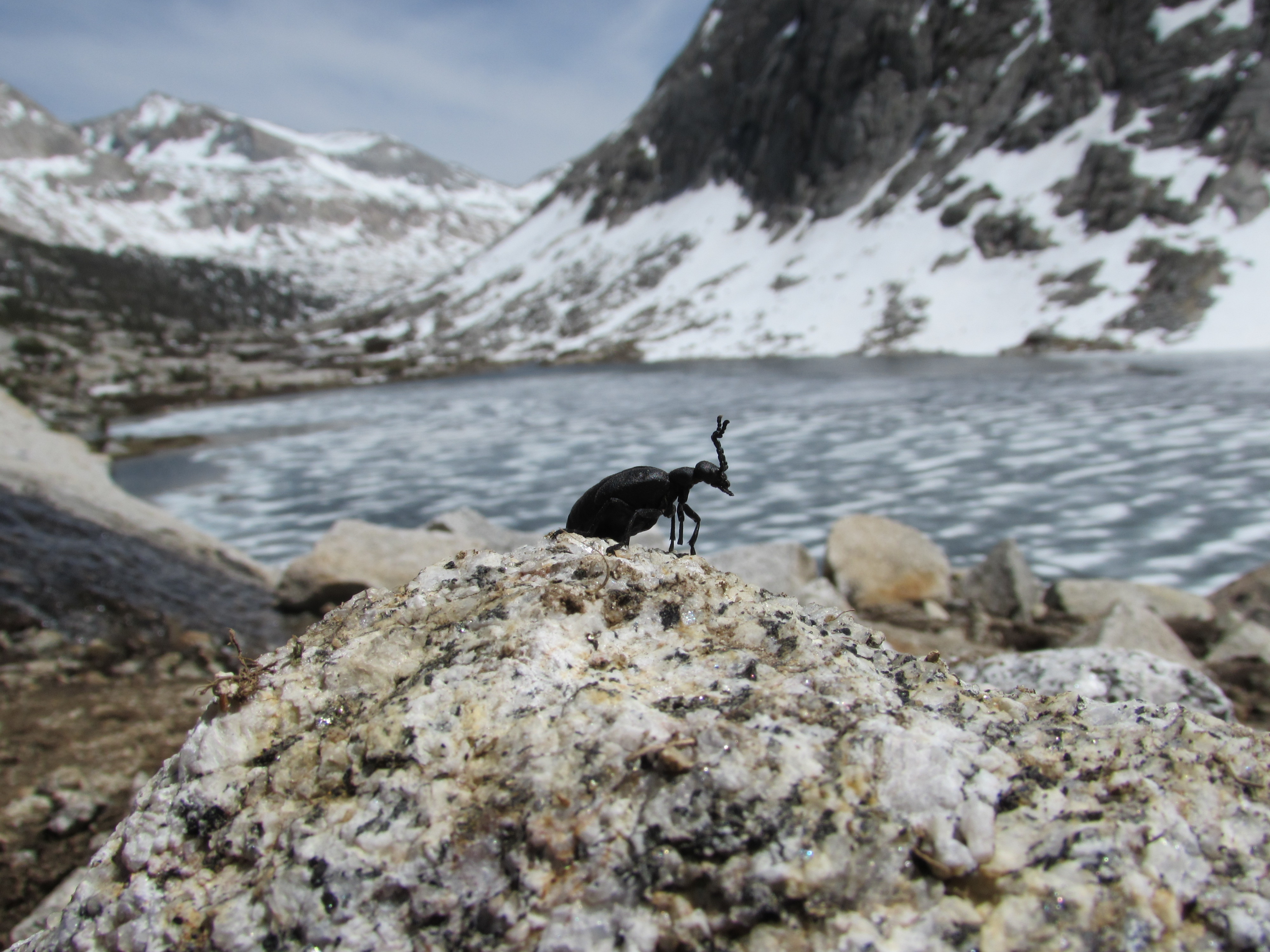
American Oil Beetle at Palisade Lakes in Kings Canyon National Park
Palisade Creek in Kings Canyon National Park
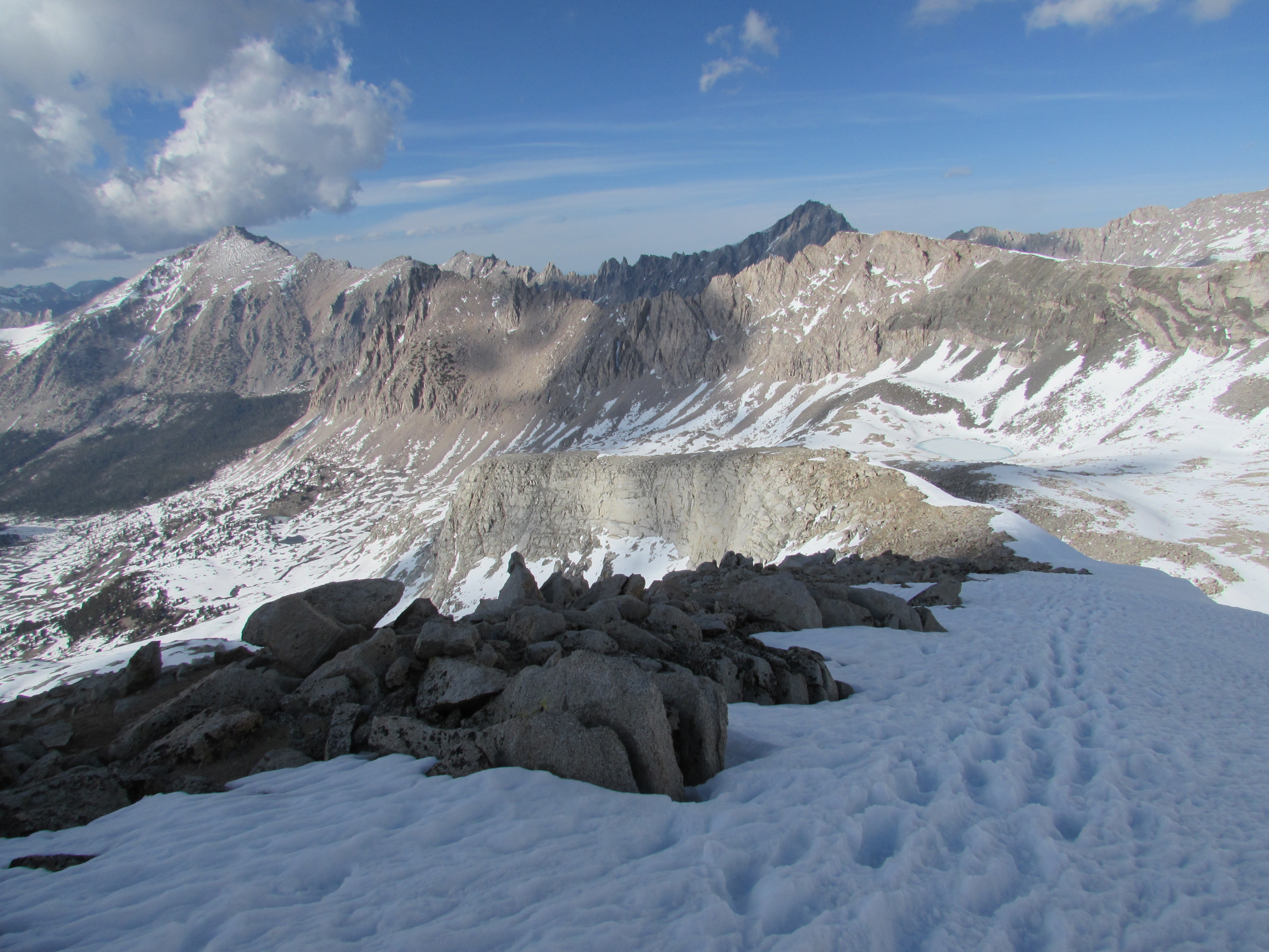
Glen Pass in Kings Canyon National Park Panorama
It was a powerful bond that I developed with many of the hikers that matched my pace over those passes, relating in our daily challenges and triumphs. By hiking fewer miles, however, I was forced to climb over a few extra passes in order to hitch into town and resupply on food. As soon as I felt I had found a group I would enjoy hiking with for a while, I would have to go off trail and they would pass by, continuing their own adventure at their own pace. As I have come to learn however, we will all likely see each other again, perhaps months from now, because everyone has good and bad days, and leap-frogging is pretty common among hikers with roughly the same pace. I am now about 50 trail miles away from Yosemite Valley, which ends the John Muir Trail. While I won’t reach such high elevation again on this hike, I have many more stunning ecosystems to encounter, and I will continue to post pictures and write about my experience in hopes that it may inspire you to go out and enjoy the natural scenery that John Muir dedicated his life to.
And as always, visit my Pictures/Videos page to see all the photos I didn’t feature in this post!
2 Responses to Sittin’ On Top of the World