
In mid-April of 2016, I left my job as a retail salesman at Big Sky Ski Resort in Southwest Montana to move to Moab, Utah for the summer to work as a whitewater raft guide on the Colorado River. But my rafting gig didn’t start until May 15th, giving me time to explore before I hit the river. I decided to spend some of that time hiking to and through the Needle District of Canyonlands National Park. In total, I hiked 140 miles from Moab, down the Kane Creek Road, and along the trails within the Needles District. Here are some snippets from my journal entries and some of the pictures from my adventure!
Day 0- Getting to Moab 4/18-4/19/16
My last day of work was 2 days ago and I have since driven down to Moab. Stayed half a day in Lander, Wyoming on the way to visit my friend Danny and we went spelunking in the Sinks.
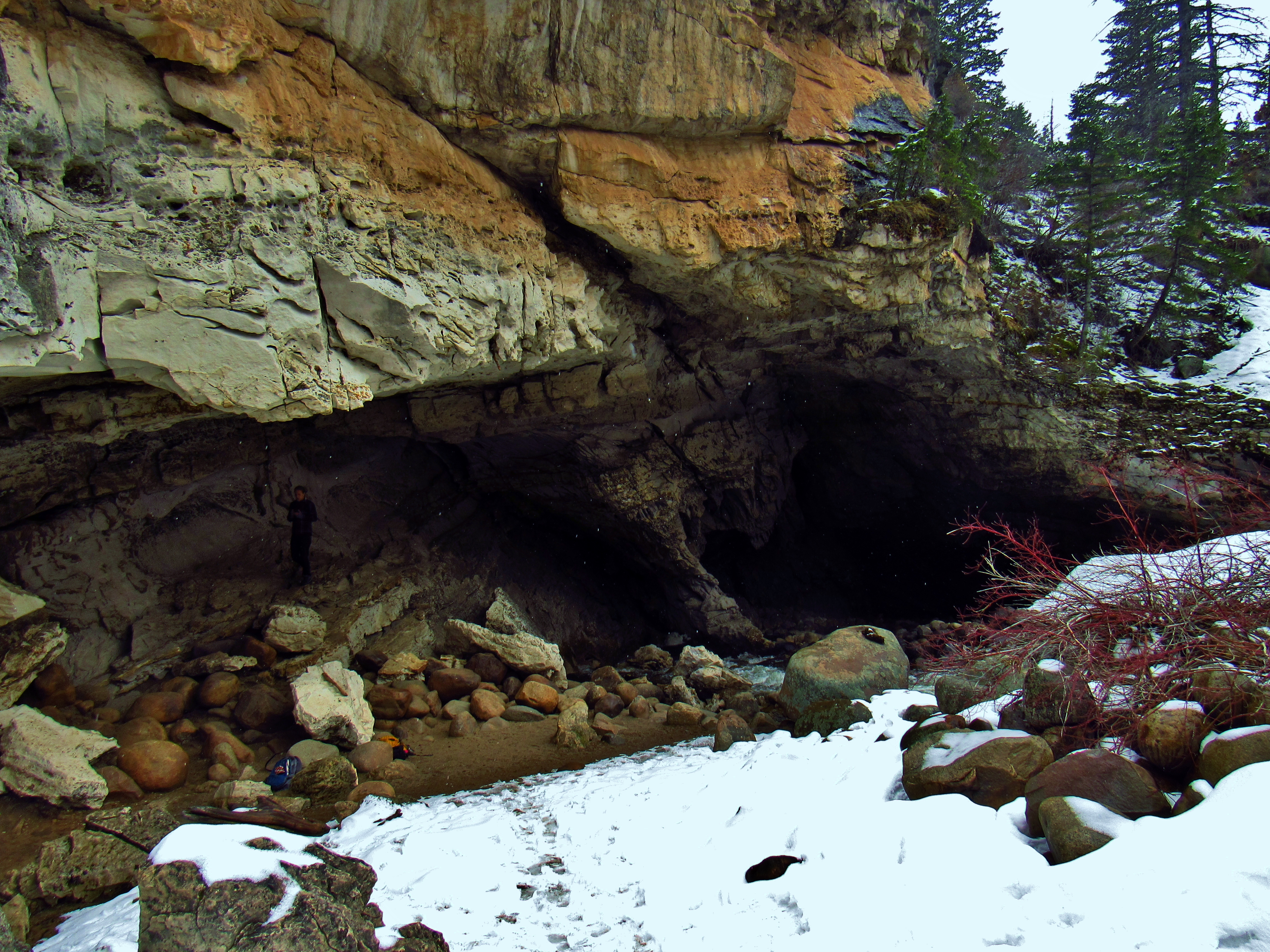
The Sinks Outside Lander, Wyoming
The Popo Agie River flows right into this cave, where a small entrance is found on the left above the water. Danny is an excellent climber, so he led the way as we ducked down into this little hole in the rock. Soon, we were down-climbing through thin, tilted slots maybe 16″ wide at the narrowest and sometimes down drops of 15-20 feet. It was pitch black and dead silent aside from the light and sound we were making. We army crawled, passed our packs up and down, and gave each other advice for footholds we couldn’t see. After maybe a half mile of this, we reached this little room big enough for 4-5 people, floor made of guano, with tea candles resting on the overhanging ledges that layered down from the ceiling like a chandelier.

The Sinks Outside Lander, Wyoming
We chilled in there for a little while, eating snacks and relishing the awesomeness in the moment. Upon our return to Lander, we hucked the frisbee for a bit, jammed out on guitars and an electronic drum set, and got some coffee at the local shop. It was so nice to catch up with one of my longtime homies! But Moab was still on my mind, so after only a half a day, I hit the road again.
Stopped to sleep in Dinosaur National Monument and didn’t hike as much as I would have liked. But the canyon country is calling!
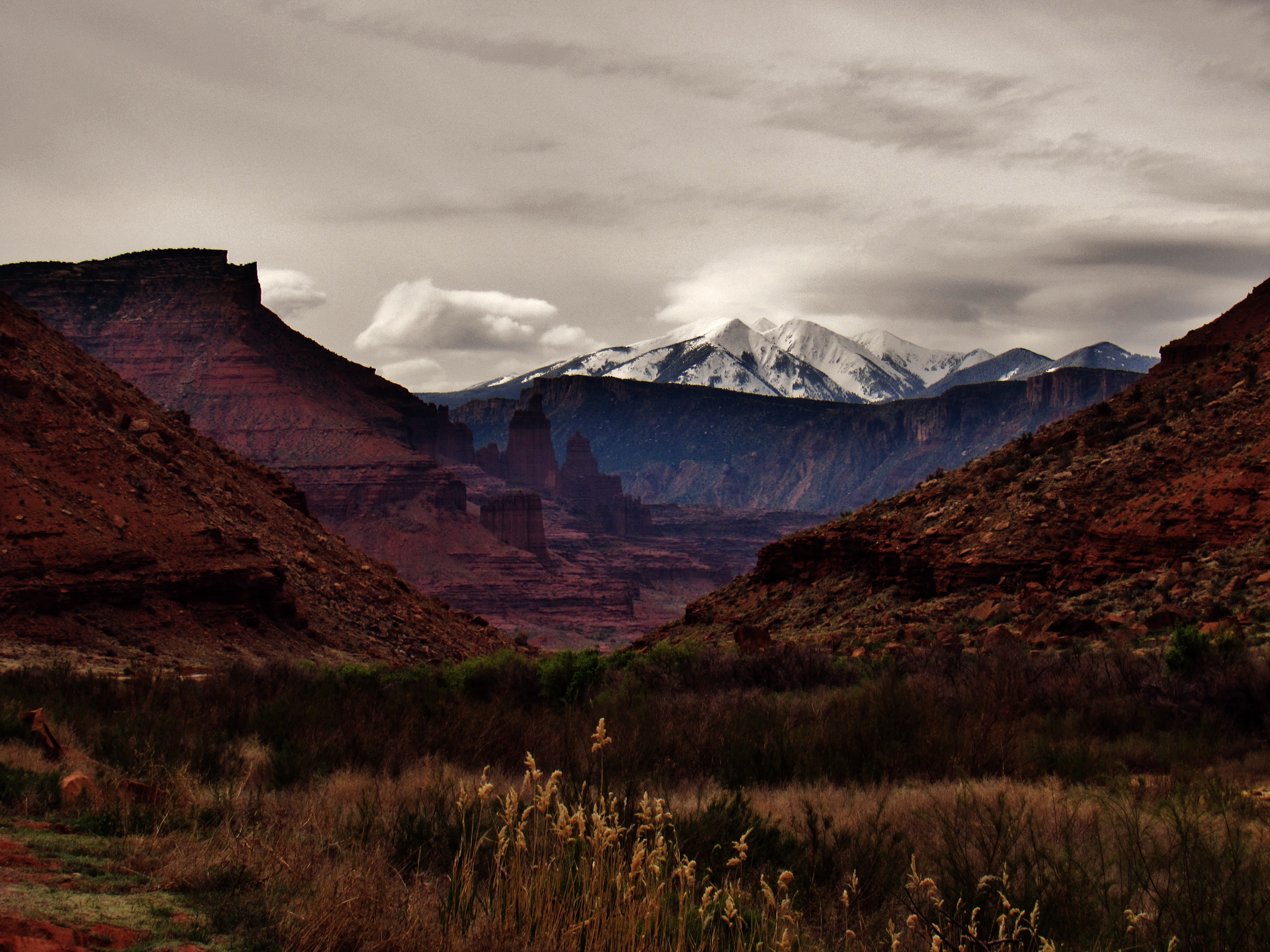
Postcard Alley
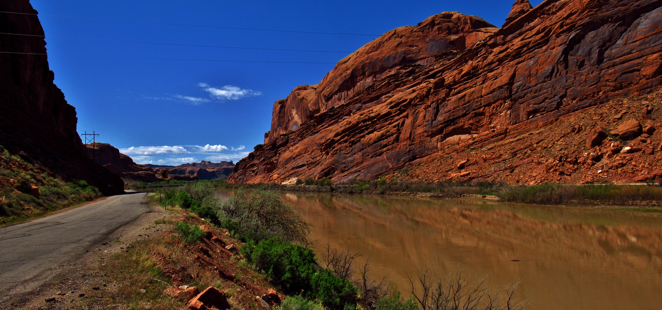
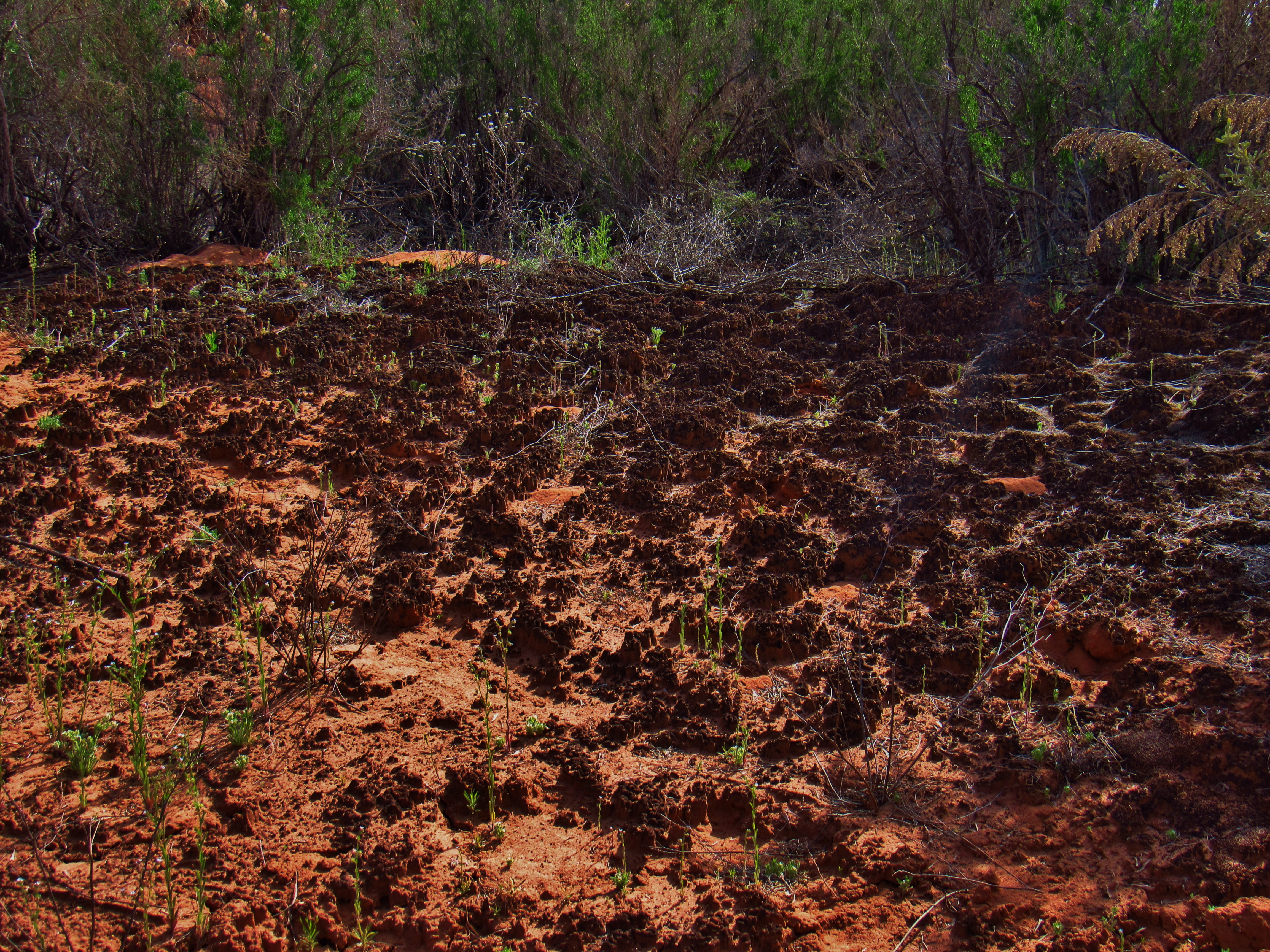
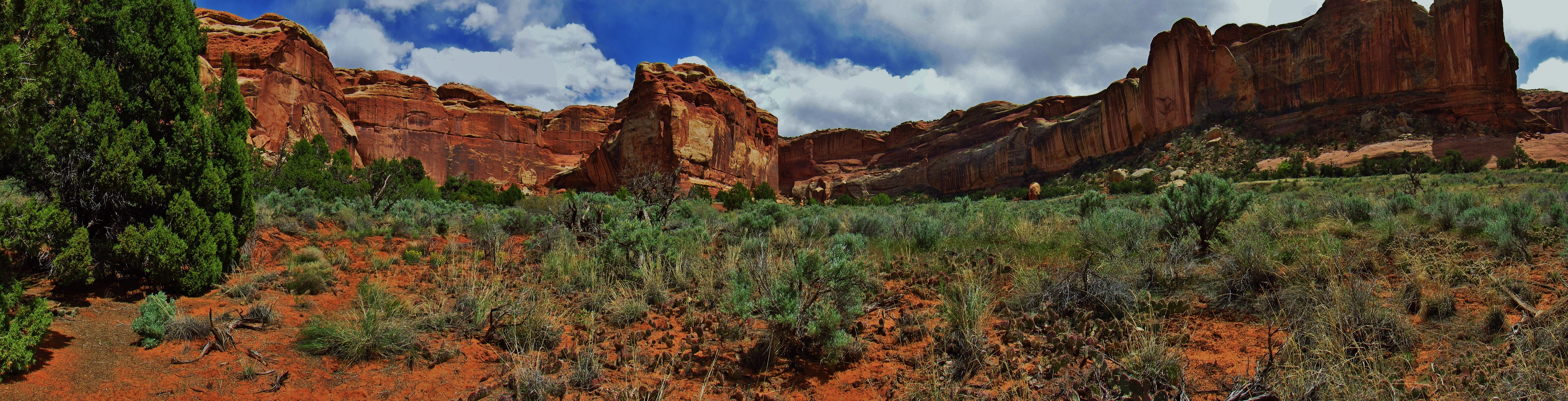
B-lined straight there and stopped to hike Negro Bill Canyon on the way. Lots of fun wearing my crocs while walking through the creek. I was trucking, so I passed up everyone on the way, mostly old people. The shapes in the sandstone were endlessly fascinating. And there were so many flowers blooming in the canyon this time of year!
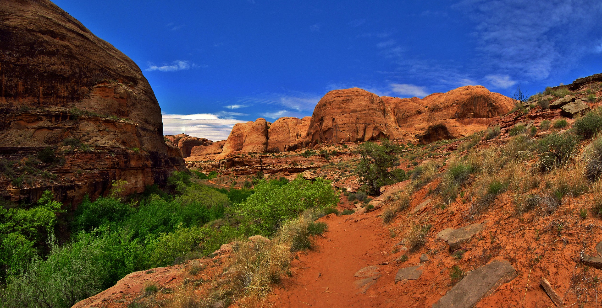
Negro Bill Canyon Panorama
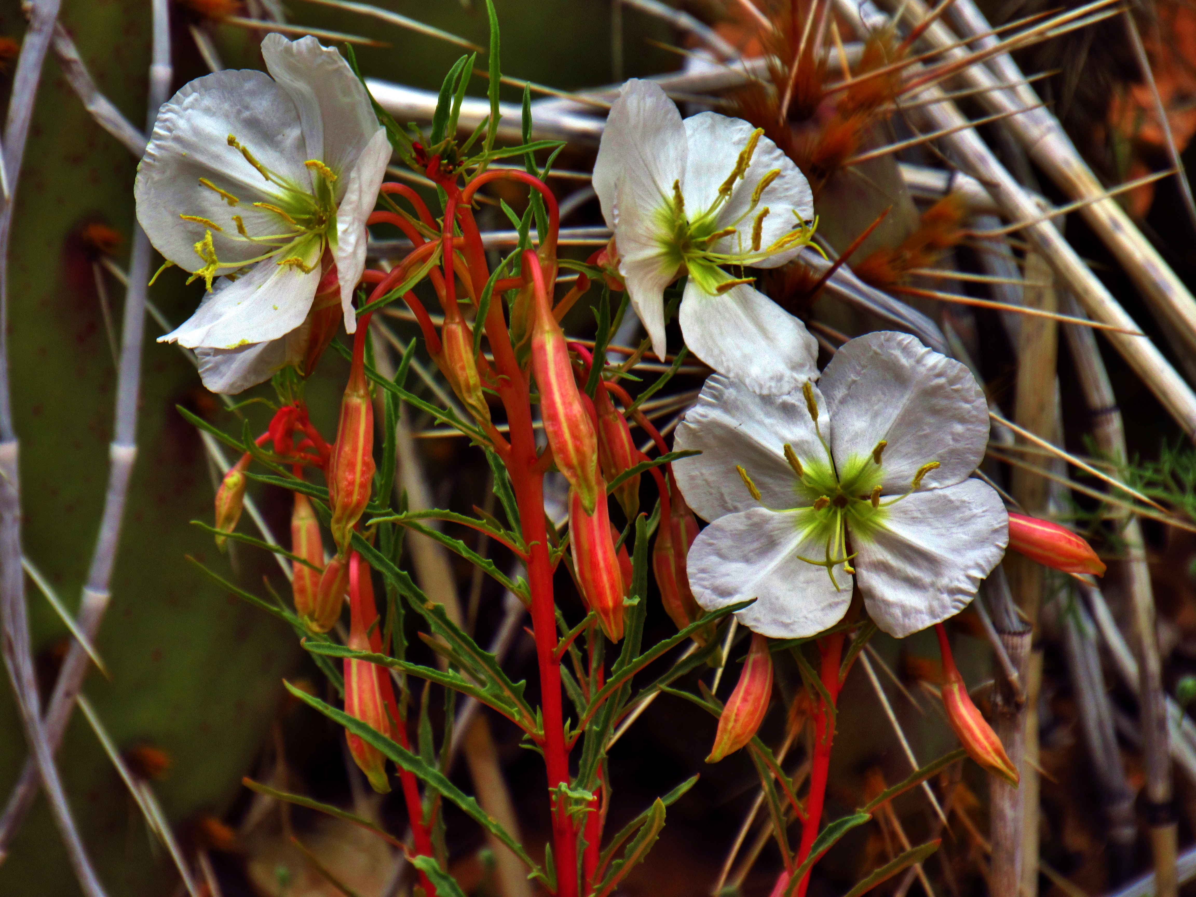
Pale Evening Primrose in Negro Bill Canyon
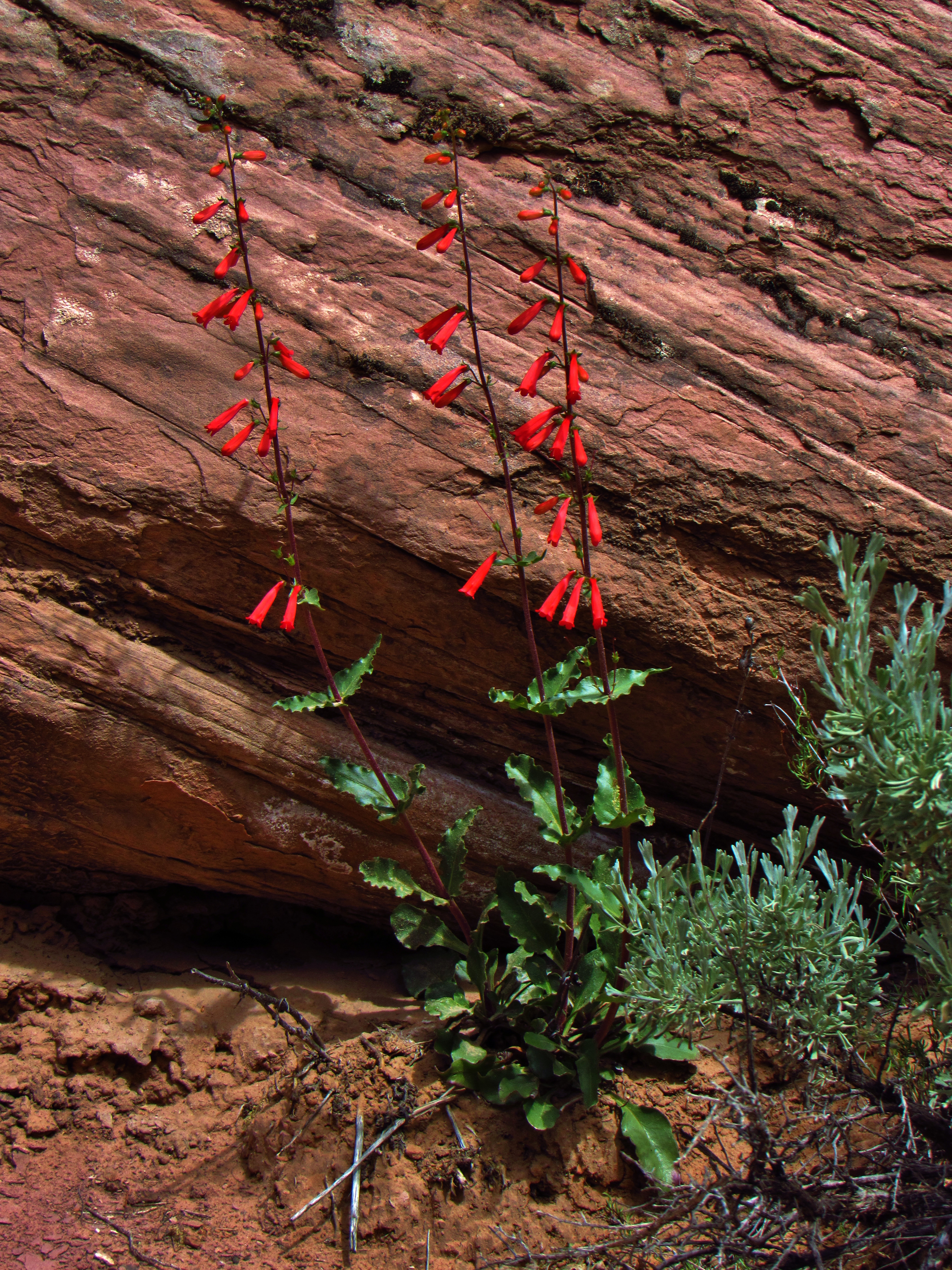
Utah Pentstemon in Negro Bill Canyon

Desert Paintbrush in Negro Bill Canyon
The arch was humongous, and a small spring seemed to come straight out of a crack in the rock- I couldn’t tell where the water was coming form at all. I laid under the arch and took a panorama while looking up at it.
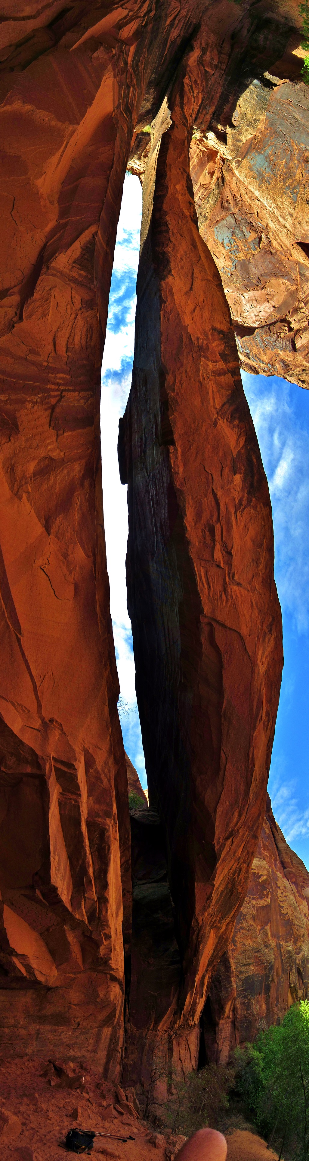
Morning Glory Arch Panorama
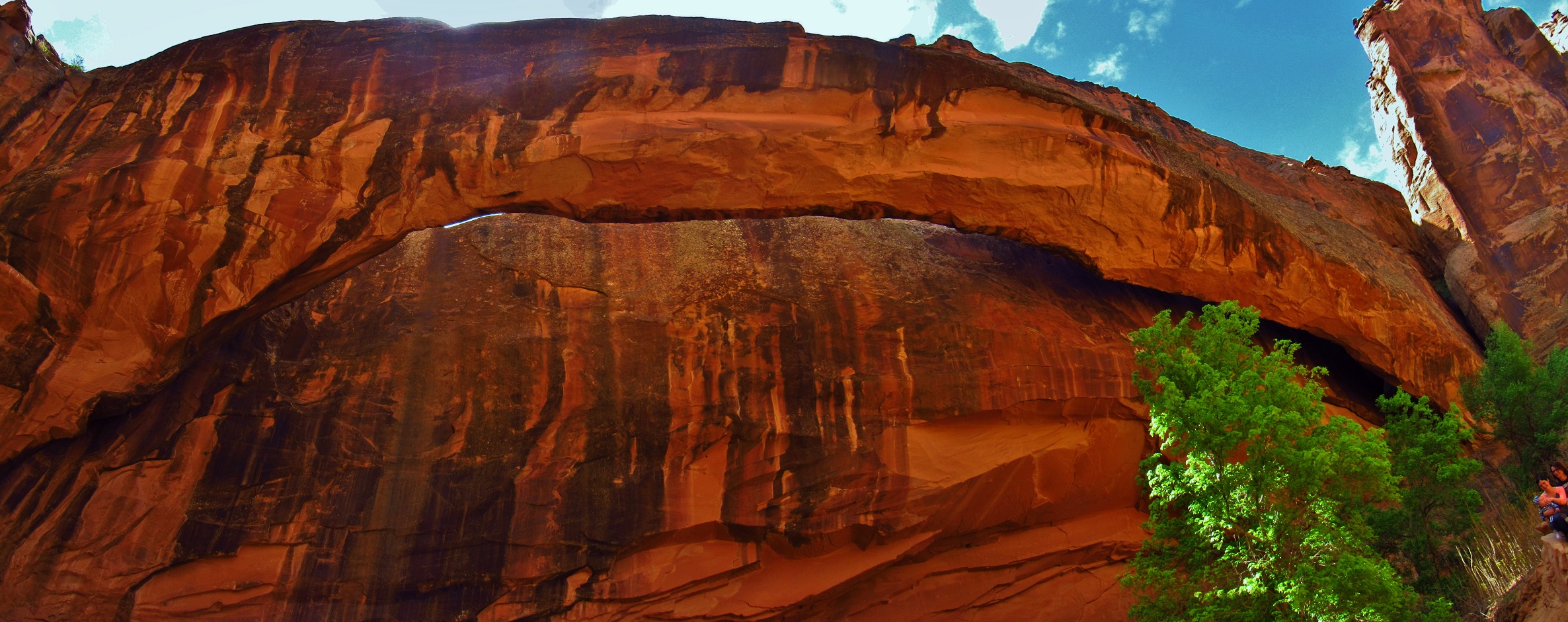
Morning Glory Arch Panorama
I spent the night at the Lazy Lizard hostel in Moab that night, after a day full of flashbacks from when I walked through Moab on my coast-to-coast walk.
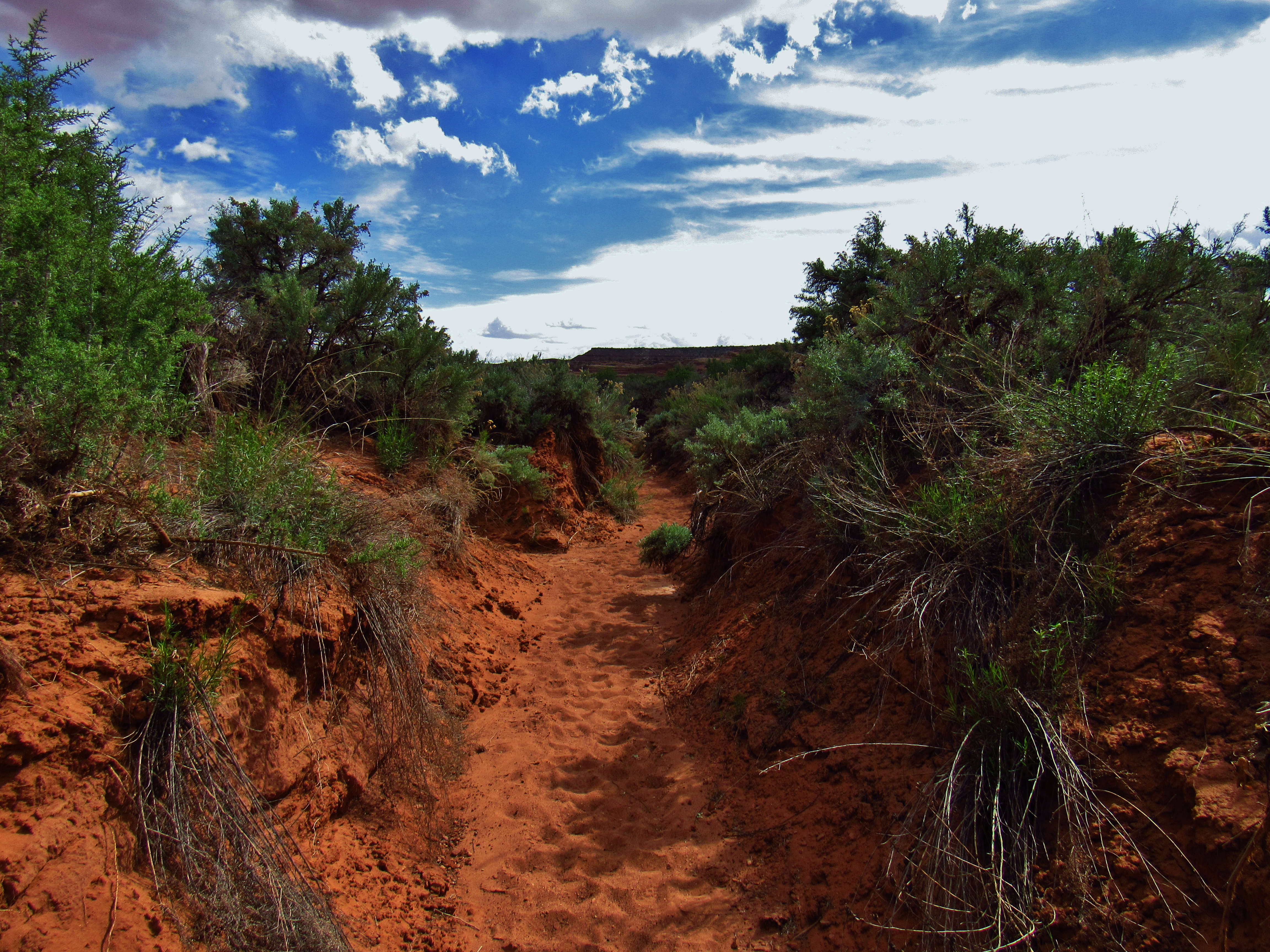
Day 1- The next day I left my truck in the parking lot of Navtec Expeditions, the rafting company I would start working for in a few weeks, then started walking towards Canyonlands.
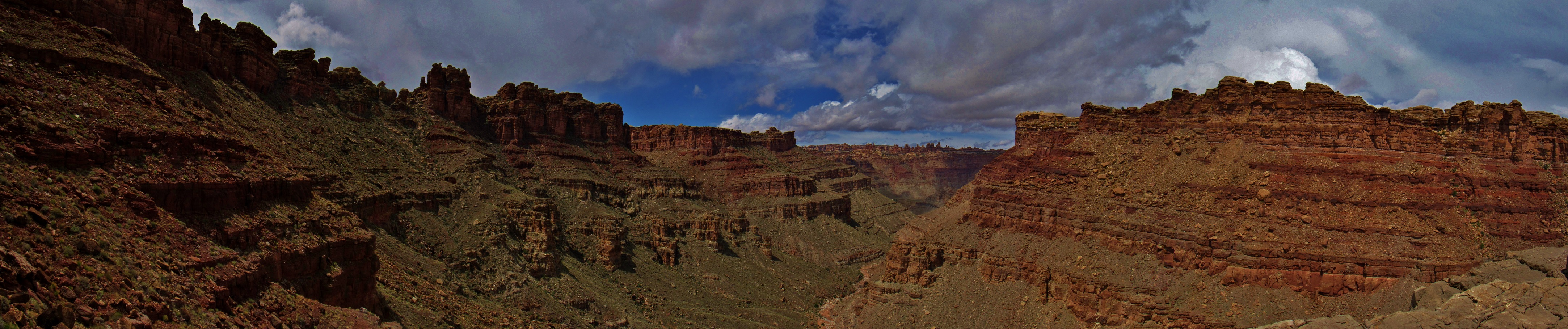
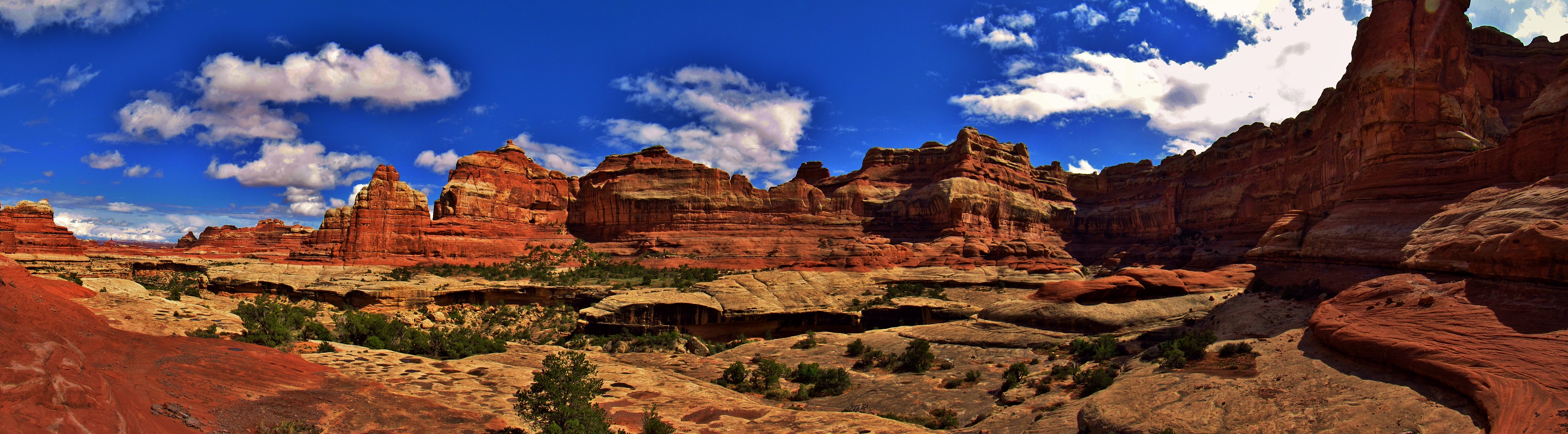
The Portal Panorama
For the first couple miles after entering the Portal, I was totally taken away by the beauty of the rock. Despite my tendency to rush with my head down, I was now just strolling through the canyon slowly soaking it all in. And it was hot! I had just come from a frigid winter in Southwest Montana to the dry heat and relentless sun of Southeast Utah! What a shock to my system! I threw out the peace sign to every car passing by, and just as I remembered from my last visit to Moab, almost everyone threw it back. I’m going to like this town 🙂
As I entered Kane Springs Canyon, I saw some basejumpers leap off of a huge cliff and even I was so stoked by it that I yelled “YEEEAHHH DUUUDEEE!” and scrambled to get my camera ready to film the next jumpers.
I walked to the parking lot where they all met up after landing, and talked to the instructor for a bit. Irish guy. Said this is one of the only legal basejumping areas in the US and that 200 skydives are recommended before one tries basejumping. Wow.
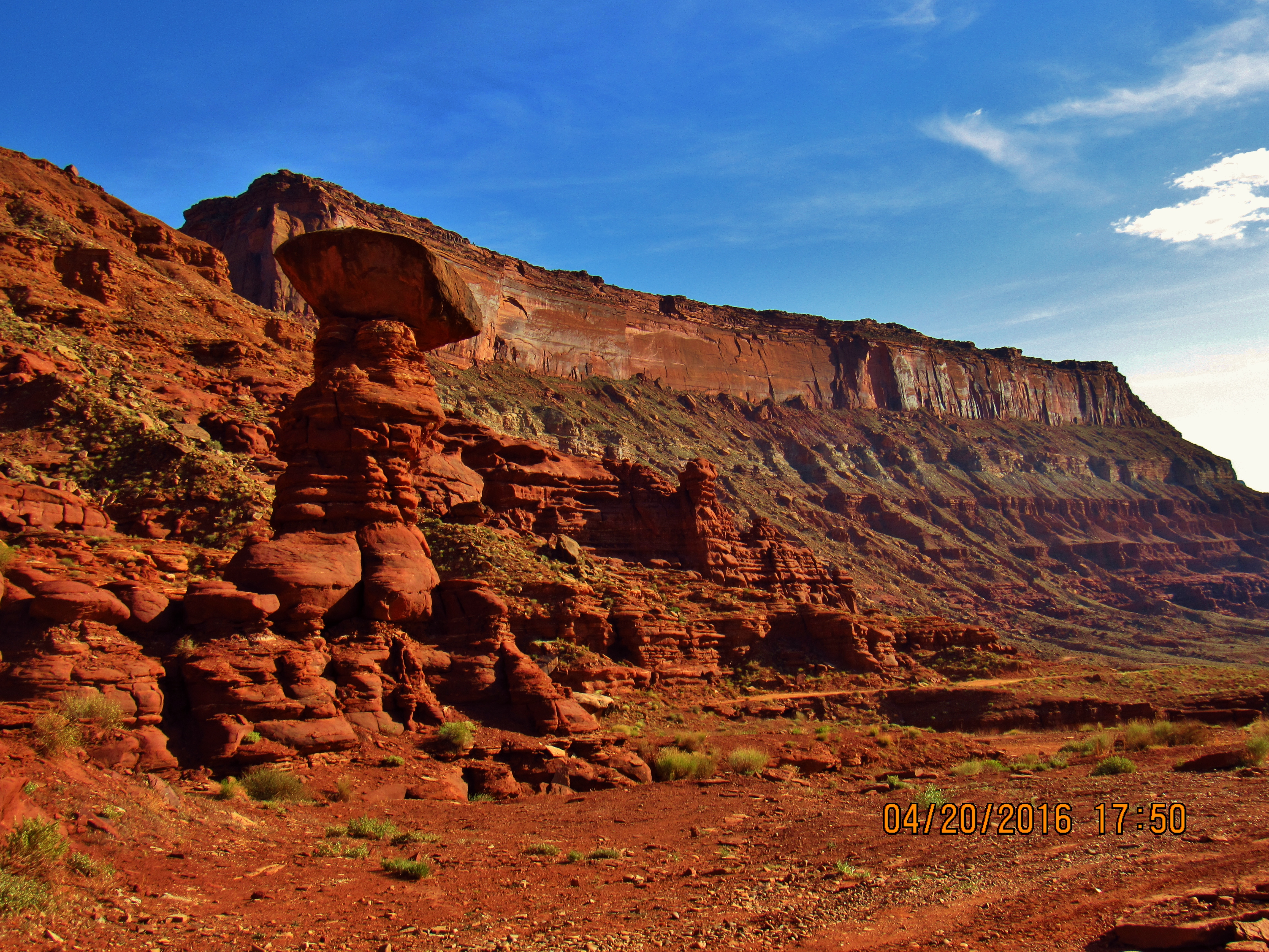
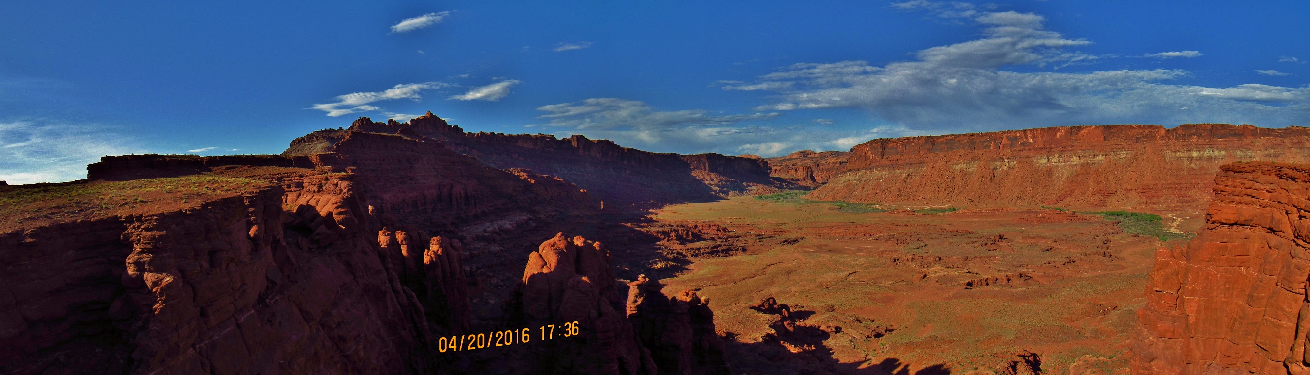
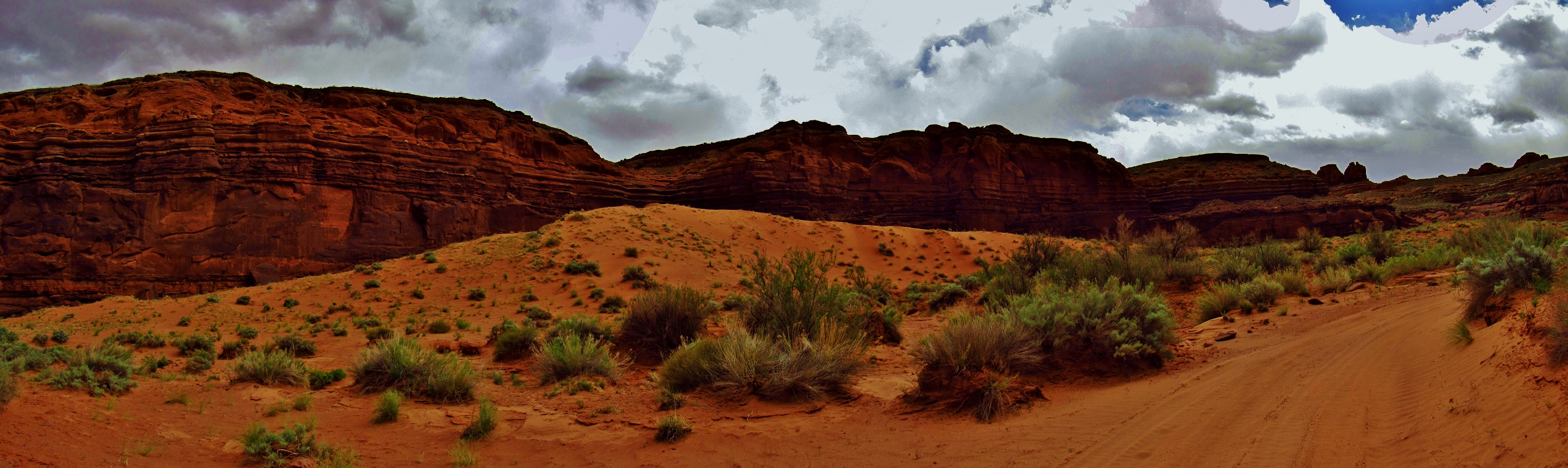
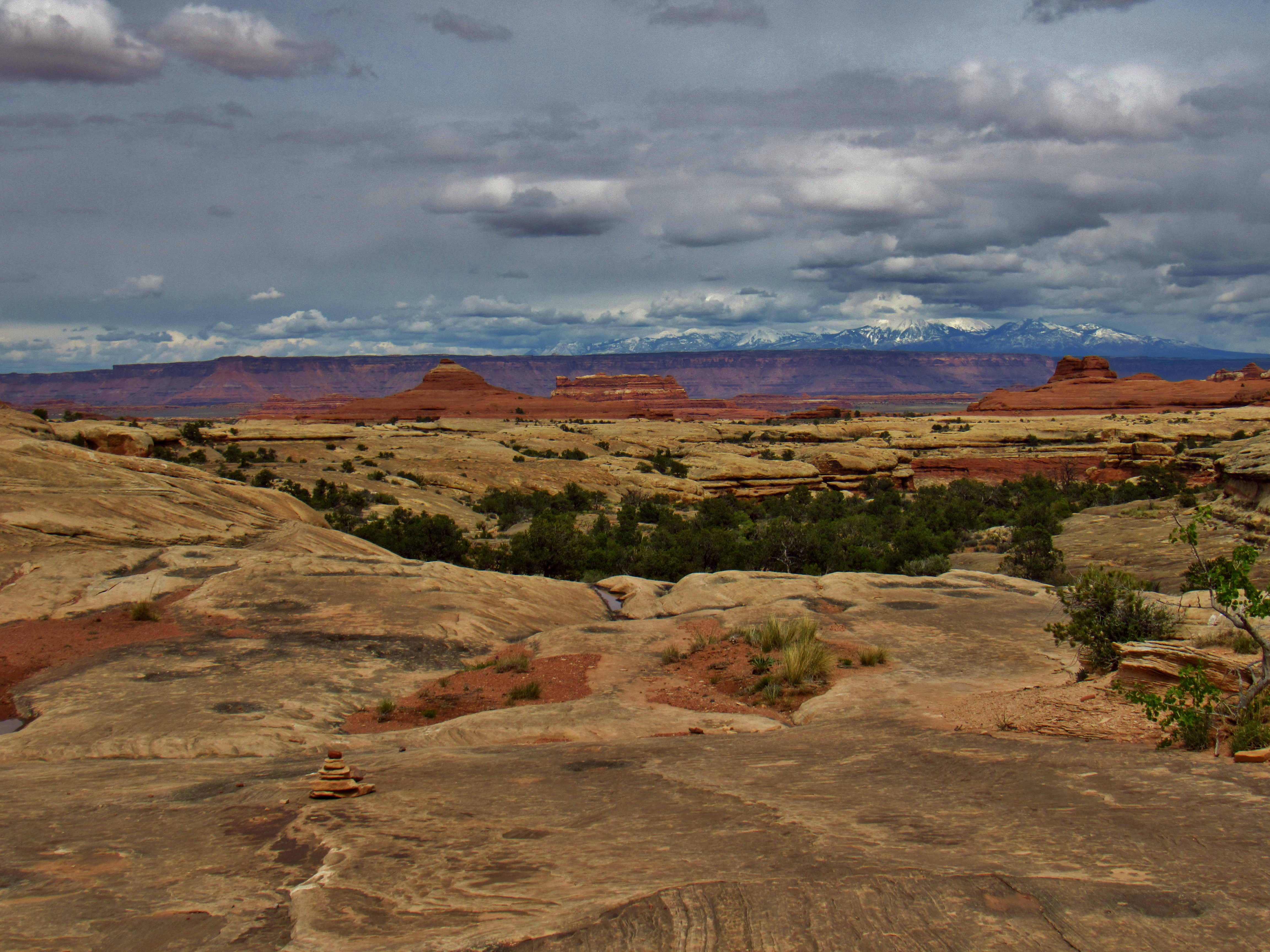
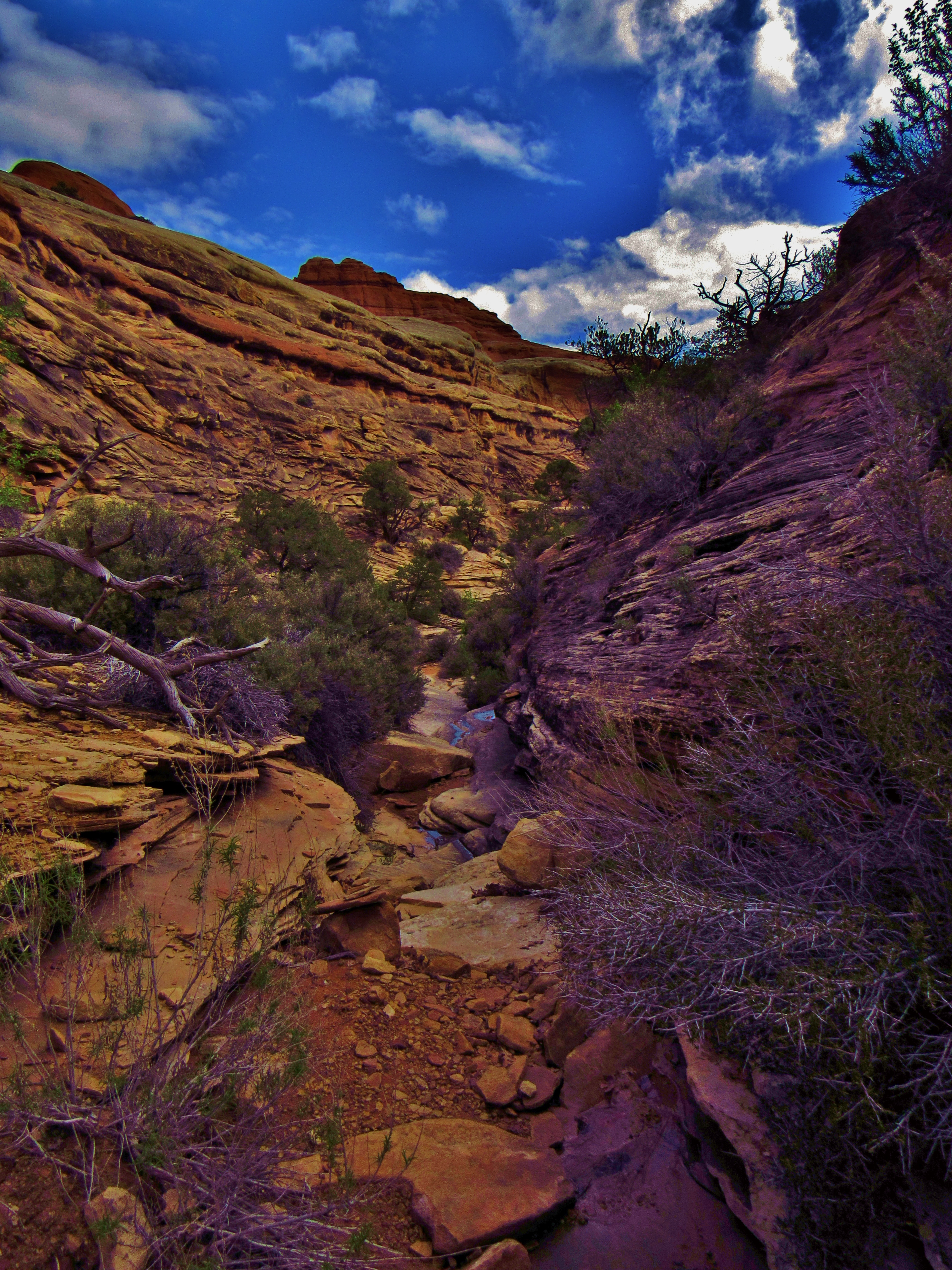
I fill up 3 liters from a crystal clear spring, thinking I may need more later, but there is a spot listed on my map where I should be able to get down to the Colorado River about 16 miles away. Hiked past Hurrah Pass before camping for the night with incredible views the entire way.
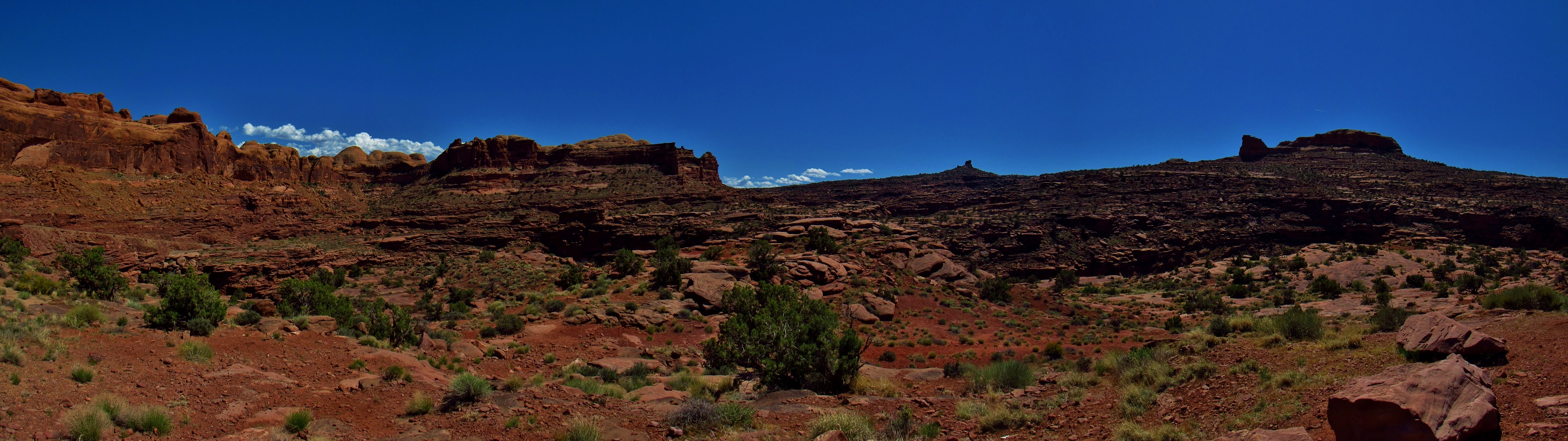
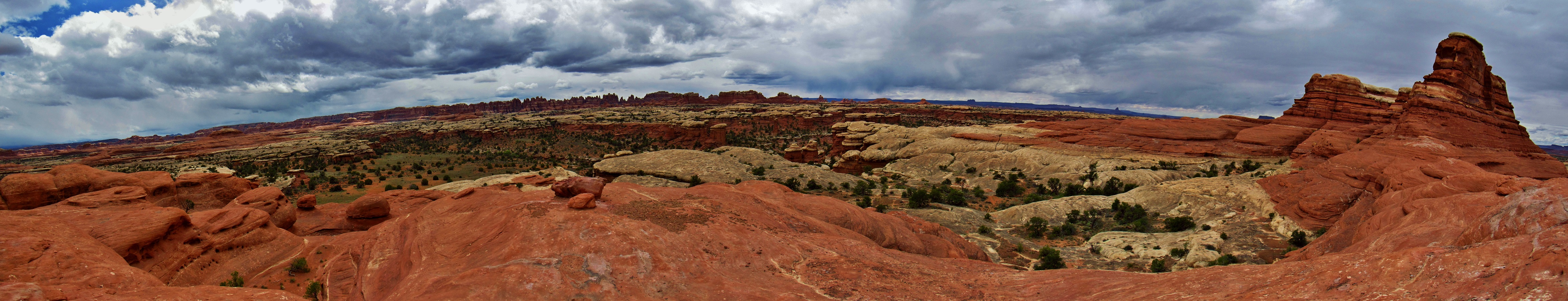
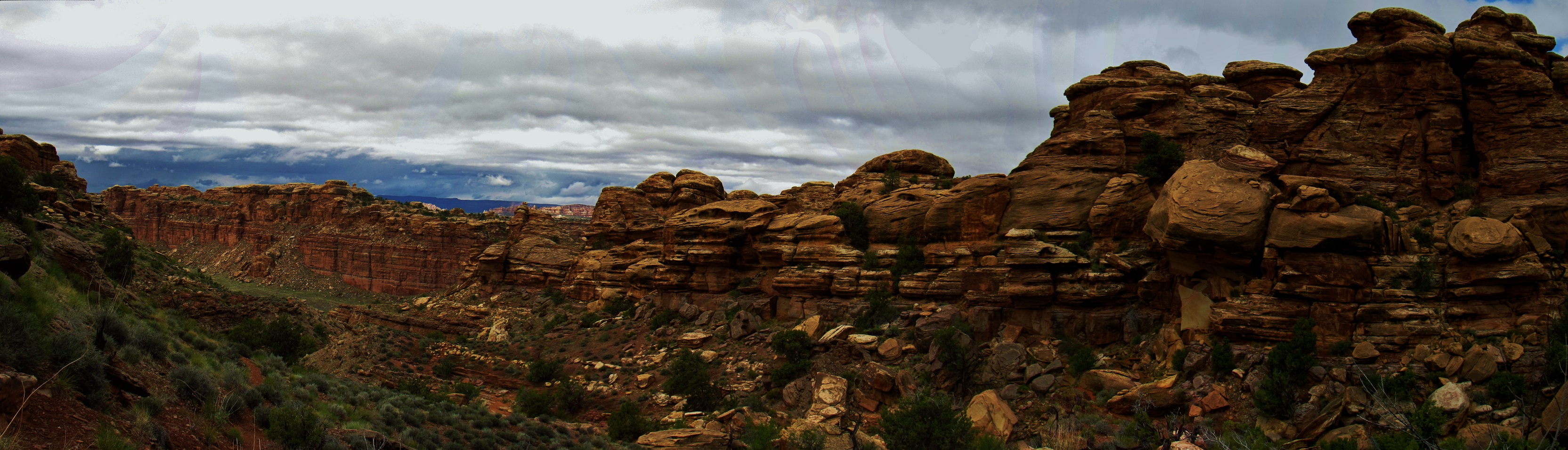
Kane Springs Road Panorama
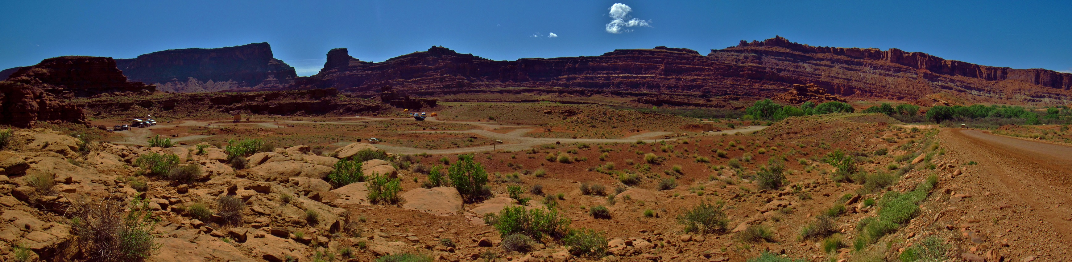
Kane Springs Campground Panorama
Kane Springs Road Panorama
Kane Springs Road Panorama
Kane Springs Road Below Hurrah Pass
Kane Springs Road Panorama
Kane Springs Road Panorama
Kane Springs Road Panorama
Day 2- The next morning I hiked down and spent a lot of time filtering the sand out of the water from the river. I had to backflush my filter for every 1/2 liter I filtered. Quite time consuming, but absolutely necessary. There’s no other water anywhere around here.
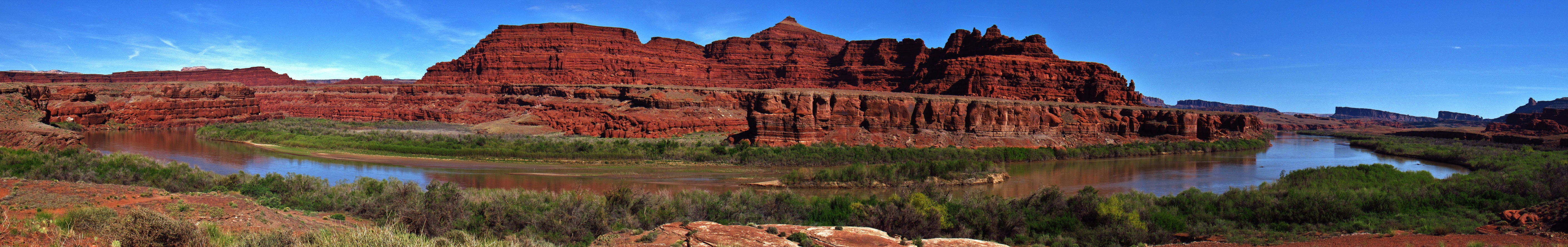
Colorado River Panorama
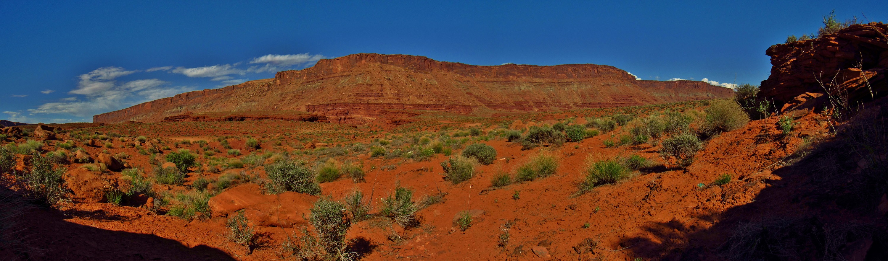
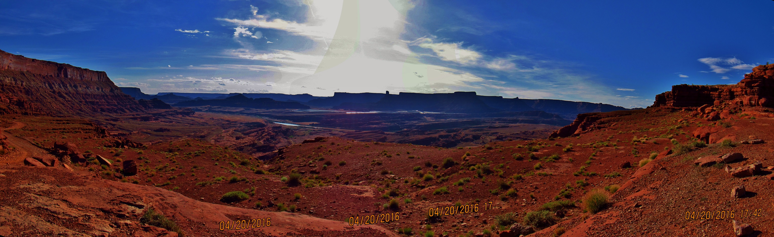
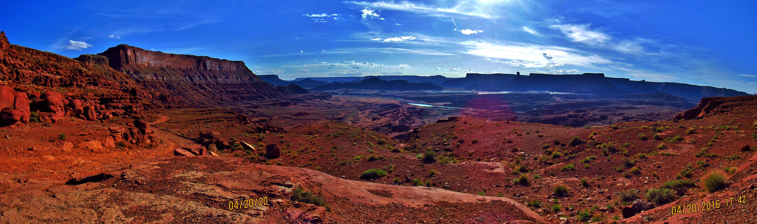
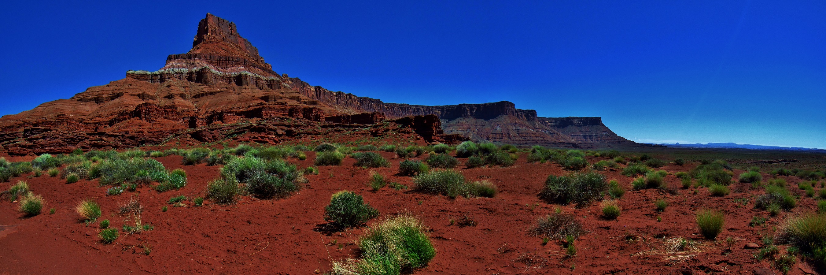
All day I leap frogged a group of old people in 2 white jeeps that had to keep stopping and scouting out routes to drive up the rugged 4×4 road. One of the wives kept chickening out, so only one guy was willing to try driving it and had to drive up with the first jeep, then get out and hike back to drive up with the second one too. Still, it’s super impressive what those jeeps are able to do, driving over big boulders that are strewn across the road; stuff that is easy for me to do on foot, and with (perhaps) far less risk. I am sore from carrying 70+ pounds of gear, mostly from all my food for 3 weeks. My shoulders and hips ache, the blisters on my toes bring a constant and annoying pain, and my sunburn is getting worse by the hour. I stopped to talk to a few older dudes on motorbikes while high up on a pass and one guy was super- I mean SUPER- stoked that I had hiked part of the PCT “self-supported”. I gave him my card and told him to call my mom when he got out, because I know she was probably worried and I wasn’t going to have cell reception for a while. There are lots of beautiful flowers out right now, and a ton of lizards too. Rubbed some mud on my skin where the sunburn was worst, then camped under a rock ledge shortly before the next listed spring.
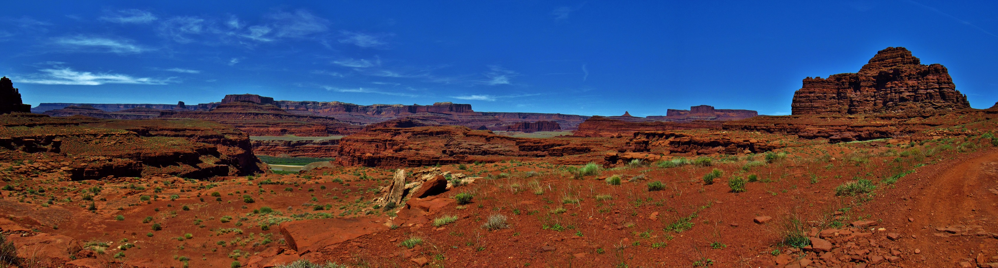
Kane Springs Road Panorama
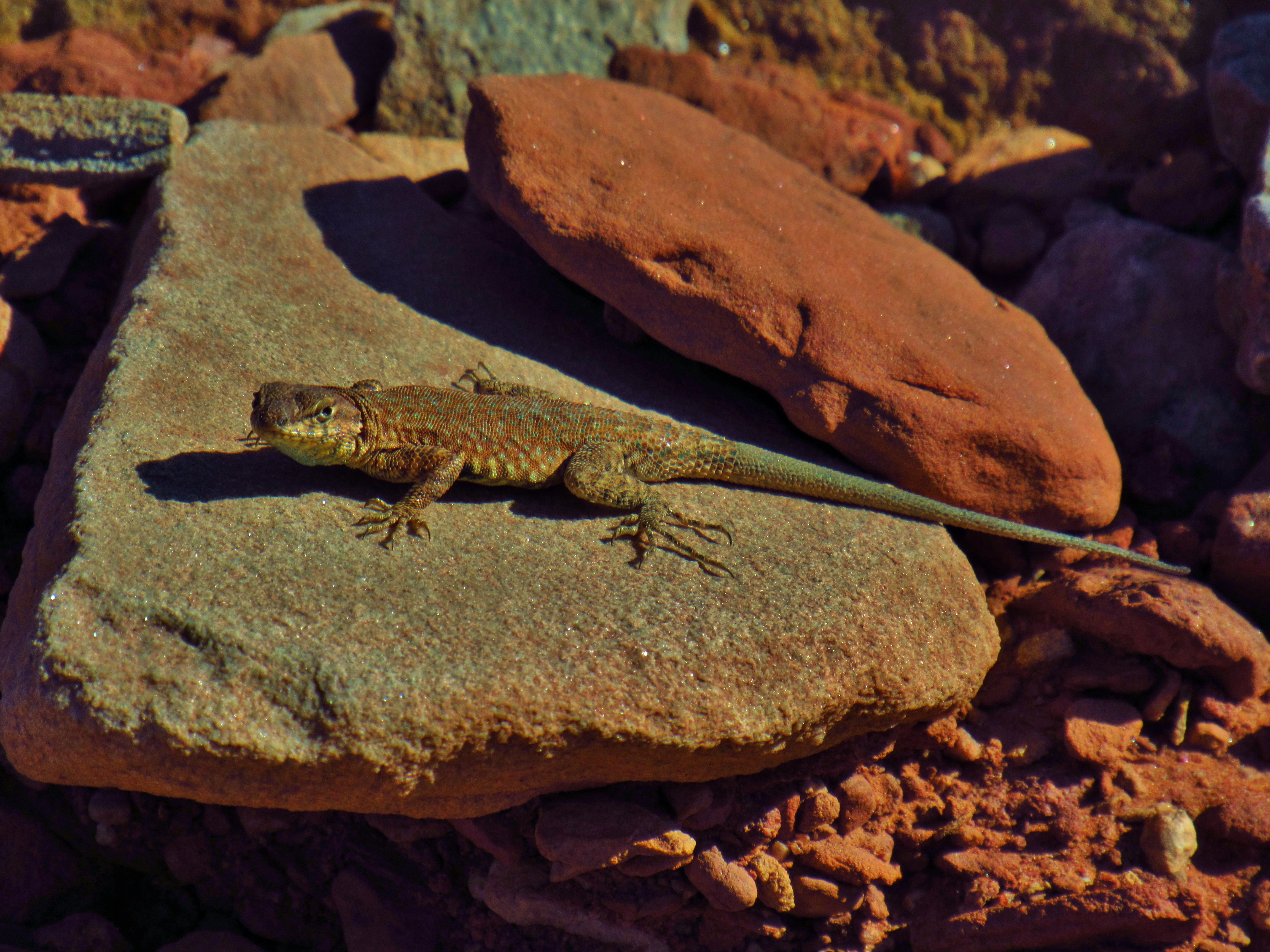
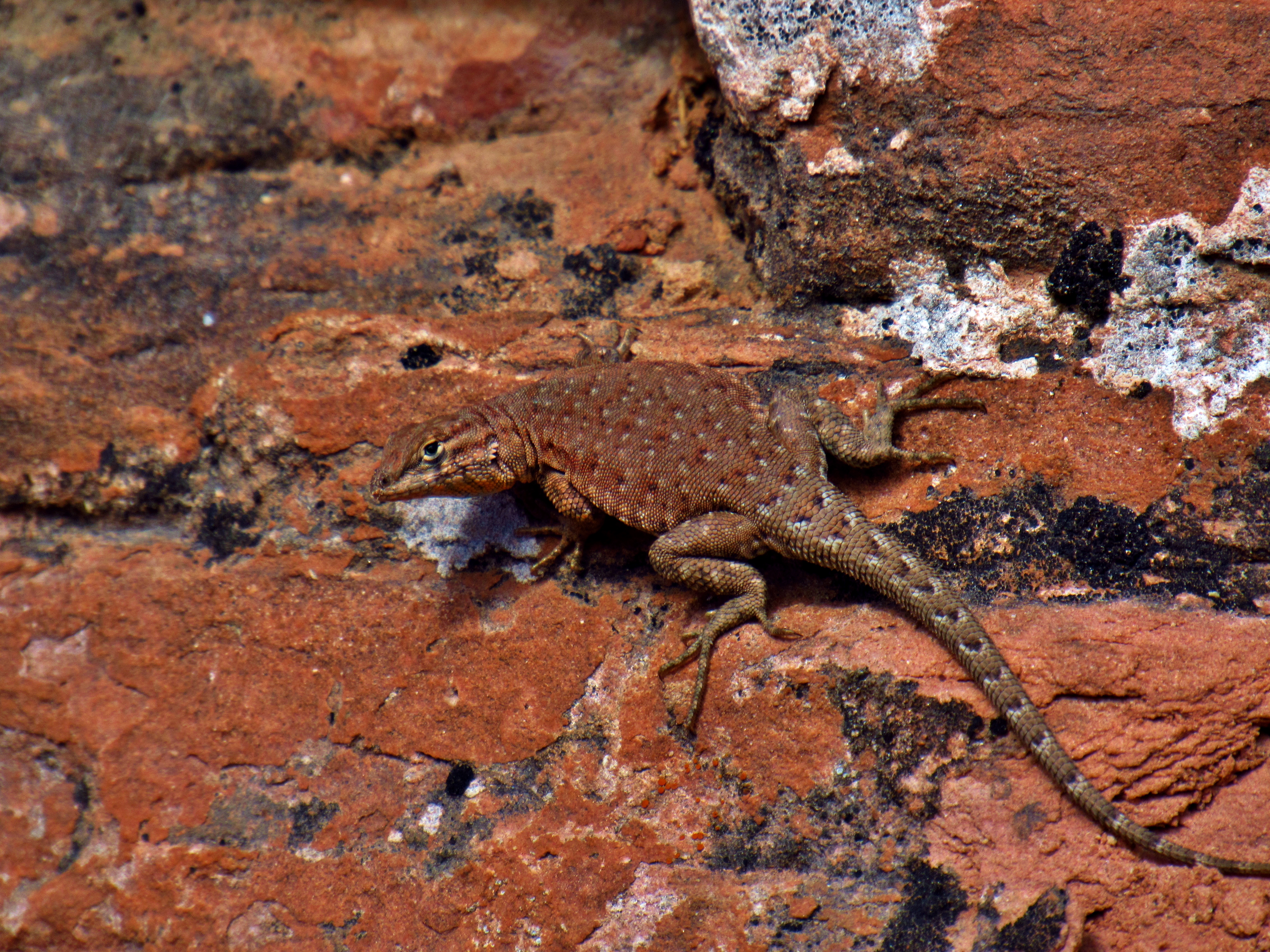
Side Blotched Lizard on the Kane Springs Road
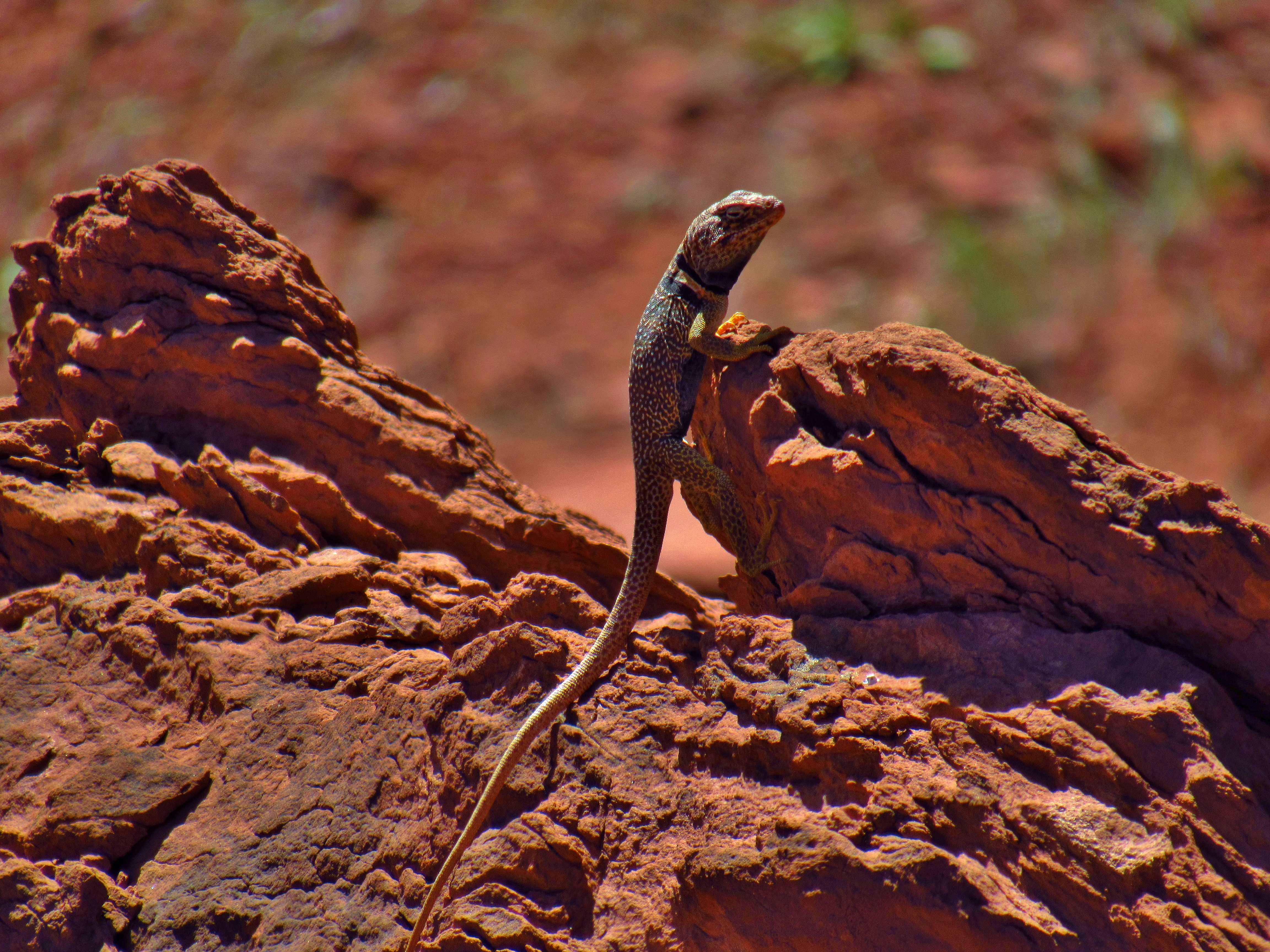
Western Collared Lizard on the Kane Springs Road
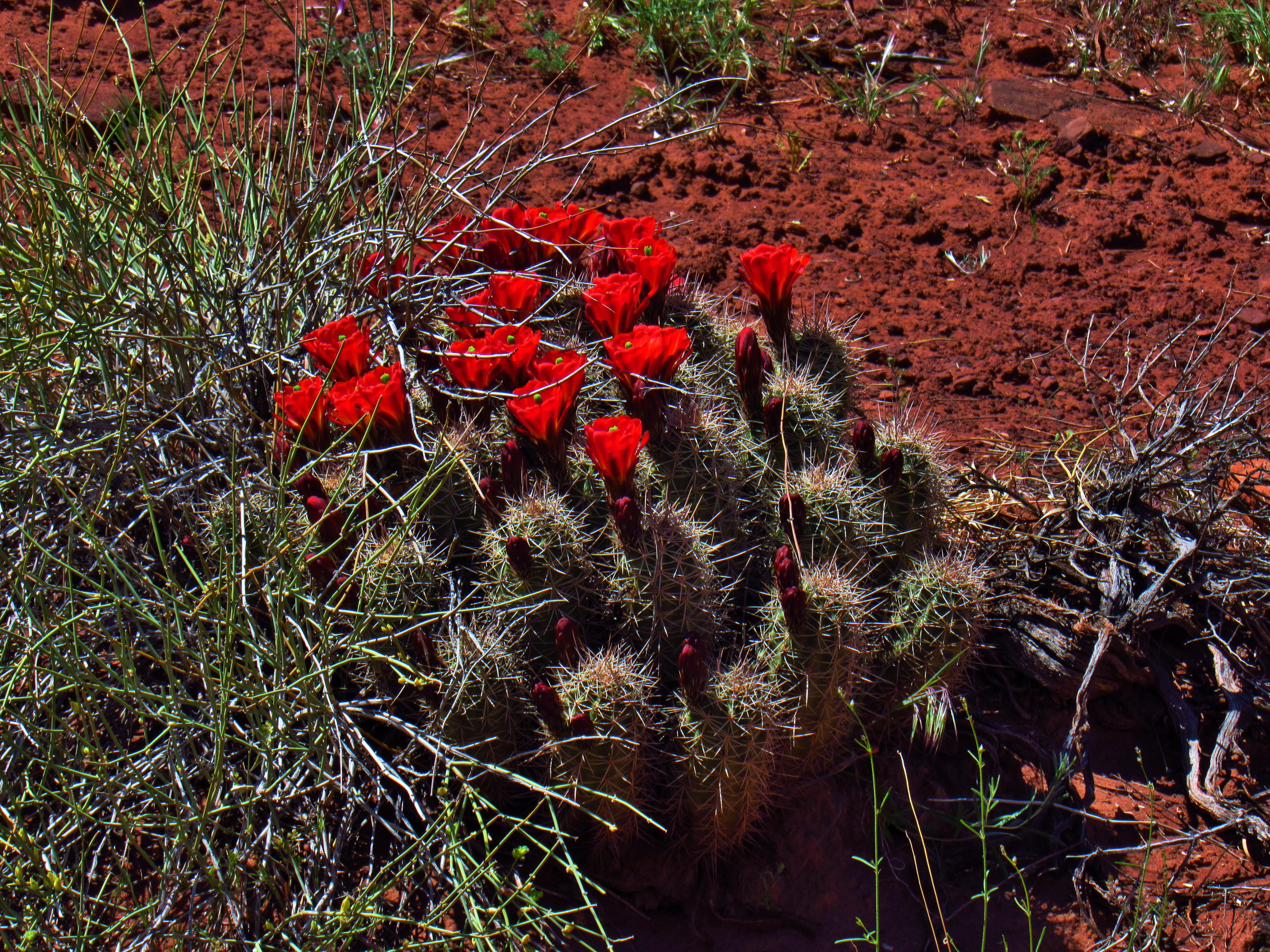
Claret Cup Cactus on the Kane Springs Road
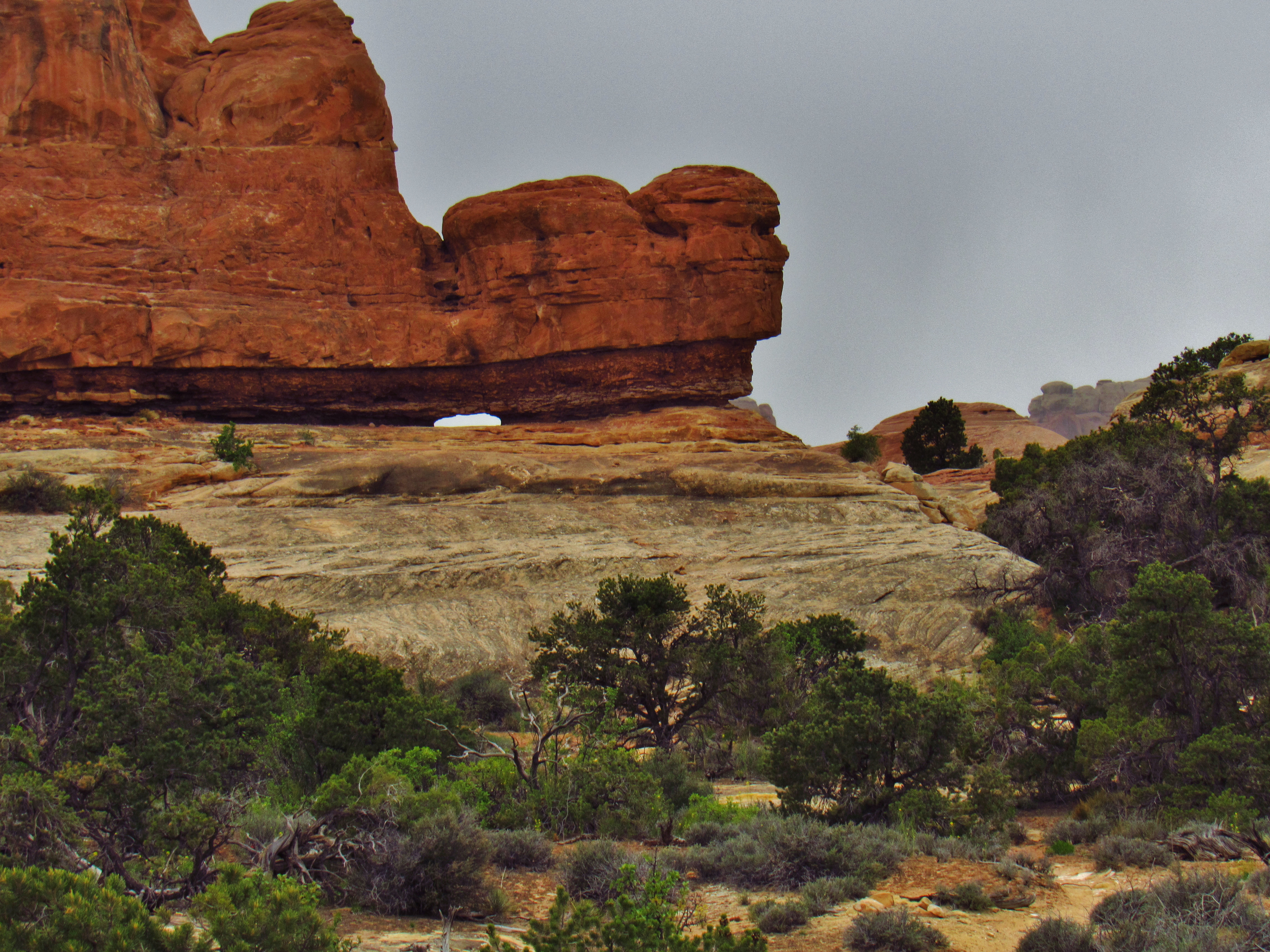
Kane Springs Road
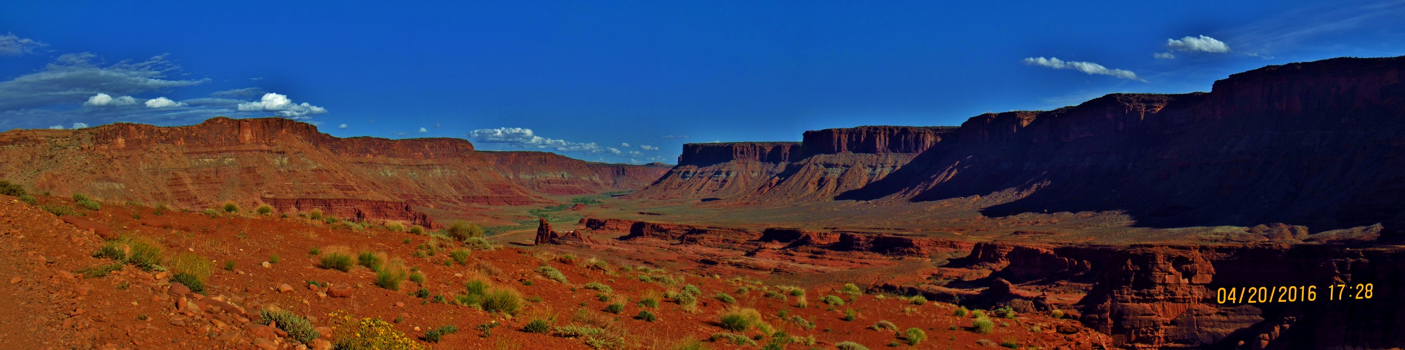
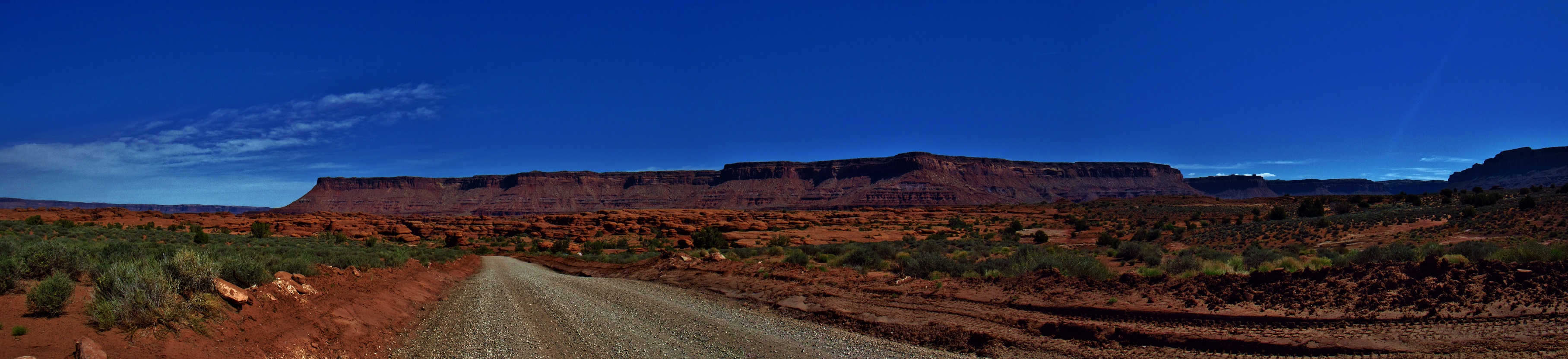
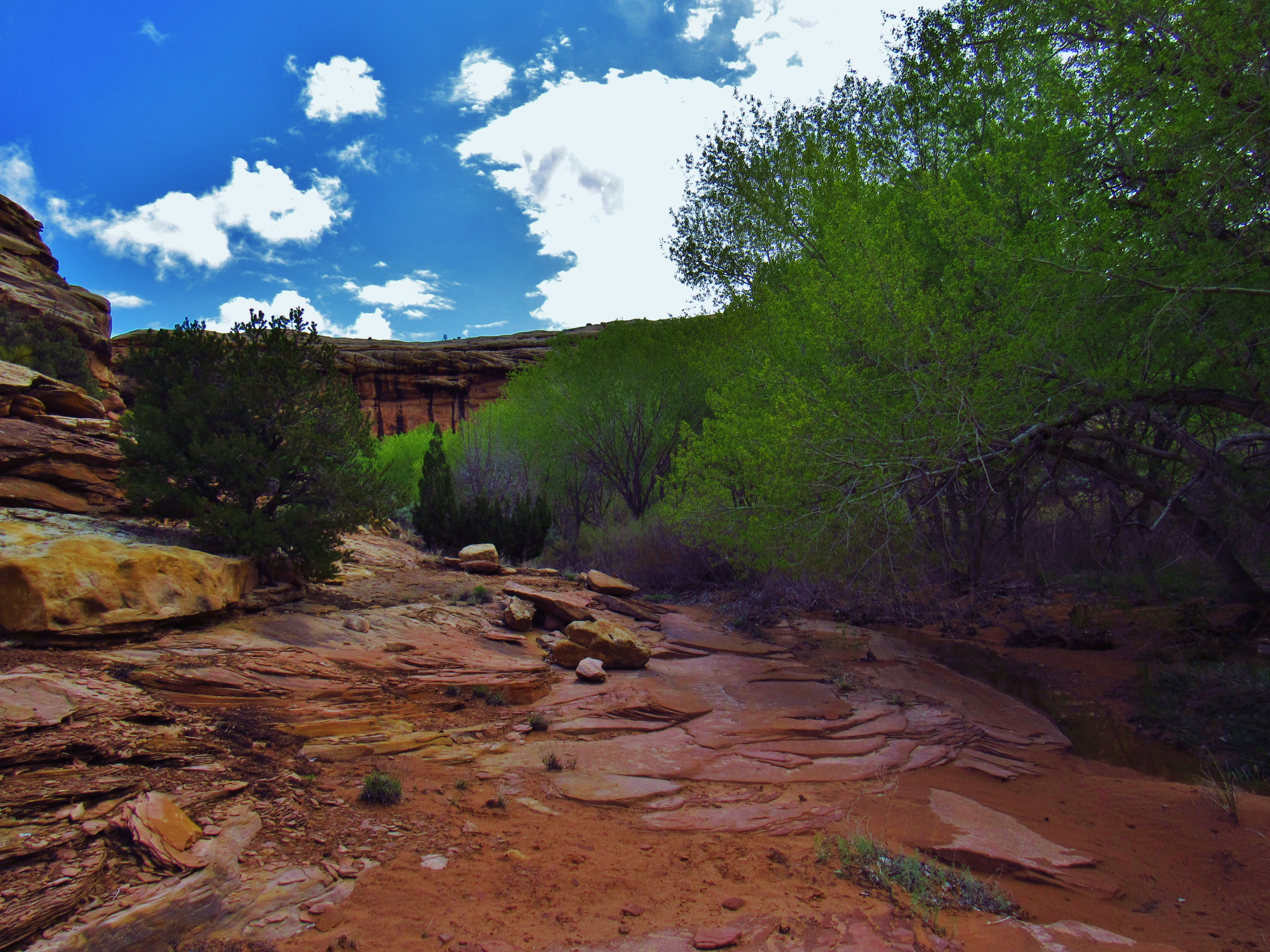
Day 3- No water in the listed spring. I searched for hours in the morning for any water, because I was down to my last half liter. DAMN. I shouldn’t have let this happen. But there’s got to be water somewhere, so I keep moving. Maybe some more jeeps will pass by and have some extra water for me. A guided mountain biking trip with 11 kids from Alaska rode by me in the morning, and the first 2 and one of their guides flew by me way ahead of the rest of the group.The guide stopped to ask where I was headed, said there’s no water ahead, and joked about trying to keep up with these crazy kids. I chose not to ask for any water because I figure they needed it just as much as I did. 10-15 minutes later, the girls of the group slowly ride by in a long train of bikes, clearly having a hard time and asking if there’s a downhill coming up. The second leader in the back says that my reputation precedes me, and that the 2 kids in the front of the group are part of an indigenous tribe from an island way up north. They have told stories of hunting walrus and snow geese, ice-fishing, etc. None of them are liking the heat, but the indigenous dudes are much tougher. She says there is a pool of water maybe 2-3 miles ahead on the right, and that I’ll see it before I get there. Sweet. I keep pushing, saving just a sip of my water. When I reach the pool, about a tenth of a mile off the road, it is clearly alkali and extremely silty. Damn. I climb back up the hill and hide in a grotto beside the road, shifting every once in a while to stay in the shade. The plan is to just wait for someone to pass by. They might have some water, or at least be able to tell me where the next water is. I wait for 2-3 hours before a dude comes by going the same direction on a motorbike. He’s only got a half liter of water himself, and though he offers it all to me, I only take half of that because I don’t want to leave him without water either. He says that he’ll turn around and let me know if there’s water ahead. Comes back in 15 minutes saying there’s a sign 4 miles down in Lockhart Basin for Lockhart Canyon, which would take me to the Colorado River after another 6 miles. So 10 miles to the river without water. Ugghh. So I start moving again after taking my last sip of water. Once I get into the basin, I start to get really dry, my legs are constantly hurting from sunburn, and I beginning to feel exhausted. When I make it to the sign I switch into pants to help with the burns. The canyon road is almost all deep sand, and it’s hard work moving through it. At this point, I am in a dze. About halfway through the canyon, I find a shady spot around a bend in the road and lay down with my eyes closed for an hour. I also hadn’t eaten more than some almonds, raisins, and poptarts for breakfast because I didn’t want to dehydrate myself any further. Damn was it hard getting back up from that nap. But I was only a few miles away and I was not about to die out here. I basically crawled the last few miles, cross the fence into Canyonlands NP, drop my pack at the end of the road and carry all my bottles through the thick, pokey tamarisk, down a short stretch of mud in a wash that led me to the river, then onto a sandbar where I could filter my water. The mud caked the sand around my feet, just to make those last couple steps especially difficult. The water was cloudy and full of silt, but once it passed through the filter, it was crystal clear. But again, it took almost 2 hours to filter a couple gallons of water with how often I had to backflush it. I brought the water back up to a rock outcropping, went back and fetched my pack, and made some dinner before bed. The wind was so strong that night that the blowing sand woke me up a few times. I could hear some of my smaller items blowing away in the wind, like a stuff sack and my solar light, but i didn’t have the energy to get up and just hoped that the tamarisk caught them. Rough day.

Lockhart Basin Panorama
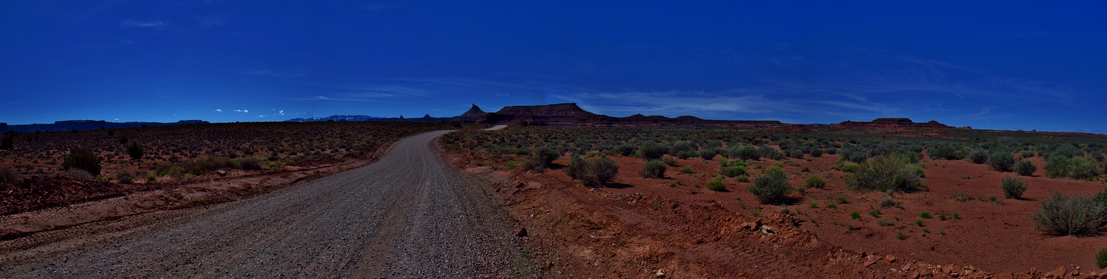
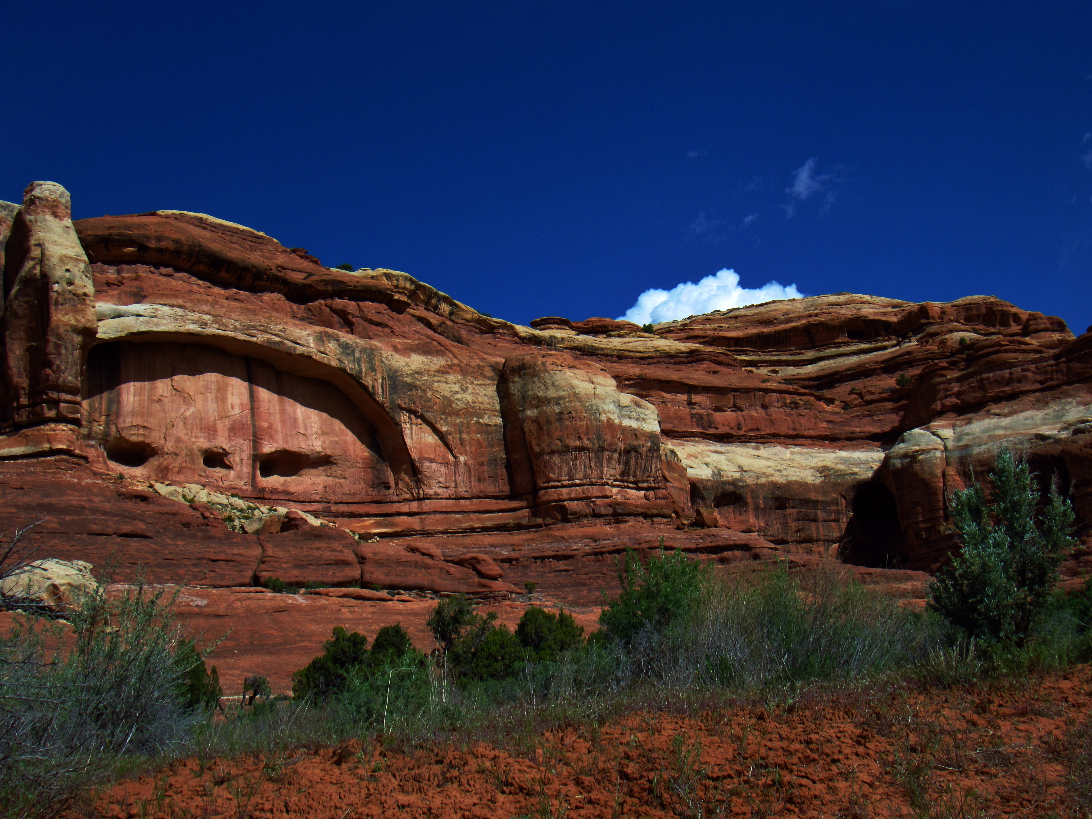
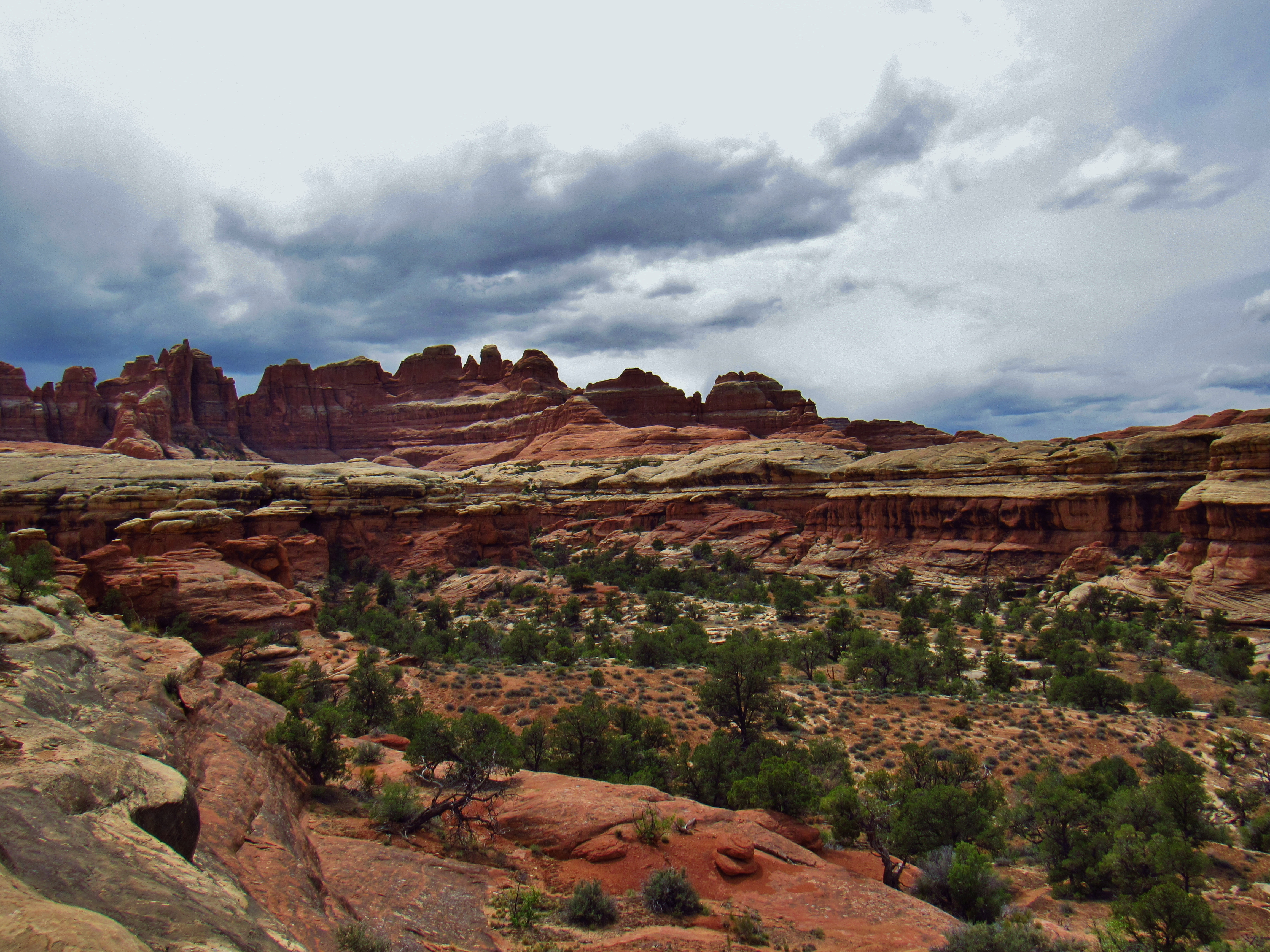
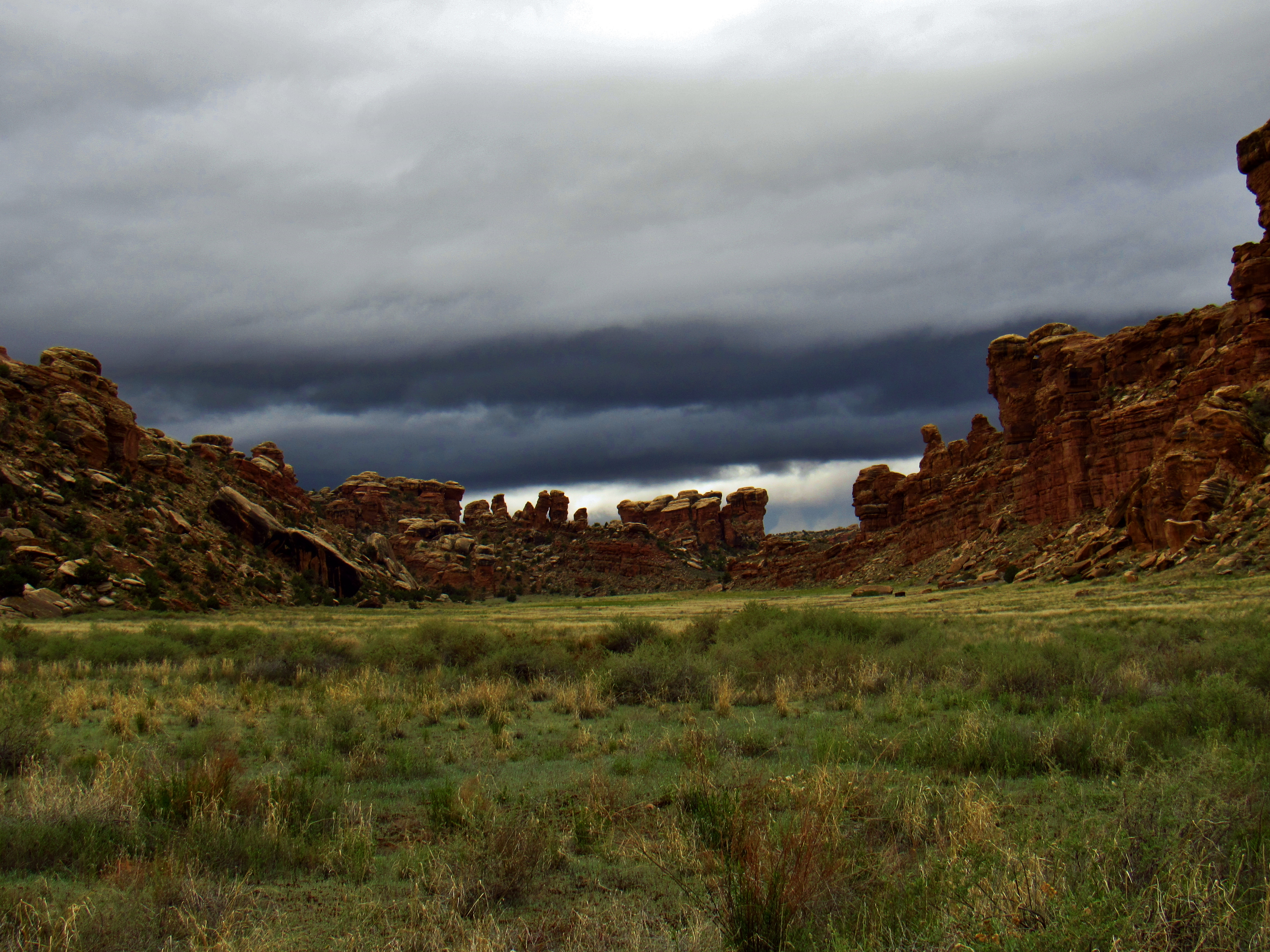
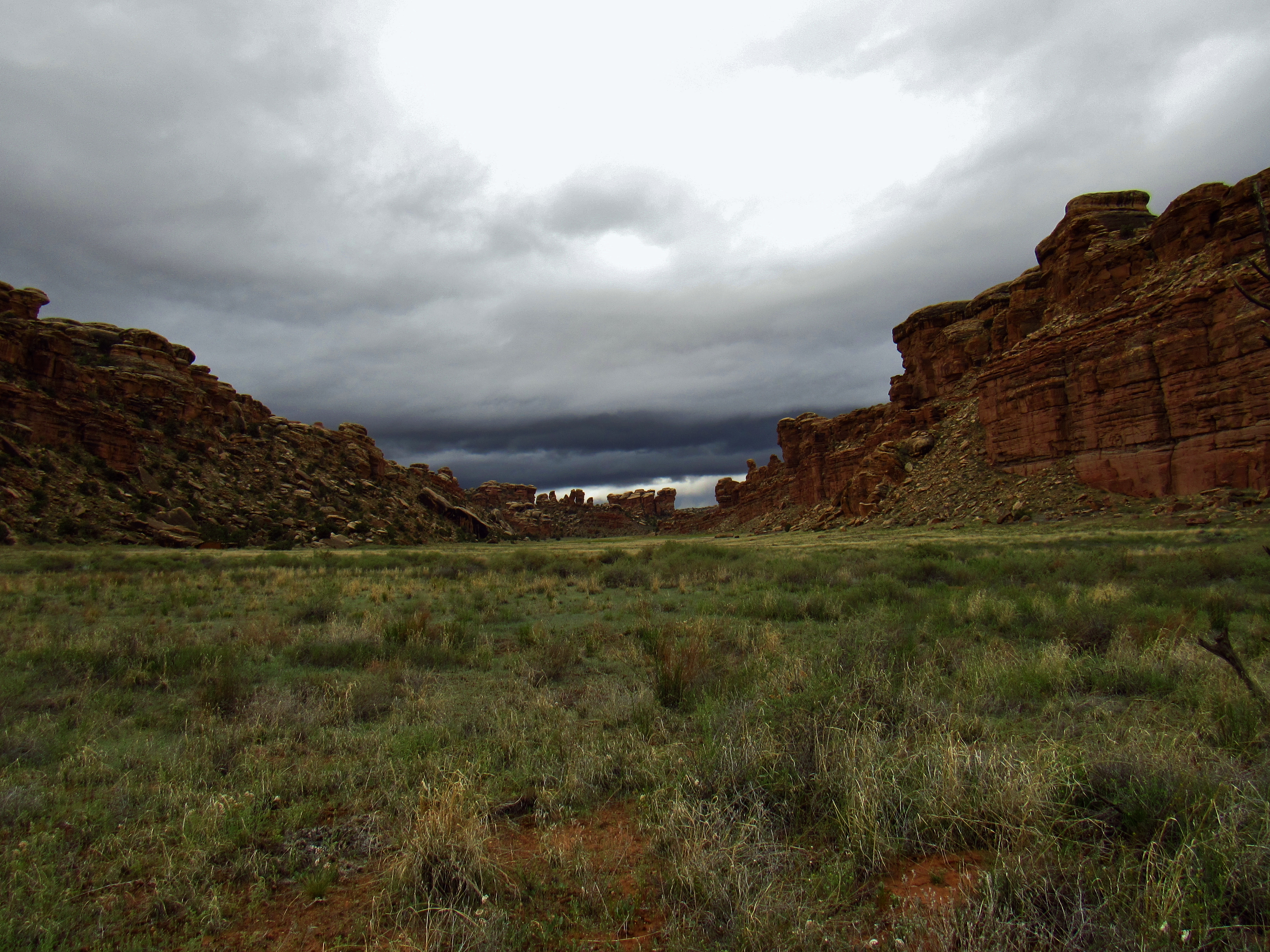
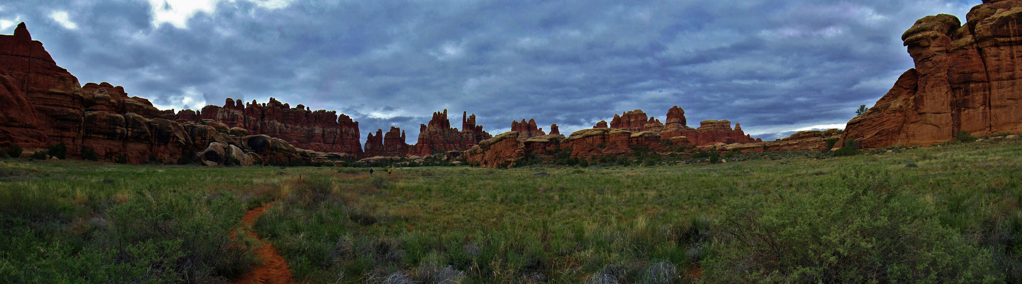
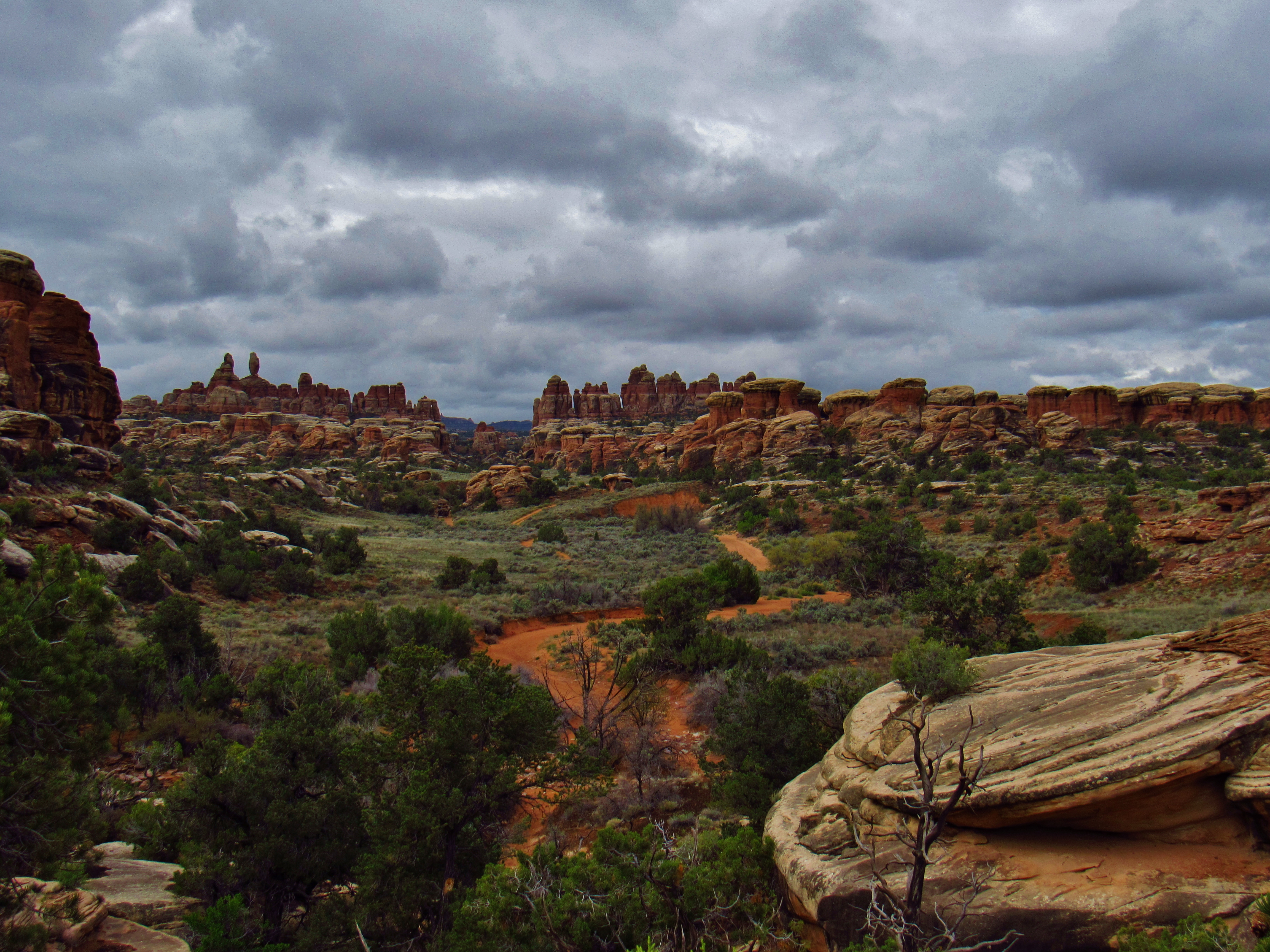
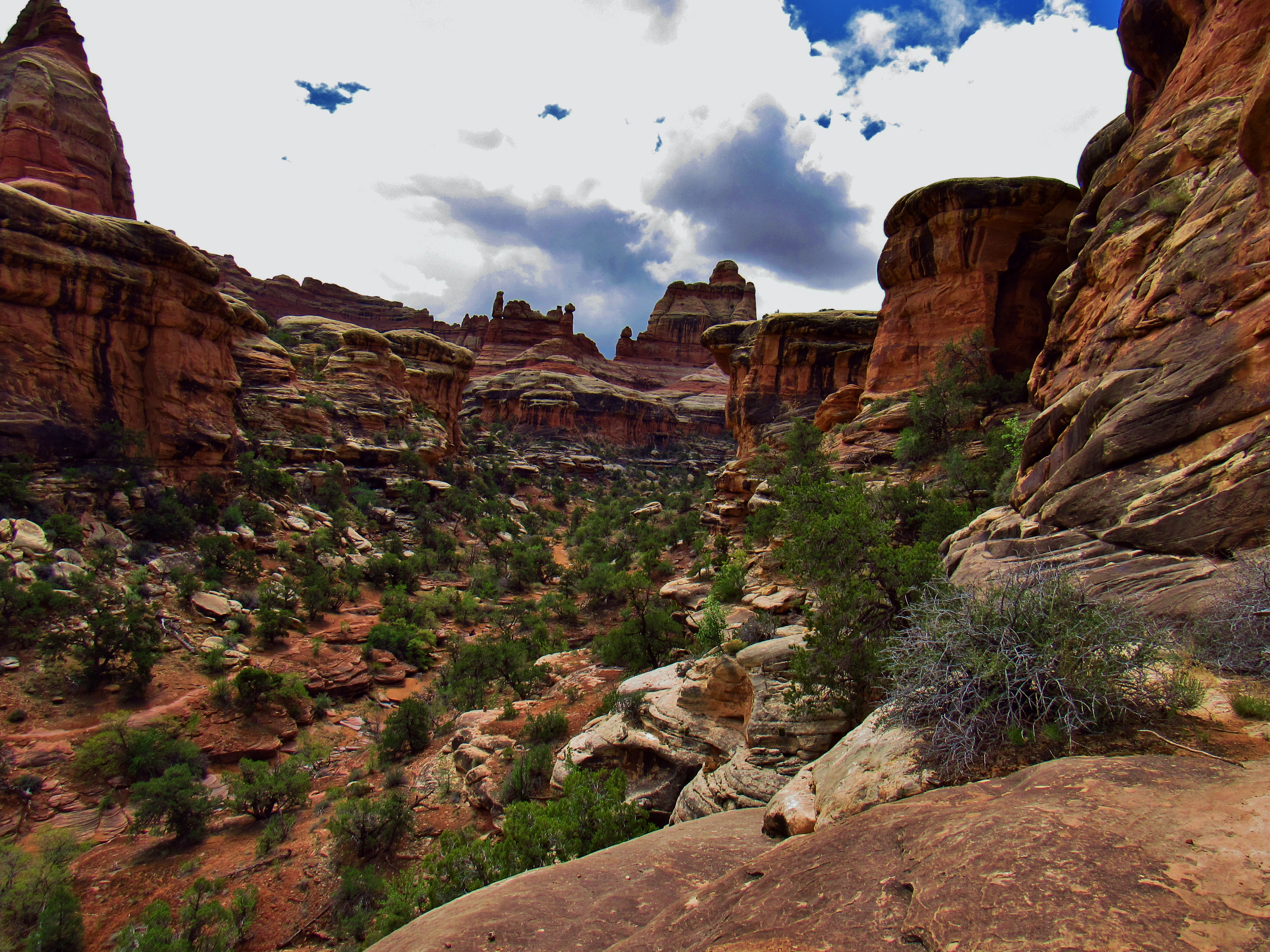
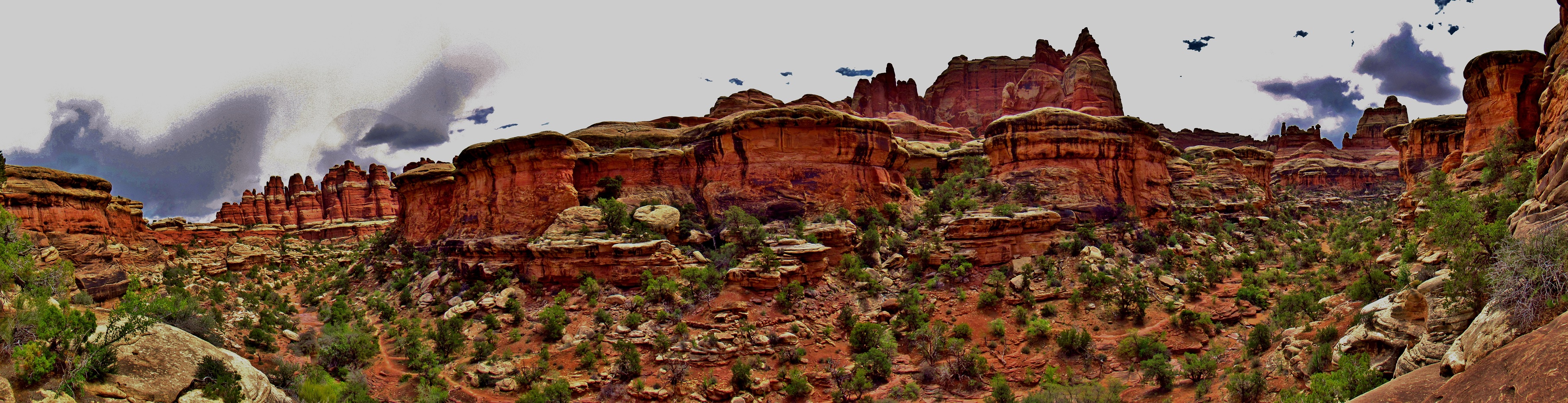
Day 4- Slept like 11 hours. Definitely needed it. Thought about taking a zero day here to recuperate, but decided to push on to Canyonlands. Filtered the rest of the water from last night into my bladder, then went back to get more. At the junction of the wash and the river, there was a white-faced ibis! It was stunning. I so wish I would’ve brought my camera. It’s footprints were huge relative to its body size, and it had feathers that flashed green in the sunlight with a very dark purple or black base color. I packed out 8.5 liters of water and my pack is SO heavy. Would walk an hour or so, then take a 15-30 minute break. Took pictures of Lockhart Canyon today because I missed them yesterday. Very windy today and the blowing sand hurt at times. It got into my eyes, mouth, nose, ears, everything. Sat under a rock for a bit and told myself I would just hitch to Indian Creek, but even with a bunch of jeeps and ATVs rolling by now, I just kept walking. Got out of the basin and slowly into the canyons around Indian Creek, and when a group of young folks in a Cherokee, PBR’s in hand, asked if I was headed to Indian Creek, I said I would see them there, craving for some social interaction and maybe the opportunity to trade a couple songs for a beer. With the sun below the canyon walls, it wa easier the last few miles, but I was hobbling. My left foot is pretty sore, like it’s a bone pain. Kind of worries me that I might have a stress fracture. Finally made it up and over a ridge and behold… Indian Creek! Wide, shallow river in the slickrock canyons with a big waterfall right by the road crossing. There was a group of dudes playing extreme, all-terrain bocce ball as I made my way down the hill, and when I passed a group to make my way to the ridge overlook, one of the girls asked about my guitar, and I told them I’d come back in a minute to play a song. Come back with my guitar and bear canister/seat and chilled with them until around 11 around the fire. They are a family with friends and significant others who make the trip out here each year. They are from Durango with around a dozen in all. They made bean, sausage, avocado, and salsa burritos and I played everything I know for them. Real good folks.
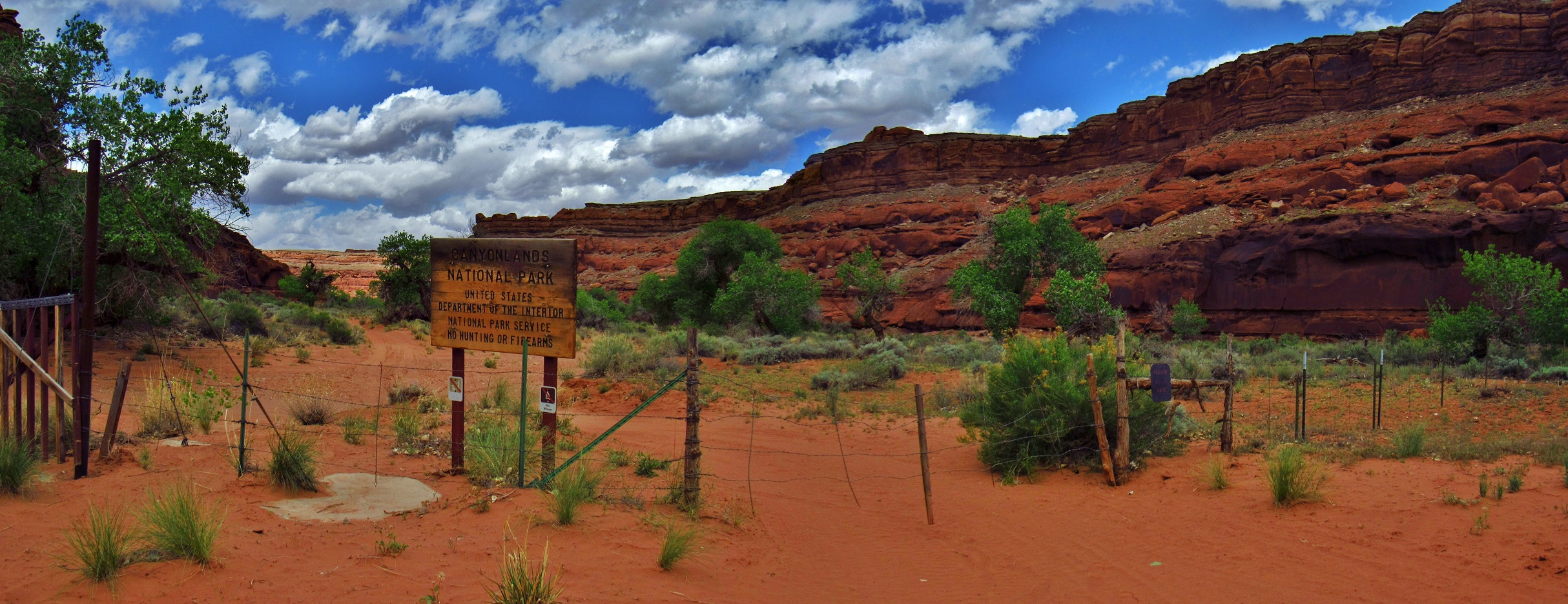
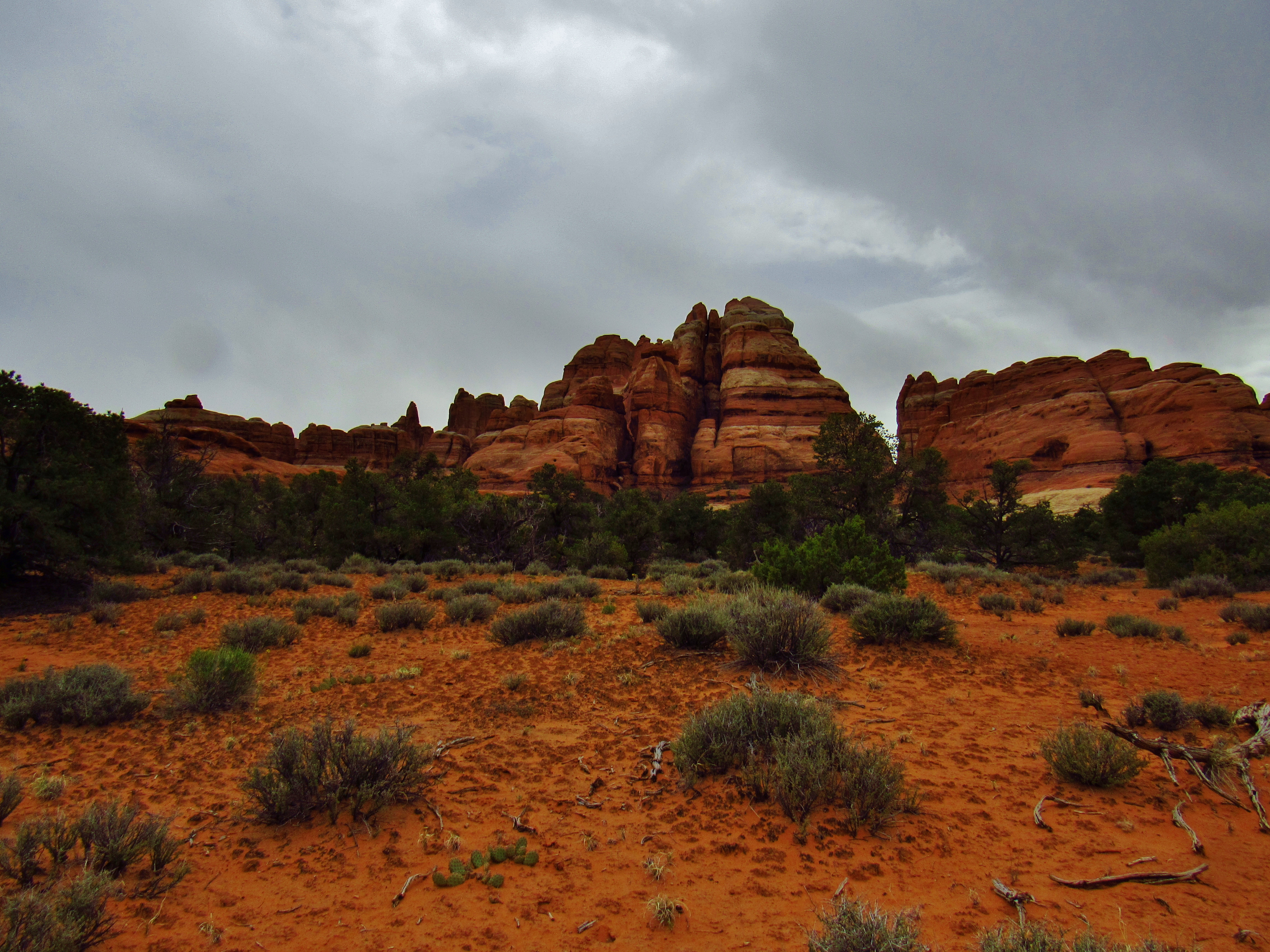
Canyonlands Sign Panorama
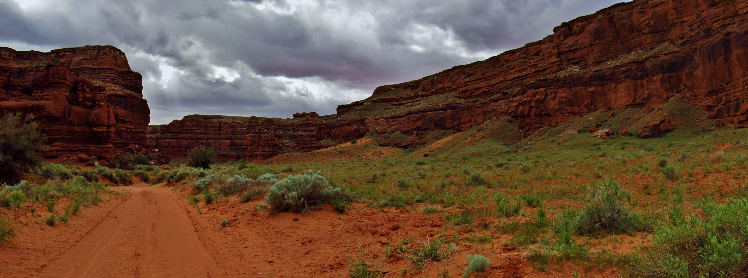
Lockhart Canyon Panorama
Lockhart Canyon Panorama

Lockhart Basin Shade Rock Panorama
Kane Springs Road Panorama
Day 5- First things first, stitched up the right shoulder of my shirt, then went down and played them My Black Butterfly, an original song about living in the moment, being happy, and how everyone has something to offer and something to learn. Sat around, drank some strong and gritty coffee, had a little bit of beans, eggs, and sausage, then gave hugs and headed out. Young folks in the Cherokee from yesterday gave me a Capri Sun on the road. Clutch! Got to Highway 211, and tried hitching for the first couple cars, then gave up. Foot is still pretty sore, decidedly from bad support in my sandals. Passed up the outpost outside the Needles entrance- needed to my permit from the visitors center in time, and I can always hitch from the Grabens later if I need food. Permit at the visitors center took 2 seconds. Met some folks that just finished the Arizona Trail and thru-hiked the PCT in 2014. Ate a little, then pushed on into Salt Creek. As soon as I got into the canyon, it was slow going. Foot really hurt, sand was deep, sandal cutting into my skin, and I felt lightheaded and sick. Set up my hammock right off the river and crashed early in my hammock, around 5:30
Kane Springs Road Panorama
Kane Springs Road Panorama
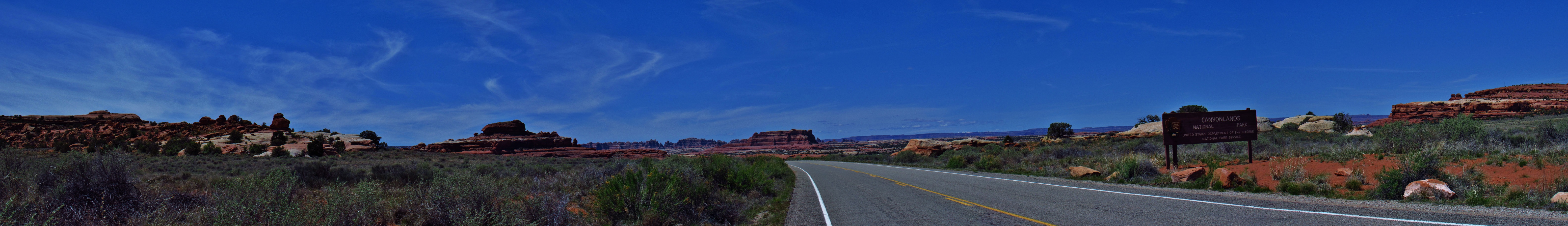
Canyonlands Entrance Panorama
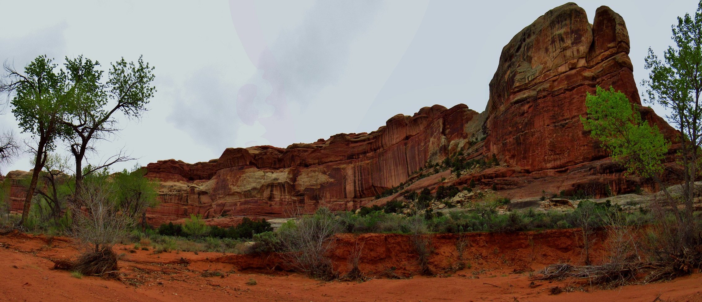
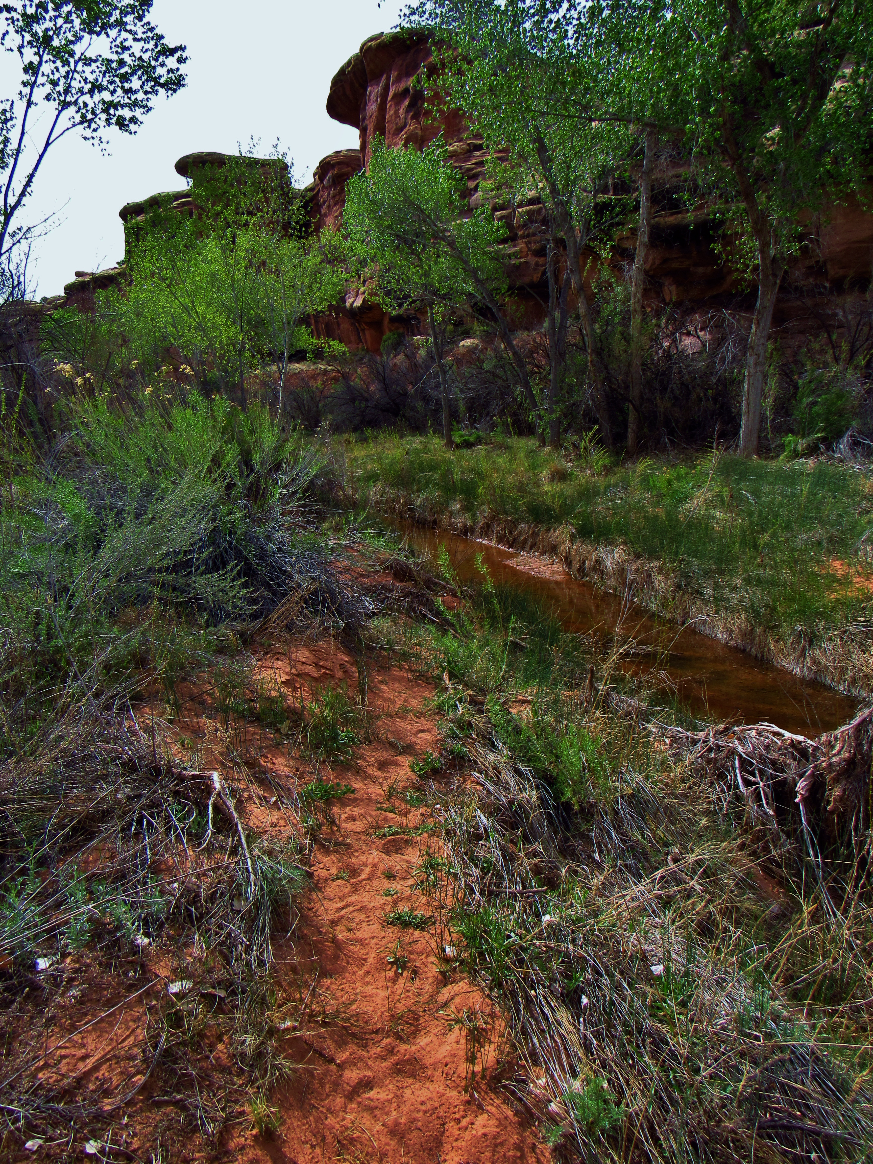
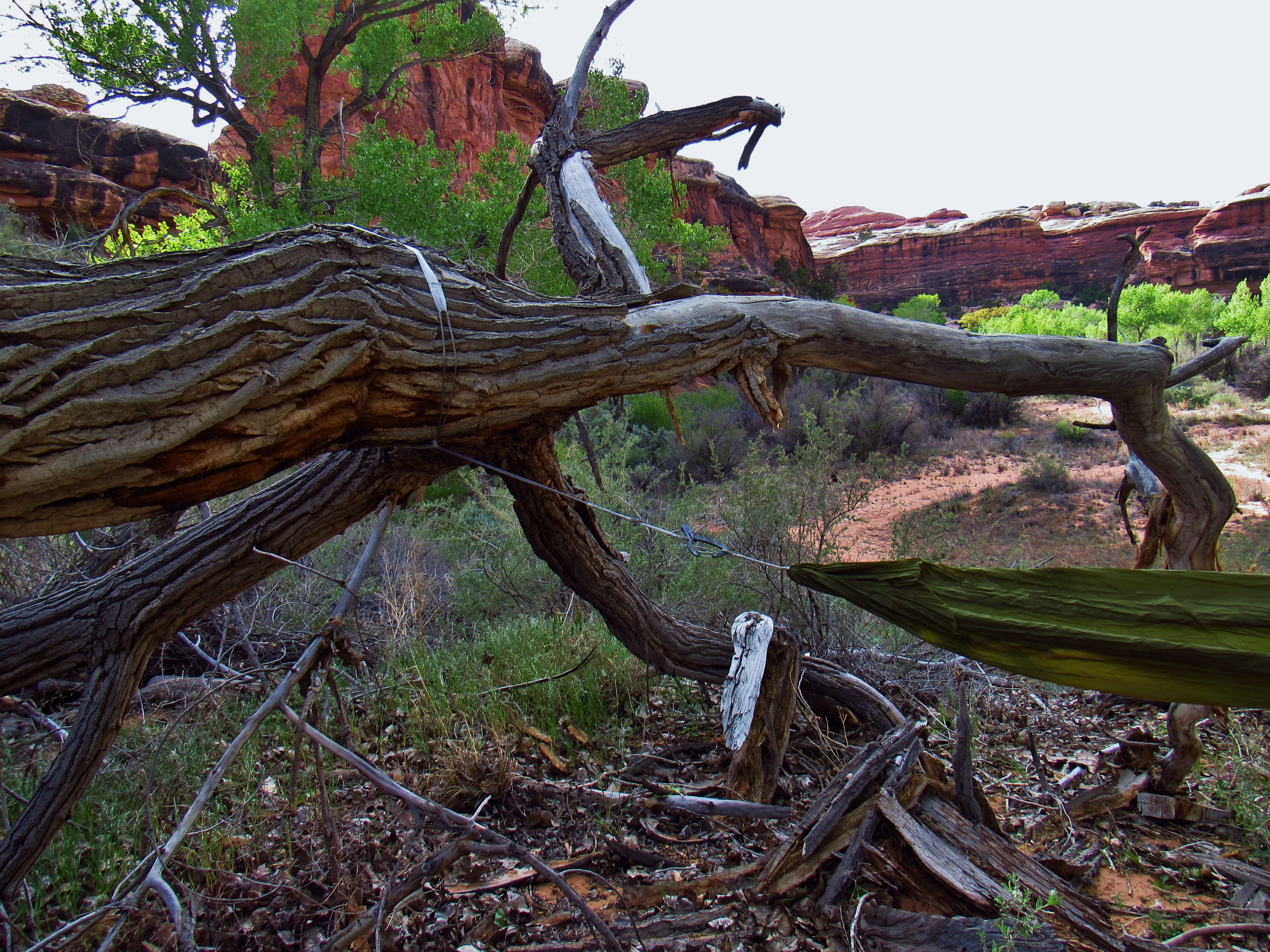
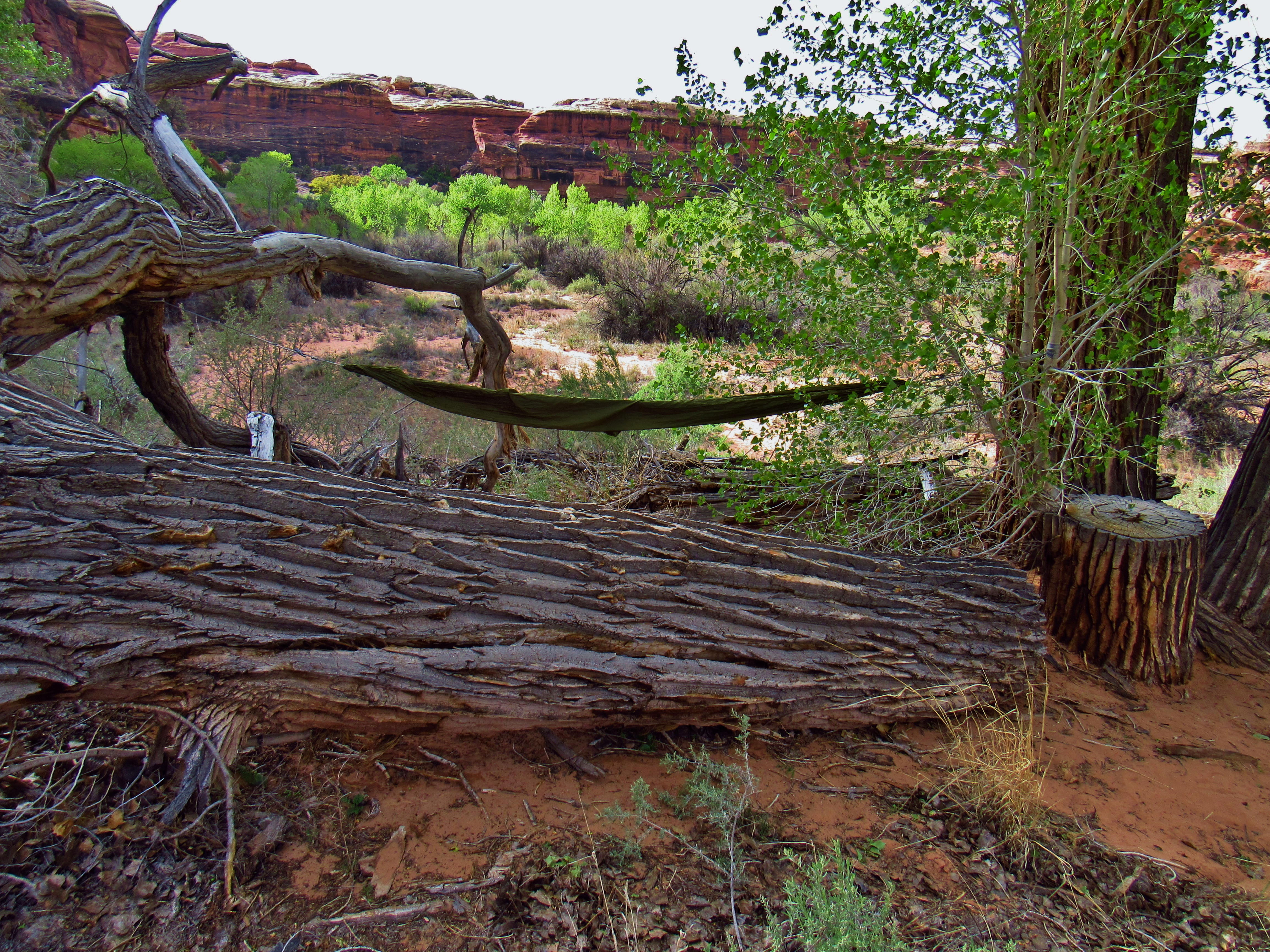
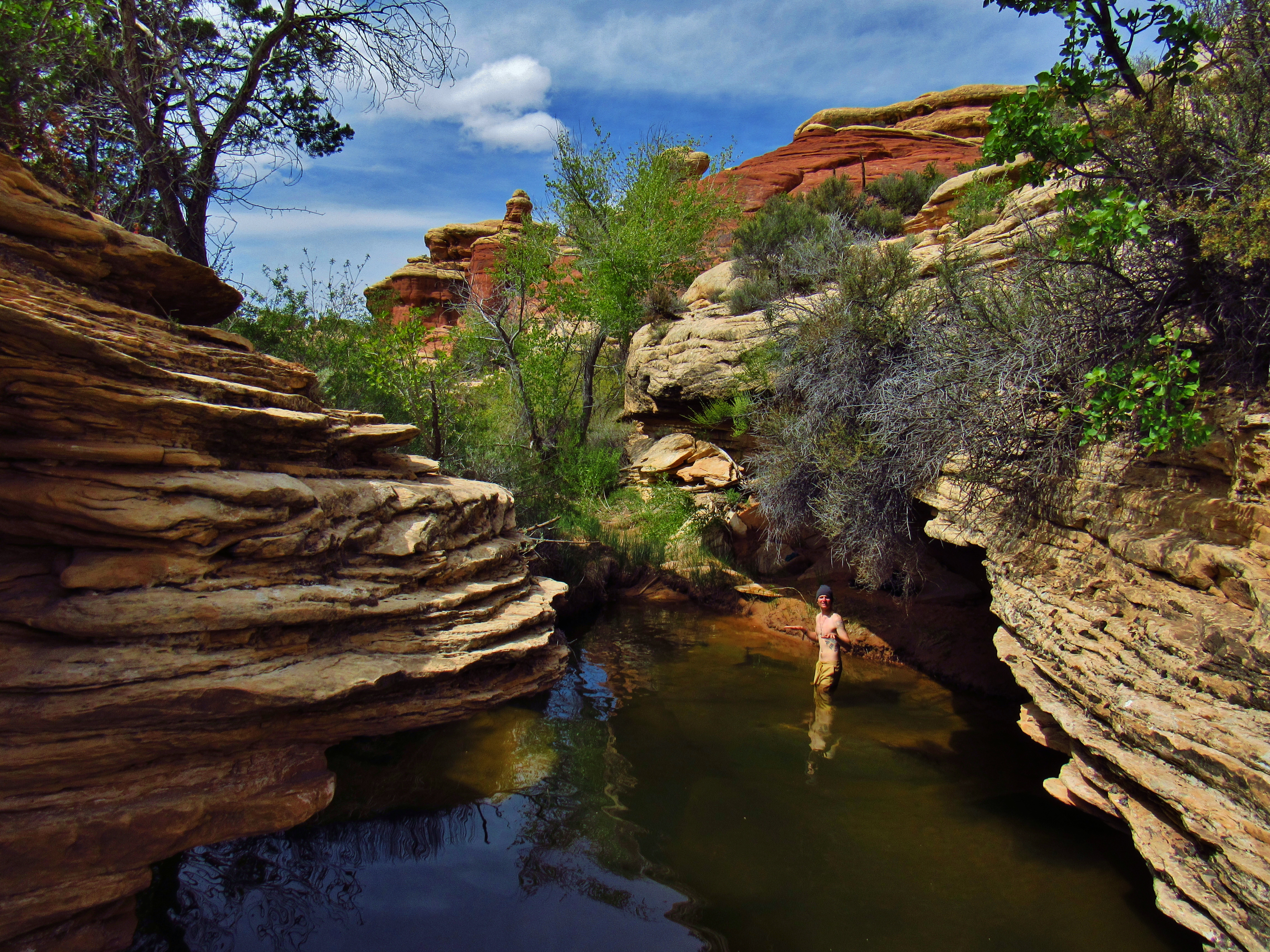
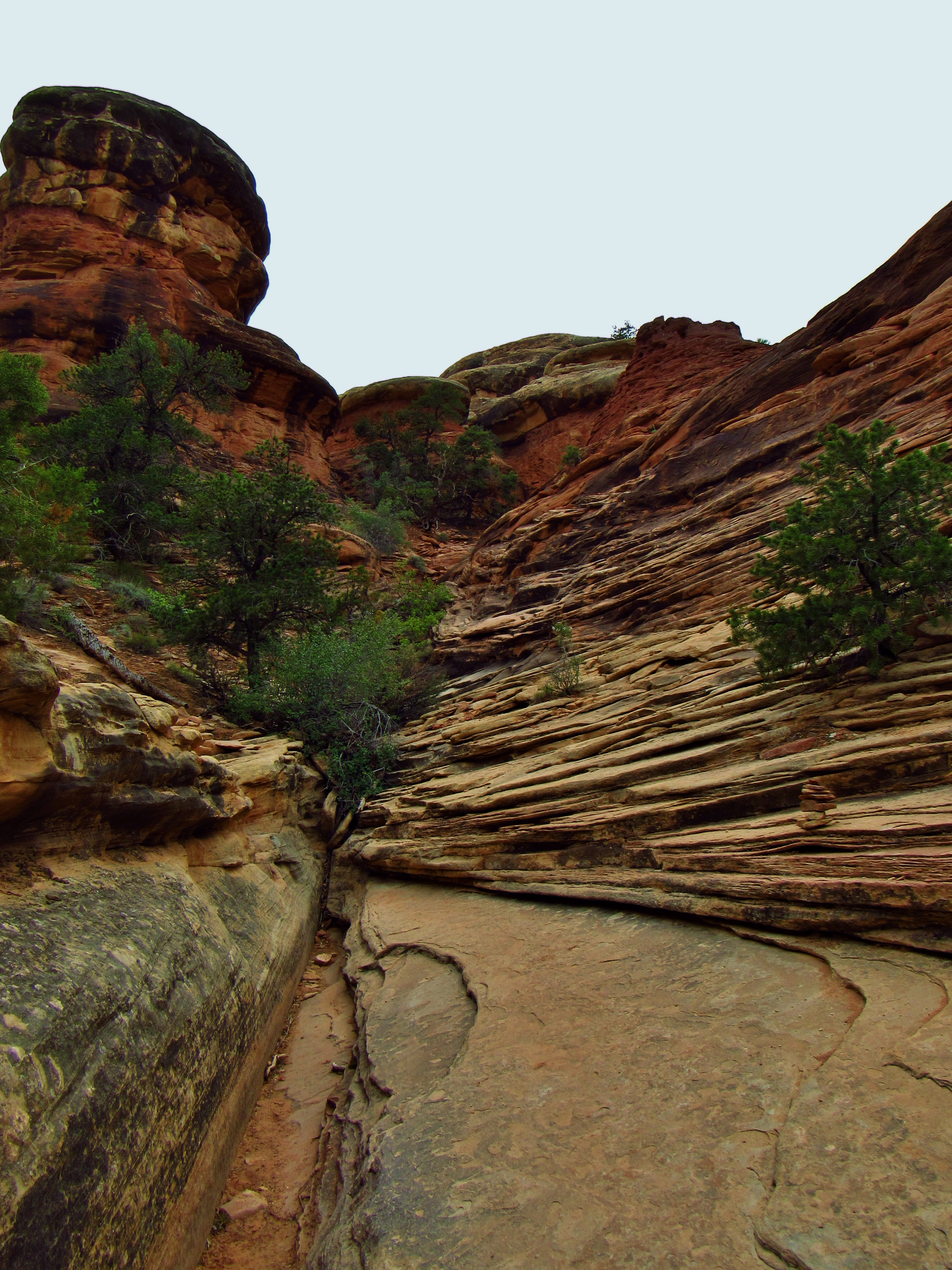
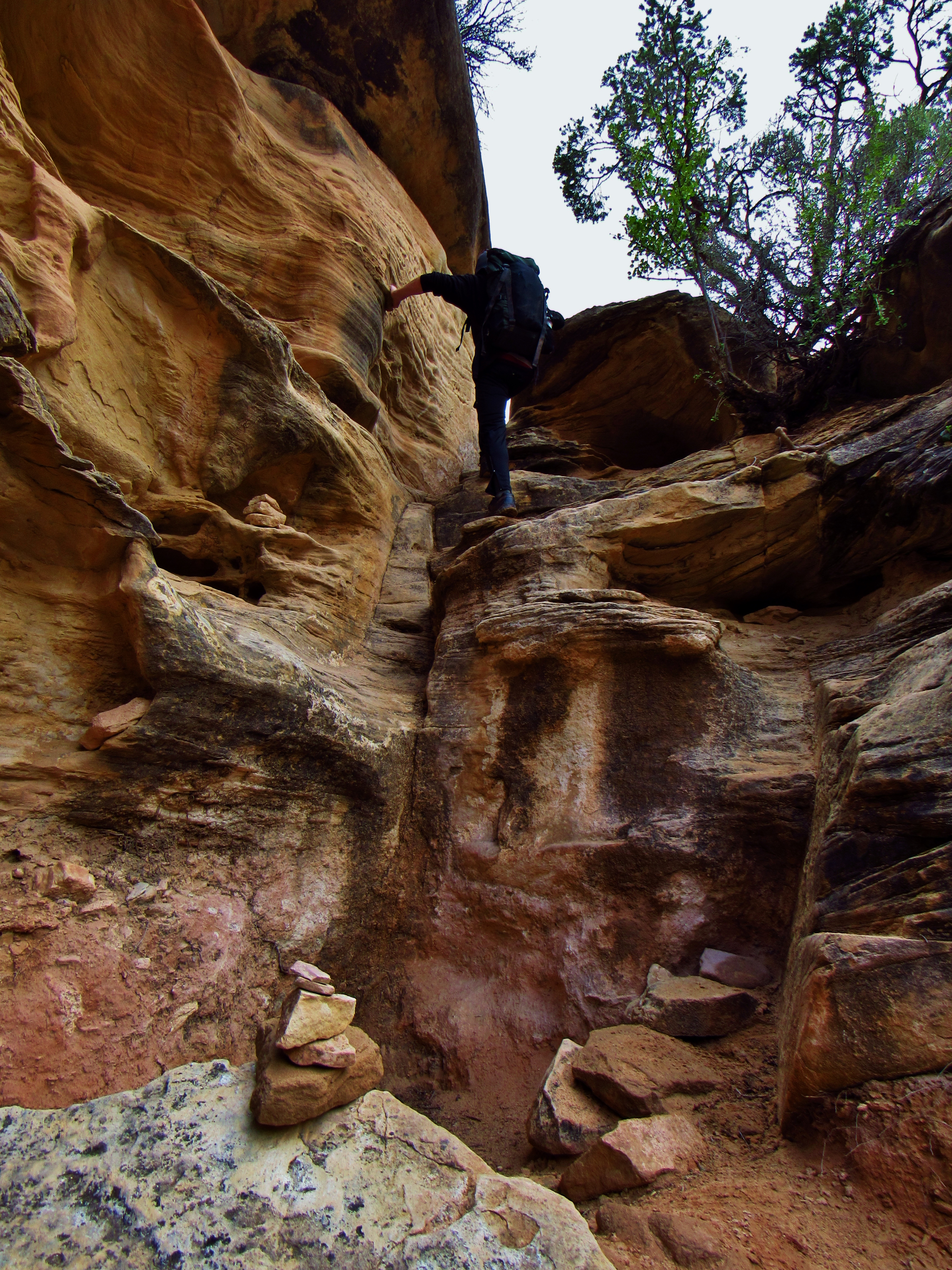
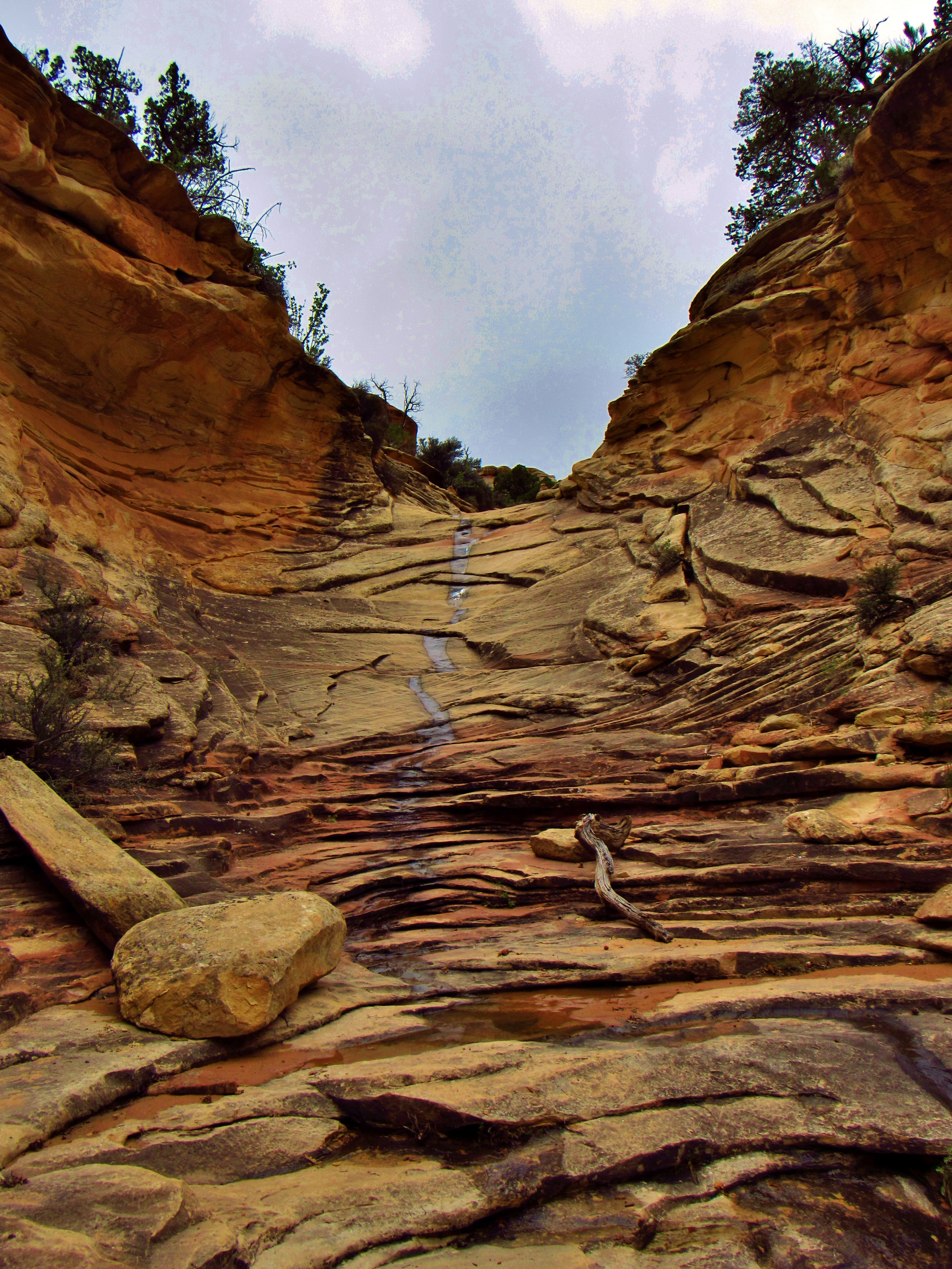
Day 6- My hammock is so great. Stayed in it until 7 this morning. Shot hot green poop out of my butthole right after waking up. Oh the joys of camping! Almonds, raisins, granola, and Hershey’s chocolate spread for breakfast, then caught up on 2 days of journals. Left around 9am, feeling better than last night but still sore. The uneven sand makes me land on the middle of my foot sometimes, which really hurts. Followed Salt Creek on some really obscure paths. They look like deer trails, and as with snow, following footprints on them can sometimes lead to a bunch of people making the same mistake. I went into Horse Canyon and there was nobody else in there. In fact, the only person I saw today was someone walking back towards the parking lot, dressed in a clean plaid short sleeve shirt, slacks, and dress shoes. He said this was the best flow he’s ever seen in Salt Creek, and that there were surprisingly few people in the park, considering it was currently National Parks Week. It was pretty cool and quite windy again today. I went back and forth with my wind/drizzle shirt because I was a little too cool or too hot either way. Paul Bunyon’s Potty (a funny old cowboy name that stuck around) was first, an arch on the outside of a giant amphitheater, like a toilet bowl with the face of the bowl cut away. The names of these features are great for finding my place on a map, but honestly everything could have a name. There are arches and hoodoos and caverns , and everything imaginable all around. It’s literally like walking the ocean floor, except that walking in the sand here is a bit harder. Couldn’t see the keyhole ruins, but walked the extra mile for tower ruins. Looked like a fairly easy climb up, but I just took pictures from below. No point in impacting them any more than they already have been. Rubbed some sage on my hands because it smells great, then I turned around. Kept following Horse Canyon and the wind picked up and clouds rolled in. The trail follows the wash- a wide, deep corridor of sand, so it’s slow going and the wind sends it right into my face. It drizzled a little, but would dry instantly when the sun came back out. Stopped to rest, played some blues, saw the clouds coming back and kept moving. Checked out Castle and Fortress Arch, and saw some deer tracks in a muddy spring. The rock formations at the end of Horse Canyon were stunning too. Turned around about 2pm with the light rain and wind following me back to the junction. Turned into Salt Creek and set up camp at Peekaboo Springs. Set up my hammock on one thin tree and one giant horizantal fallen branch. Isaac from Denver is here too and he’s hauling a huge pack. We talked about Big Sky, and crossed our fingers for no rain tonight. There was no easy way for me to set up my tarp above the hammock, so if it happened I would have to just drape it over me. Little more blues and then bedtime for me.
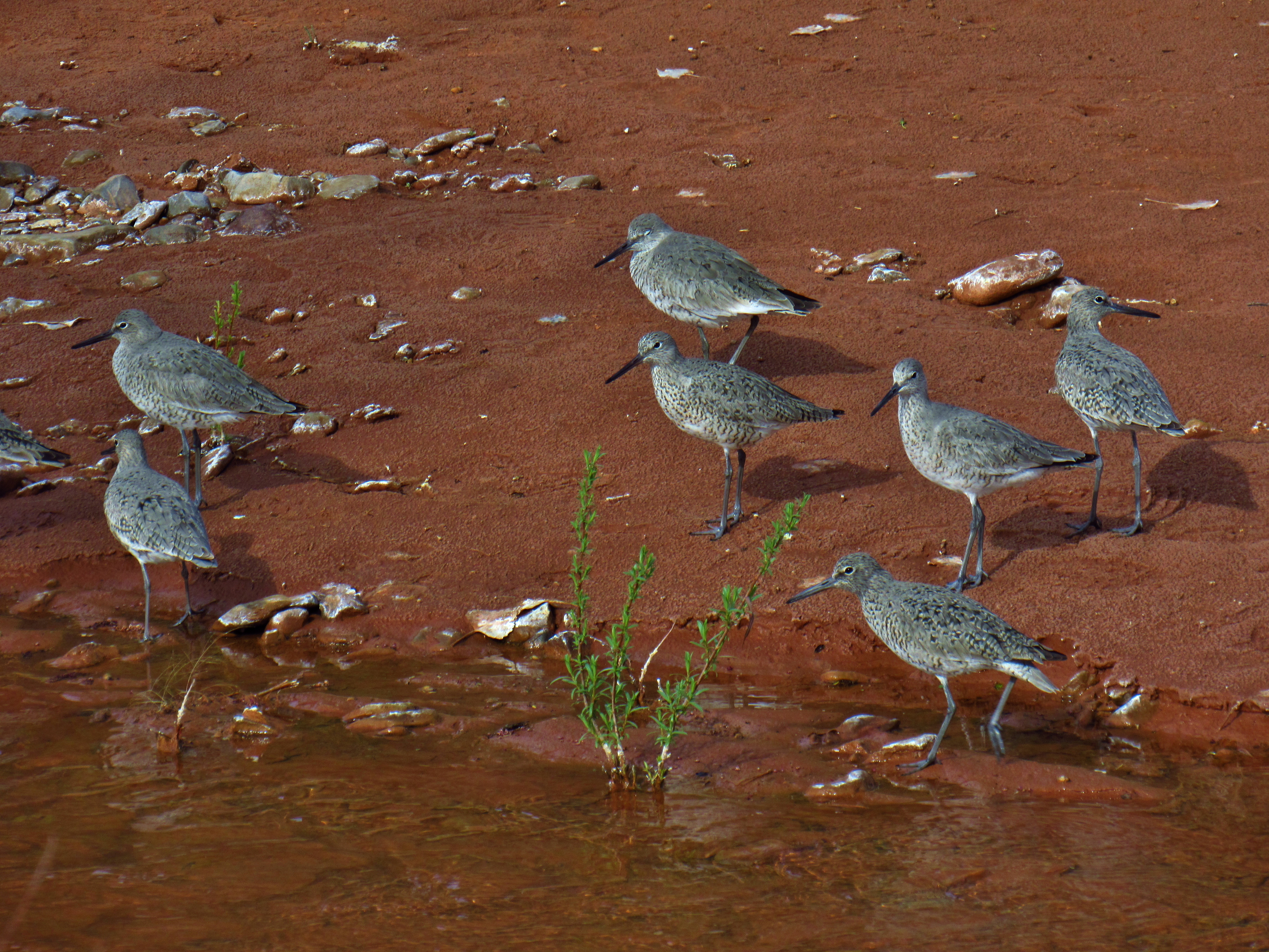
Willets in Salt Creek Canyon
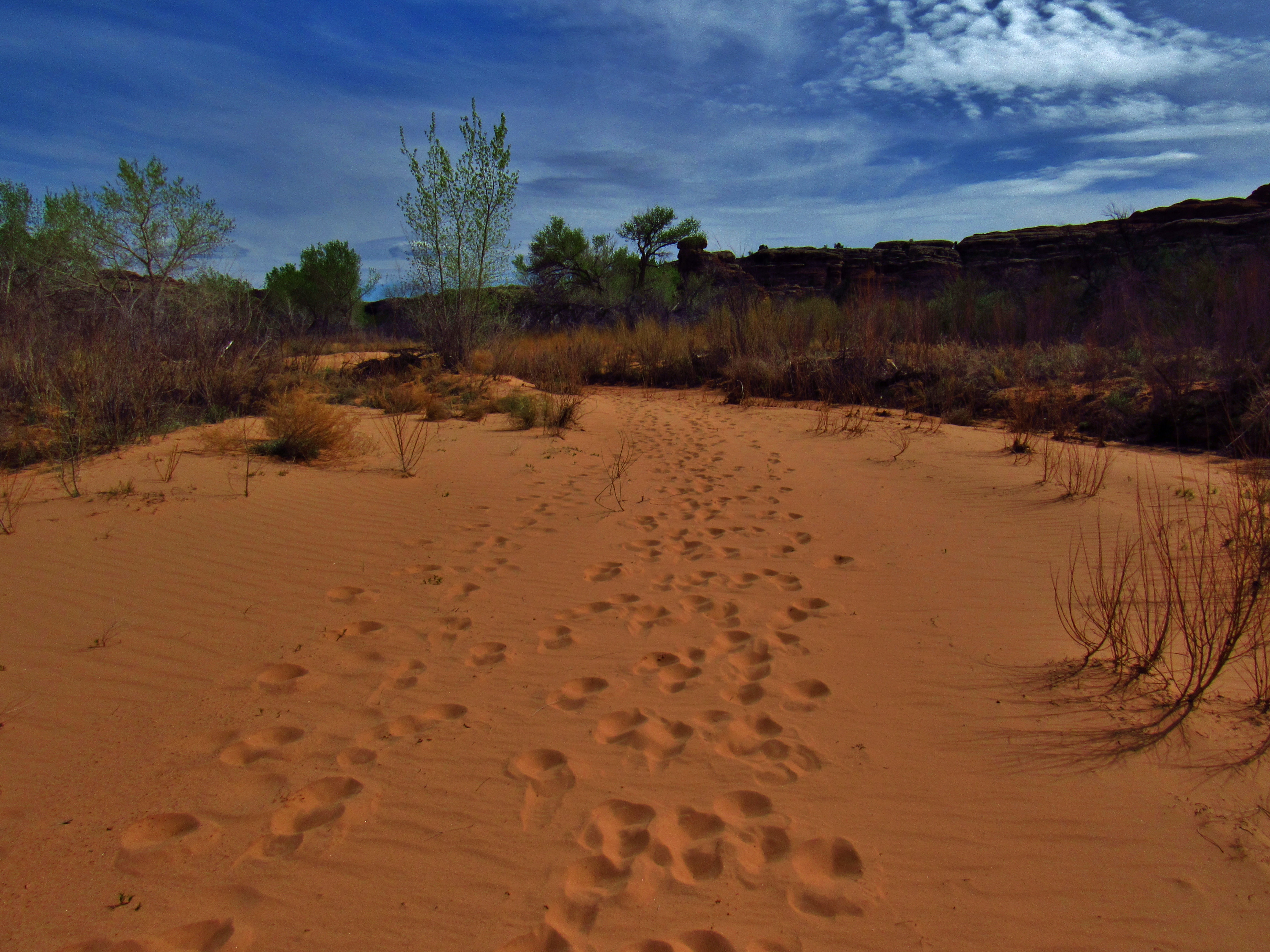
Footprints in the Sand in Horse Canyon

Pearl Crescent Butterfly in Horse Canyon
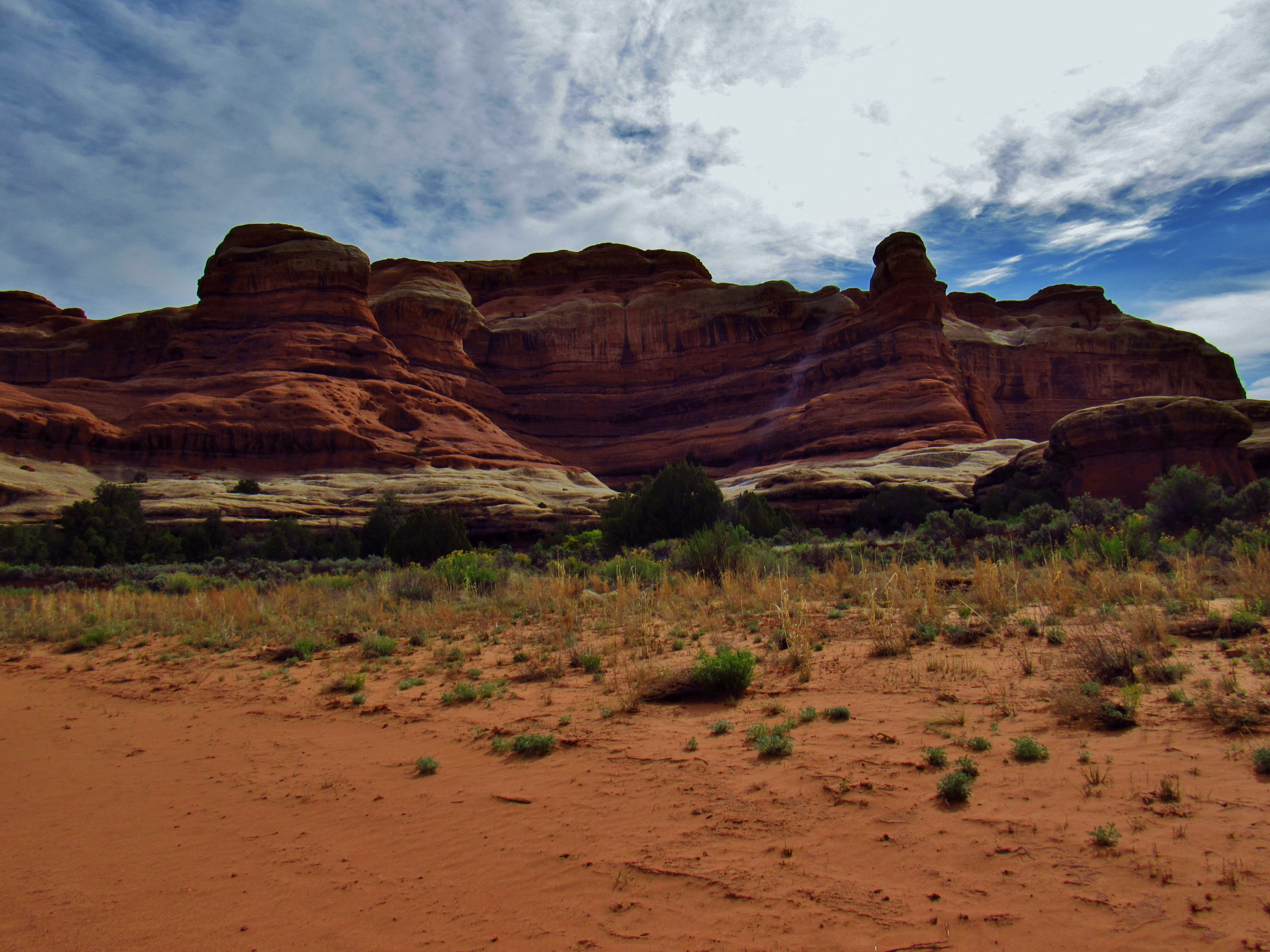
Horse Canyon
Biological Soil Crust in Horse Canyon
Trail in Horse Canyon
Horse Canyon
Amphitheater in Horse Canyon
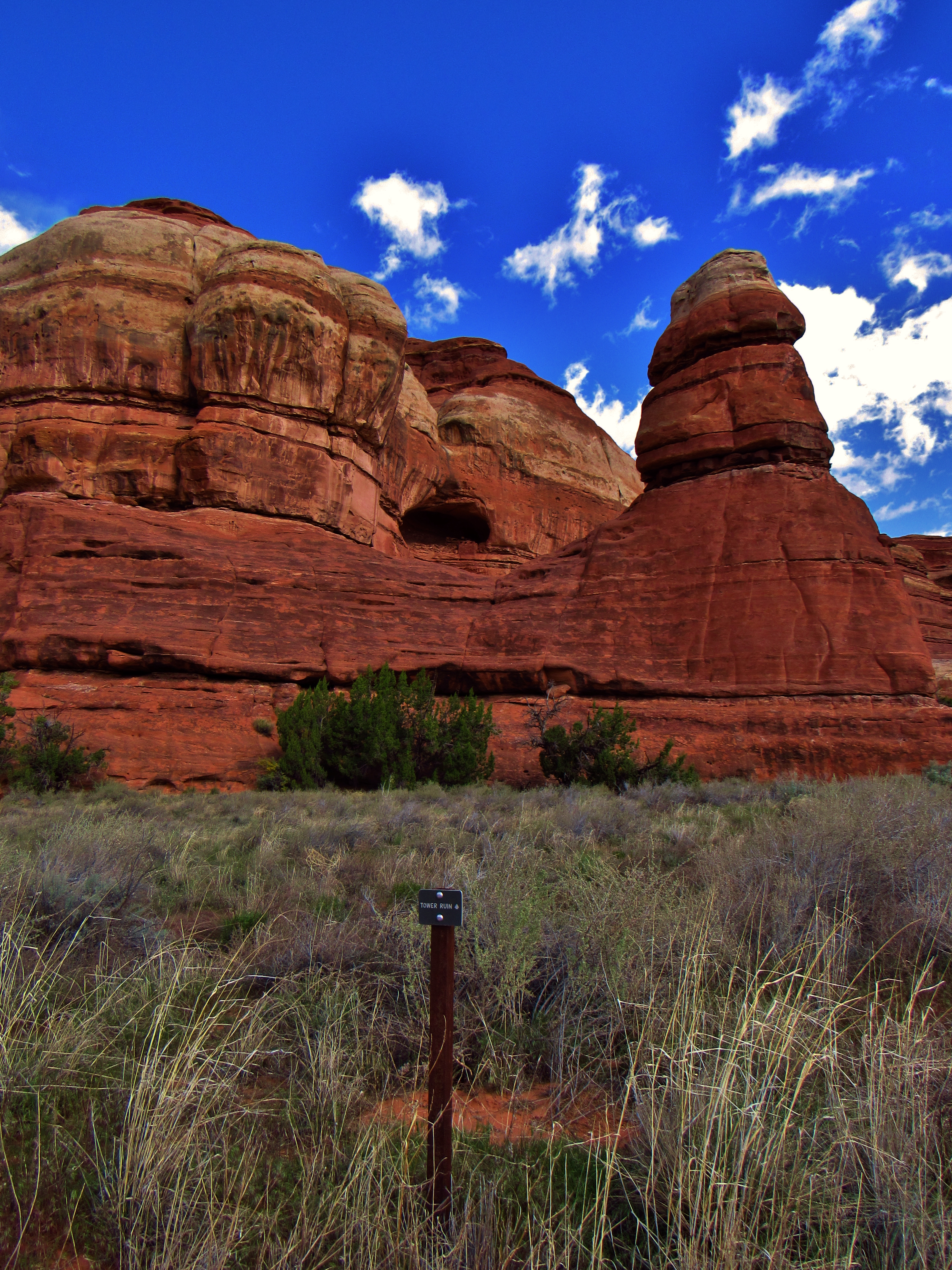
Tower Ruin in Horse Canyon
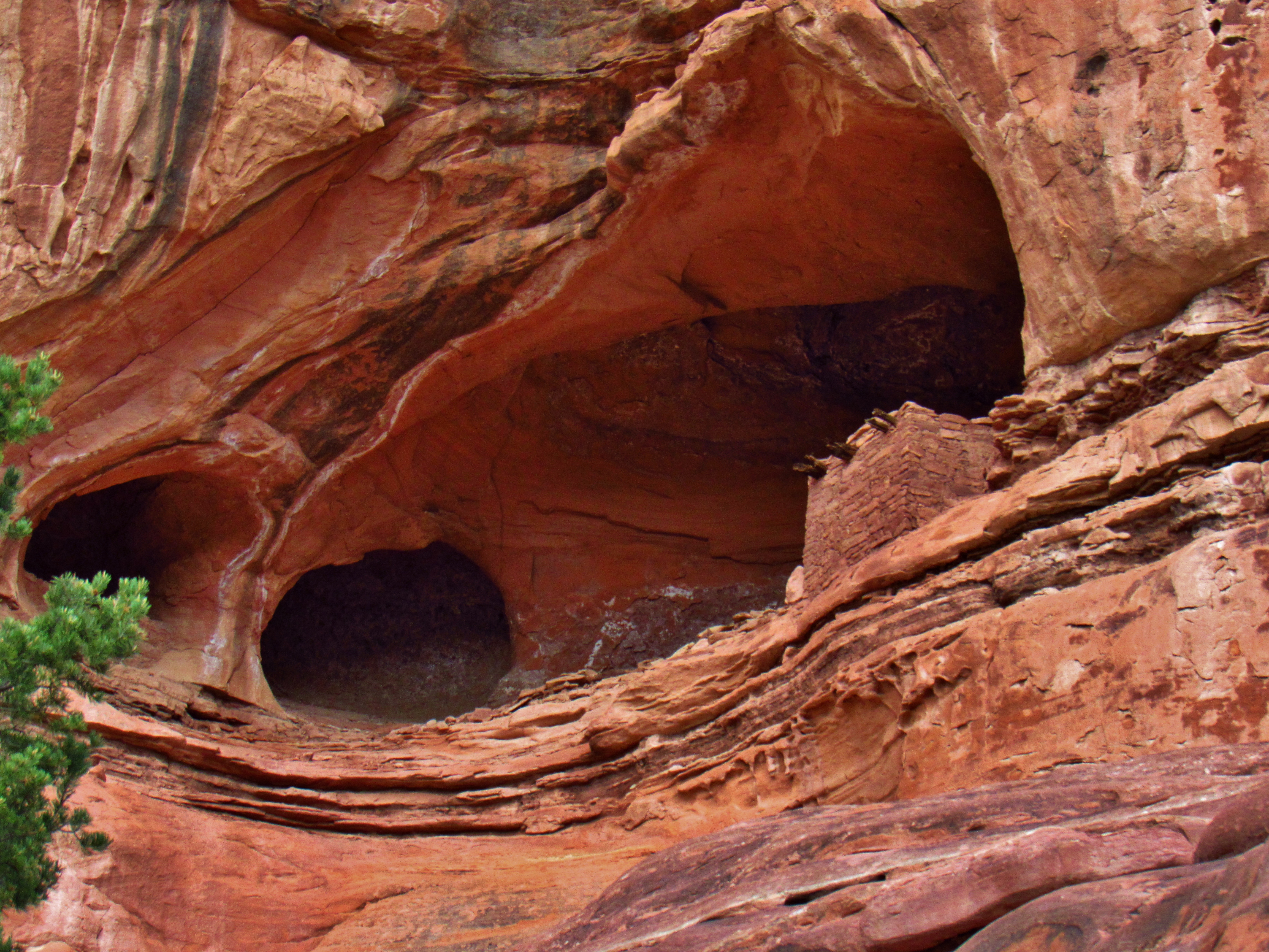
Tower Ruin in Horse Canyon

Cricket in Horse Canyon
Horse Canyon Panorama
Horse Canyon

Horse Canyon Panorama
Horse Canyon Panorama
Trail in Salt Creek Canyon
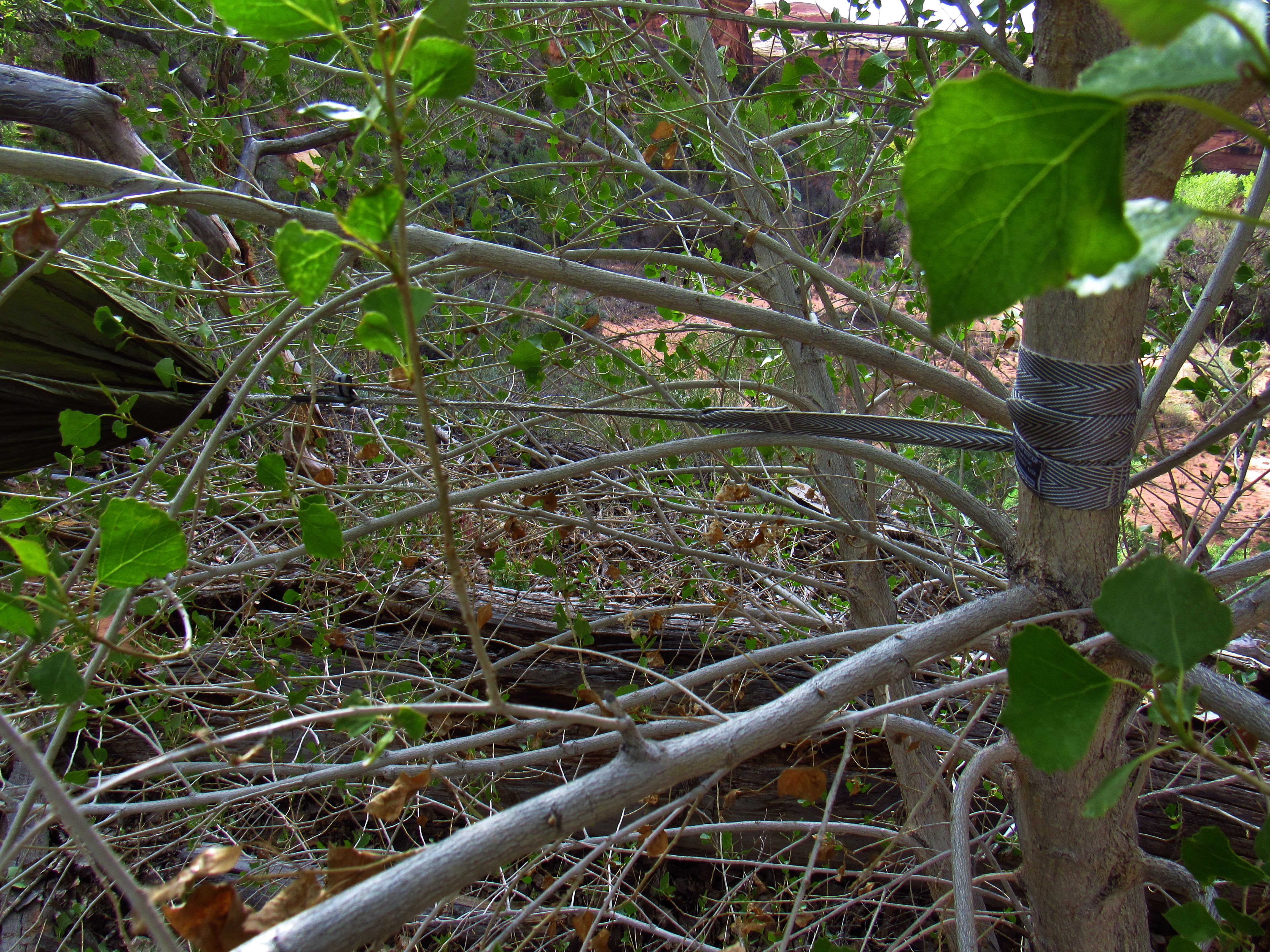
Hammock Setup at Peekaboo Springs
Campsite at Peekaboo Springs
Hammock setup at Peekaboo Springs
Hammock Setup at Peekaboo Springs
Day 7- What a shitty night. Started raining so I scrambled to drape the tarp over me. I didn’t bring my puffy, so I was wearing my wool baselayer, nylon shirt, and wind/drizzle shirt, plus rain pants inside my sleeping bag but my body couldn’t decide if I was hot or cold. Maybe it was bad summer sausage or cheese or tortillas, maybe it was the water from Salt Creek, which as its name implies, is slightly saline, (though it doesn’t smell or taste like it, and I purified the water), or a million other reasons- I threw up a couple times in the middle of the night. I felt myself start to feel sick, and would try to breathe through it, but I couldn’t wait it out. I leaned out of my hammock, pushed the tarp away from me, and barfed enough times that the last couple were just dry heaves with a loogie or two. Woke up at 8 or so after a restless night and I had puked on my tarp… I fell out of my hammock on the last dry heave, but fell so that the tarp was between me and the grossness. Yuck. I shit green liquid when I made it to the pit toilet, then again a couple times when I came back and took a sip of water. So glad there’s a toilet here. Felt totally brain drained and queezy while I packed up, moving slowly and still kind of cold. I washed off the tarp but couldn’t find it’s stuff sack, so I put it in an extra that I had. Zombie marched back up Salt Creek, only stopping once for a handful of almonds and a sip of water. Didn’t sit well. When I finally got to the road, I waved down 3 chicks in their car and they graciously brought me back to the visitor’s center. I needed to head back to Moab. I can deal with pain and even a close call with water, but not with sickness like this. I apologized for my scent, but thanked them generously. Drank some good water at the visitor’s center, then talked to a group of 4 older people traveling all around the country in RVs. Dude asked to take a picture of me, and then I was a zoo exhibit for 15 minutes. What kind of food do you eat? Shitty sausage and cheese, apparently. Where do you come from? Space. Take me to your leader. Where do you sleep? On rocks with sand blankets. Nice folks though. I traded cards with the lady and she later commented on Dudetrek. When I went out to the road, it took 2 seconds to get a ride. This couple from Boulder picked me up and brought me all the way into Moab. I told them (and the girls before) that I ran out of food so they wouldn’t think I might puke in their car. This couple was super chill. We talked about Andrew Skurka and Alex Honnold and Scott Jurek and how they see all these guys just chilling in Boulder. Dude hiked a little with Alex Honnold, she’s been to Skurka’s clinics, and sees Jurek at Whole Foods. She’s an ultrarunner and he’s a climber though- pretty serious. Very enjoyable talking the dirtbag life and pushing the limits of sport with them. Dropped me off at Navtec and I went to the Lazy Lizard to get a bunk, a shower, and some clean clothes. Got a chili cheeseburger and a milkshake (I was feeling much better after some water). Met a dude named Ben at the hostel and saw him again at Milt’s burger shack. Was a manager at a fine dining place in Cincinnati, but is now traveling across the country in his Four Runner. We chowed, then went 4x4ing on Hell’s Revenge Trail in Sand Flats and DAMN was it intense. The first part was so bumpy that I ended up puking out the malt shake I just had. Haha. We definitely scraped the back and bottom a little bit, but went slow and he was driving quite well. Very steep in a few spots and we felt very close to tipping. We went back to the Lazy Lizard after he brought me back to my truck, and I did some laundry and played the organ in the bunk room. Then chatted with 4 old people about hosteling across Europe. Dude knew about all 7 ‘stans (Pakistan, Turkmenistan, Kazakhstan, Kyrgyzstan, Tajikistan, Afghanistan, Uzbekistan) and knows a 75 year old woman who goes backpacking to Mongolia and Tajikistan. When my clothes were done, I moved to the bunk room and chatted with a group of dudes who had been day drinking, one of whom hiked the PCT in 2014, the AT in 2013, and just got off the Te Araroa. Owen is his name. We talked trail a bit and he was surprised when I said I wouldn’t yet try the Hayduke, but I later told him about my experience with the bad food/water and he laughed heartily. He’s totalled 8,500 miles and is 22 too. Jammed some tunes into the night and crashed around 11
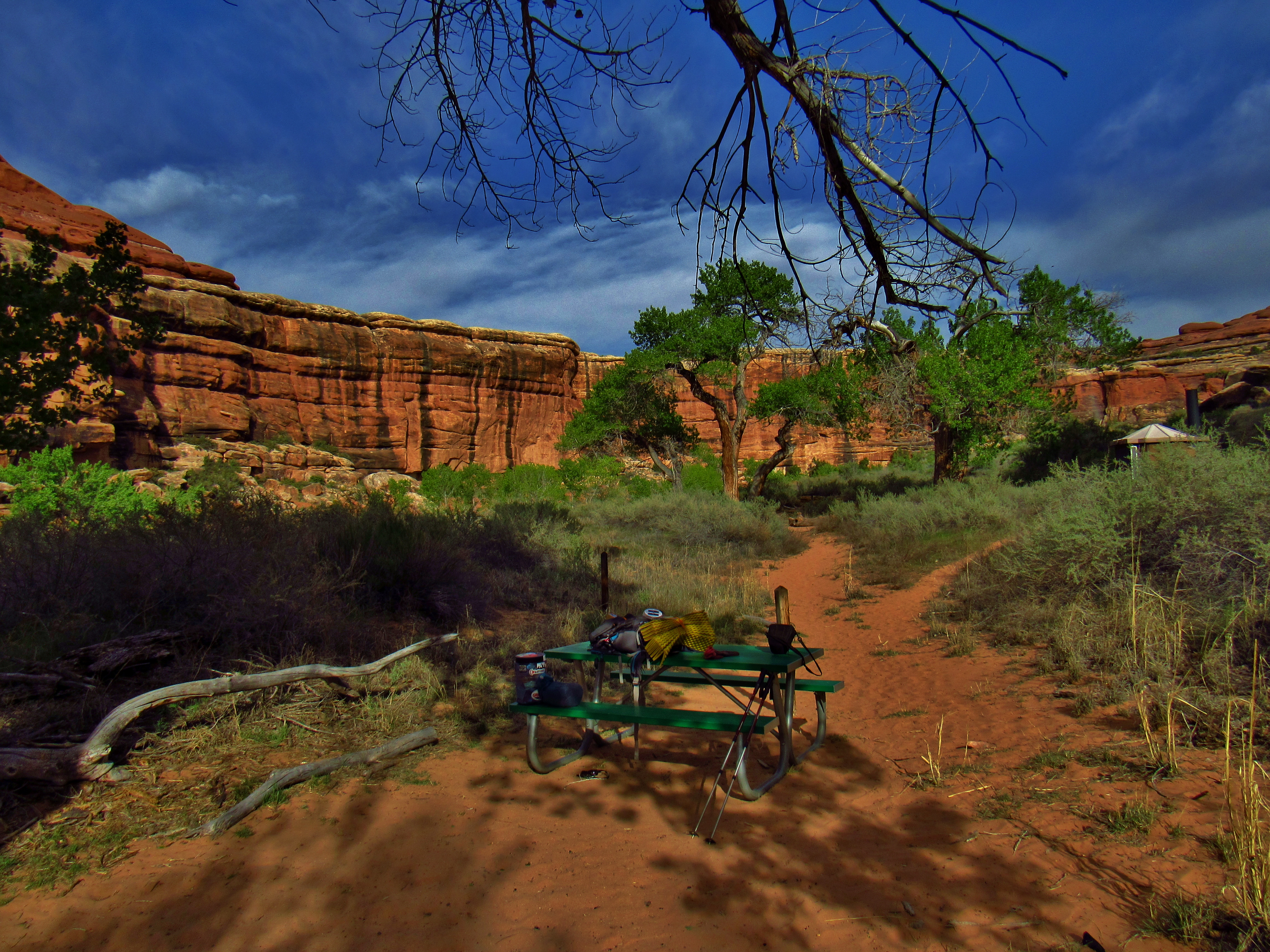
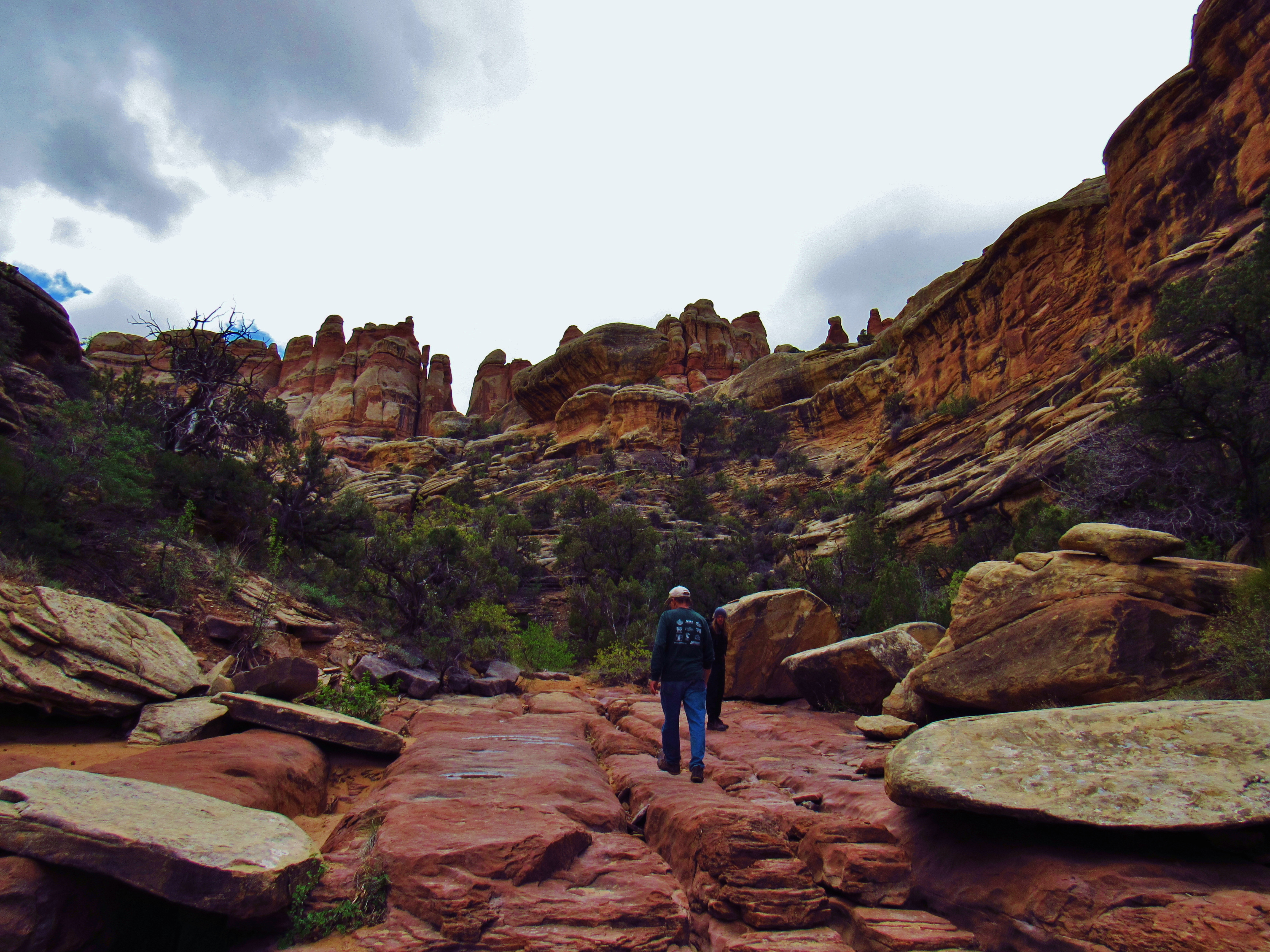
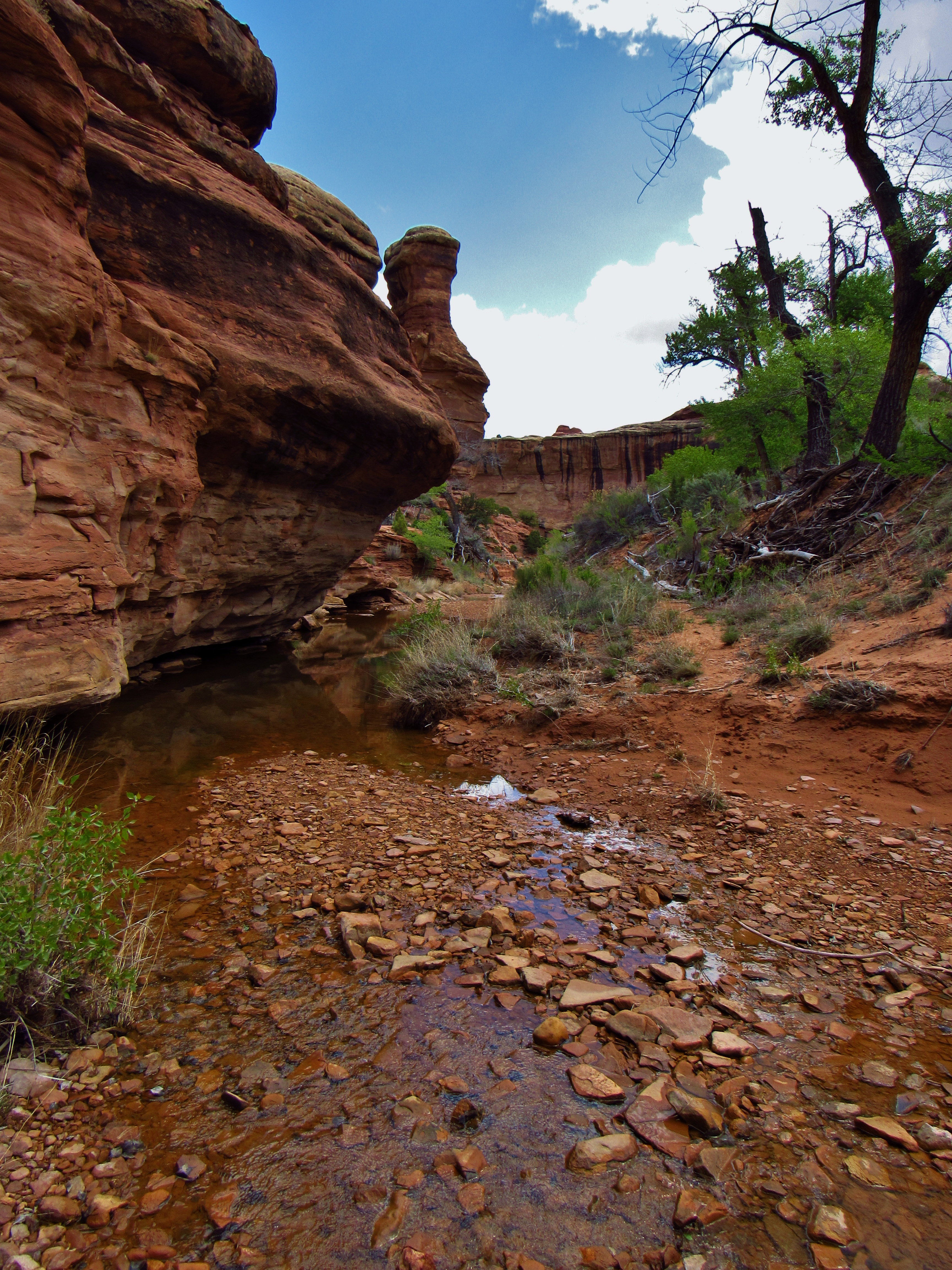
Day 8- Woke up at 6, packed up and went to Ekleticafe for the best damn huevos rancheros in town. Talked to Serinda Conner on the phone, the woman that helped me on my first day of hiking across the country and the state coordinator for the Delaware section of the American Discovery Trail. Reminder of how many people have helped me get to where I am now. Resupplied at the grocery store, then drove back to Canyonlands to continue my trek, sickness free, and now with trail running shoes. Parked at Squaw Butte Trailhead B and the trail was amazing today. I took so many pictures within the first mile because it was breathtaking right away. Flowers, rock formations, canyon/mountain landscape, chipmunks, etc. Then 2 dudes from Colorado- Ben and Seth started hiking with me. We went into some narrow side canyons and I played my guitar in the sweet acoustics. I split off at camp EC1 in Elephant Canyon, made my way to Devils Kitchen, moving way faster solo, catching a bunch of great panoramas, flower photos, and a desert hare that just sat there posing for me. Made Ramen with pepperoni and cheese with chex mix and cheese its on the side. Saw a Ring-Tailed Cat in the rocks in Devils Kitchen!!! Such a great day. I was literally smiling, laughing, and singing like a fool with the radio on the drive back into the park today.
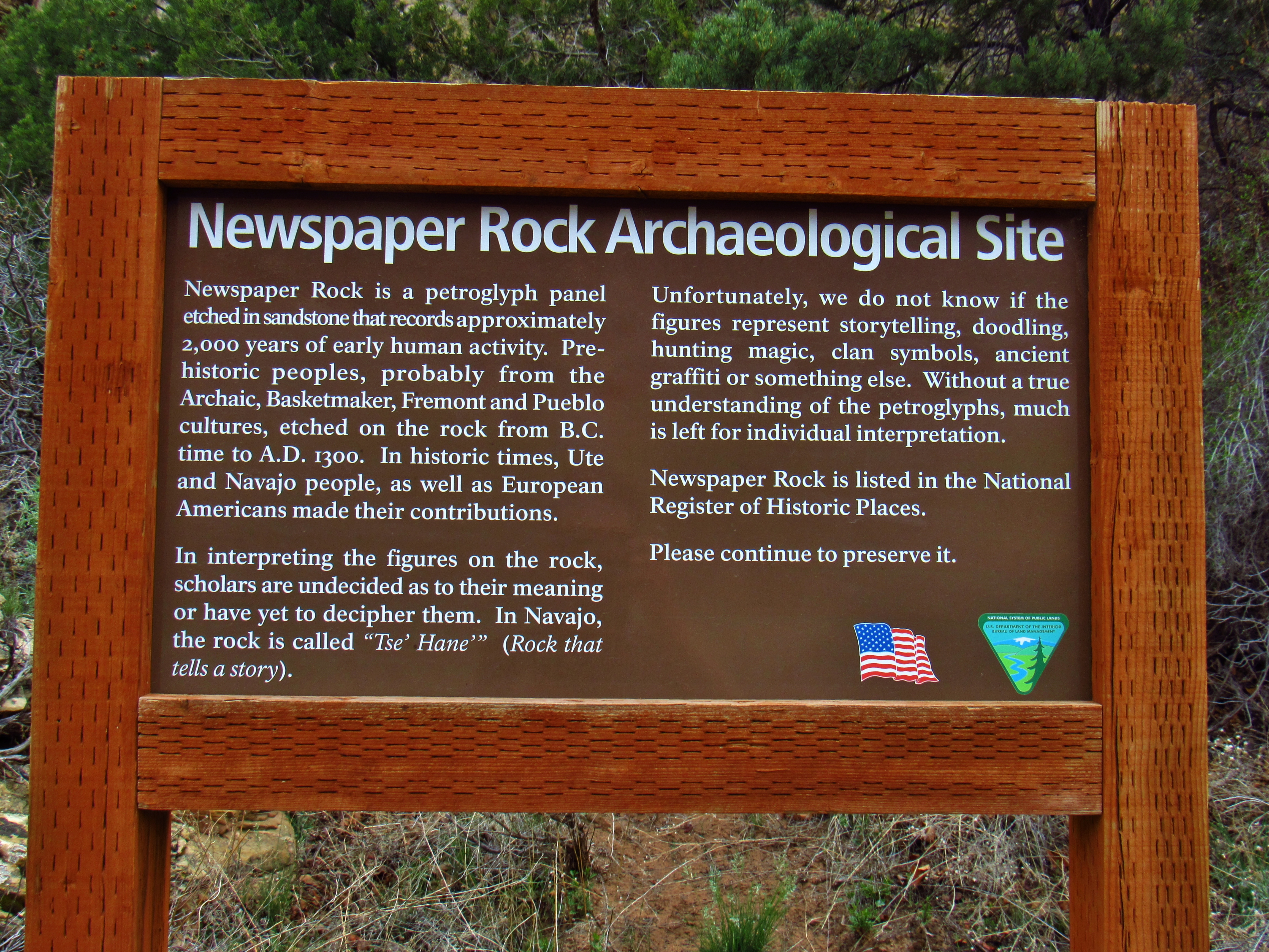
Newspaper Rock Sign
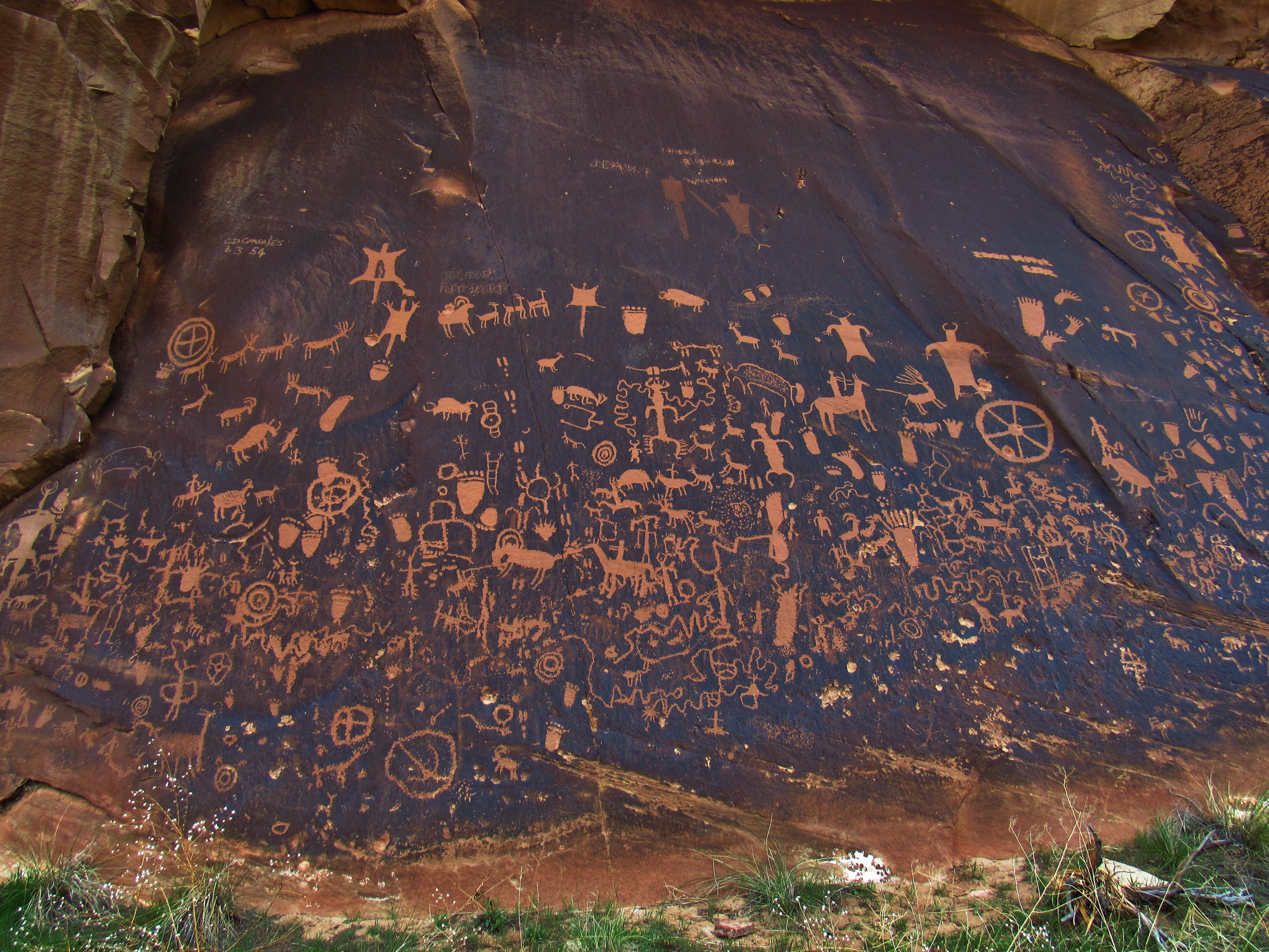
Newspaper Rock Petroglyphs
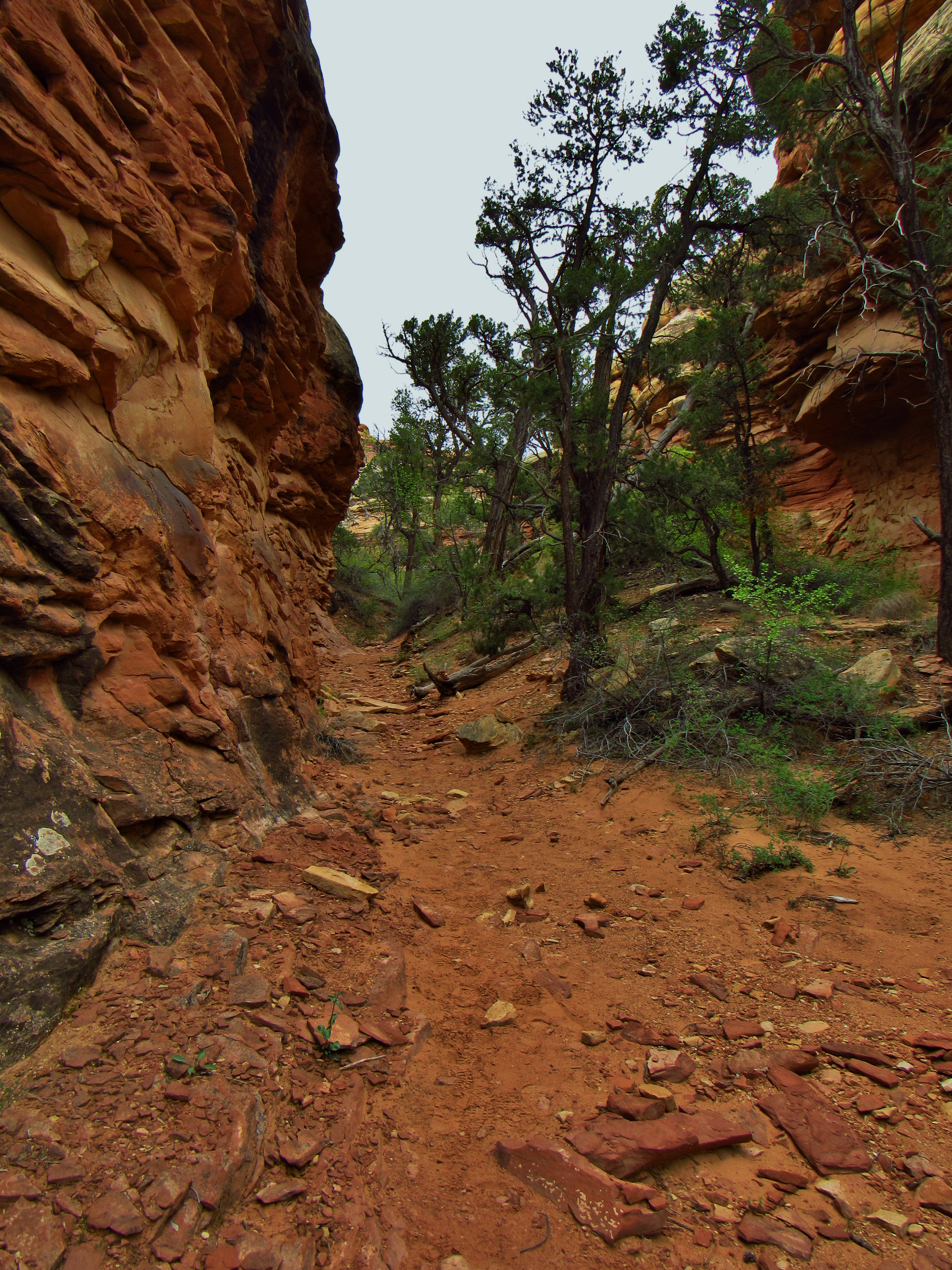
Trail from Squaw Campground
Trail up Squaw Butte
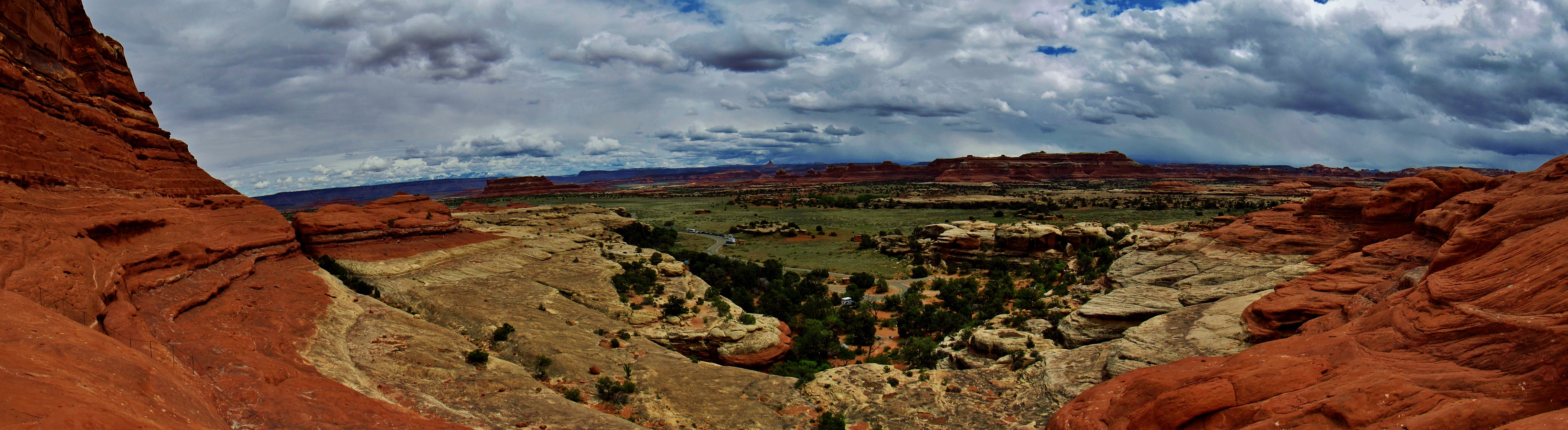
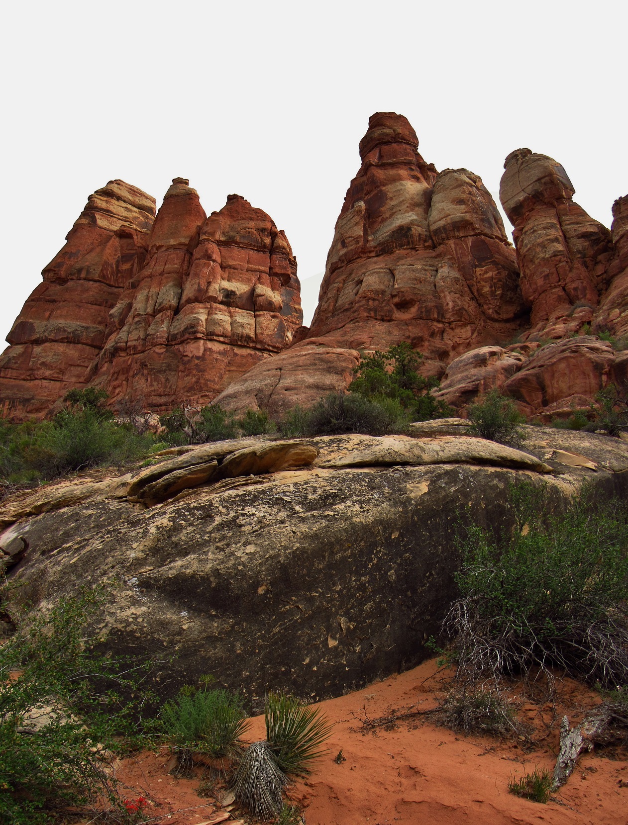
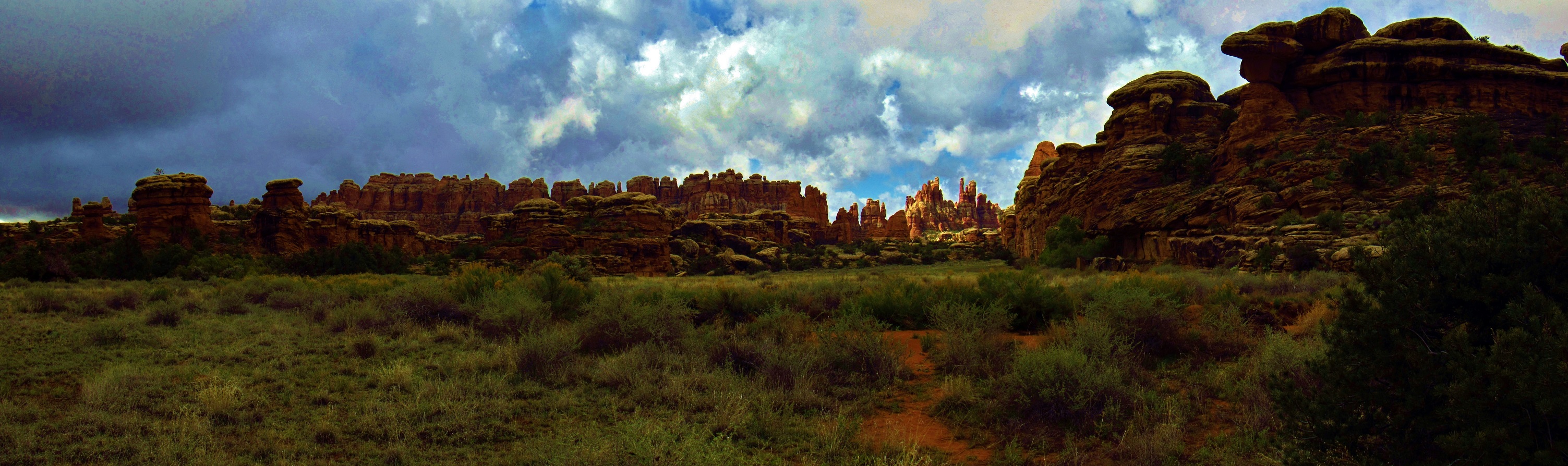
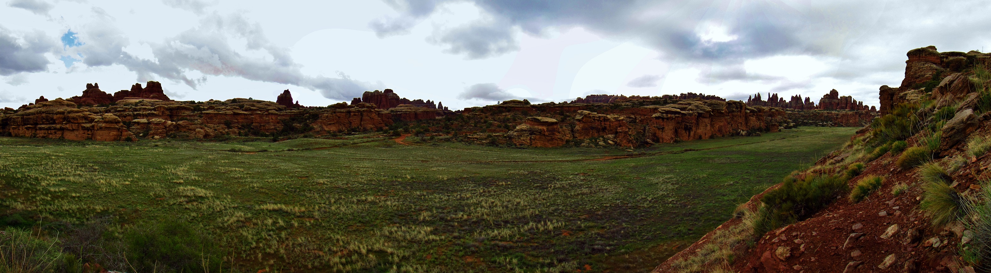
Squaw Flat Panorama

Squaw Flat Panorama

Say’s Phoebe on Squaw Butte
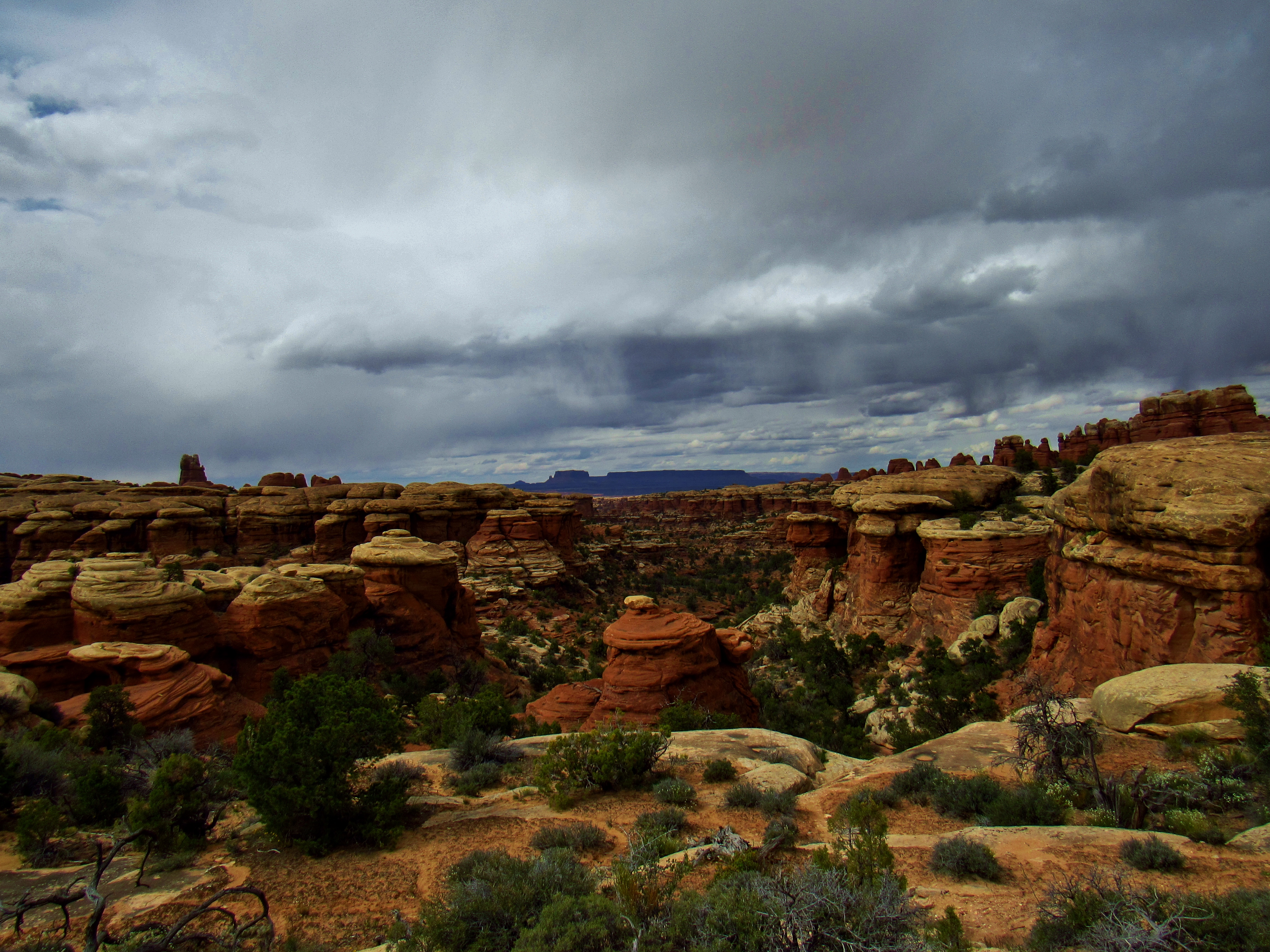
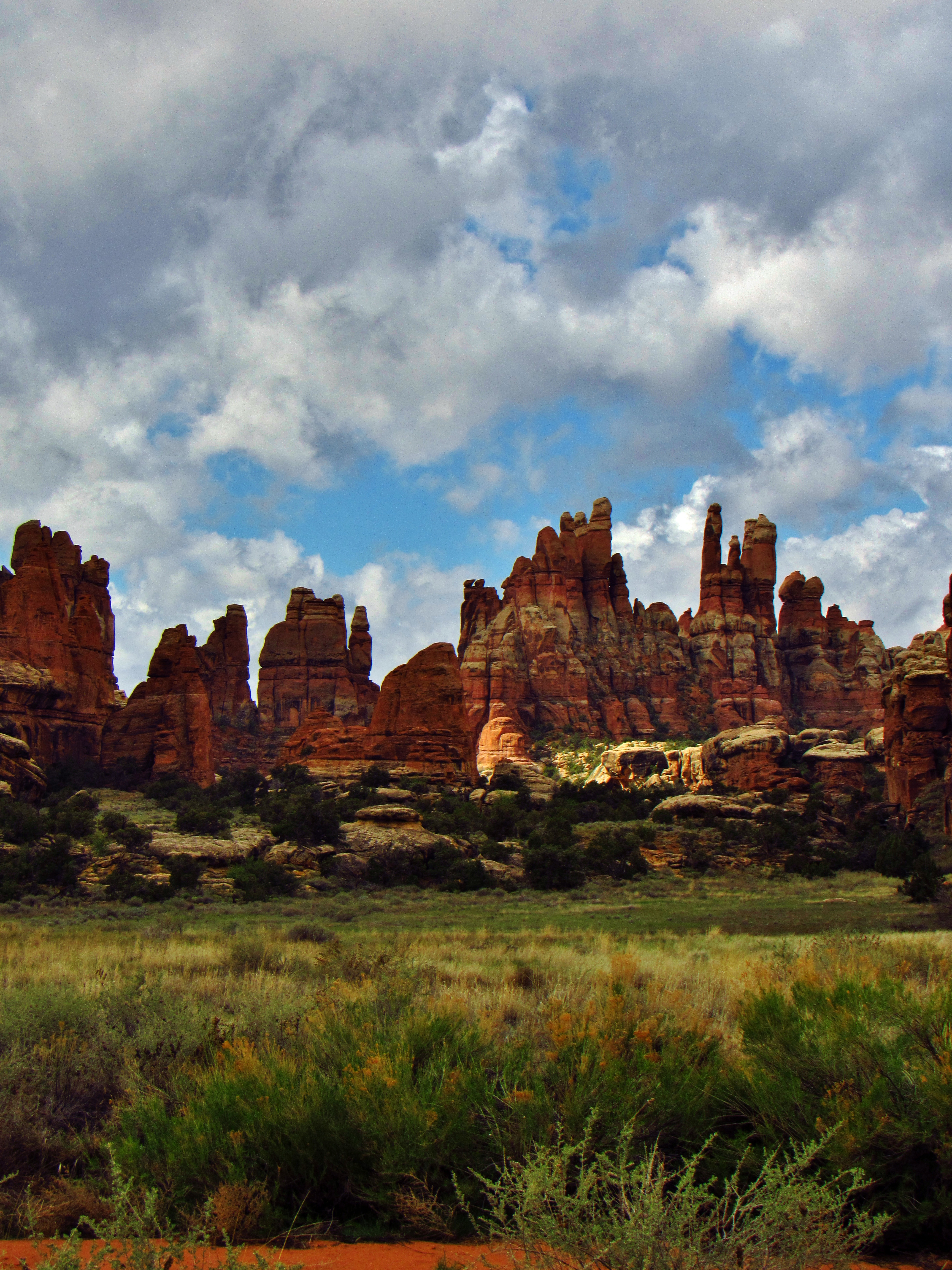
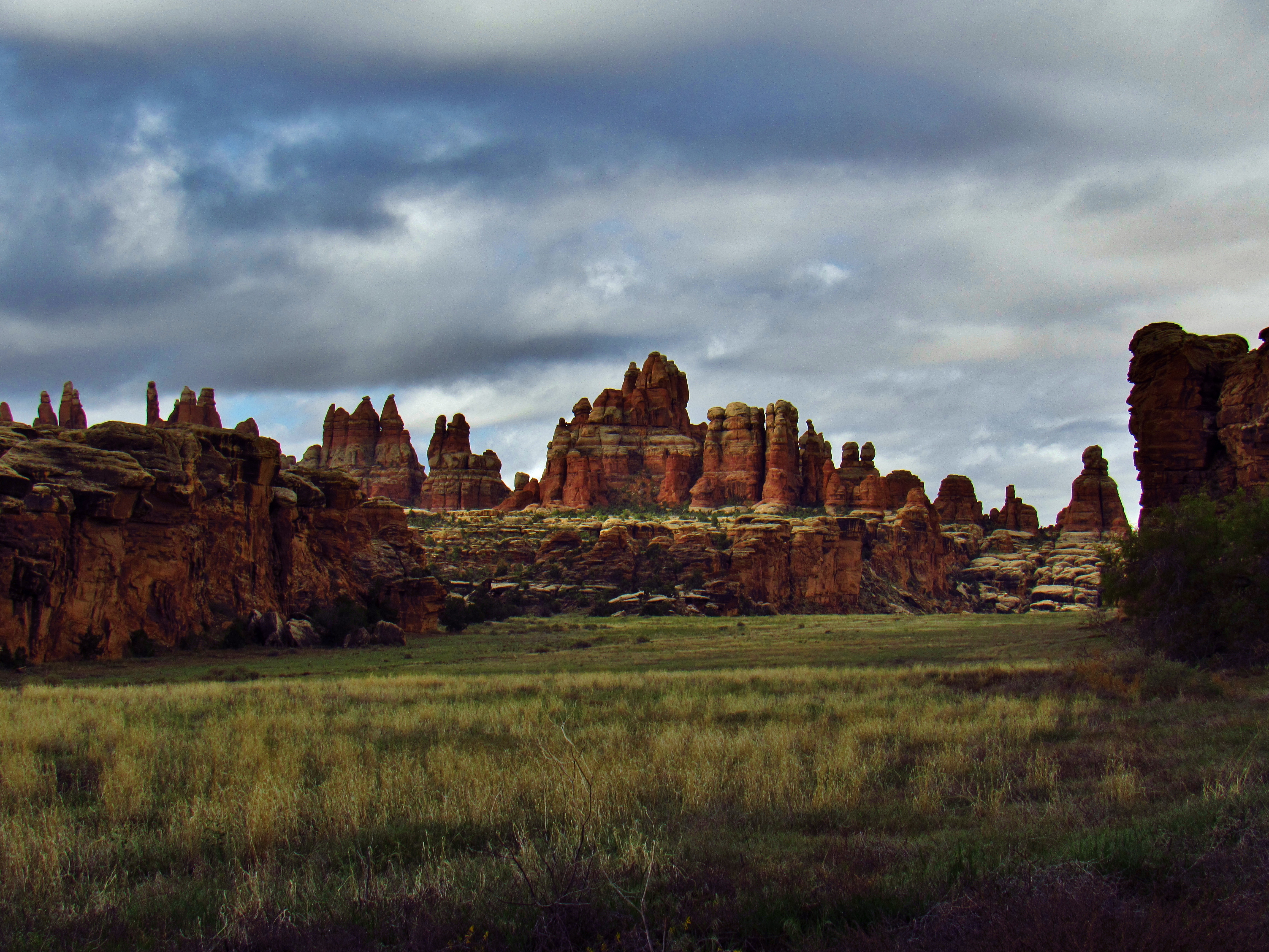
Big Spring Canyon Panorama
Big Spring Canyon Panorama

Sandstone on Squaw Butte

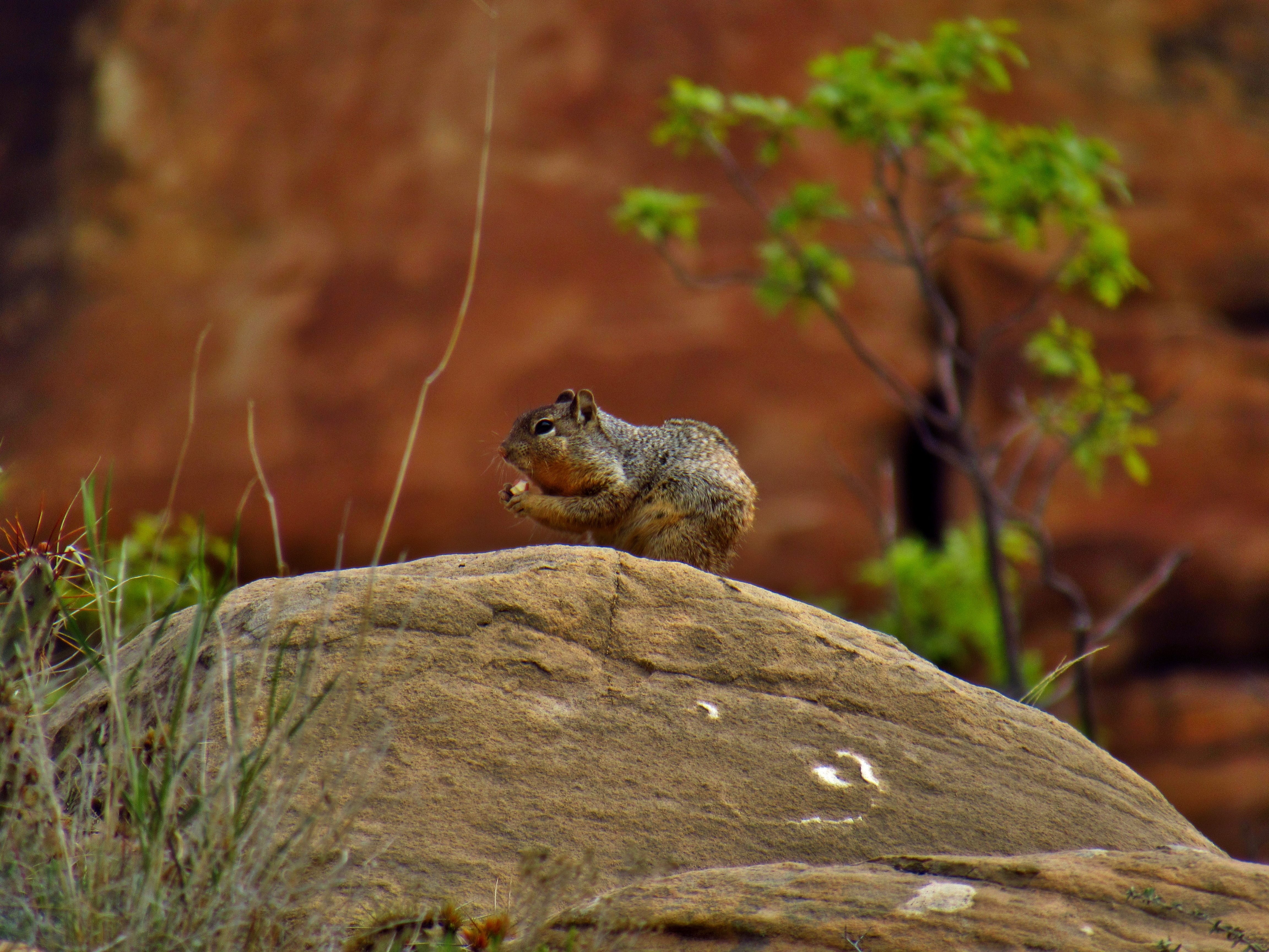
Hopi Chipmunk on Squaw Butte
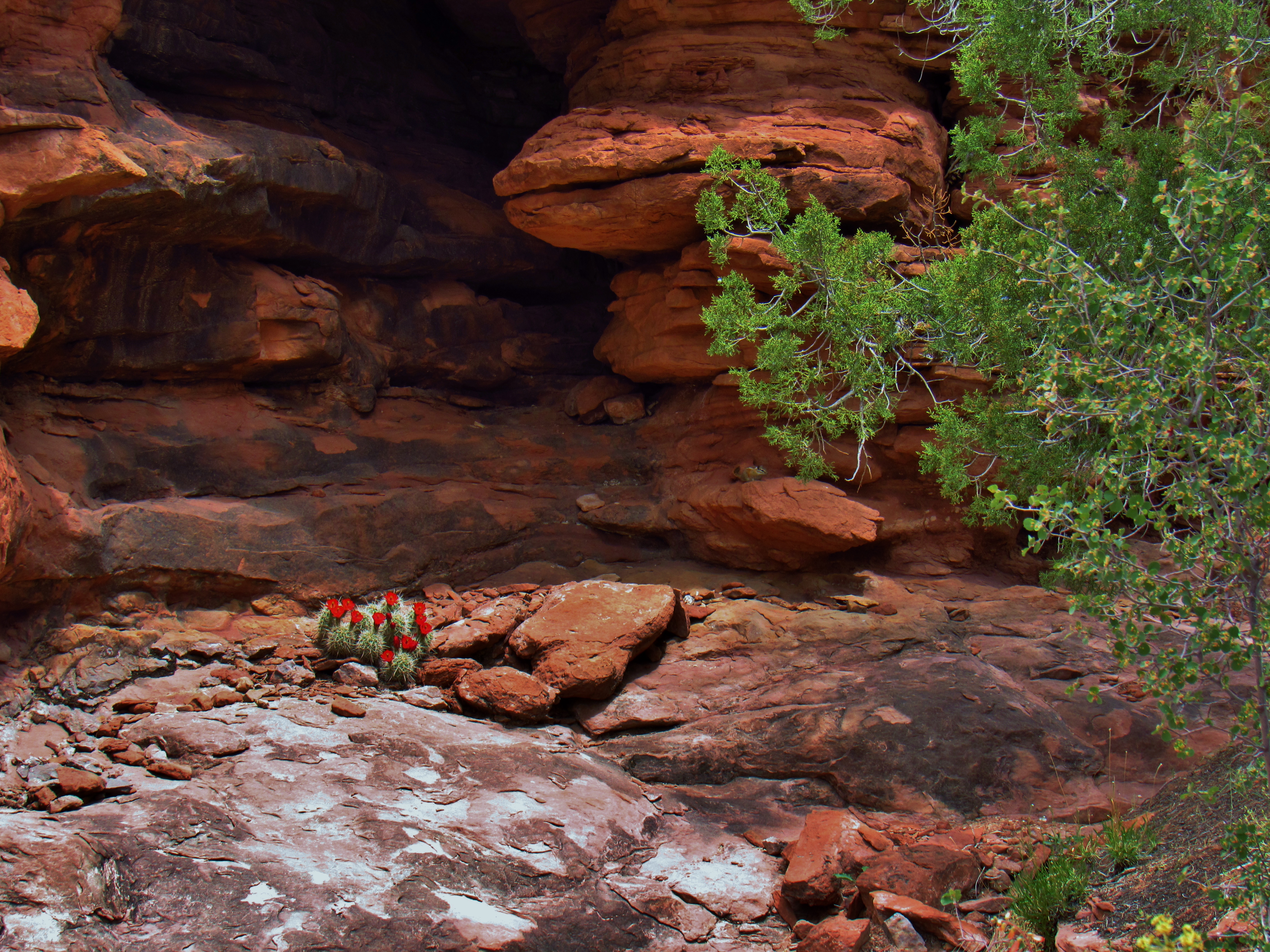
Claret Cup Cactus and Hopi Chipmunk on Squaw Butte

Claret Cup Cactus on Squaw Butte

Howell’s Phacelia on Squaw Butte

Desert Paintbrush on Squaw Butte
Big Spring Canyon
Big Spring Canyon
Squaw Butte and the La Sals
Big Spring Canyon

Big Spring Canyon
Side Canyon in Big Spring Canyon
Tiny Arch in Big Spring Canyon

Evening Primrose in Big Spring Canyon

Seth in the Tiny Arch in Big Spring Canyon
Big Spring Canyon

Elephant Canyon Panorama
Elephant Canyon Panorama

Elephant Canyon Panorama
Big Spring Canyon

Big Spring Canyon

Big Spring Canyon
Big Spring Canyon

Big Spring Canyon
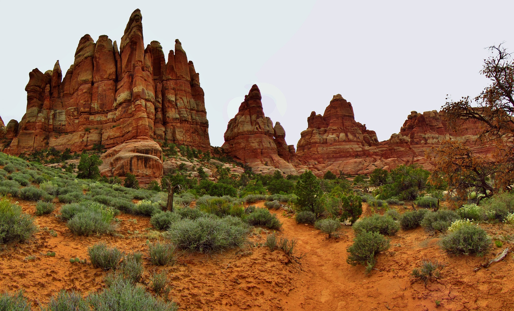
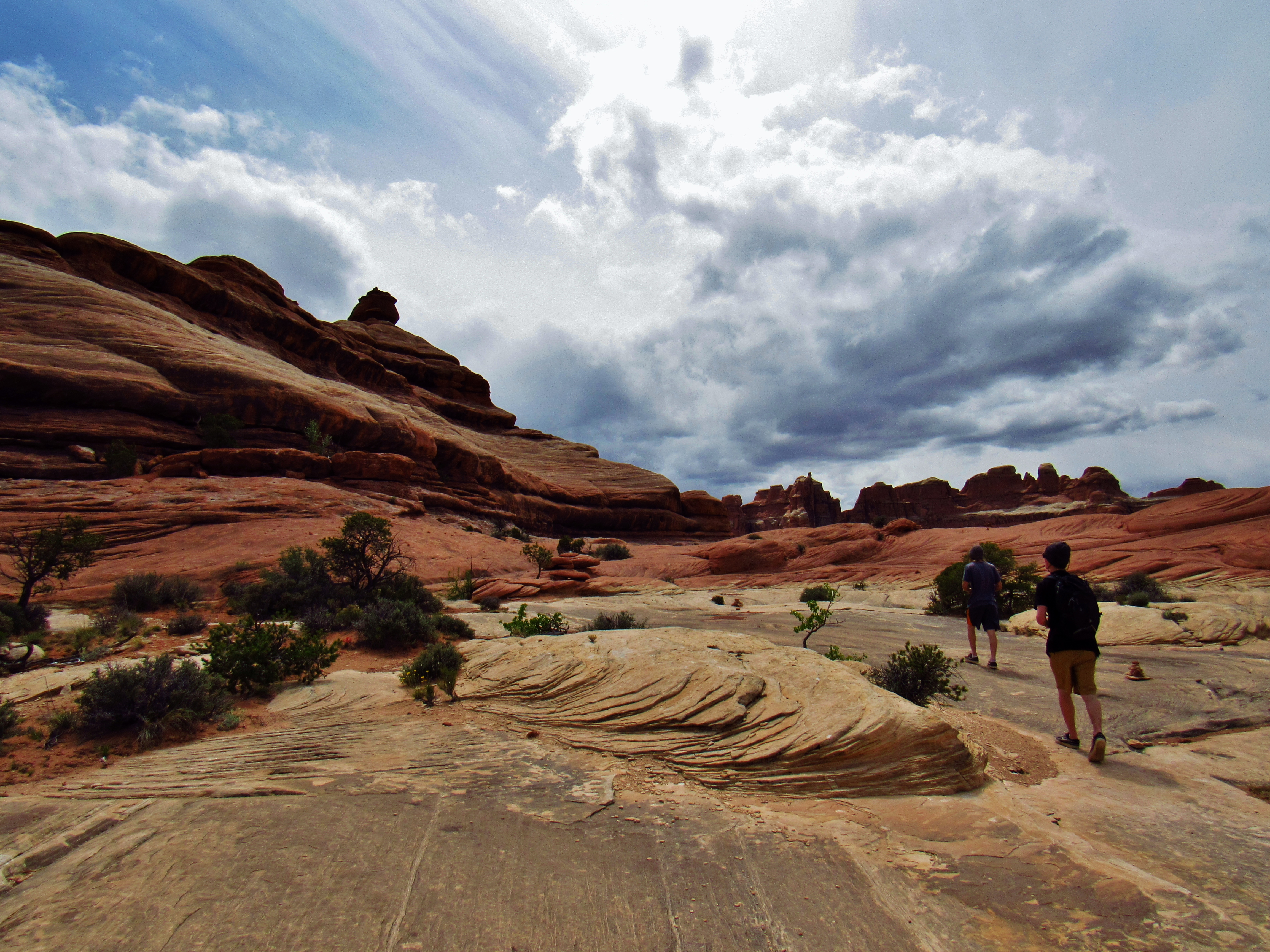
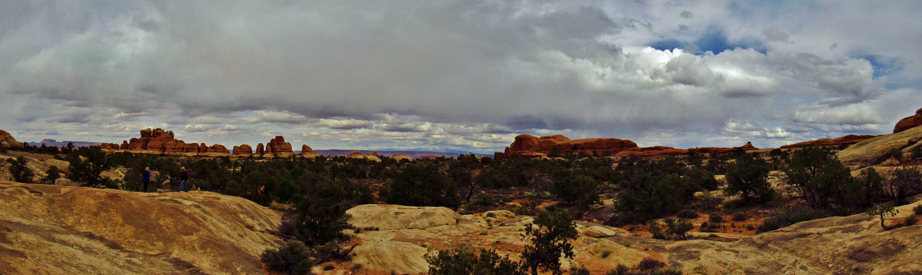
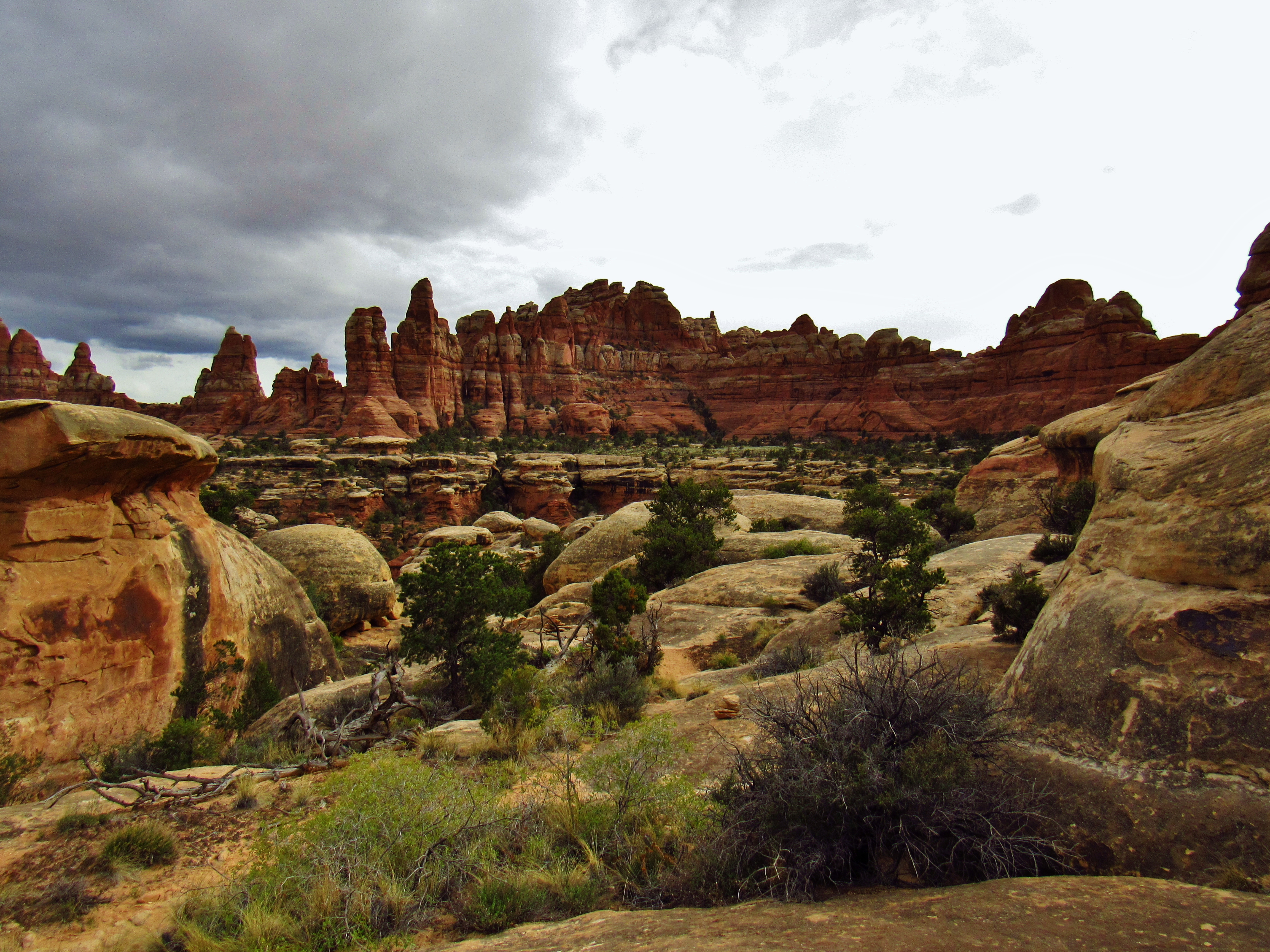
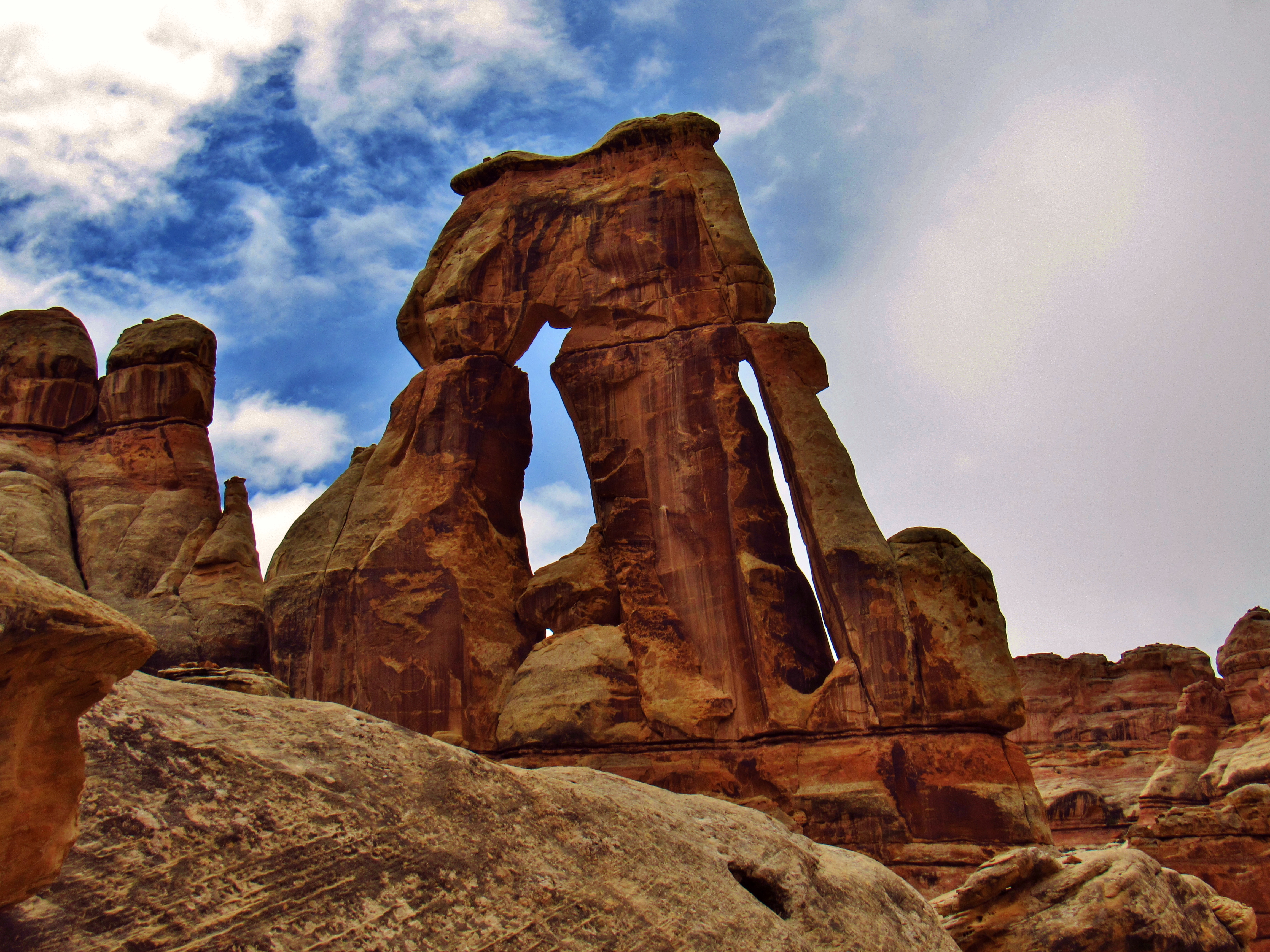
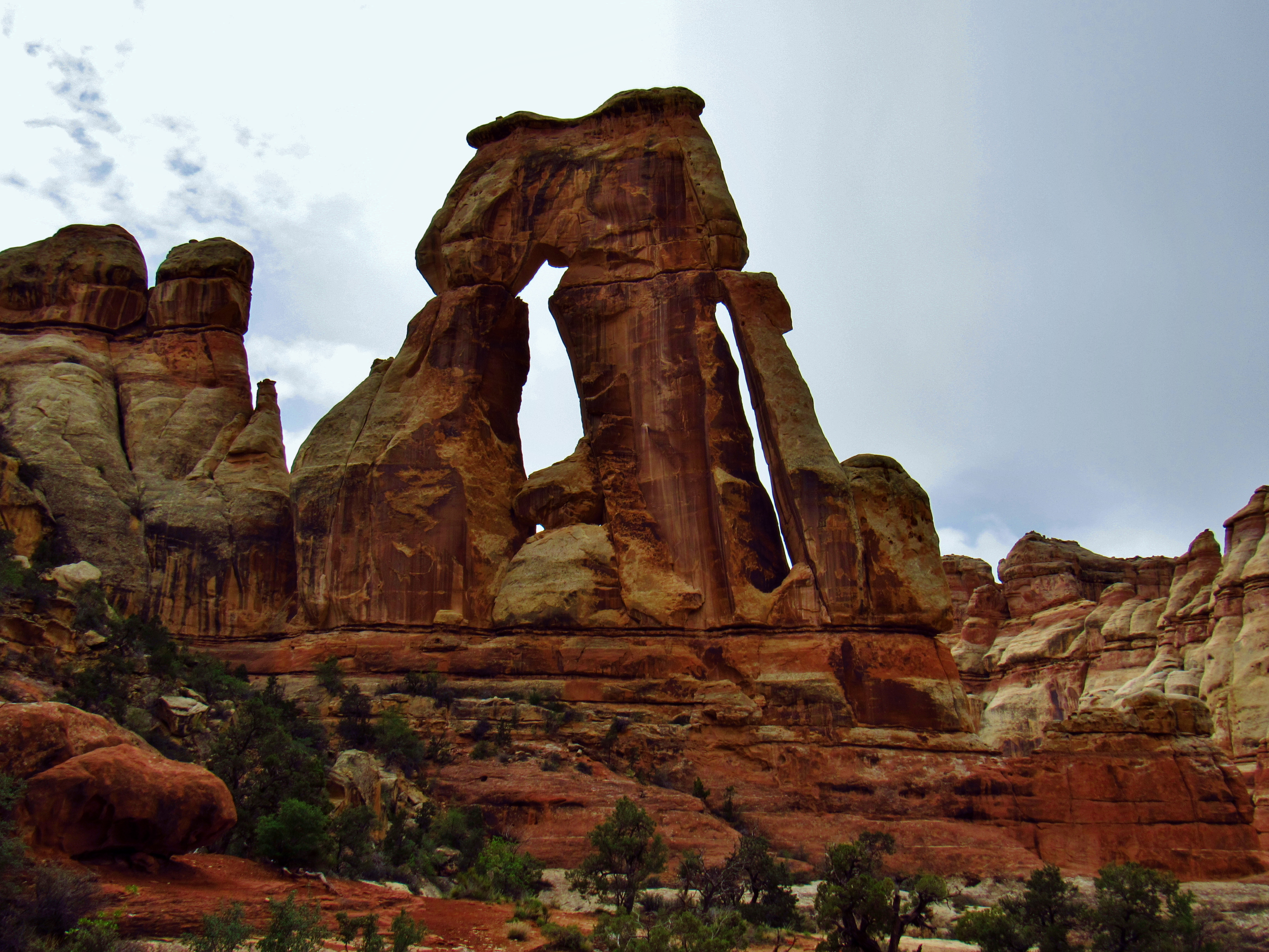
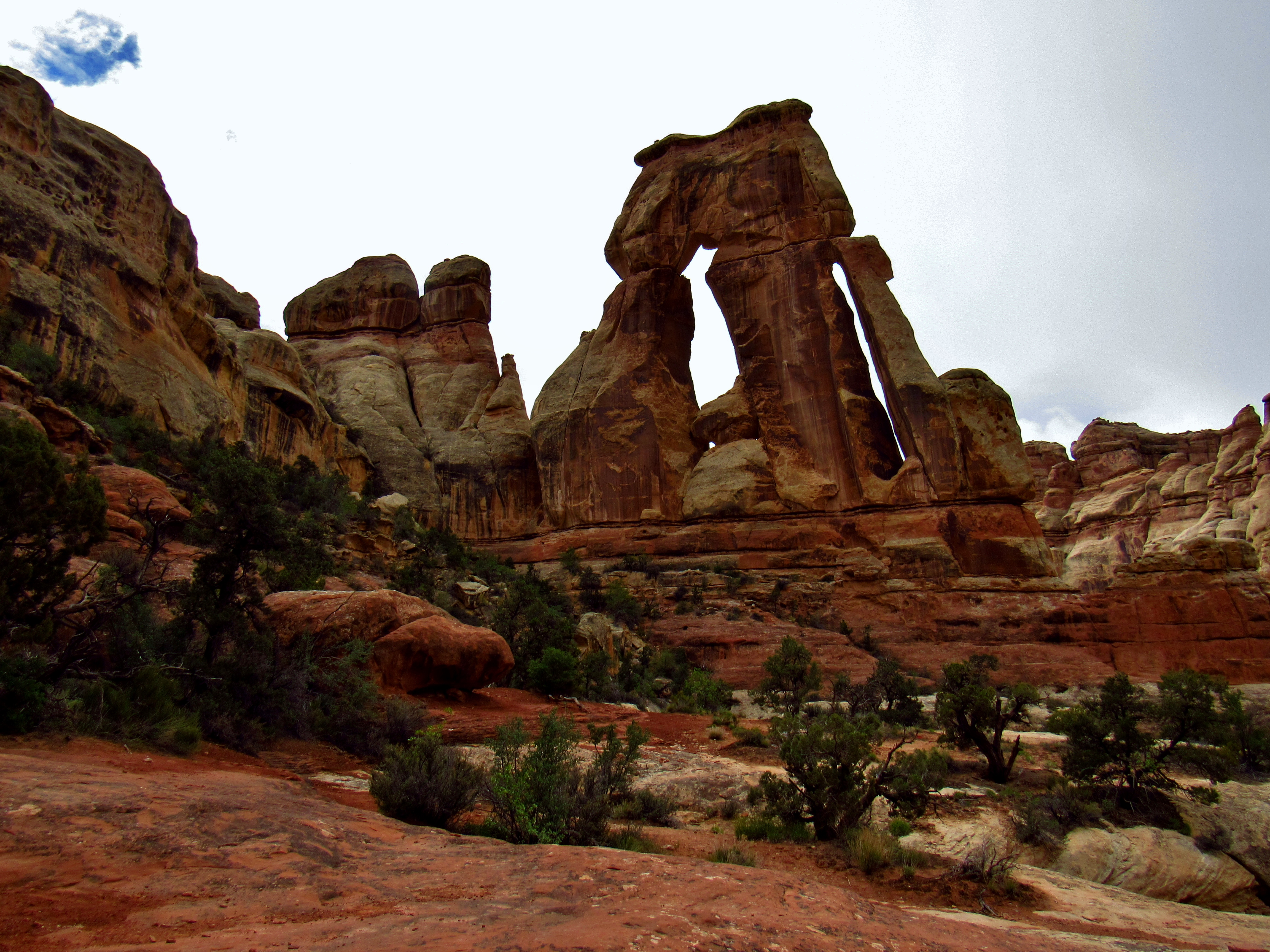
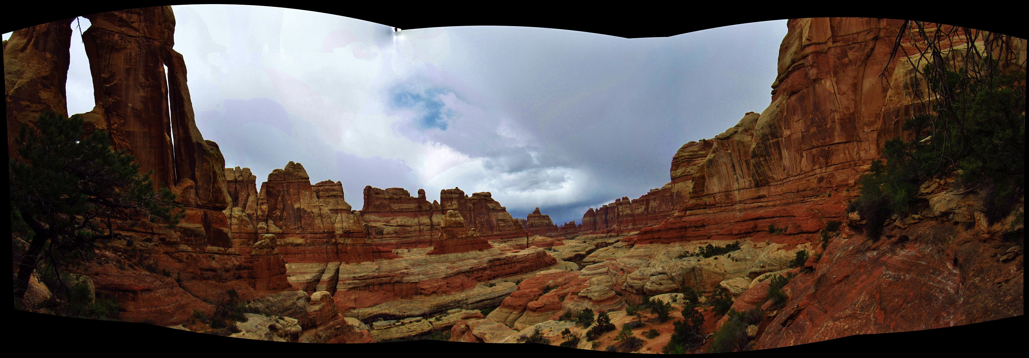
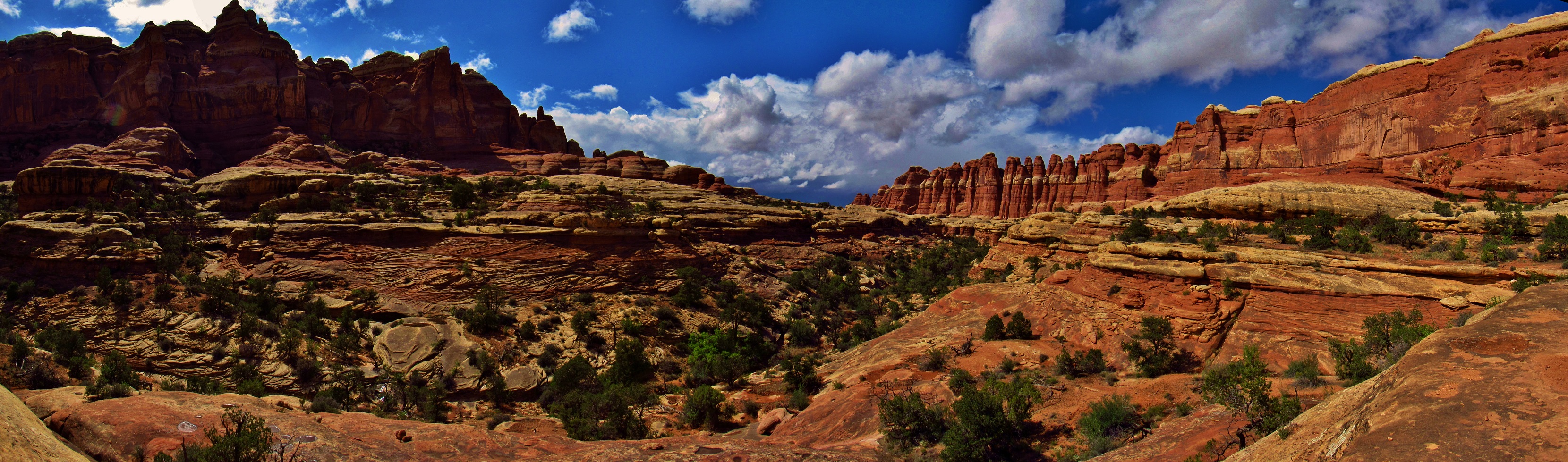
Chesler Park Panorama
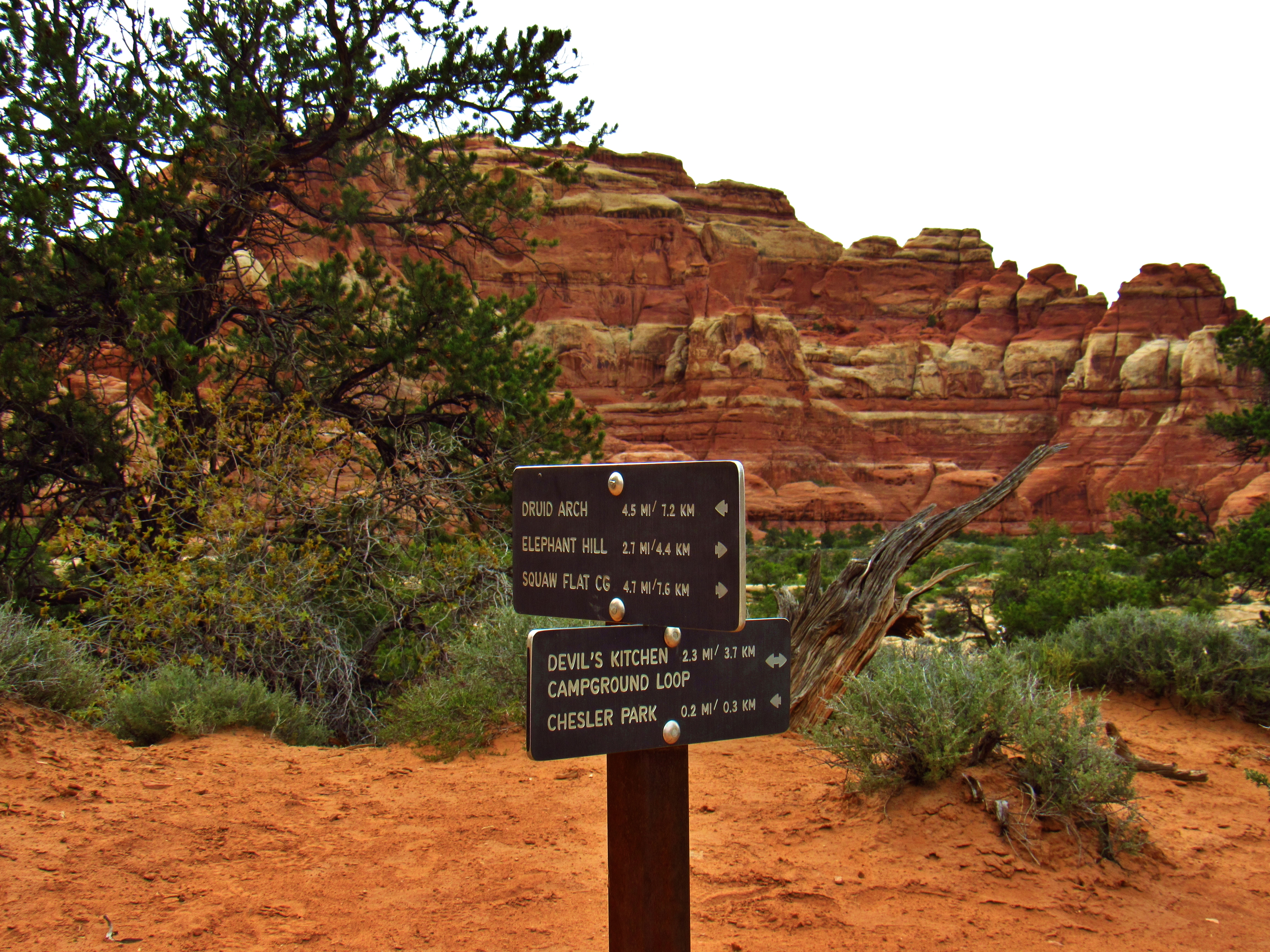
Trail Junction Sign
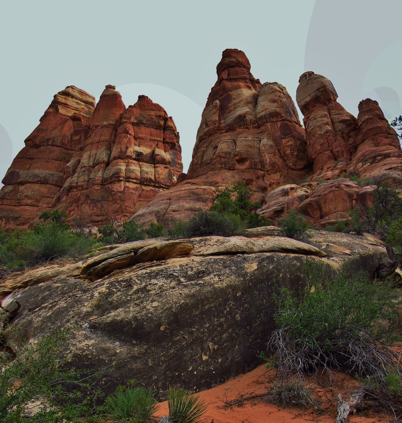
Chesler Park Panorama
Chesler Park Panorama

Chesler Park Panorama

Desert Hare in Chesler Park
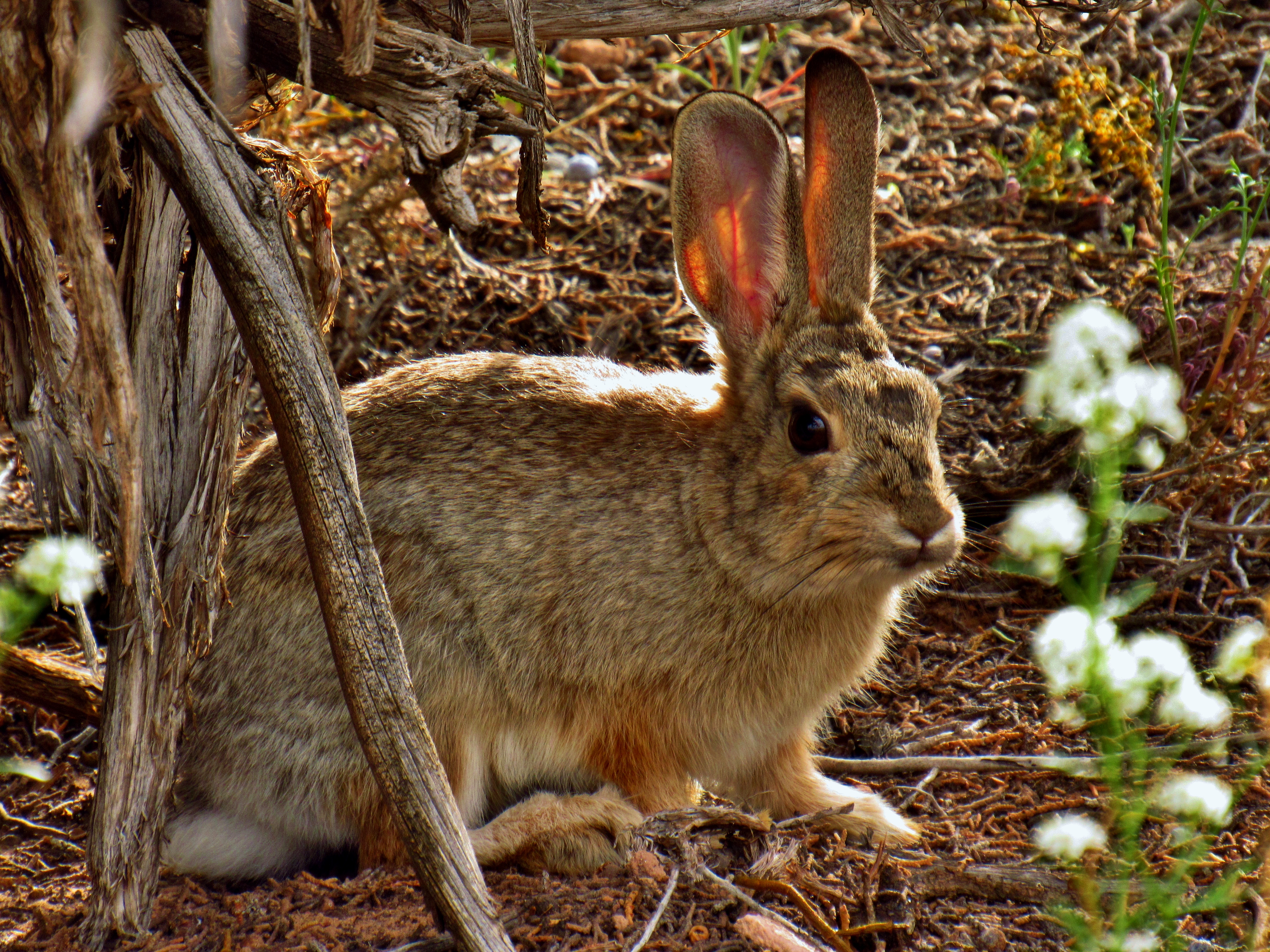
Desert Hare in Chesler Park
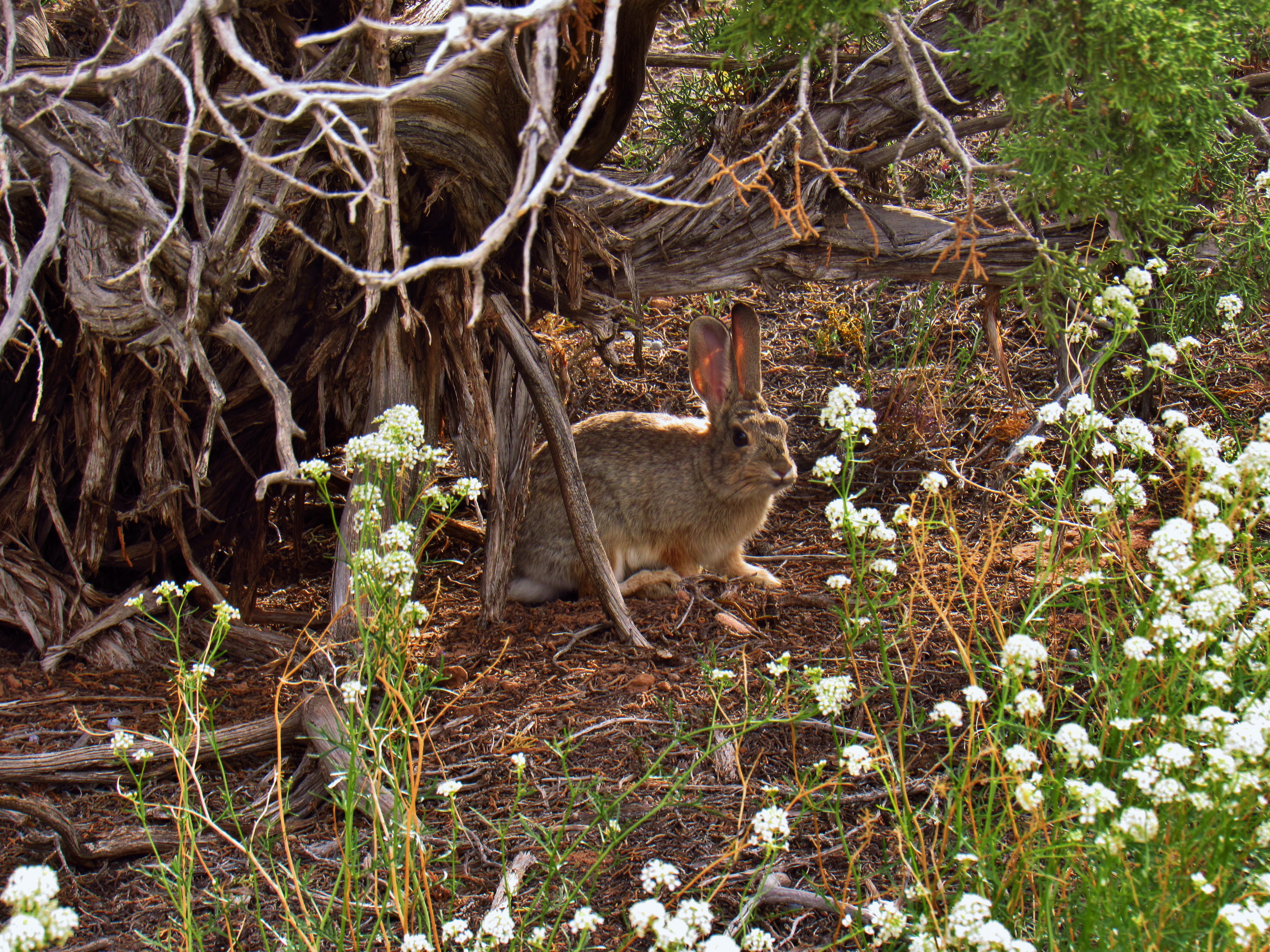
Desert Hare in Chesler Park
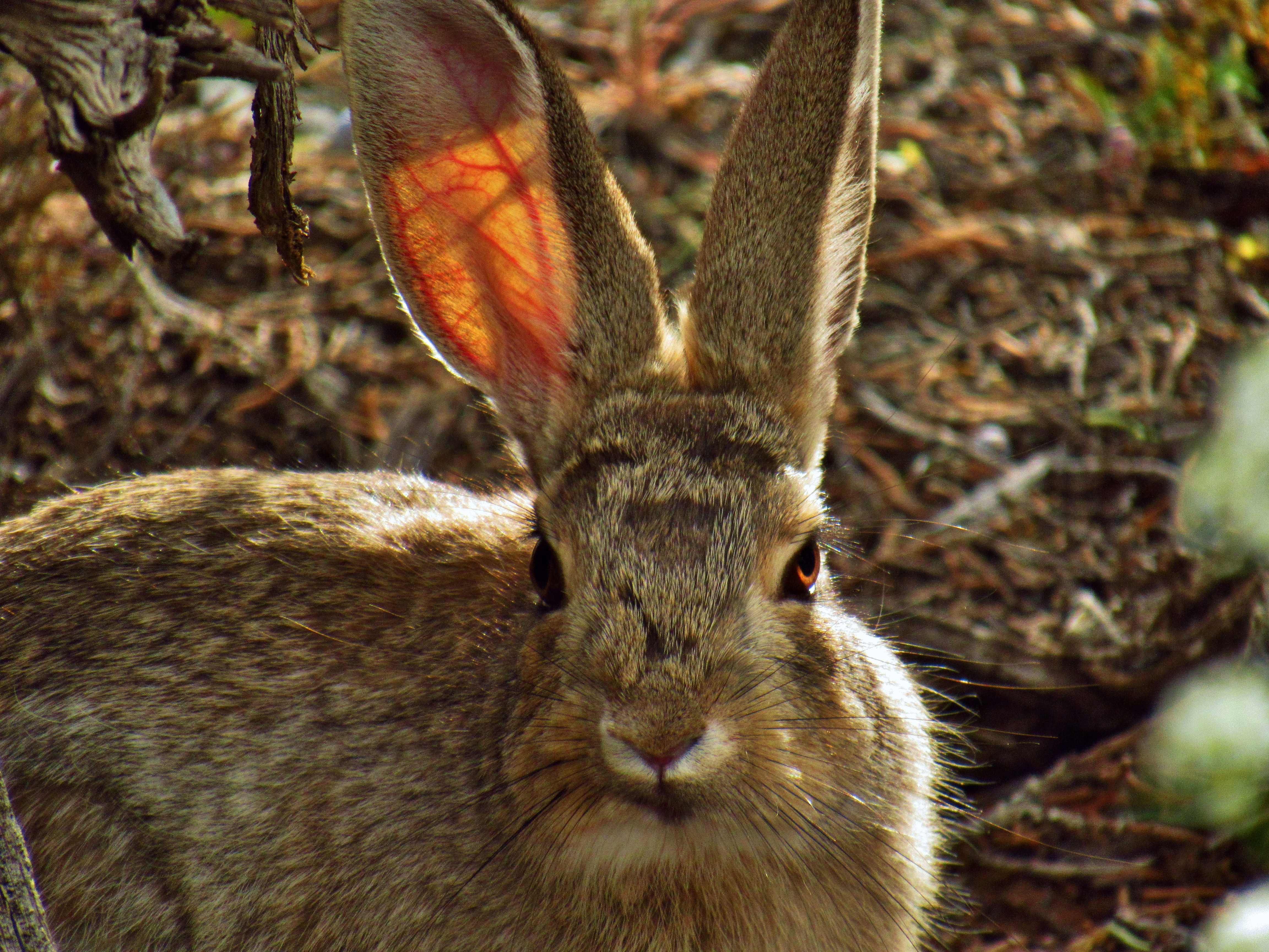
Desert Hare in Chesler Park

Trail into Devils Kitchen

Trail into Devils Kitchen
Trail into Devils Kitchen
View Above Devils Kitchen
Trail into Devils Kitchen
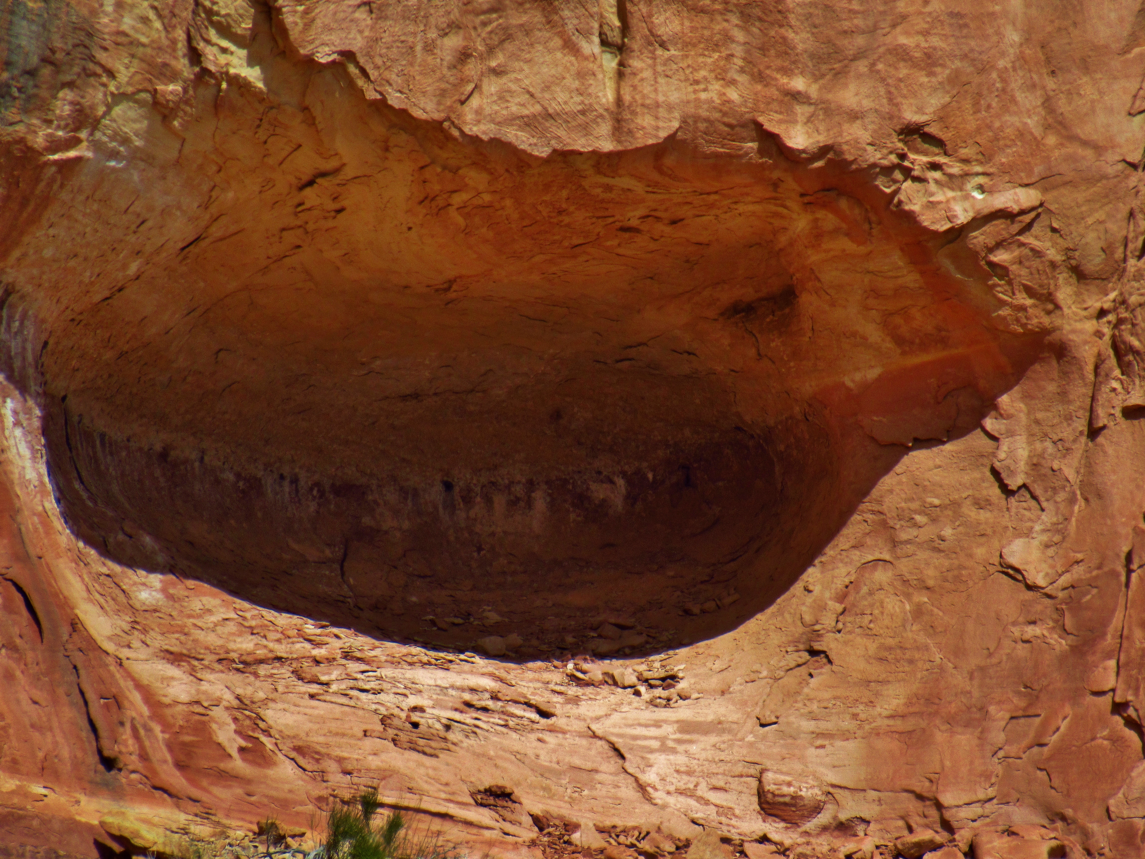
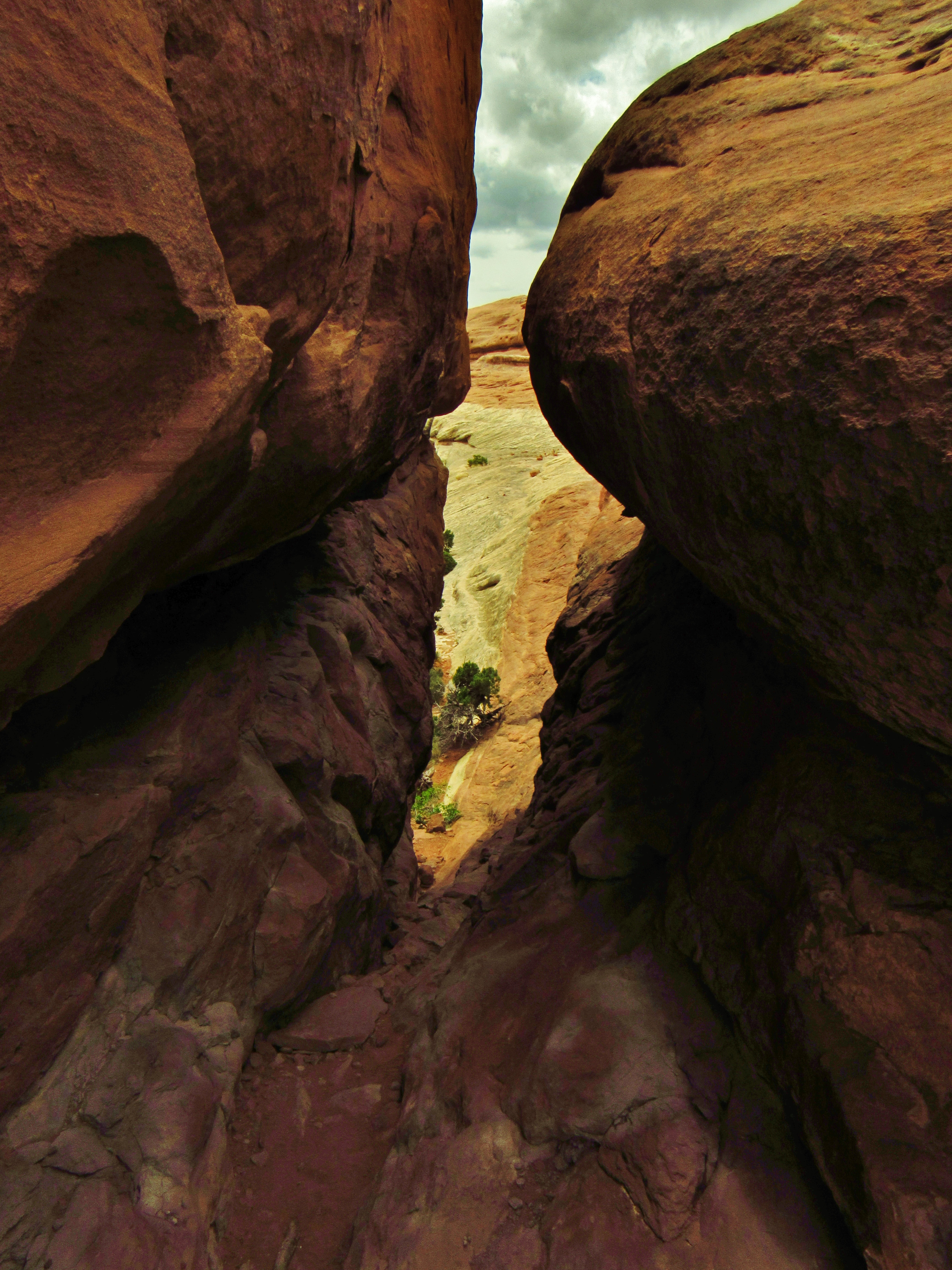
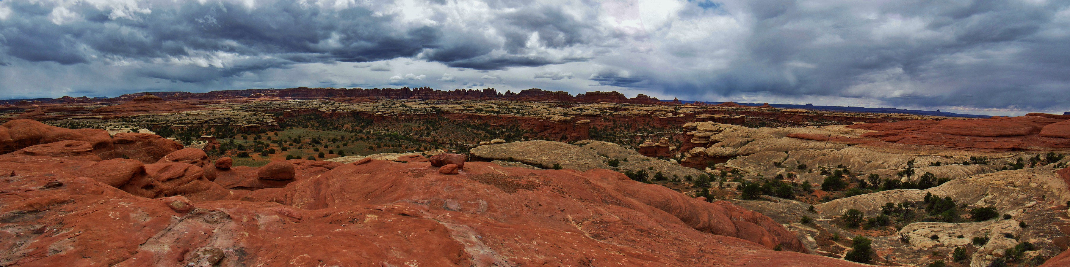
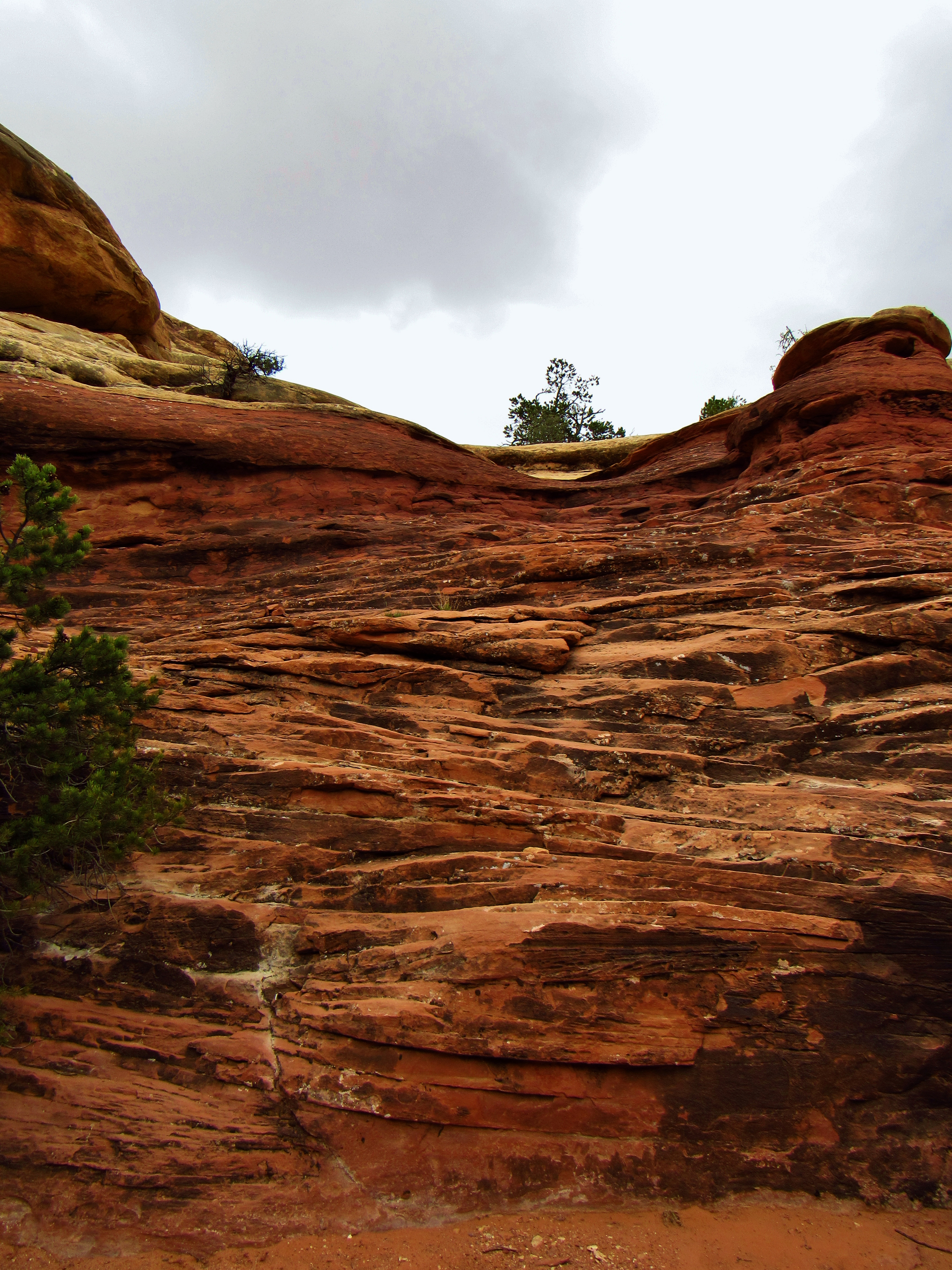
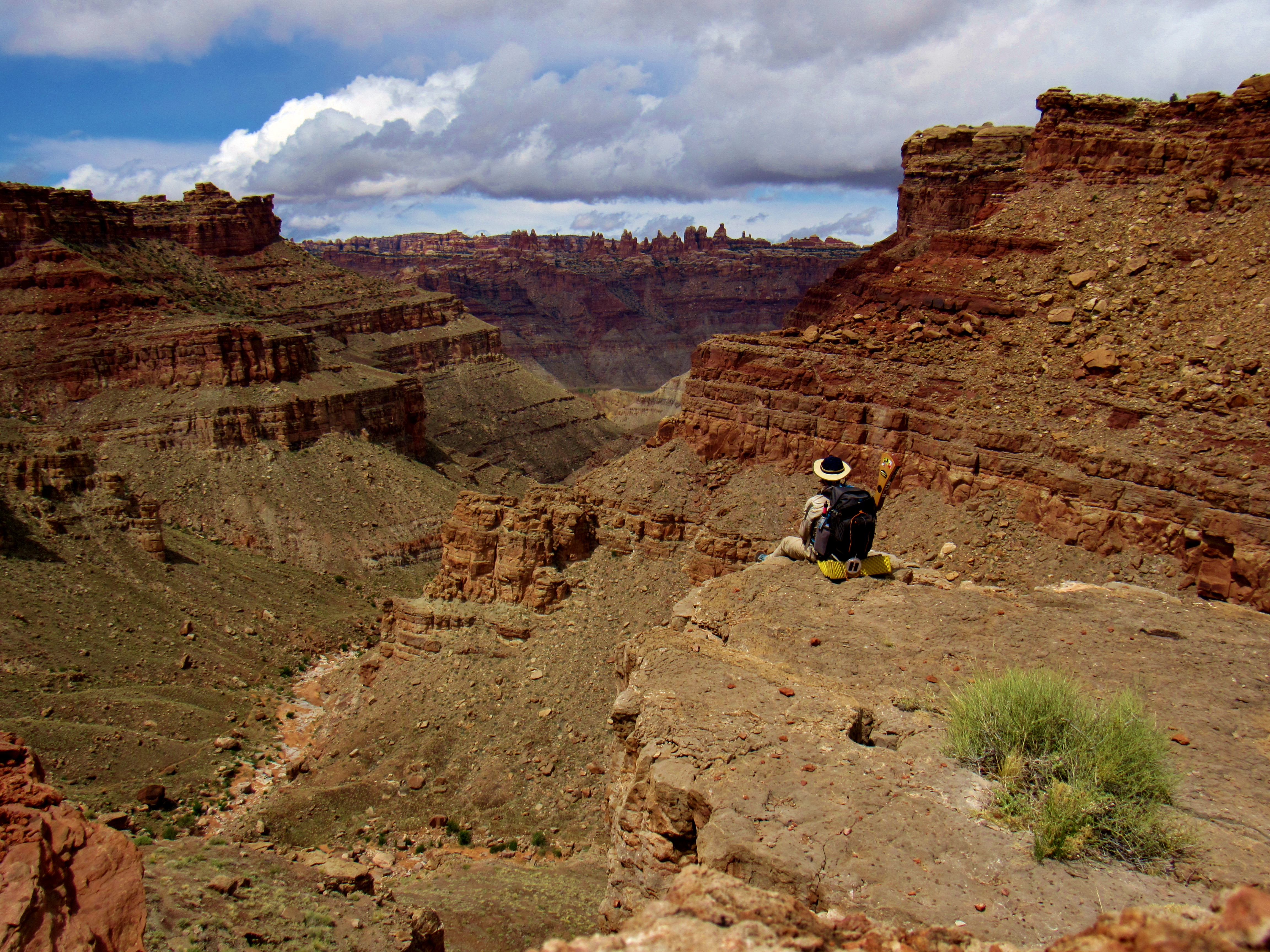
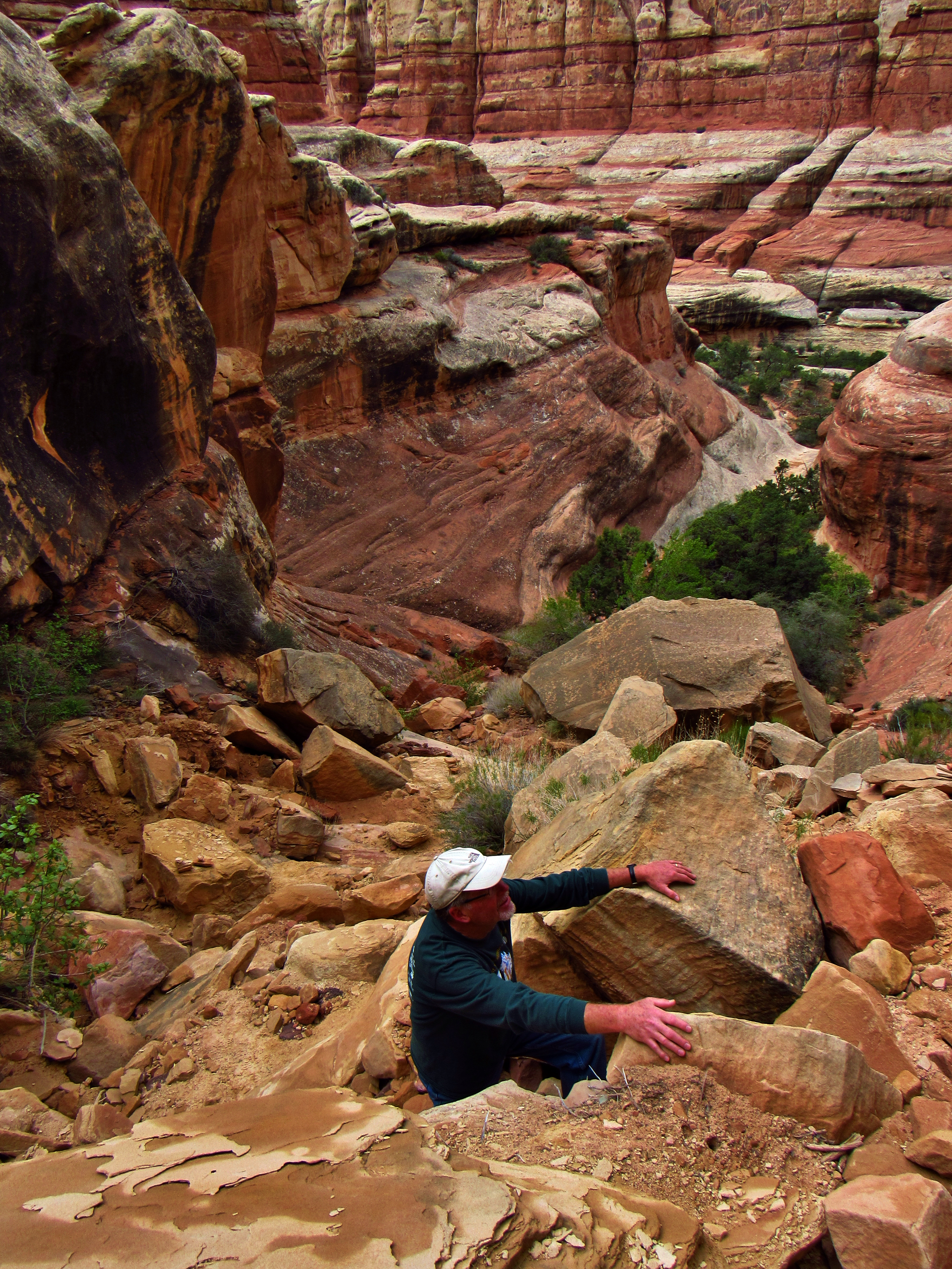
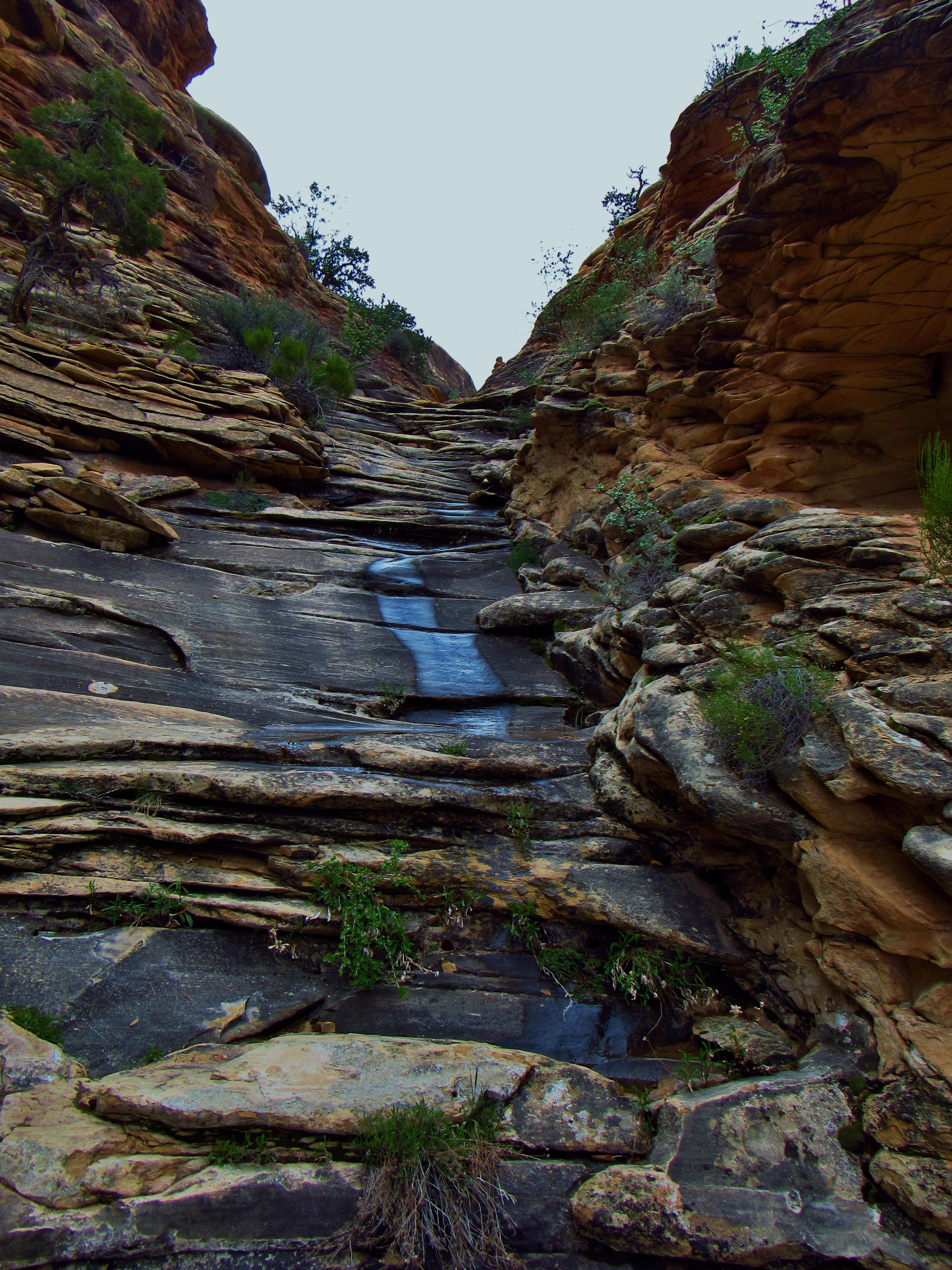
Day 9- Took 2 hours getting out of camp- stitching a tear in my pants, eating granola, almonds, and raisins in chocolate spread for breakfast, and packing up. Out by about 9:15. This canyon is glorious- short buddy green plants carpet the valley and rich red-orange, black stained rock walls above it in towering needles, mushrooms, and round slabs of slickrock. I’ve seen deer tracks, but haven’t seen the deer themselves yet. Still, this place is an Eden of beautiful nature. Devils lane was really sweet to see coming down into it- it’s like the canyon at Devils Kitchen with the green floor, but it’s longer and the walls on either side rise straight up. So glad to be hiking actual trails now instead of 4×4 roads. Makes for much better scenery. Cyclone Canyon was similar to Devils lane, but still shockingly beautiful. A mountain bluebird posed for me on a dead tree in the middle of the path. After Cyclone Canyon, the trail became rocky and fairly steep as it crossed Red Lakes Canyon, then curved around and above and slowly switchbacked into Lower Red Lakes Canyon. The first part of the day was a piece of cake. Easier than the Maryland section of the AT. Going down into Lower Red Lakes Canyon was comparable to parts of Maine or New Hampshire. Not the hardest stuff, but the steep, long, rocky stuff. Never really had to use my hands, but was fighting the slope as it tried to make me fall. One overlook in particular, where you could see all the way through the canyon, across Spanish Bottom on the Colorado River, and into the Dollhouse in the Maze District of Canyonlands, was simply amazing. So many formations capped by the strangest shapes of slickrock, blue sky and billowy clouds around, with the great walls, scree, and thin trail in the wash in the foreground. Hailed for about 30 seconds before Cyclone Canyon, but rained for 5-10 minutes once I got down into the wash of Lower Red Lakes Canyon. One girl carrying a 90+ Liter pack with oars in the side pockets said she packrafted across the river and just spent 6 days in the maze. She commented on how steep the climb was. Must’ve been a truly amazing trip, but doubtless it was an ass-kicker. Never put my rain jacket on, staying comfortable enough as I evaporated rain as quickly as it fell. Another group of 3 big-packed mazers passed by later. When I finally got to the river, I took my sweet time filtering and purifying the nasty water that came partly up the wash like a tide pool from the river. It was green-brown with all kinds of shit floating in it. Backflushed my filter for every .75 liters or so, and filled up about 4.5 or 5 liters. Ate 2 poptarts just fast enough to pack up and go before it started raining again. This time it didn’t really stop for more than 5 minutes. Thankfully, those 5 minutes were the hardest part of the climb, and that girl was right- this is so steep. I was sweating like a mofo, but my legs felt great. A little past halfway, it started raining again and now I was really getting soaked. Hail again in Cyclone Canyon, and heavy cold rain from there all the way back to Devils Kitchen. Was gonna go to New Bates Wilson, but I like the little rock overhang site and 11.2 miles on the day is good enough for me on this trip. Love how lax the mileage for this trip has been. Haven’t felt pressured to push myself to go faster or later into the day, and have really enjoyed the extra time playing guitar and getting back to journaling. Plus, hot meals are just luxurious. Once I got back to Devils Kitchen, the group of 3 was chilling under a rock overhang and I sat with them for only a few minutes while I put on all my wet layers, then they left and I chatted with the dude camped next to me for a minute. Now time for dinner and some blues! Also, the sun came out, if only for a moment. Went to chat with the campers in the next site after the dad, Brad, came over and asked if I had dinner and if I wanted to join them. I told them about my shitty night in Salt Creek Canyon and 4x4ing. They’re from Northern Utah somewhere, but one of his two sons works in New Jersey. They tell me about some 4×4 misadventures with 2 popped tires and a $2,800 tow, plus brad showed me a picture of a trip in April in Island in the Sky when they woke up to 6″ of snow on the ground. Crashed around 8:30 when it was dark. Hard to sleep, hip sore, butt and head cold, and have some weird dreams.
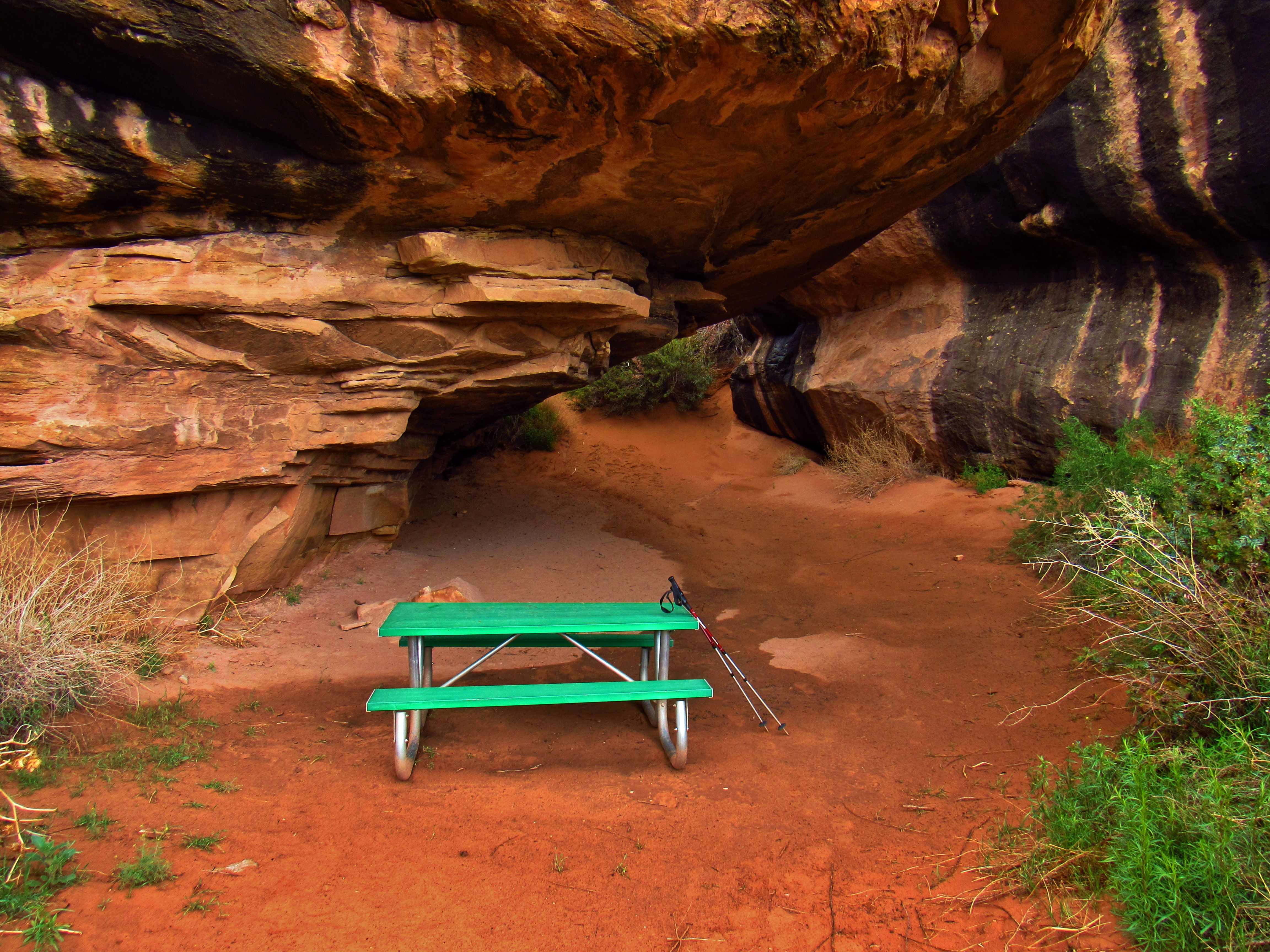
Devils Kitchen Campsite

Chesler Park from Devils Kitchen
Chesler Park Panorama
Chesler Park from Devils Kitchen

Cyclone Canyon Panorama
Devils Lane
Red Lakes Canyon Panorama
Lower Red Lakes Canyon Panorama

Mountain Bluebird in Cyclone Canyon
Cyclone Canyon
Cyclone Canyon

Lower Red Lakes Canyon Panorama
Lower Red Lakes Canyon
Lower Red Lakes Canyon Panorama
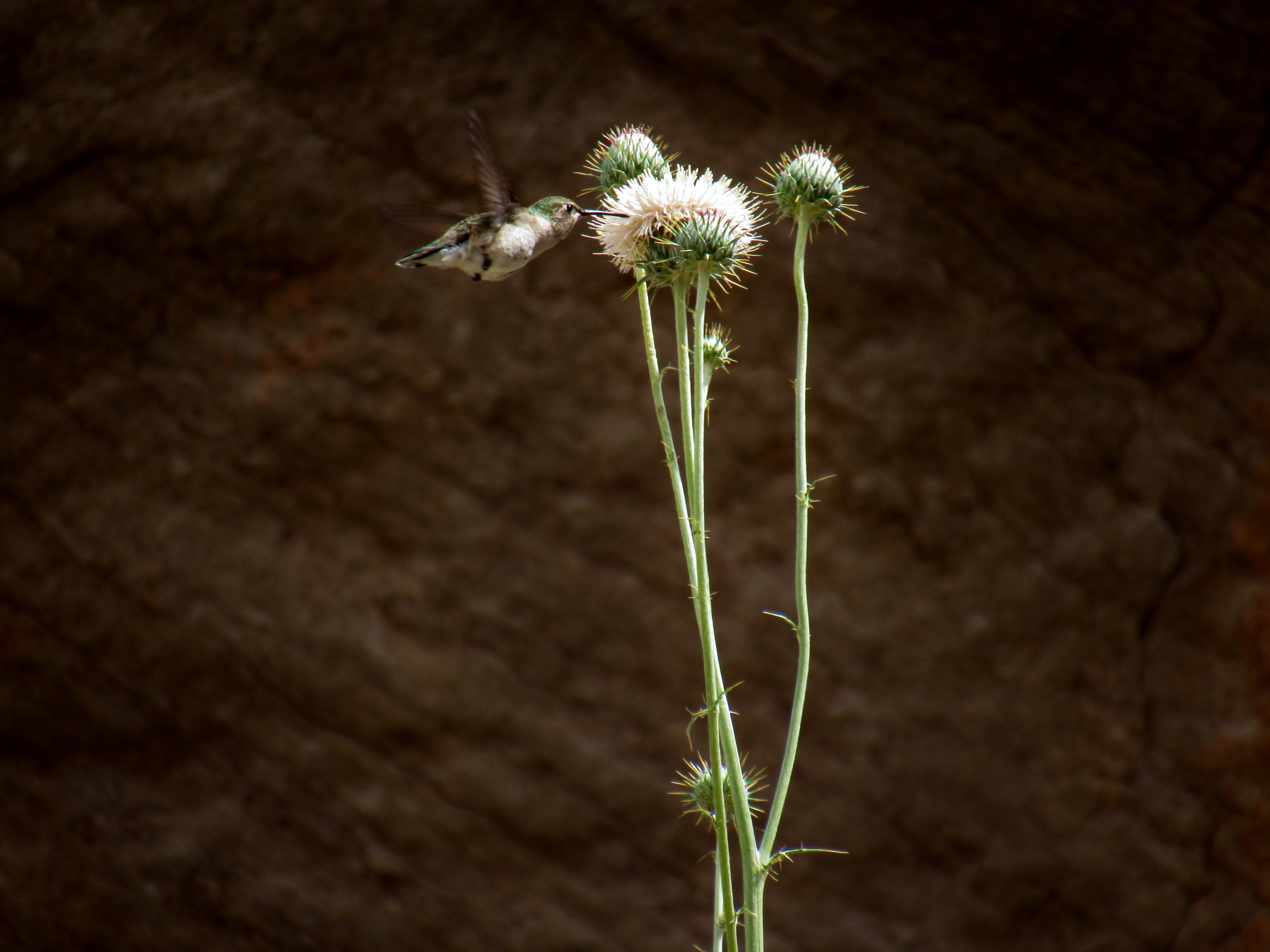
Hummingbird in Lower Red Lakes Canyon

Trail in Lower Red Lakes Canyon
Day 10- Wake up in the cold around 7 and ate breakfast. Pack up, brush my teeth in the morning sun to warm up, because the spot under the rock is still pretty cold, then start to head out. As I pass by my neighbors, they’ve got packs on and are heading out too, so we walk to Chesler Park, and ultimately to Druid Arch together. These guys are real nice. All 4 of us stop and take a ton of pictures, but don’t stop for much more than drinking water or shedding layers, and we all keep up a decent pace which i am comfortable with. We point out a giant, gnarled, black, dead tree and wonder how it split like it did. One of the sons points out some tracks and we wonder if it’s from the ring tailed cat. As we talk about our own adventures, I learn that Brad has met Mammoth, whom I met on the PCT, and who has hiked across the country twice, thru-hiked the AT, the PCT, and is now southbounding the CDT all in one trip. We also talk about Paul Salopek, who is walking the path of human migration all around the world. I would love to chat with all of these legendary backpackers, some of which have walked over 50,000 miles! The trail is all awesome today. It takes us through narrow cracks in the canyon walls, over rocky gaps between giant needles, across green valleys surrounded by epic red rock, and along washes filled with fresh rain water from yesterday. It was cool all day, but the sun came out here and there. The Joint trail was a real highlight- half a mile or longer slot canyon just barely wide enough to squeeze through with a pack and walls hundreds of feet high. The cavern leading us into it had hundreds of cairns set up, some in really interesting ways, up in sketchy spots to climb to. The rest of the way to Druid Arch was tough. Steep and rocky, like the hardest parts of Maine on the AT, but this rock is slickrock with fine sand on it from people climbing around after hiking in the wash. We still keep a good pace, never fall, and manage to keep our feet dry. We see a ranger on the trail and he checks my permit, which I am more than happy to let him do. He says it should be nice tomorrow and the day after, with 20% and 30% chance of rain, respectively. When we finally get to Druid Arch around 1, it is a tough last climb, but the arch is stunning and humongous! It’s just starting to drizzle after we get a group picture, so we hide in an eroded bubble in the sandstone with a great view of the canyon and the arch and we eat lunch. They leave soon after, but I stick around a while to play some blues and chill. When I’ve got my fill, I walk down, chat for a minute with some people that just arrived, then keep moving. They tail me through the wash back to the trail junction, then I split off towards Squaw Canyon Camp 2 through Lost Canyon. This trail seems like very few people have been on it, and it is sweet. I get a great shot of 2 side-blotched lizards doing pushups next to each other- for me or for each other, I don’t know. Plus, a great shot of a Pine Grosbeak! One section of trail climbs a ladder over a saddle between the canyons, then along the ledge above the canyon. I wind along the side of the wall on slickrock, jumping across cracks and crouching through a little cave that opens up to another high ledge. It starts raining, so I stop to get my wind/drizzle shirt out and stuff my extra layers in my pack liner, then hike the last mile to camp. Lots of water around here. Big dinner- ramen and fettucini pasta side with pepperoni and cheese, and a couple spoonfuls of chex mix and cheese its too. Plan out my route for tomorrow, play some blues, then I hit the hay, with the plan of heading back to Moab in the morning.
Chesler Park Panorama

Chesler Park

Chesler Park Overlook

Chesler Park
Chesler Park

Chesler Park
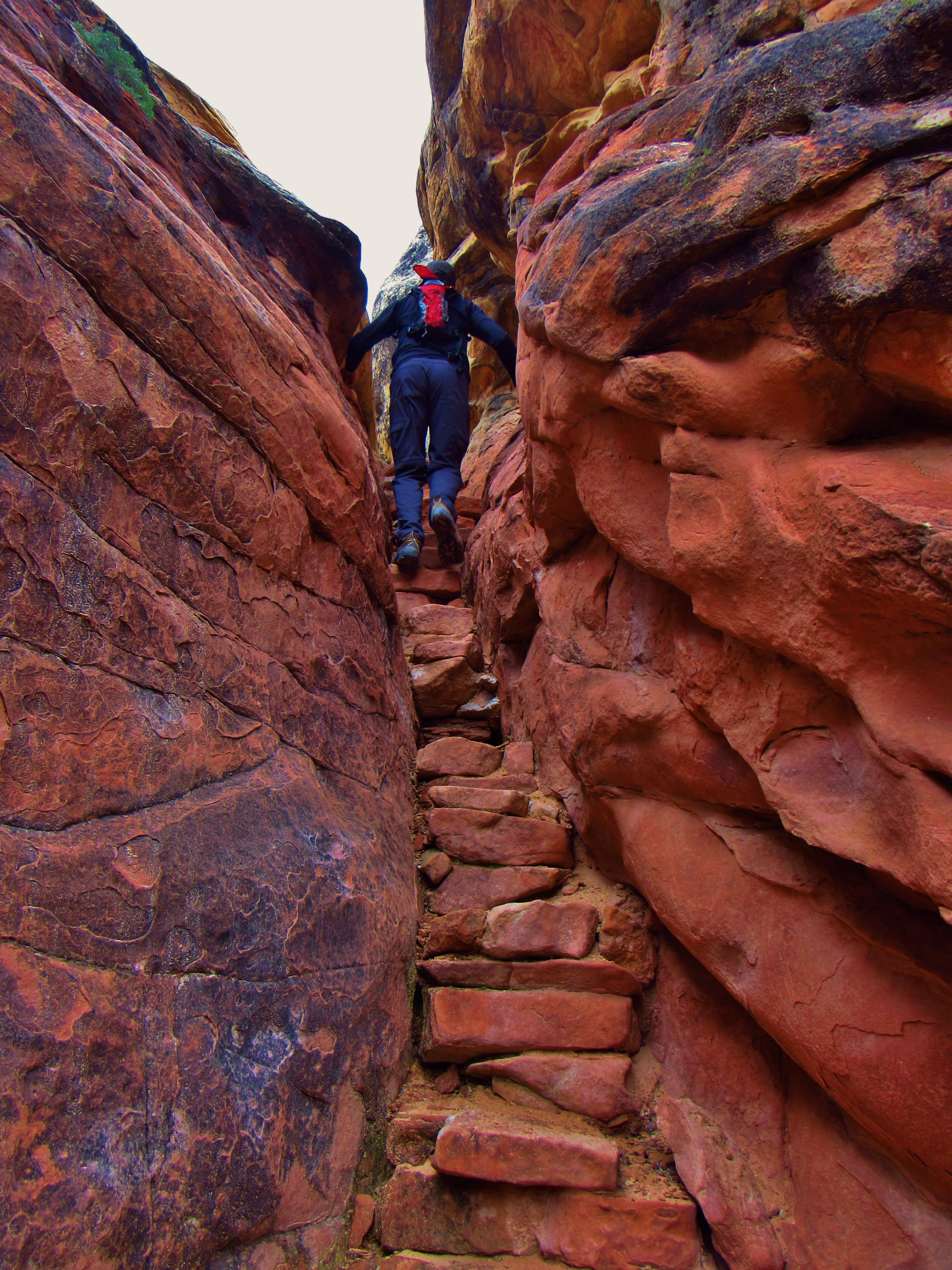
Chesler Park Stairs on the Trail
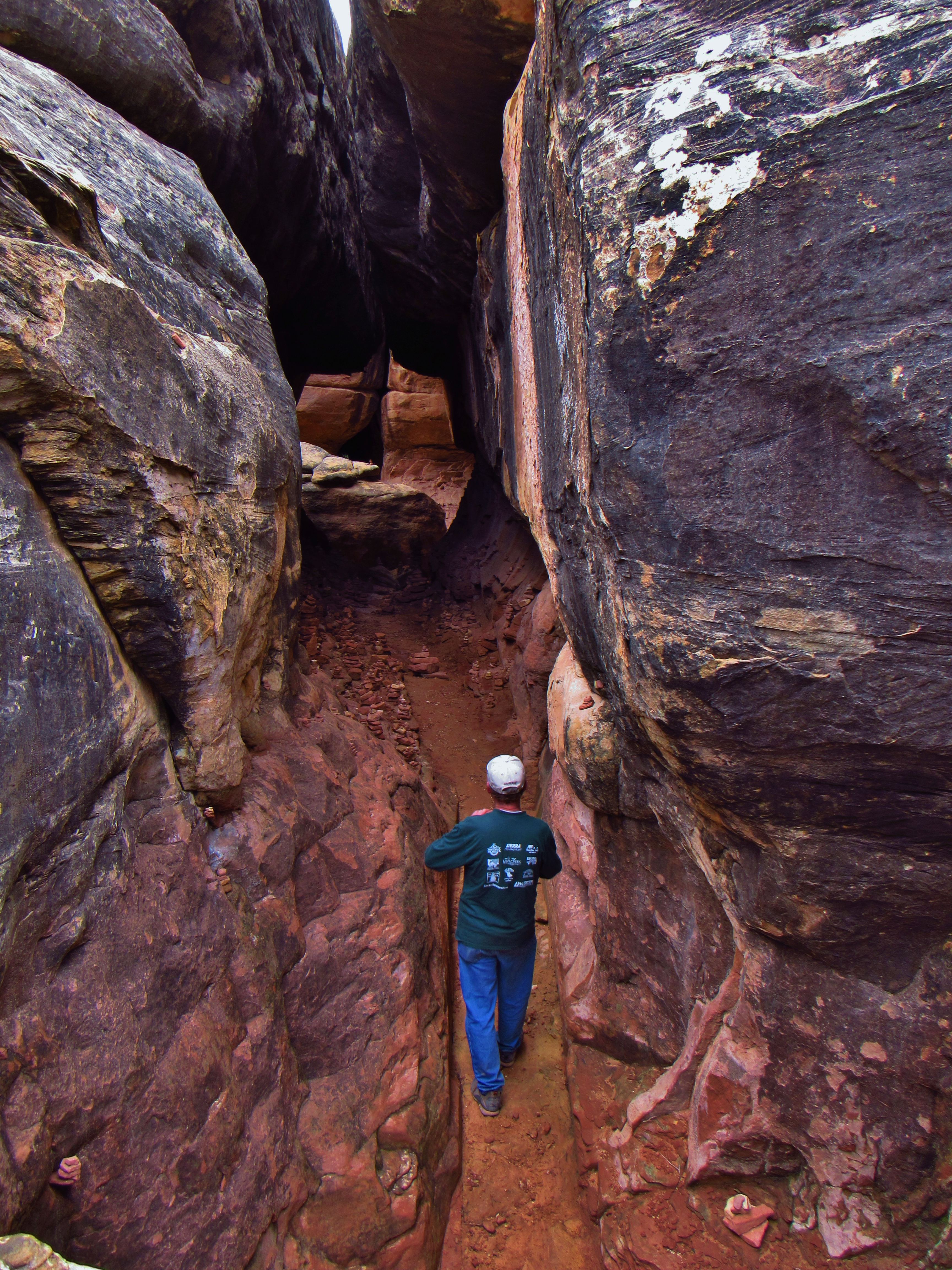
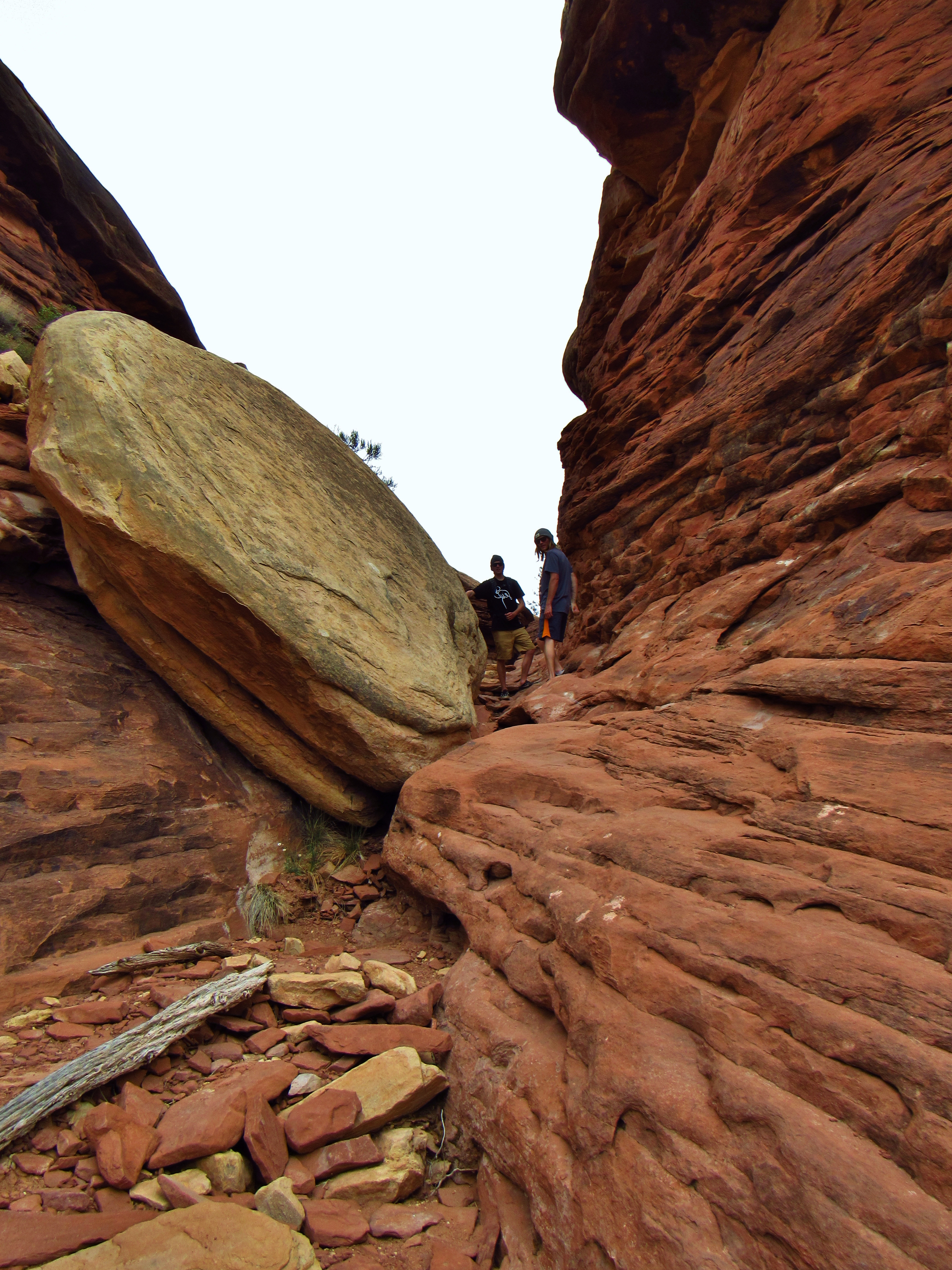
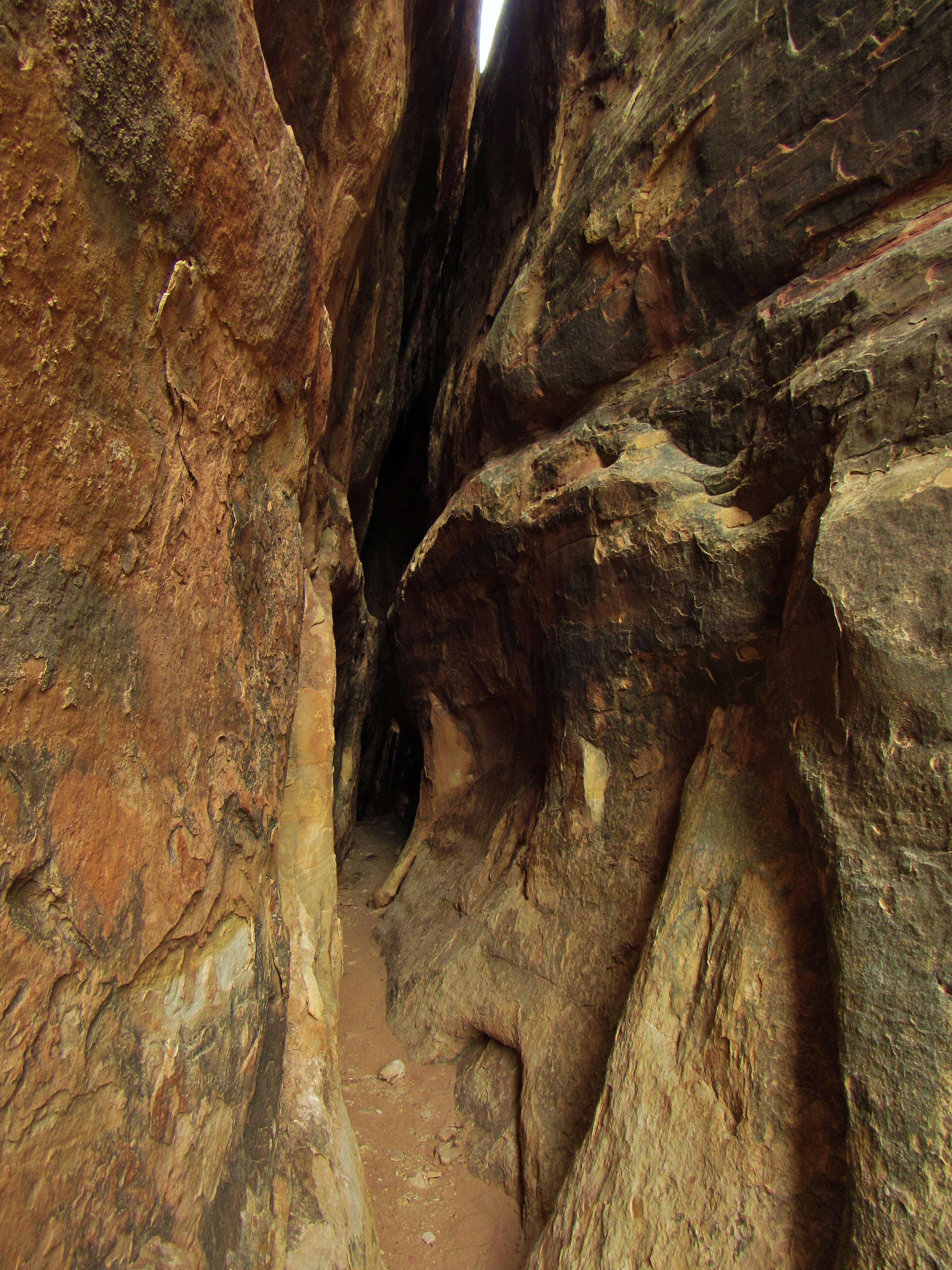
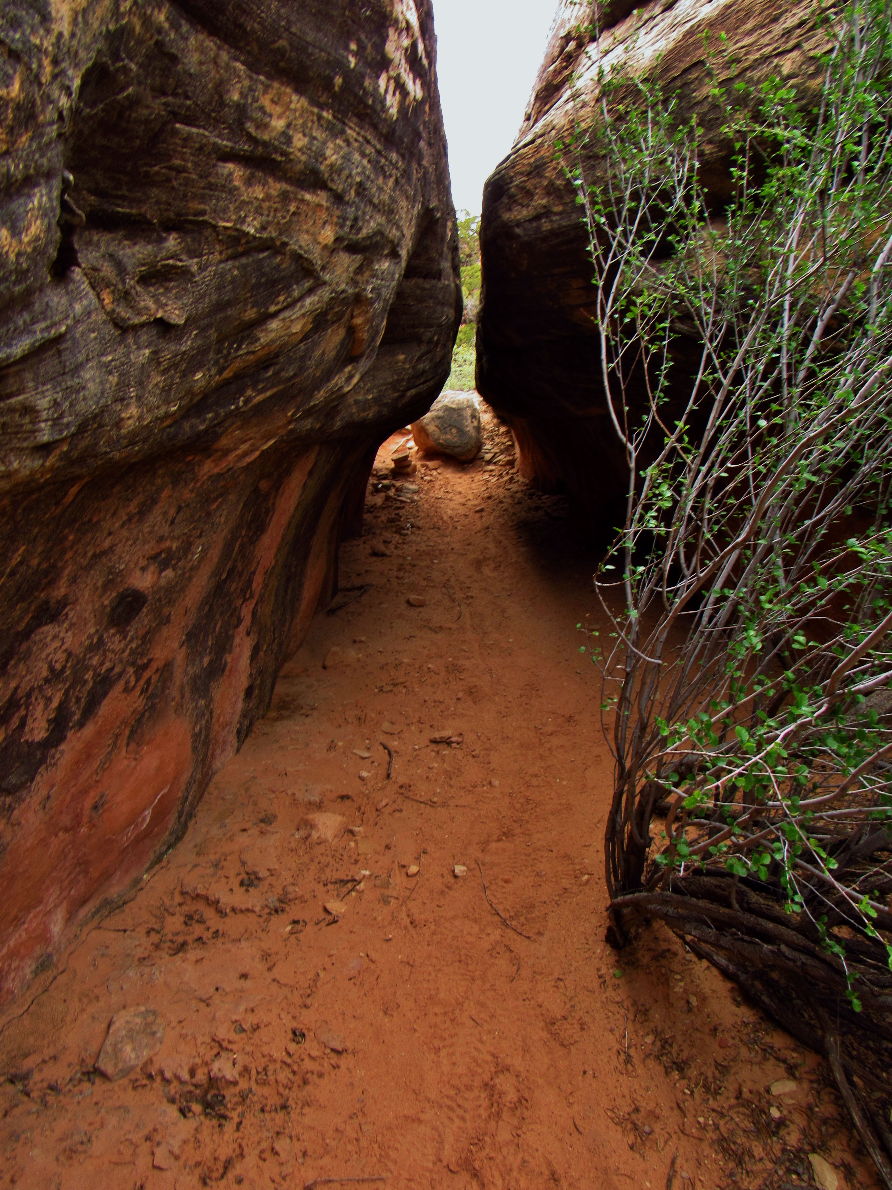
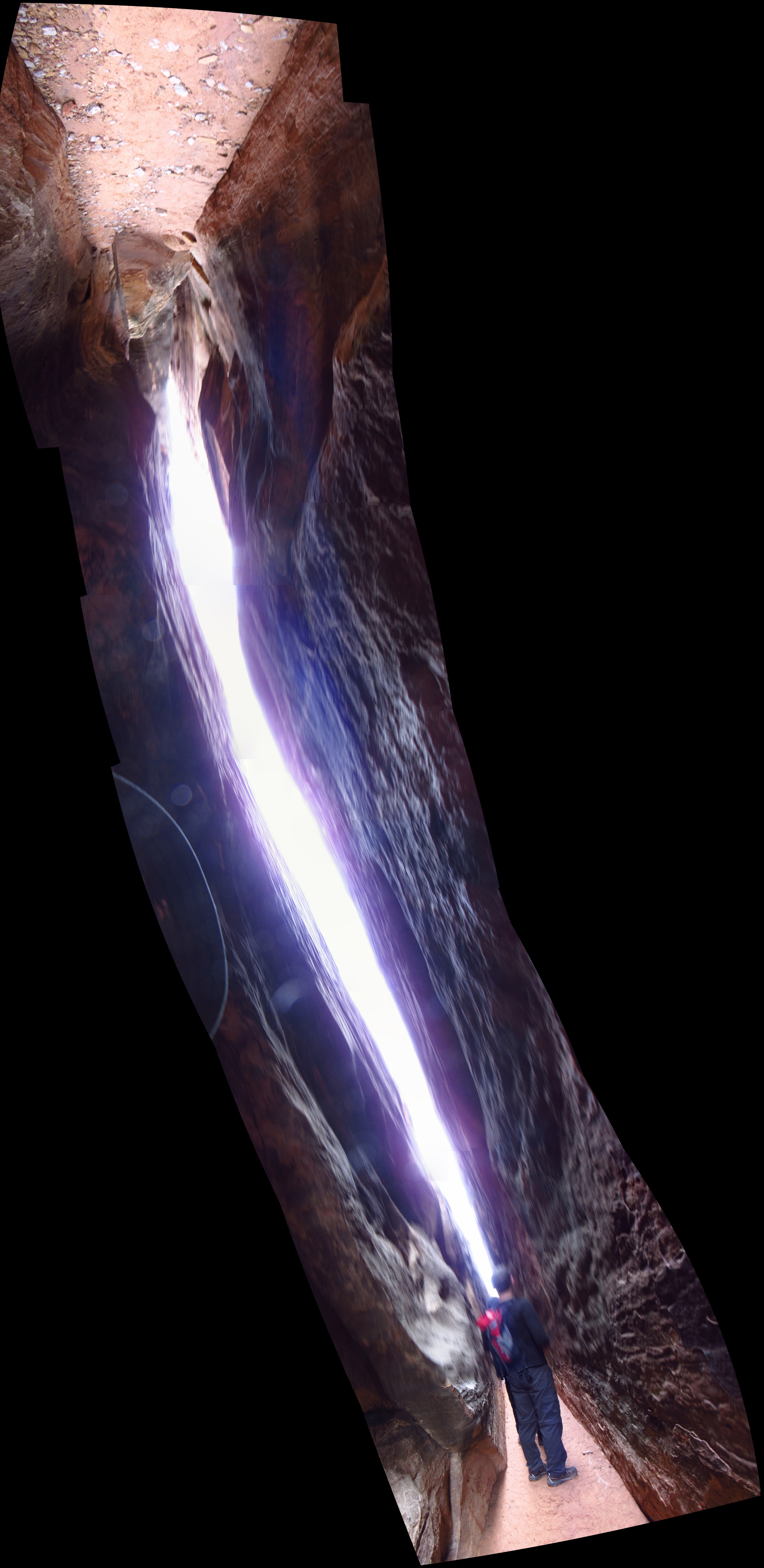
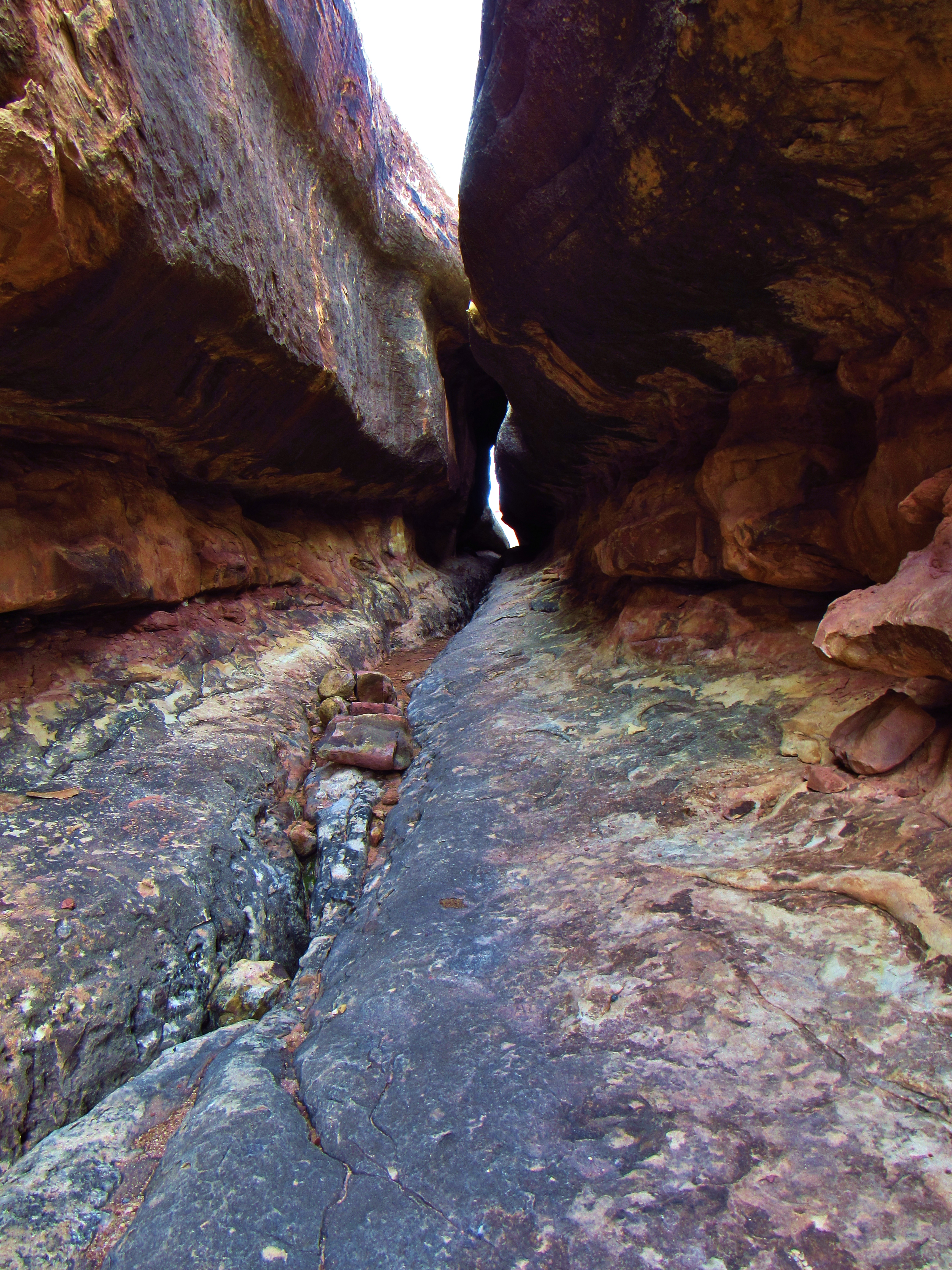
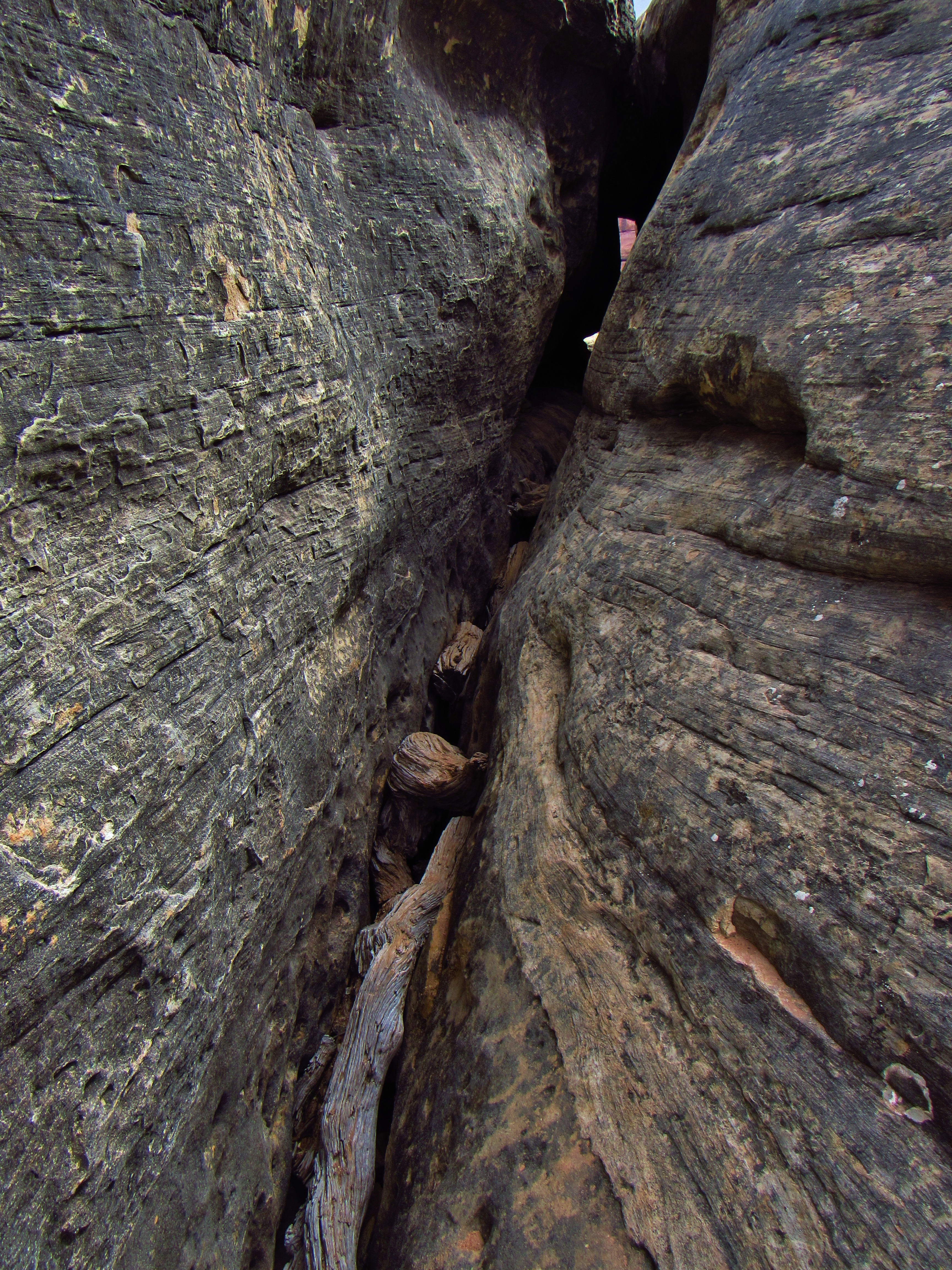
Joint Trail
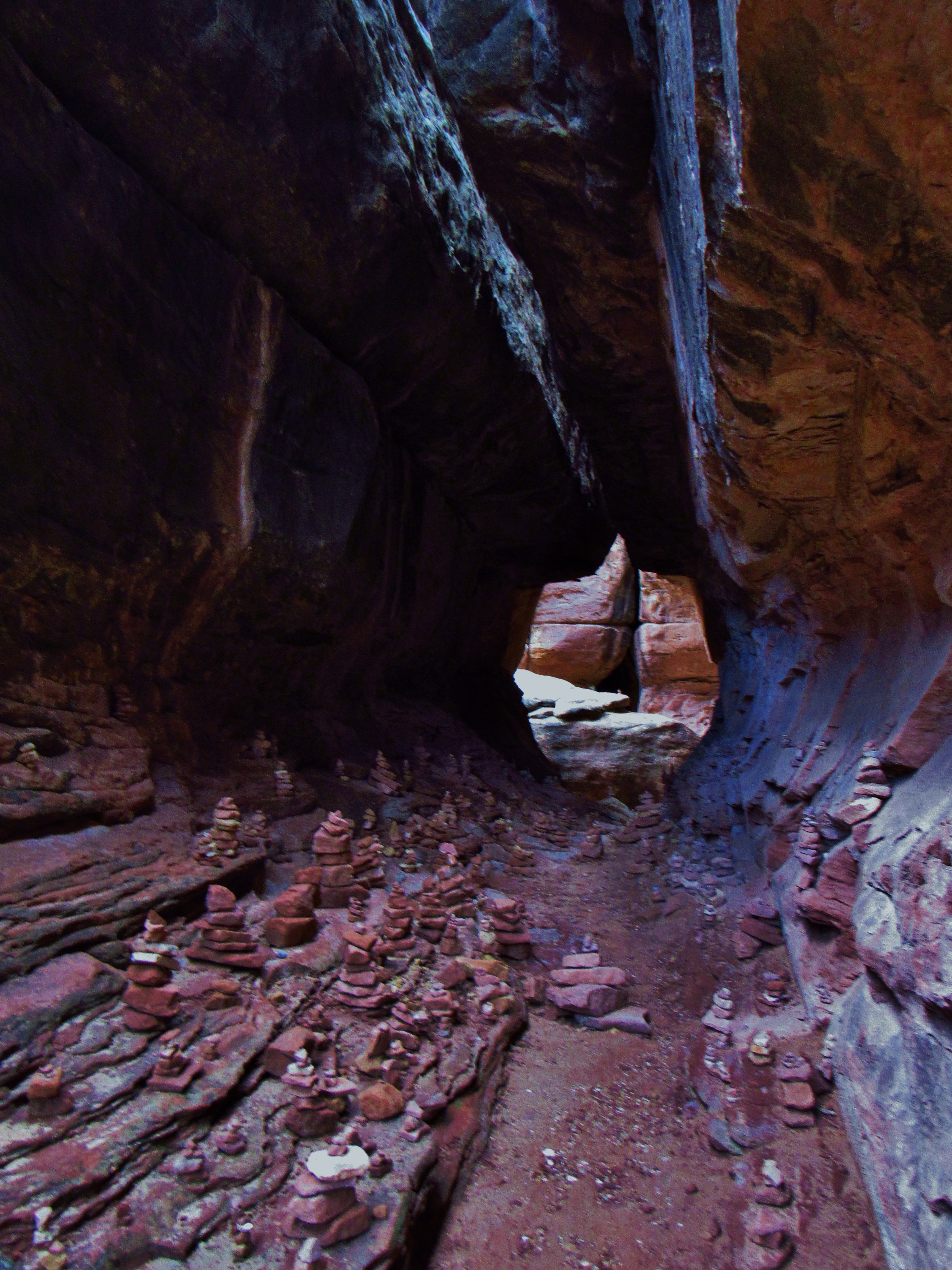
Joint Trail
Joint Trail
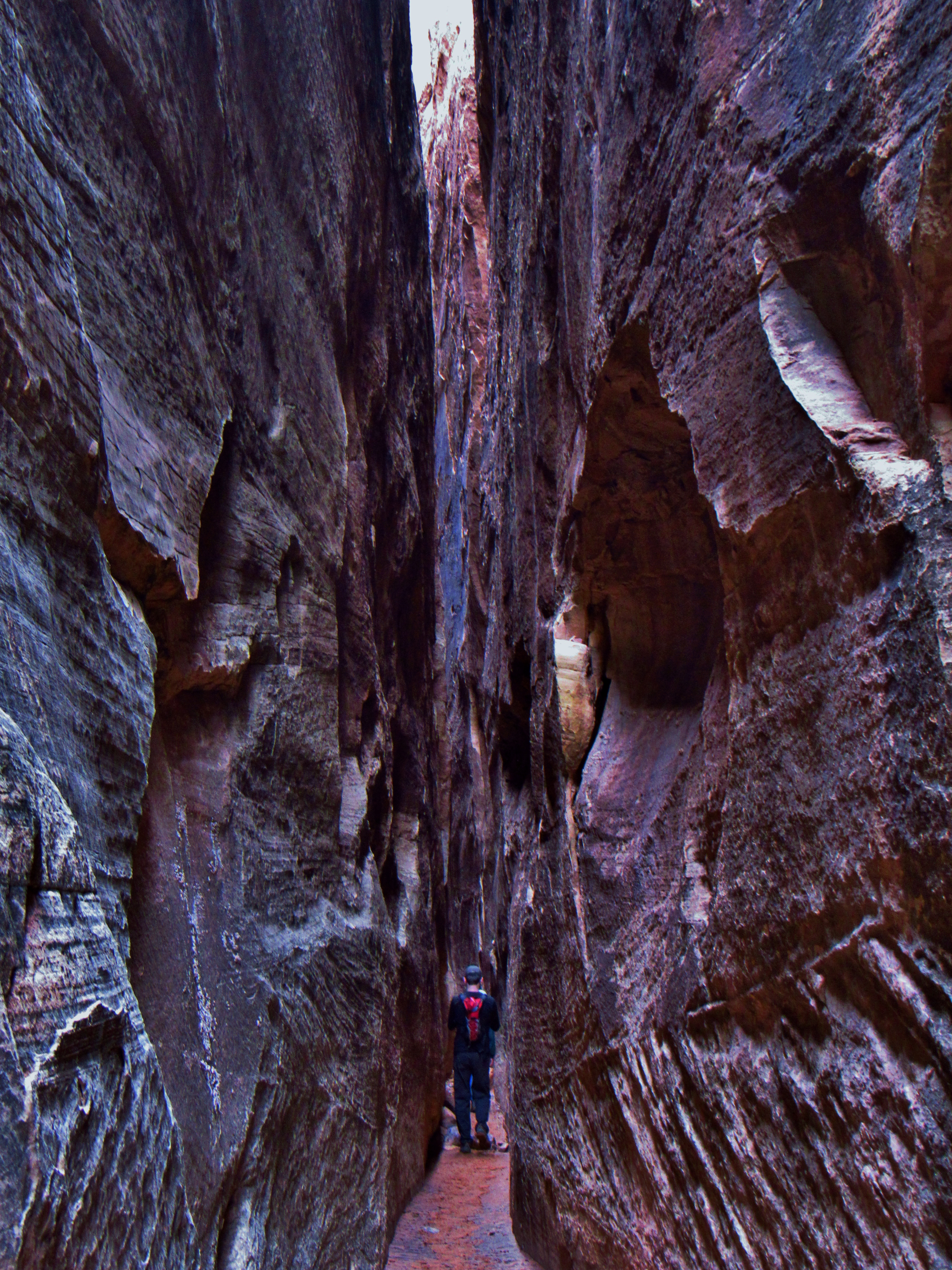
Joint Trail
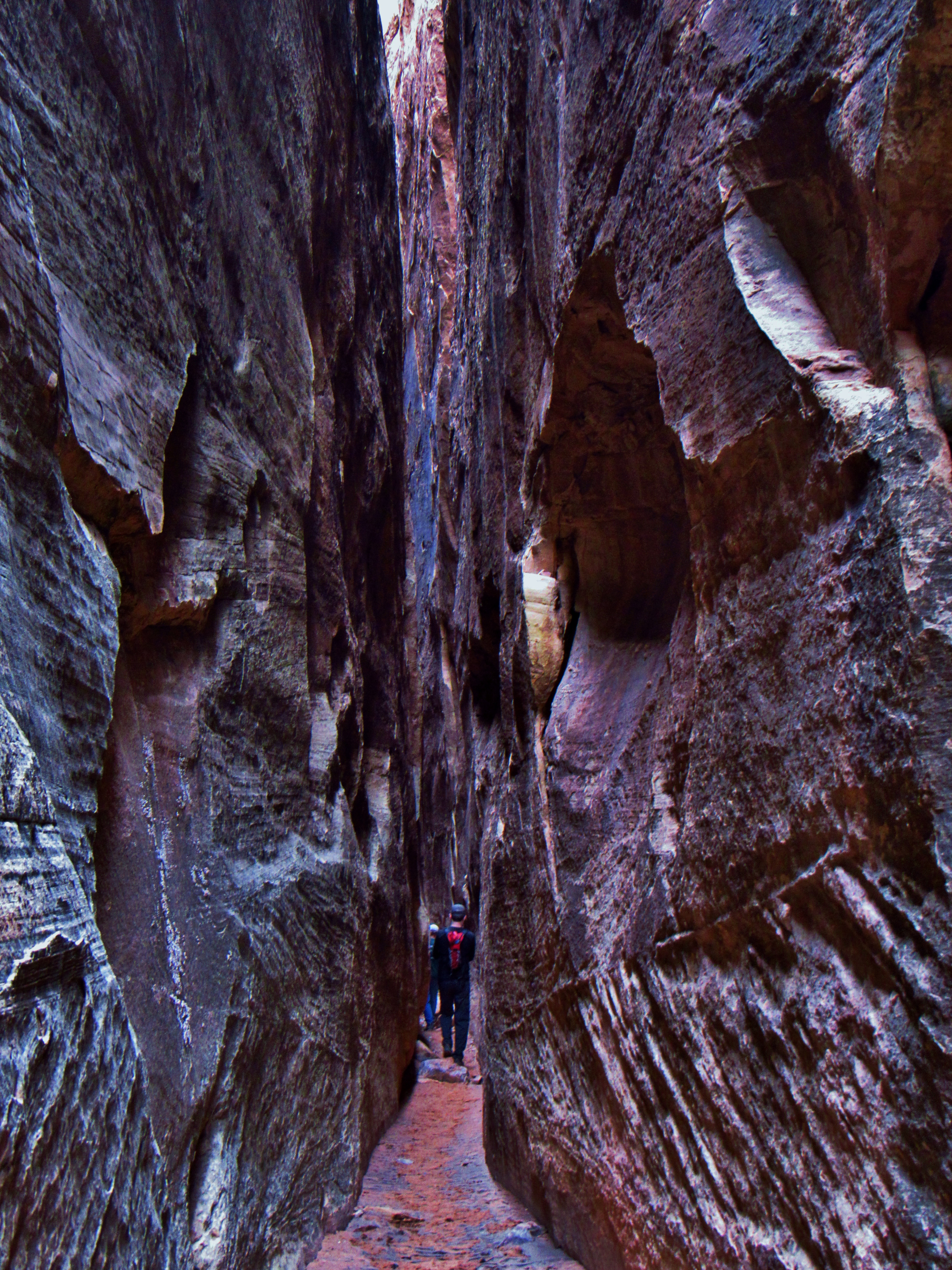
Joint Trail
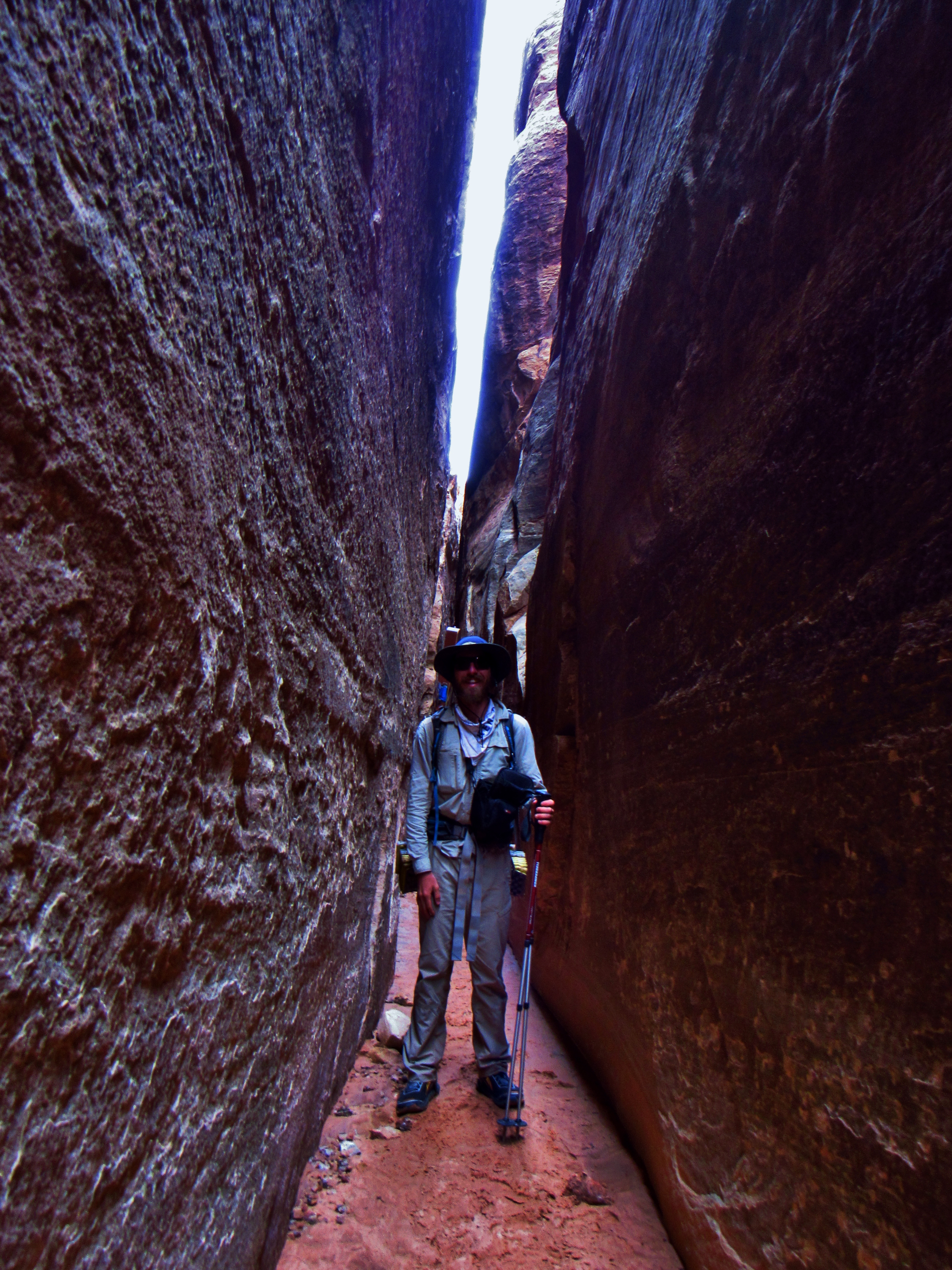
Joint Trail
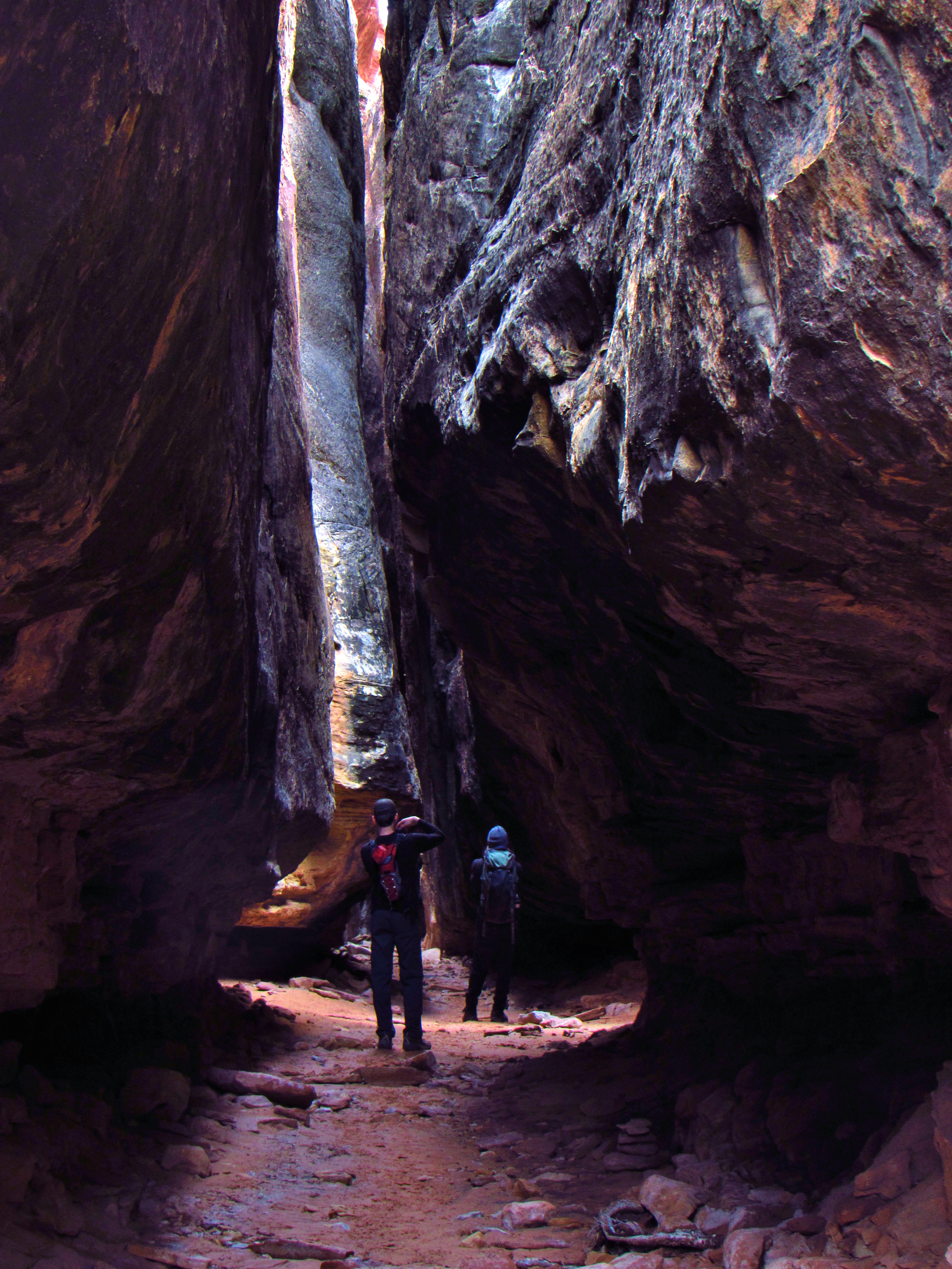
Joint Trail Panorama
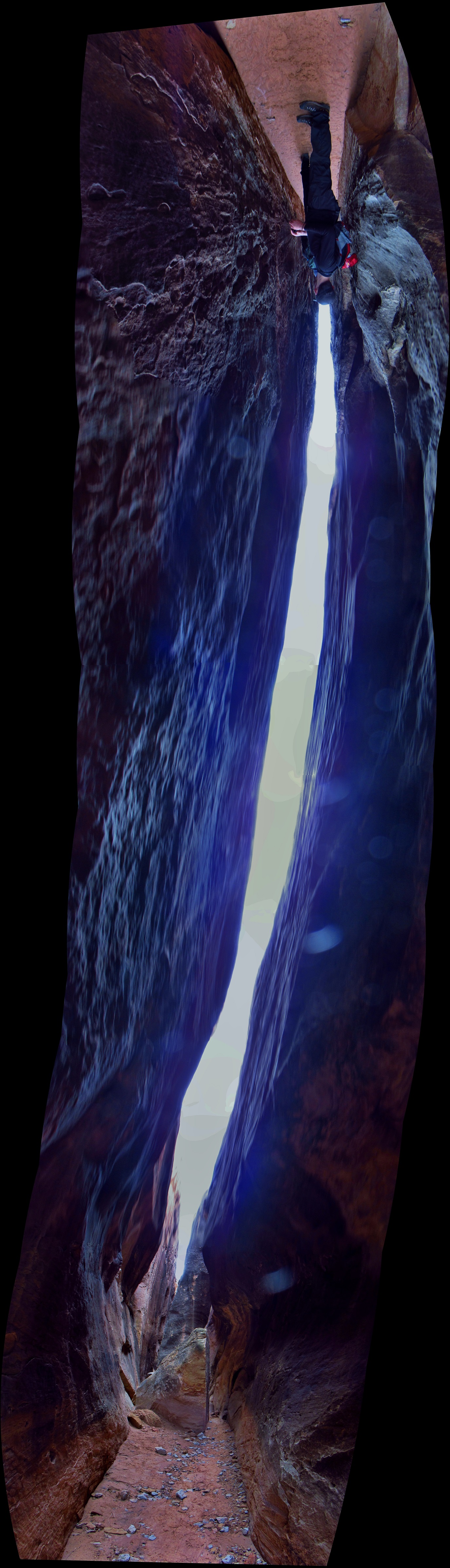
Joint Trail Panorama

Join Trail Overlook Panorama

Chesler Park Overlook
Elephant Canyon to Druid Arch
Elephant Canyon to Druid Arch Panorama

Druid Arch Trail
Druid Arch Trail
Druid Arch Trail
Druid Arch Trail
Druid Arch
Druid Arch
Druid Arch
Druid Arch Panorama

Druid Arch Selfie
Squaw Canyon

Side Blotched Lizard
Side Blotched Lizard
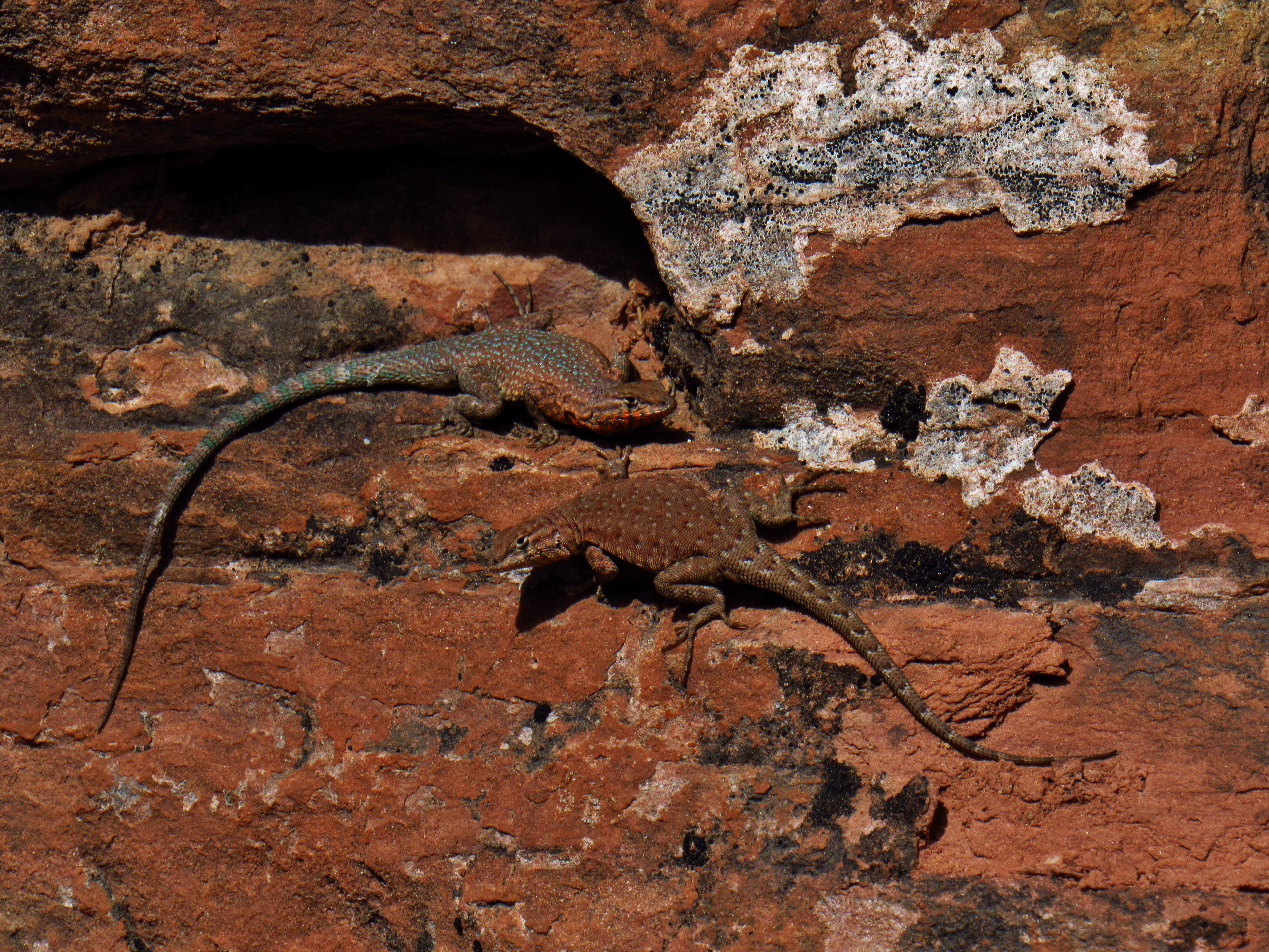
Side Blotched Lizards
Lost Canyon Panorama
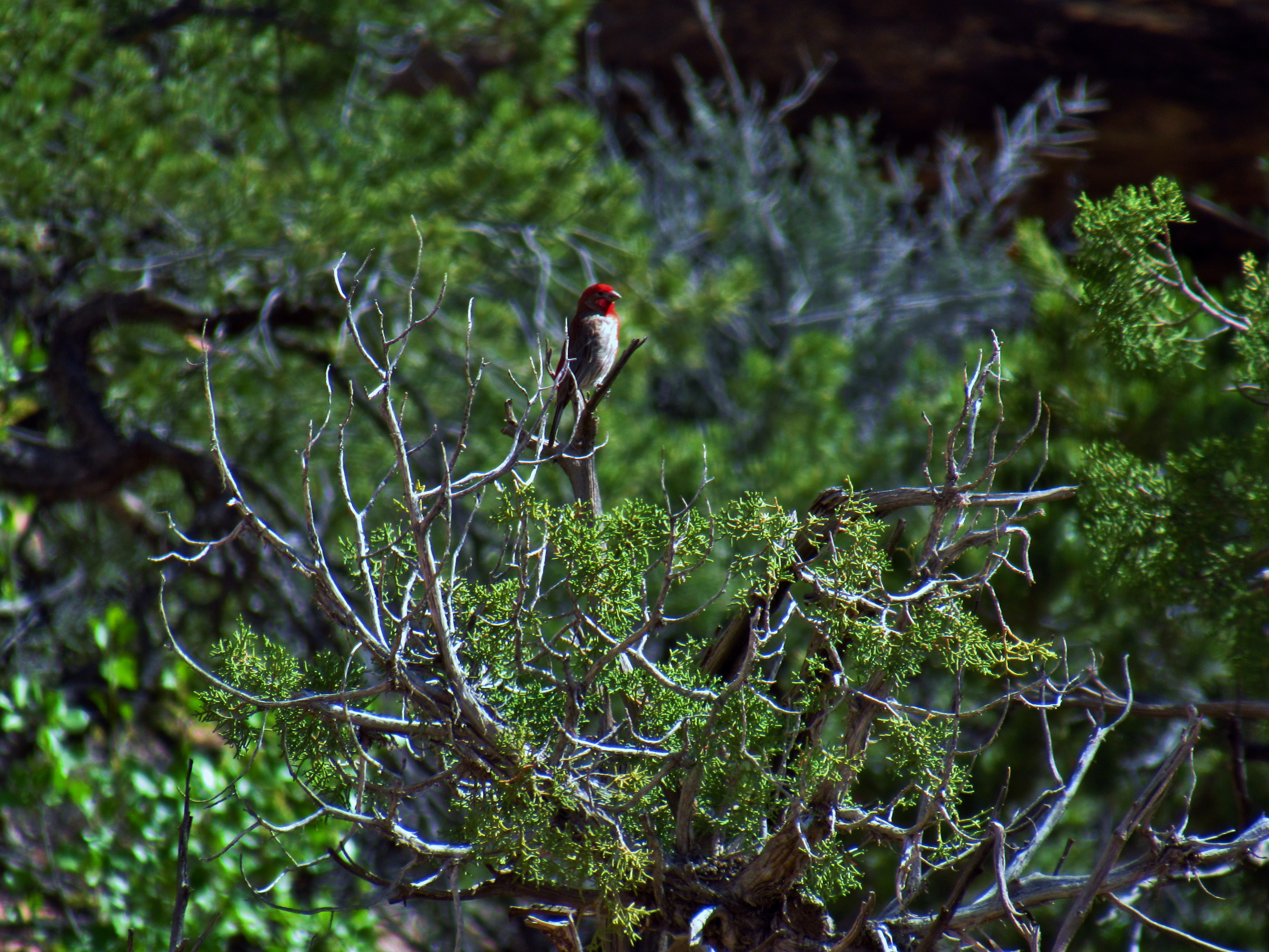
Pine Grosbeak in Lost Canyon
Squaw Canyon to Lost Canyon Panorama

Lost Canyon
Lost Canyon
Lost Canyon
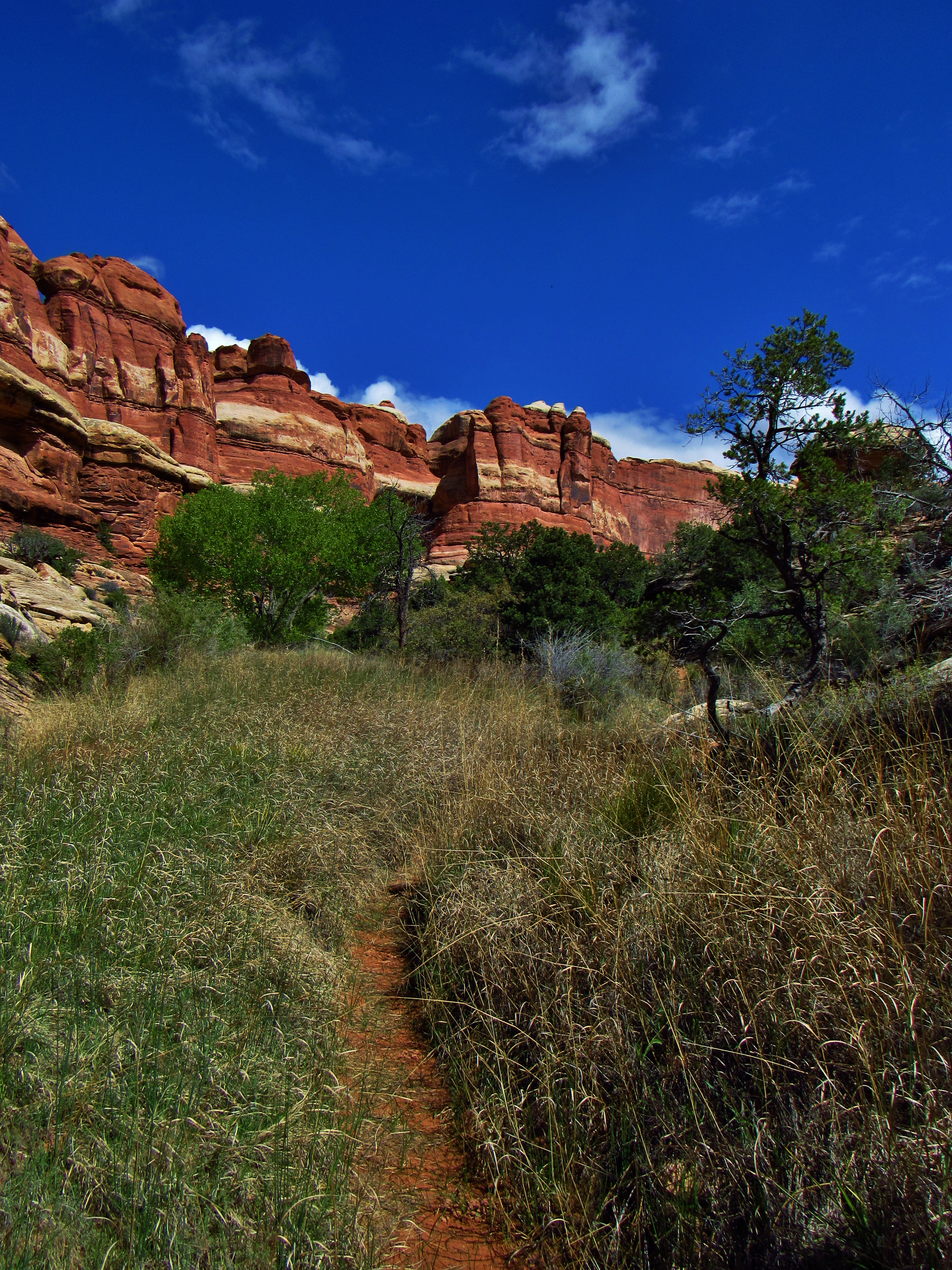
Day 11- Woke up at Squaw Canyon Camp 2, still chilly out just before 8am. Climbed up on the little hill to have breakfast in the sun. Sun bright upon my face, probably burning my nose, the warmth feels great. Stretched my tarp out on the rock below to let it dry off the condensation- tarp in the A-frame was low last night and a little soggy around the sides- also covered in faint puke stains from Salt Creek. Slow to pack up, and a ranger and his SCA intern show up, chat for a minute, listen to the weather report on his radio and it says last night dumped 1/100th inch of rain. I end up catching up with them in Lost Canyon, and we chat about natural resource policy and the balance between preservation of wilderness and enjoyment of the people. I referenced a famous part of Desert Solitaire by Edward Abbey, a book which he (of course) has read, and he mentions how naturally all the trails out here follow the path of least resistance, and since people have been here for thousands of years, many of the same routes we use today pass over archaeological sites. He says that ultimately in the National Parks, enjoyment of the people will always come first, but Salt Creek, for example, has been a 4×4 road for over 100 years, so the folks representing that community claim precedence, but there’s no denying the erosion that takes place. Soon, he says, it will become foot traffic only, but the way that happens is very political and drawn out: meetings and 20 plans proposed before narrowing it down to 1 possibility, a vote, then research and data collection before implementation. Also, I learn that the rock steps carved out of the slickrock are called Moki steps, and some, but not all, have been here before it was a National Park. They stop to scope out a campsite, and as I push on through the low, thick, marshy, sandy vegetation of Lost Canyon, taking tons of pictures of the canyon, squirrels and birds too, I start to run into many groups of people. I must be getting close to the trailhead. I climb over the slickrock saddle into the head of Squaw Canyon and into open desert. At the junction, a group of 10-15 people stops and a dude asks me to play him a song. So I jam on some blues for a minute or so to a short applause afterwards. Made my day. In the last 2 miles, literally everyone that passes by asks me about my guitar. I hike over the butte back to the truck and as if in some crazy fantasy, drive back to Moab.
Lost Canyon Trail
Lost Canyon Trail
Lost Canyon
Hungry Squirrel in Lost Canyon
Lost Canyon

Lost Canyon Trail

Squaw Flat Panorama